The Swiss Alpine Club Hiking Grading System
The Swiss Alpine Club (SAC) grading system is a widely used rating system to describe the difficulty level of mountain trails in Switzerland. It provides hikers and mountaineers with a standardized way to evaluate the technical and physical challenges of a trail before embarking on it.
We don’t have a comparable system for hiking in the United Kingdom. Personally, I have found the SAC grading system very useful for trying to convey the difficulty of my hiking routes, and have categorised walks on this website using it. No grading scheme is perfect and is open to interpretation, but I think this scale is a lot more useful than descriptions like easy or hard.
The SAC grading system rates trails on a scale from T1 to T6, with T1 being the easiest and T6 being the most challenging. This system takes into account various factors, such as steepness, terrain, and exposure to risk. Keep in mind that this system aims to describes the overall characteristics of a hiking route and doesn’t replace climbing grades for any named routes which may be contained within an overall route.
SAC Grade T1
T1 trails are considered easy and suitable for beginners, children, and older hikers. These trails are well marked, usually wide and flat, and can be done without any special equipment or previous experience. No steady footing is needed. In dry conditions, normal trainers would be acceptable footwear.

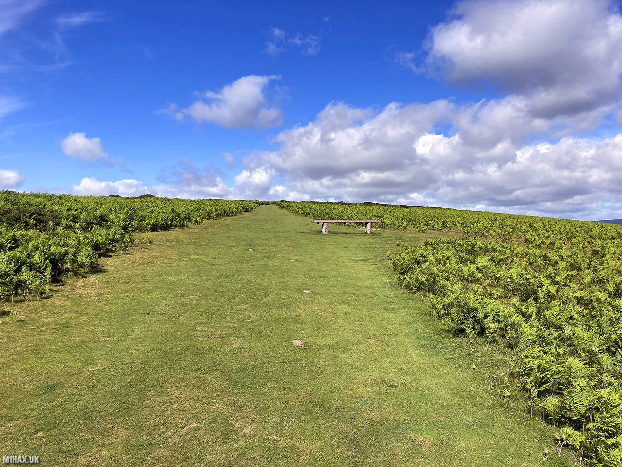
The photo above shows the wide flat grassy path to the summit of Hergest Ridge (SOTA reference G/WB-008), typical of grade T1 terrain.
SAC Grade T2
T2 trails are slightly more difficult and require a bit more physical exertion. They may include some steeper sections, uneven terrain, or narrow paths, but still do not require any technical climbing skills or equipment. Some basic navigational abilities will be required. In dry conditions, ‘trail runner’ trainers or light boots would be appropriate.

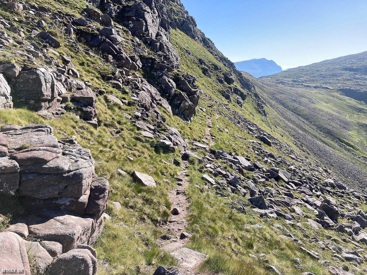
The rough narrow hillside trail leading towards Beinn Tarsuinn in Scotland (SOTA reference GM/NS-016) illustrates a typical grade T2 route.
SAC Grade T3
T3 trails are moderately challenging and require a good level of fitness and some hiking experience. These trails may include steep and partially exposed sections, scree slopes, or rocky terrain. Hikers may need to use their hands to steady themselves. Ability to navigate using features on a map probably required. Walking boots with ankle protection would be appropriate footwear.

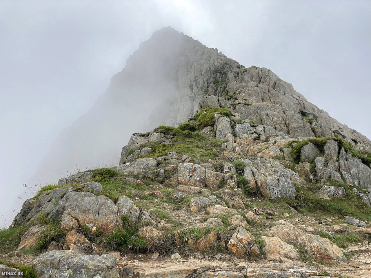
The rocky walking route up the north-west ridge to the summit of Y Lliwedd (SOTA reference GW/NW-008) in North Wales doesn’t require much use of the hands but does have a little exposure. Never quite becoming a real scramble, this is terrain I would associate with a T3 graded hiking route.
SAC Grade T4
T4 trails are considered difficult and require a high level of fitness and experience. These trails may include steep and exposed sections, scree slopes, or rocky terrain, as well as passages possibly requiring the use of climbing or confidence ropes. Hikers may need to be able to handle exposure to heights and be comfortable with scrambling and climbing. It is unlikely that there will be a continuous path along the route. Type B0 hiking boots are appropriate footwear. Requires an ability to navigate using map and compass and make terrain assessments while on the route. The ‘hands on’ portions of a SAC Grade T4 route will often approximate a UK Grade 1 summer scramble.

Sharp Edge is a popular ridge leading to the summit of Blencathra in the Lake District (SOTA reference G/LD-008). The exposure and hands-on nature of this route offers a good example of T4 terrain in the UK.
SAC Grade T5
T5 trails are very difficult and require advanced hiking skills, experience, and a high level of fitness. These trails may include exposed, steep, and technical sections, with the use of ropes, cables, and climbing equipment necessary for safe passage. Hikers need to have a good understanding of mountaineering skills and be able to assess risks and make sound decisions. High degree of competence required with map and compass for navigation. Type B1 or B2 mountaineering boots are likely to be the most appropriate footwear. In winter, basic use of an ice axe and crampons will be required. There may be easy sections of rock climbing and these ‘hands on’ elements of a SAC Grade T5 route will usually align with a UK Grade 2 summer scramble.
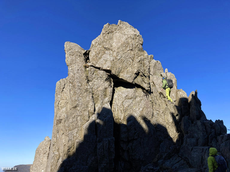
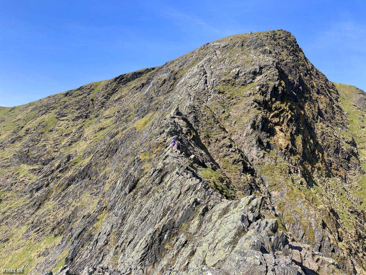
Bristly Ridge is a well-known ridge in North Wales which connects the south col of Tryfan to Glyder Fawr (SOTA reference GW/NW-003). The technical difficulties of this UK grade 2 scramble can be equated with a grade T5 route.
SAC Grade T6
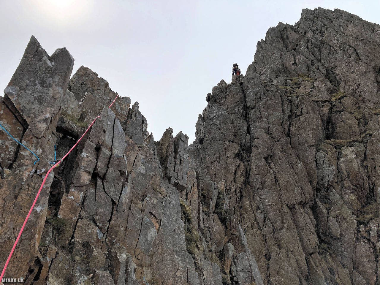
T6 trails are the most challenging and difficult hiking trails. These trails are reserved for experienced mountaineers with advanced technical skills, a high level of fitness, and an ability to handle very high exposure to risk. T6 trails will include steep and exposed terrain, glaciers, rock climbing, and/or ice climbing. Type B2 or B3 mountaineering boots are likely to be the most appropriate footwear. The route will mostly be without any obvious path, so an ability to independently navigate complex terrain to a high degree of accuracy will be required. Competence with ropes and self-rescue is needed. Novices would typically use the services of a guide. A SAC Grade T6 route which includes climbing approximates to UK Grade 3 summer scrambling, but may have more challenging climbing at ‘Moderate’ or ‘Diff’ (UIAA II) grades.

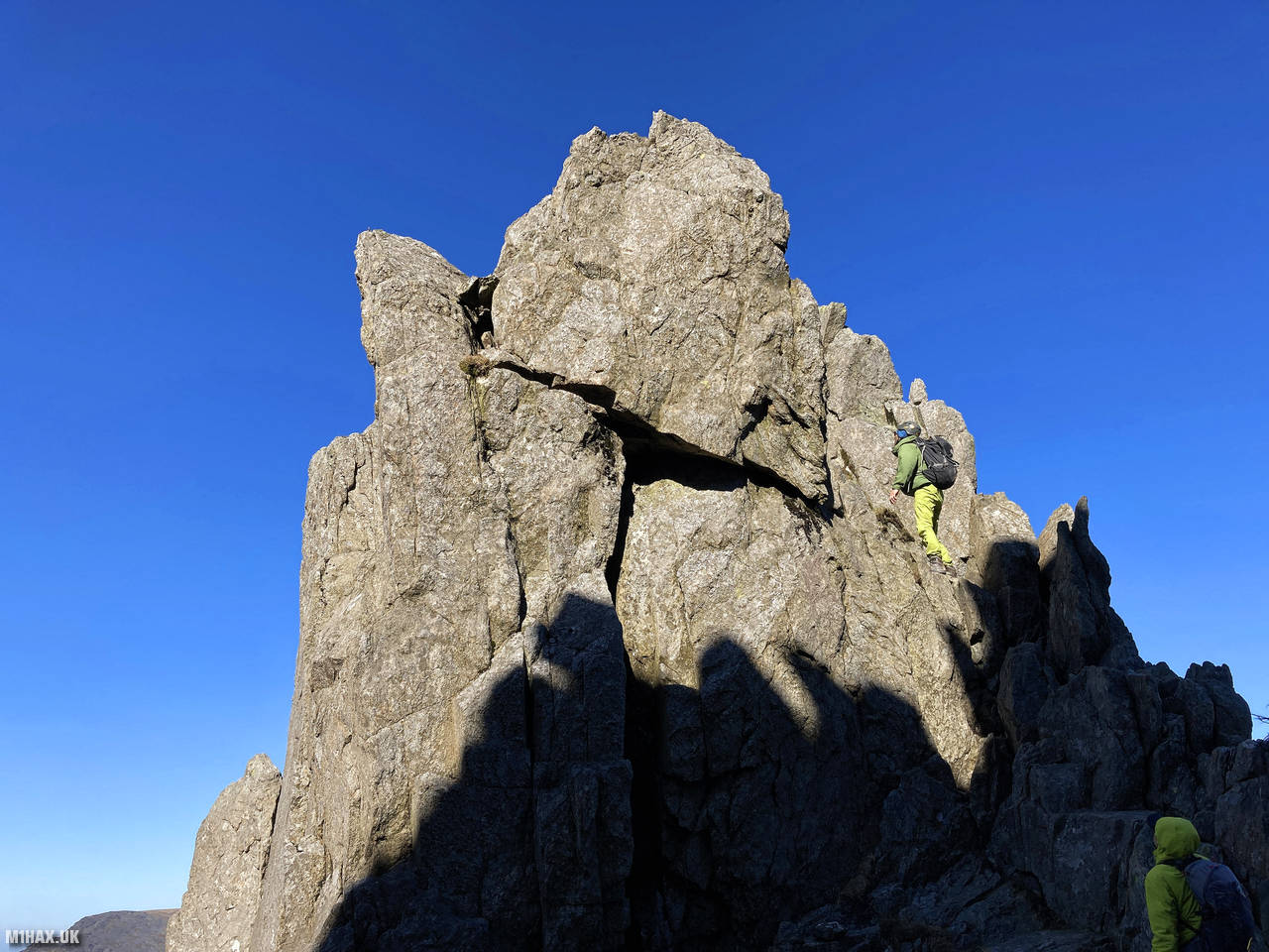
The Cyfrwy Arete is a true mountaineering adventure taking a ridge line towards the summit of Cadair Idris (SOTA reference GW/NW-009) in North Wales. Depending on the route variation used, this is graded as a multipitch ‘Diff’ climb or a grade 3 scramble. A circuit of Cadair Idris incorporating the Cyfrwy Arete would be considered a SAC Grade T6 route equivalent in the UK.
In summary, the SAC grading system provides a useful and standardized way for hikers and mountaineers to evaluate the difficulty level of a trail before embarking on it. It is important to note, however, that the grading system is not a guarantee of safety and that other factors, such as weather conditions, can significantly impact the difficulty level of a trail.
If you found this content valuable, why not Buy Me a Coffee?