Carnedd Llewelyn - GW/NW-002 SOTA (2019)

Summits on the Air Activation Report
Activation Date: Saturday 16th February, 2019.
Activator(s): Richard M1HAX, Andrew M1CJE.
Summit: Carnedd Llewelyn, North Wales, Wales.
Summit ID: SOTA reference GW/NW-002 (10+3 points).
Summit Height: 1064m elevation, 750m prominence.
Summit Location: Lat./Long. 53.16017, -3.97033. Maidenhead Grid IO83ad.
Also Activated: GW/NW-013.
Distance: 15.1km travelled with 1425m of ascent.
Difficulty: SAC Grade T3.(?)
Elapsed Time: 6hr 15m (incl. operating and other summit(s) on the same hike).
Weather: Feels like 3.9°C, 44 kph SW wind, 85% humidity.
Radio Equipment: Yaesu FTM100D, MFJ-1714, Zippy 4200mAh 4S LiFePo4.
Callsign Used: MW1HAX.
Contacts: 12 (2m FM).
Trip Notes
Carnedd Llewelyn is a mountain located in the Snowdonia National Park in North Wales. It is the second highest mountain in the region, after Snowdon. The mountain is named after a Welsh prince, and has a rich history dating back thousands of years. It has been the site of ancient artifacts such as burial cairns and stone circles, and continues to be a popular destination for hikers and climbers today.
The weather on the day of our hike was relatively mild for the month of February, with mostly dry conditions and some cloud cover. This was a welcome change from the cold and wet weather that is often associated with this time of year in North Wales. Although there was some cloud cover, it did not significantly impact visibility or hinder our progress on the trail.
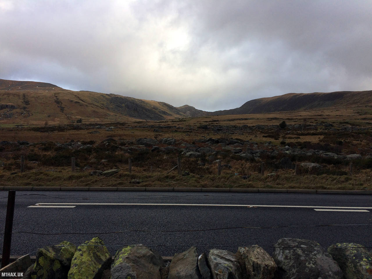
We began our hike to Carnedd Llewelyn by approaching the mountain from the A5 main road. This road provides easy access to the mountain. However, parking near the reservoir access road is limited, so we paid to park at the nearby Gwern Gof Isaf farm. From there, we set off on foot, following the access road.
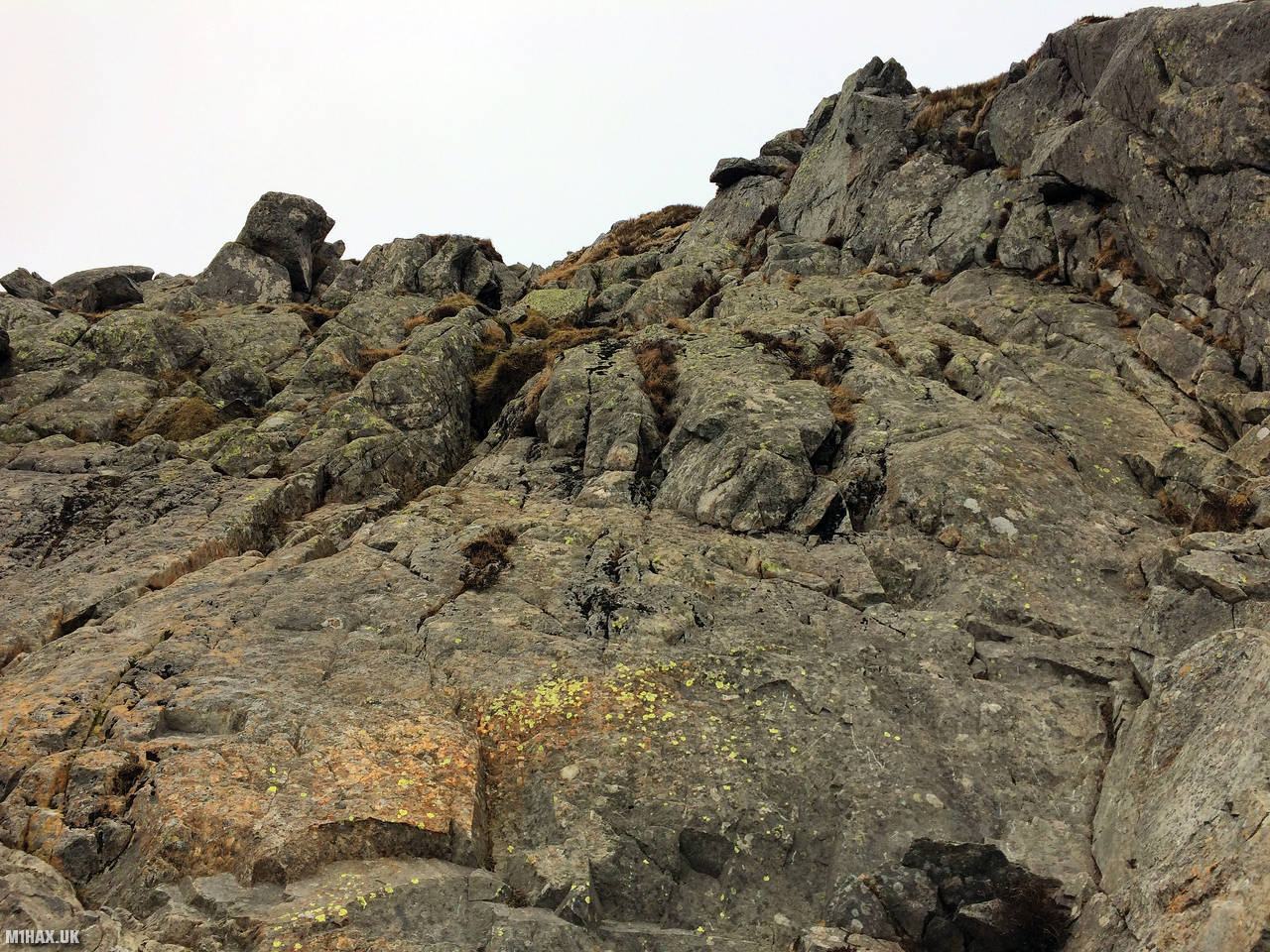
We followed footpaths that wound their way up the mountain, providing a clear route to the summit. There is a small section of easy scrambling along the way, which is located about midway between the base of the mountain and the summit. This section is easily navigated in dry conditions, and presents no difficulty for experienced hikers. However, it may be more challenging in wet or slippery conditions, so it’s important to use caution and good judgement when tackling this section of the route.
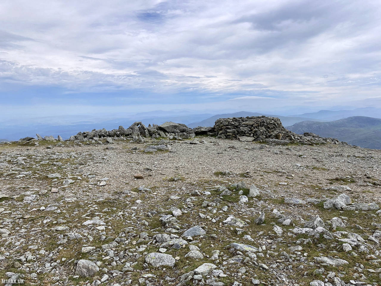
After reaching the summit, we set up our amateur radio equipment in the small stone shelter that is located on the rocky peak. From this vantage point, we were able to take advantage of the height to make plenty of contacts with other radio operators.
Carnedd Llewelyn is an ideal location for SOTA activation, and we were able to make many contacts with other radio enthusiasts, including a S2S with 2W0JYN/P on GW/NW-062.
After completing our SOTA activations from the summit of Carnedd Llewelyn, Andrew and I retraced our steps back down the mountain. We headed east towards our next target: the summit of Pen Llithrig y wrach, the second summit that we had planned to activate.
Photos
Below are some photographs taken during my activation of Carnedd Llewelyn on Saturday 16th February, 2019.


Walking Route for Carnedd Llewelyn
The interactive map below shows my GPS track taken to the SOTA activation zone for Carnedd Llewelyn. Note that this summit was activated as part of a multi-summit hike and the map below shows the full route taken on the day. The GW/NW-002 summit area is marked on the map with a blue pin icon.
You can download the route shown above as a GPX file suitable for use with most GPS devices. This file is provided for information only, to support your own walk planning and research (it may contain navigation errors, detours and/or safety hazards). The route downloads provided here are governed by the Creative Commons BY-NC-SA 4.0 licence.
Station Log
I logged the following 12 amateur radio contacts operating as MW1HAX from GW/NW-002 Carnedd Llewelyn on Saturday 16th February, 2019 (all times shown are UTC):
| Time | Callsign | Band | Mode | Notes |
|---|---|---|---|---|
| 12:00 | GW4ZPL/P | 2m | FM | 5/9 |
| 12:02 | M0ISC | 2m | FM | 5/8 |
| 12:03 | 2W0JYN/P | 2m | FM | 5/3, S2S GW/NW-062 |
| 12:05 | GW4PUX | 2m | FM | 5/9 |
| 12:06 | GW4CQZ | 2m | FM | 5/9 |
| 12:08 | 2E0MRR | 2m | FM | 5/9 |
| 12:10 | 2E0BLL | 2m | FM | 5/5 |
| 12:11 | G8MIA | 2m | FM | 5/9 |
| 12:13 | 2E0EWU/P | 2m | FM | 5/0 |
| 12:15 | 2E0TUE | 2m | FM | 5/1 |
| 12:17 | MW0OFA | 2m | FM | 5/8 |
| 12:18 | G7LMF | 2m | FM | 5/9 |
In the notes field I will usually log the other operator’s name and the signal report they provided. In accordance with the Summits on the Air rules, I do not make a log entry where a complete exchange of callsigns and signal reports was unsuccessful.
Additional Information
The following resources may be helpful to walkers, mountaineers and SOTA activators interested in Carnedd Llewelyn:
- Sotl.as Summit Page for GW/NW-002 Carnedd Llewelyn.
- Hill Bagging UK Summit Page for Carnedd Llewelyn.
- Google Maps Page for Carnedd Llewelyn.
- Wikipedia entry for Carnedd Llewelyn.
- 360° Panorama near summit of GW/NW-002 Carnedd Llewelyn.
If you found this content valuable, why not Buy Me a Coffee?