Glyder Fawr - GW/NW-003 SOTA (2019)

Summits on the Air Activation Report
Activation Date: Sunday 3rd February, 2019.
Activator(s): Richard M1HAX, Andrew M1CJE, Peter M6XPE.
Summit: Glyder Fawr, North Wales, Wales.
Summit ID: SOTA reference GW/NW-003 (10+3 points).
Summit Height: 1001m elevation, 642m prominence.
Summit Location: Lat./Long. 53.10147, -4.02916. Maidenhead Grid IO73xc.
Also Activated: GW/NW-004.
Distance: 12.3km travelled with 1373m of ascent.
Difficulty: Winter Grade I.
Elapsed Time: 8hr 25m (incl. operating and other summit(s) on the same hike).
Weather: Feels like -2.8°, 20 kph W wind, 91% humidity, snow/ice.
Radio Equipment: Yaesu FTM100D, MFJ-1714, Zippy 4200mAh 4S LiFePo4.
Callsign Used: MW1HAX/P.
Contacts: 4 (2m FM).
Trip Notes
In this winter ascent of Glyder Fawr, we approached starting from the nearby summit of Y Garn.
A stiff climb in summer conditions, the snowy windy ascent from Llyn y Cwn was memorably challenging. We had to stop several times to brace ourselves against powerful wind gusts.
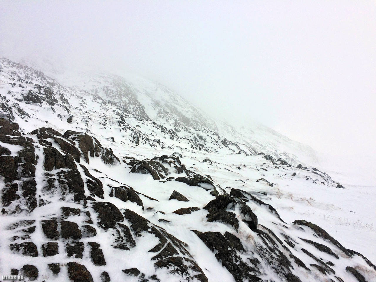
I captured only a couple of photos of this summit trip due to the severe weather. The summit has a number of rock formations which offered some limited shelter from the weather.
After another quick activation on the 2m band, the party headed east via Castell-Y-Gwynt and Glyder Fach, before taking the miners track down towards Llyn Bochlwyd.
Photos
Below are some photographs taken during my activation of Glyder Fawr on Sunday 3rd February, 2019.


Walking Route for Glyder Fawr
The interactive map below shows my GPS track taken to the SOTA activation zone for Glyder Fawr. Note that this summit was activated as part of a multi-summit hike and the map below shows the full route taken on the day. The GW/NW-003 summit area is marked on the map with a blue pin icon.
You can download the route shown above as a GPX file suitable for use with most GPS devices. This file is provided for information only, to support your own walk planning and research (it may contain navigation errors, detours and/or safety hazards). The route downloads provided here are governed by the Creative Commons BY-NC-SA 4.0 licence.
Station Log
I logged the following 4 amateur radio contacts operating as MW1HAX/P from GW/NW-003 Glyder Fawr on Sunday 3rd February, 2019 (all times shown are UTC):
| Time | Callsign | Band | Mode | Notes |
|---|---|---|---|---|
| 14:00 | GW4VPX | 2m | FM | 5/5 |
| 14:02 | GW0PLP | 2m | FM | 5/9 |
| 14:04 | 2E0LKC | 2m | FM | 5/9 |
| 14:06 | 2E0LMD | 2m | FM | 5/9 |
In the notes field I will usually log the other operator’s name and the signal report they provided. In accordance with the Summits on the Air rules, I do not make a log entry where a complete exchange of callsigns and signal reports was unsuccessful.
Additional Information
The following resources may be helpful to walkers, mountaineers and SOTA activators interested in Glyder Fawr:
- Sotl.as Summit Page for GW/NW-003 Glyder Fawr.
- Hill Bagging UK Summit Page for Glyder Fawr.
- Google Maps Page for Glyder Fawr.
- Wikipedia entry for Glyder Fawr.
- 360° Panorama near summit of GW/NW-003 Glyder Fawr.
If you found this content valuable, why not Buy Me a Coffee?