Pen Llithrig y Wrach - GW/NW-013 SOTA (2019)

Summits on the Air Activation Report
Activation Date: Saturday 16th February, 2019.
Activator(s): Richard M1HAX, Andrew M1CJE.
Summit: Pen Llithrig y Wrach, North Wales, Wales.
Summit ID: SOTA reference GW/NW-013 (6+3 points).
Summit Height: 799m elevation, 180m prominence.
Summit Location: Lat./Long. 53.14226, -3.92075. Maidenhead Grid IO83ad.
Also Activated: GW/NW-002.
Distance: 15.1km travelled with 1425m of ascent.
Difficulty: SAC Grade T3.(?)
Elapsed Time: 6hr 15m (incl. operating and other summit(s) on the same hike).
Weather: Feels like 3.9°C, 44 kph SW wind, 85% humidity.
Radio Equipment: Yaesu FTM100D, MFJ-1714, Zippy 4200mAh 4S LiFePo4.
Callsign Used: MW1HAX.
Contacts: 4 (2m FM).
Trip Notes
Pen Llithrig y Wrach is a Welsh mountain with a distinctive and evocative name that translates to “slippery peak of the witch.” This name may refer to the boggy conditions that can be found on the mountain, or to the pointed shape of the peak that resembles a witch’s hat. It is one of the more colourful names among the peaks of Britain.
Andrew and I began our hike at the summit of Carnedd Llewelyn.
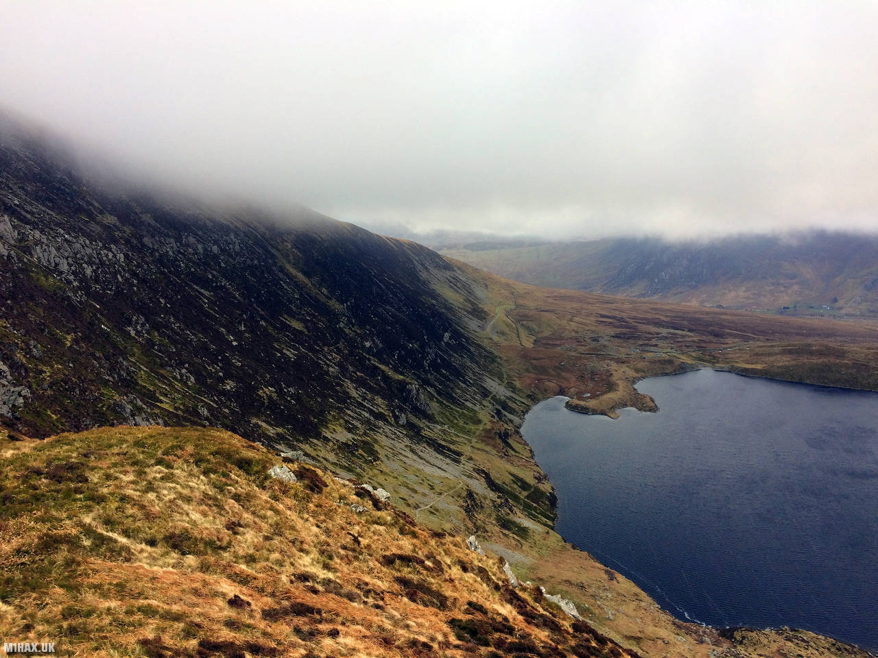
The weather was relatively mild for February in North Wales, with strong winds and heavy mist around the summit of Pen Llithrig y Wrach.
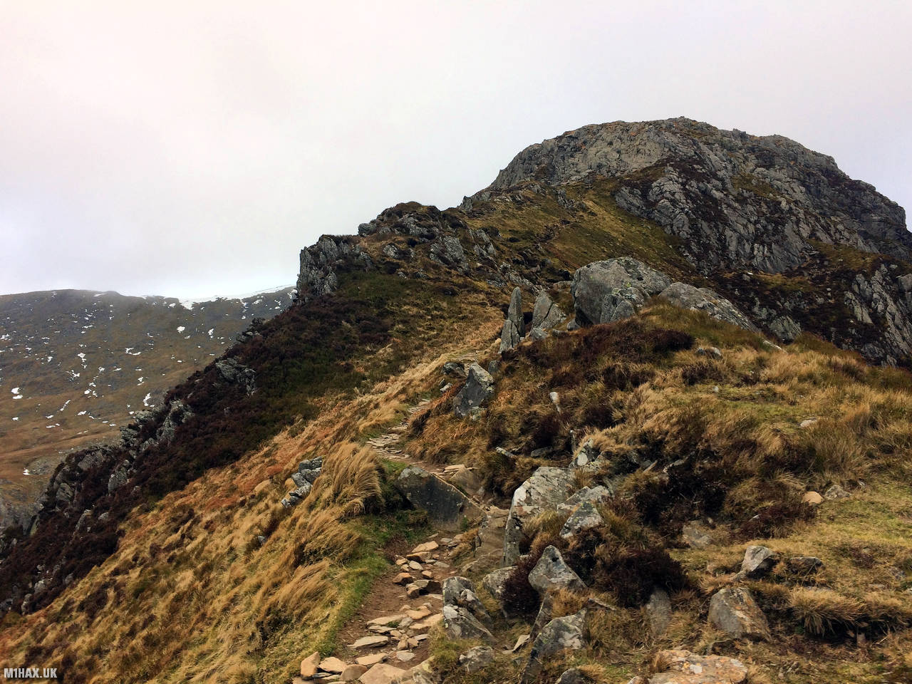
We followed the ridge path that connects the two mountains, taking care to navigate safely in the challenging conditions.
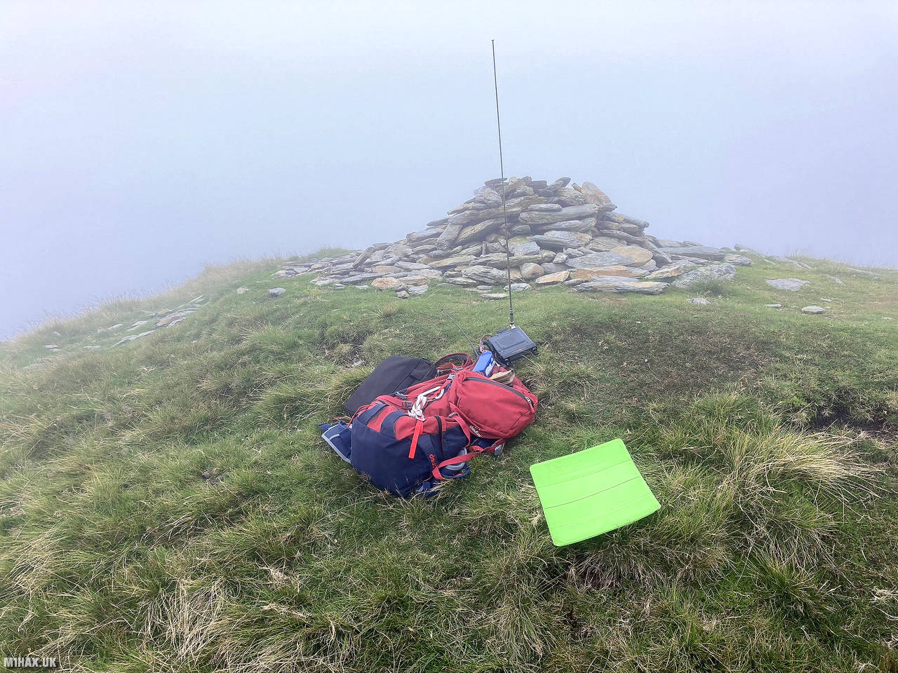
The summit of Pen Llithrig y Wrach was relatively featureless, with only a small cairn marking the highest point.
Due to deteriorating weather, my activation was quick, only making the minimum four contacts (including a summit-to-summit to South Wales).
We encountered a very wet and boggy marsh area on our descent, before picking up a farm track that led us back to the start point.
Photos
Below are some photographs taken during my activation of Pen Llithrig y Wrach on Saturday 16th February, 2019.


Walking Route for Pen Llithrig y Wrach
The interactive map below shows my GPS track taken to the SOTA activation zone for Pen Llithrig y Wrach. Note that this summit was activated as part of a multi-summit hike and the map below shows the full route taken on the day. The GW/NW-013 summit area is marked on the map with a blue pin icon.
You can download the route shown above as a GPX file suitable for use with most GPS devices. This file is provided for information only, to support your own walk planning and research (it may contain navigation errors, detours and/or safety hazards). The route downloads provided here are governed by the Creative Commons BY-NC-SA 4.0 licence.
Station Log
I logged the following 4 amateur radio contacts operating as MW1HAX from GW/NW-013 Pen Llithrig y Wrach on Saturday 16th February, 2019 (all times shown are UTC):
| Time | Callsign | Band | Mode | Notes |
|---|---|---|---|---|
| 14:30 | M0ISC | 2m | FM | 5/9 |
| 14:32 | GW7HEM/P | 2m | FM | 5/9, S2S GW/SW-015 |
| 14:34 | 2E0TUE | 2m | FM | 5/1 |
| 14:36 | 2E0WTH | 2m | FM | 5/9 |
In the notes field I will usually log the other operator’s name and the signal report they provided. In accordance with the Summits on the Air rules, I do not make a log entry where a complete exchange of callsigns and signal reports was unsuccessful.
Additional Information
The following resources may be helpful to walkers, mountaineers and SOTA activators interested in Pen Llithrig y Wrach:
- Sotl.as Summit Page for GW/NW-013 Pen Llithrig y Wrach.
- Hill Bagging UK Summit Page for Pen Llithrig y Wrach.
- Google Maps Page for Pen Llithrig y Wrach.
- Wikipedia entry for Pen Llithrig y Wrach.
- 360° Panorama near summit of GW/NW-013 Pen Llithrig y Wrach.
If you found this content valuable, why not Buy Me a Coffee?