Snowdon - GW/NW-001 SOTA (2019)

Summits on the Air Activation Report
Activation Date: Saturday 2nd February, 2019.
Activator(s): Richard M1HAX, Andrew M1CJE, Peter M6XPE.
Summit: Snowdon, North Wales, Wales.
Summit ID: SOTA reference GW/NW-001 (10+3 points).
Summit Height: 1085m elevation, 1039m prominence.
Summit Location: Lat./Long. 53.06850, -4.07623. Maidenhead Grid IO73xb.
Also Activated: GW/NW-008.
Distance: 12.0km travelled with 1272m of ascent.
Difficulty: Winter Grade I.
Elapsed Time: 8hr 30m (incl. operating and other summit(s) on the same hike).
Weather: Feels like -1.1°C, 17 kph N wind, 66% humidity, snow/ice.
Radio Equipment: Yaesu FTM100D, MFJ-1714, Zippy 4200mAh 4S LiFePo4.
Callsign Used: MW1HAX/P.
Contacts: 4 (2m FM).
Trip Notes
Snowdon (Yr Wyddfa in native Welsh) is the highest peak in Wales at 1085 metres above sea level. This summit has a number of well-established routes to the top and is a perennial favourite of tourists and hiking enthusiasts alike.
Originally intending to approach from Pen y Pass, a late breakfast at a local B&B meant the car park was full, so we opted to use the larger pay and display car park at Nantgwynant.
We also activated GW/NW-008, creating a circular all day hiking route using the Watkin path to the south of the mountain. The Snowdon summit was approached from Belch y Saethau to the south east.
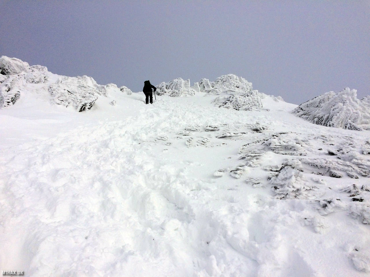
This was one of my first real winter mountain outings involving the use of crampons and ice axe. For the most part the group - led by Andrew M1CJE - were treated to excellent weather and snow conditions.
This is a serious trip in winter conditions and requires a level of pre-requisite knowledge and experience to be undertaken safely. Deep powder snow around the Watkin scree slope and -10C windchill made this a day to remember.
After making a quick four QSOs in uncomfortably cold weather, the group descended back towards Nantgwynant via Bwlch Main.
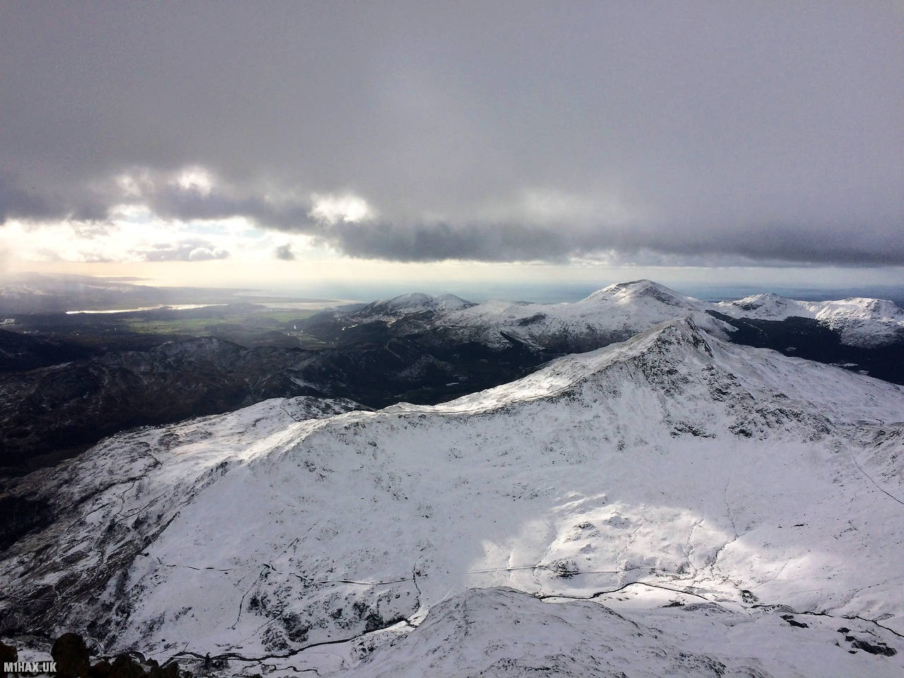
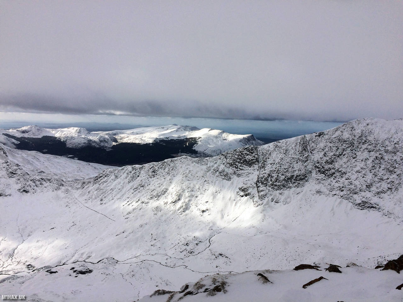
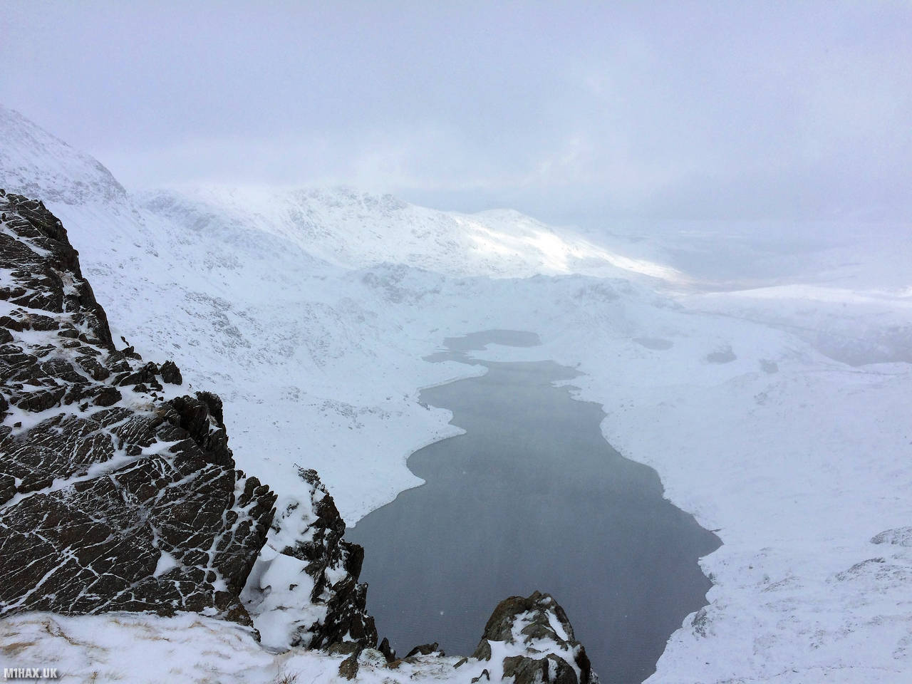
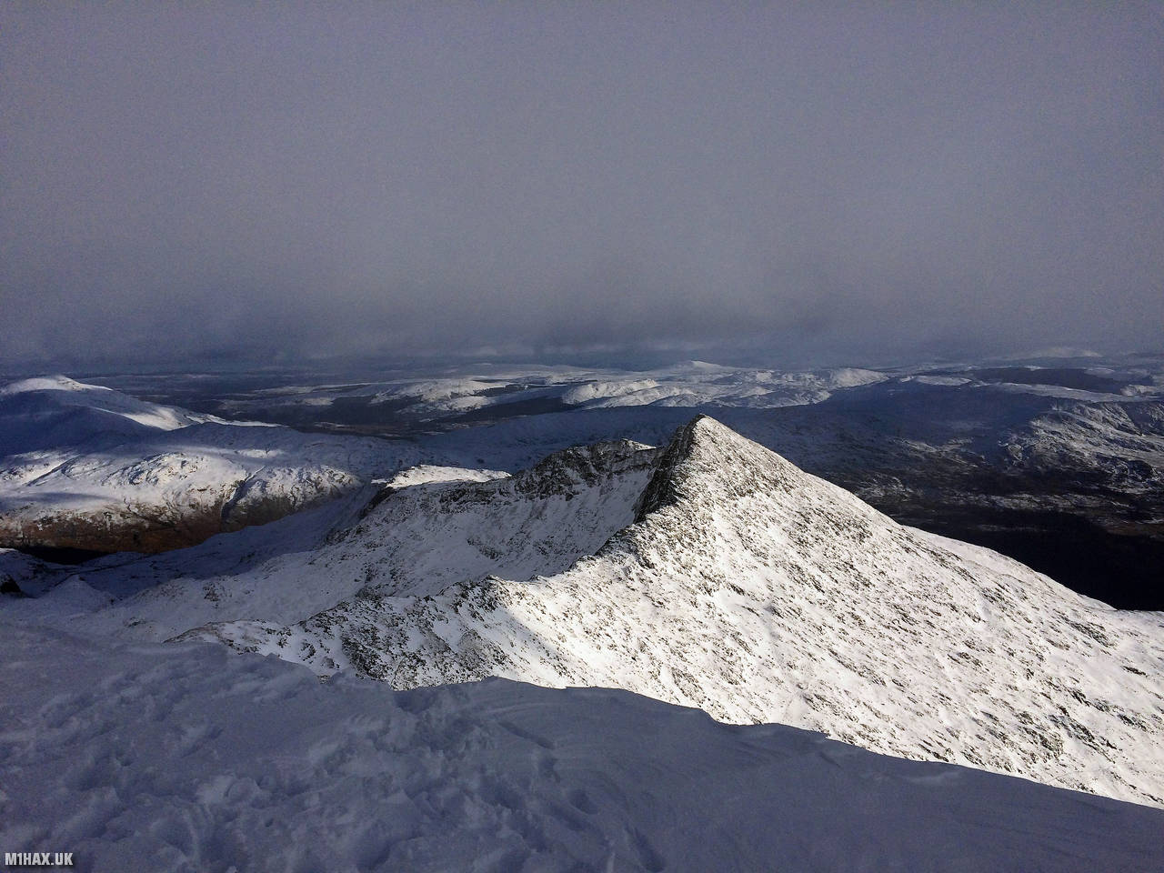
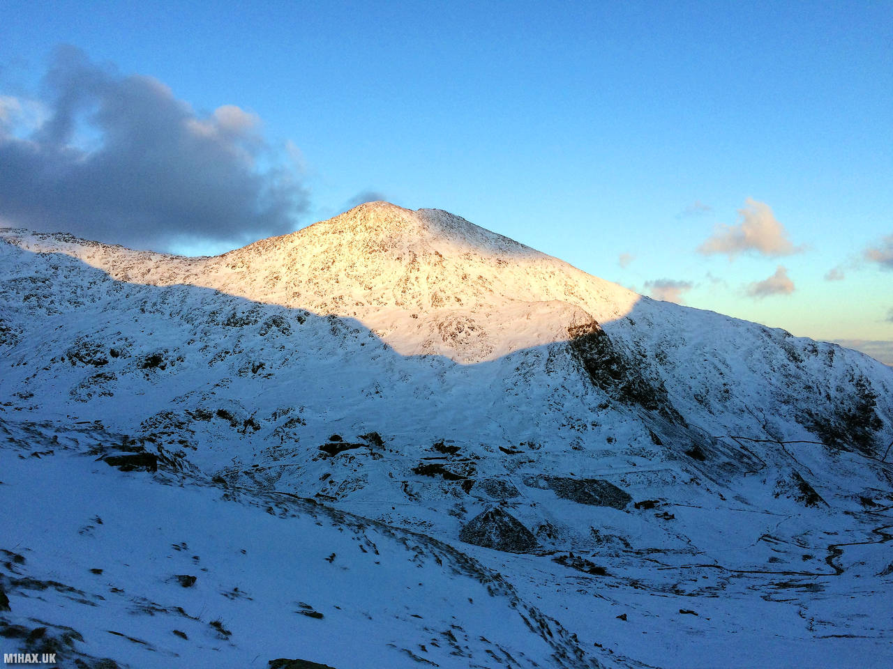
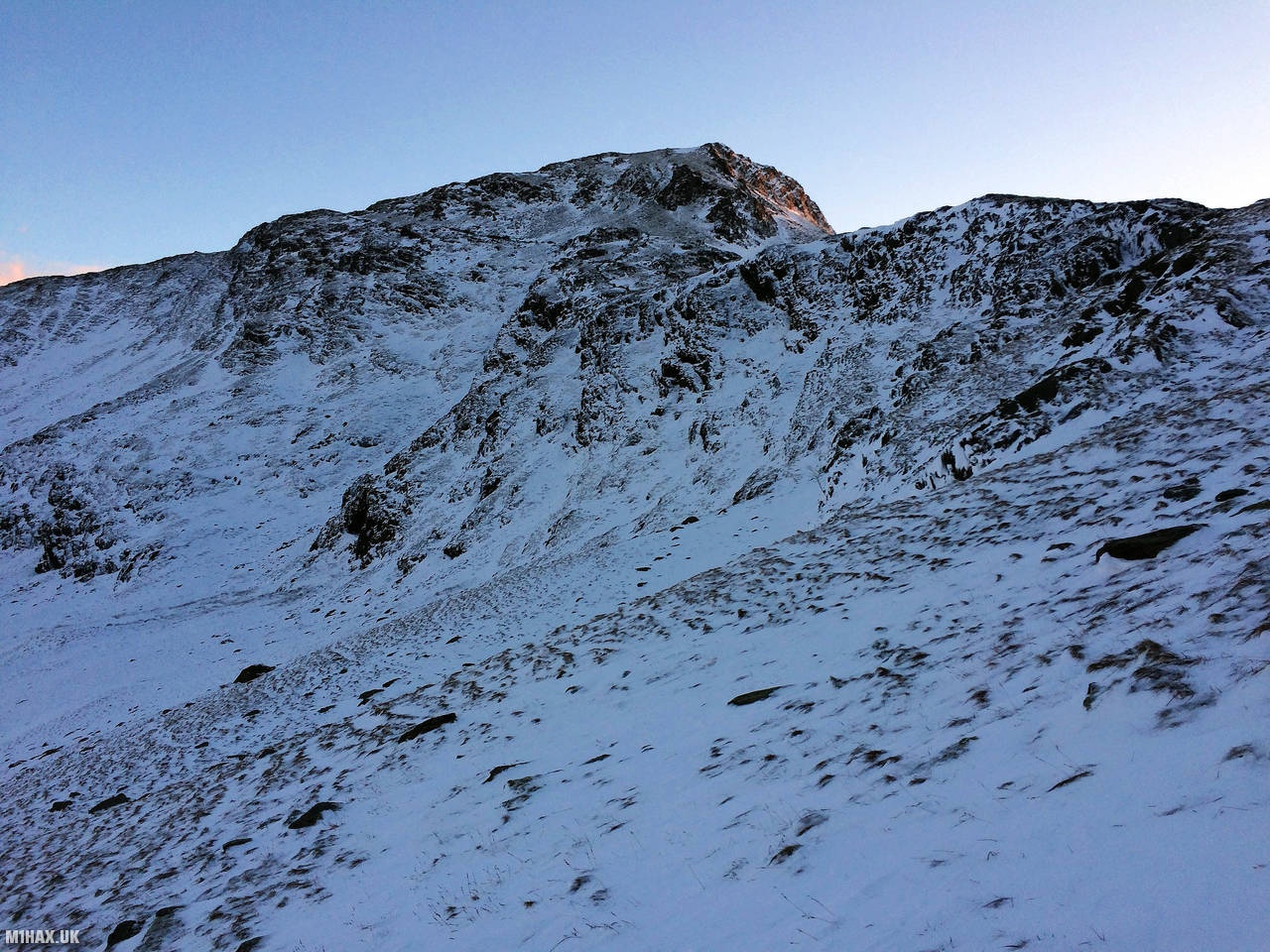
Photos
Below are some photographs taken during my activation of Snowdon on Saturday 2nd February, 2019.


Walking Route for Snowdon
The interactive map below shows my GPS track taken to the SOTA activation zone for Snowdon. Note that this summit was activated as part of a multi-summit hike and the map below shows the full route taken on the day. The GW/NW-001 summit area is marked on the map with a blue pin icon.
You can download the route shown above as a GPX file suitable for use with most GPS devices. This file is provided for information only, to support your own walk planning and research (it may contain navigation errors, detours and/or safety hazards). The route downloads provided here are governed by the Creative Commons BY-NC-SA 4.0 licence.
Station Log
I logged the following 4 amateur radio contacts operating as MW1HAX/P from GW/NW-001 Snowdon on Saturday 2nd February, 2019 (all times shown are UTC):
| Time | Callsign | Band | Mode | Notes |
|---|---|---|---|---|
| 13:30 | GW4VPX | 2m | FM | 5/5 |
| 13:32 | GW4ZPL | 2m | FM | 5/9 |
| 13:34 | GW0PLP | 2m | FM | 5/4 |
| 13:36 | 2W0SVL | 2m | FM | 5/9 |
In the notes field I will usually log the other operator’s name and the signal report they provided. In accordance with the Summits on the Air rules, I do not make a log entry where a complete exchange of callsigns and signal reports was unsuccessful.
Additional Information
The following resources may be helpful to walkers, mountaineers and SOTA activators interested in Snowdon:
- Sotl.as Summit Page for GW/NW-001 Snowdon.
- Hill Bagging UK Summit Page for Snowdon.
- Google Maps Page for Snowdon.
- Wikipedia entry for Snowdon.
- 360° Panorama near summit of GW/NW-001 Snowdon.
If you found this content valuable, why not Buy Me a Coffee?