Y Garn - GW/NW-004 SOTA (2019)

Summits on the Air Activation Report
Activation Date: Sunday 3rd February, 2019.
Activator(s): Richard M1HAX, Andrew M1CJE, Peter M6XPE.
Summit: Y Garn, North Wales, Wales.
Summit ID: SOTA reference GW/NW-004 (8+3 points).
Summit Height: 947m elevation, 236m prominence.
Summit Location: Lat./Long. 53.11569, -4.04708. Maidenhead Grid IO73xc.
Also Activated: GW/NW-003.
Distance: 12.3km travelled with 1373m of ascent.
Difficulty: Winter Grade I.
Elapsed Time: 8hr 25m (incl. operating and other summit(s) on the same hike).
Weather: Feels like -2.8°, 20 kph W wind, 91% humidity, snow/ice.
Radio Equipment: Yaesu FTM100D, MFJ-1714, Zippy 4200mAh 4S LiFePo4.
Callsign Used: MW1HAX/P.
Contacts: 4 (2m FM).
Trip Notes
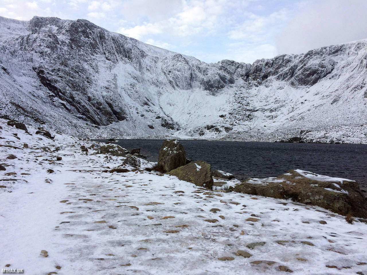
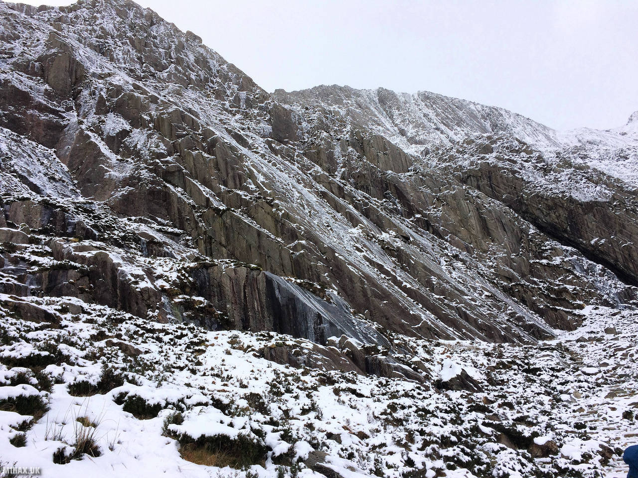
Y Garn is the fourth highest Marilyn summit in North Wales. On the second day of our winter North Wales expedition, the group approached from Ogwen Cottage, ascending through an icy Devil’s Kitchen.
Crampons were needed within minutes of leaving the car park, with an icy crust covering the path towards the Idwal Slabs.
This area is usually a tourist hotspot but in these winter conditions, visitors were few and far between. As we reached the bwlch between Y Garn and Glyder Fawr, a frozen over Llyn y Cwn greeted us. We took a right turn, in very windy blizzard-like conditions, navigating by compass to the weather-exposed summit of Y Garn.
After a quick four QSO activation, Andrew cleared the pile-up on the 2m band and we started our journey to the neighbouring Glyder Fawr.
Photos
Below are some photographs taken during my activation of Y Garn on Sunday 3rd February, 2019.


Walking Route for Y Garn
The interactive map below shows my GPS track taken to the SOTA activation zone for Y Garn. Note that this summit was activated as part of a multi-summit hike and the map below shows the full route taken on the day. The GW/NW-004 summit area is marked on the map with a blue pin icon.
You can download the route shown above as a GPX file suitable for use with most GPS devices. This file is provided for information only, to support your own walk planning and research (it may contain navigation errors, detours and/or safety hazards). The route downloads provided here are governed by the Creative Commons BY-NC-SA 4.0 licence.
Station Log
I logged the following 4 amateur radio contacts operating as MW1HAX/P from GW/NW-004 Y Garn on Sunday 3rd February, 2019 (all times shown are UTC):
| Time | Callsign | Band | Mode | Notes |
|---|---|---|---|---|
| 11:30 | MW0IDX | 2m | FM | 5/9 |
| 11:32 | G0HRT | 2m | FM | 5/8 |
| 11:34 | MW6SYL | 2m | FM | 5/9 |
| 11:36 | GW4VPX | 2m | FM | 5/9 |
In the notes field I will usually log the other operator’s name and the signal report they provided. In accordance with the Summits on the Air rules, I do not make a log entry where a complete exchange of callsigns and signal reports was unsuccessful.
Additional Information
The following resources may be helpful to walkers, mountaineers and SOTA activators interested in Y Garn:
- Sotl.as Summit Page for GW/NW-004 Y Garn.
- Hill Bagging UK Summit Page for Y Garn.
- Google Maps Page for Y Garn.
- Wikipedia entry for Y Garn.
- 360° Panorama near summit of GW/NW-004 Y Garn.
If you found this content valuable, why not Buy Me a Coffee?