Shining Tor - G/SP-004 SOTA (2019)

Summits on the Air Activation Report
Activation Date: Saturday 4th May, 2019.
Activator(s): Richard M1HAX.
Summit: Shining Tor, Southern Pennines, England.
Summit ID: SOTA reference G/SP-004 (2 points).
Summit Height: 559m elevation, 236m prominence.
Summit Location: Lat./Long. 53.26068, -2.00932. Maidenhead Grid IO83xg.
Distance: 4.0km travelled with 112m of ascent.
Difficulty: SAC Grade T1.(?)
Elapsed Time: 1hr 50m (including operating).
Weather: Feels like 5.6°C, 20 kph N wind, 50% humidity.
Radio Equipment: Yaesu FTM100D, MFJ-1714, Zippy 4200mAh 4S LiFePo4.
Callsign Used: M1HAX/P.
Contacts: 31 (2m FM).
Trip Notes
Shining Tor is the highest peak in the county of Cheshire, England, standing at a height of 559 meters (1,834 feet) above sea level. It is located in the Peak District National Park, an area known for its beautiful countryside and outdoor recreational opportunities. The hill is also a popular spot for birdwatching, as it is home to a variety of birds, including peregrine falcons, kestrels, and curlews.
This hill is an easy 2-point summit and can be readily combined with other minor summits in the area such as The Cloud G/SP-015 and Gun G/SP-013.
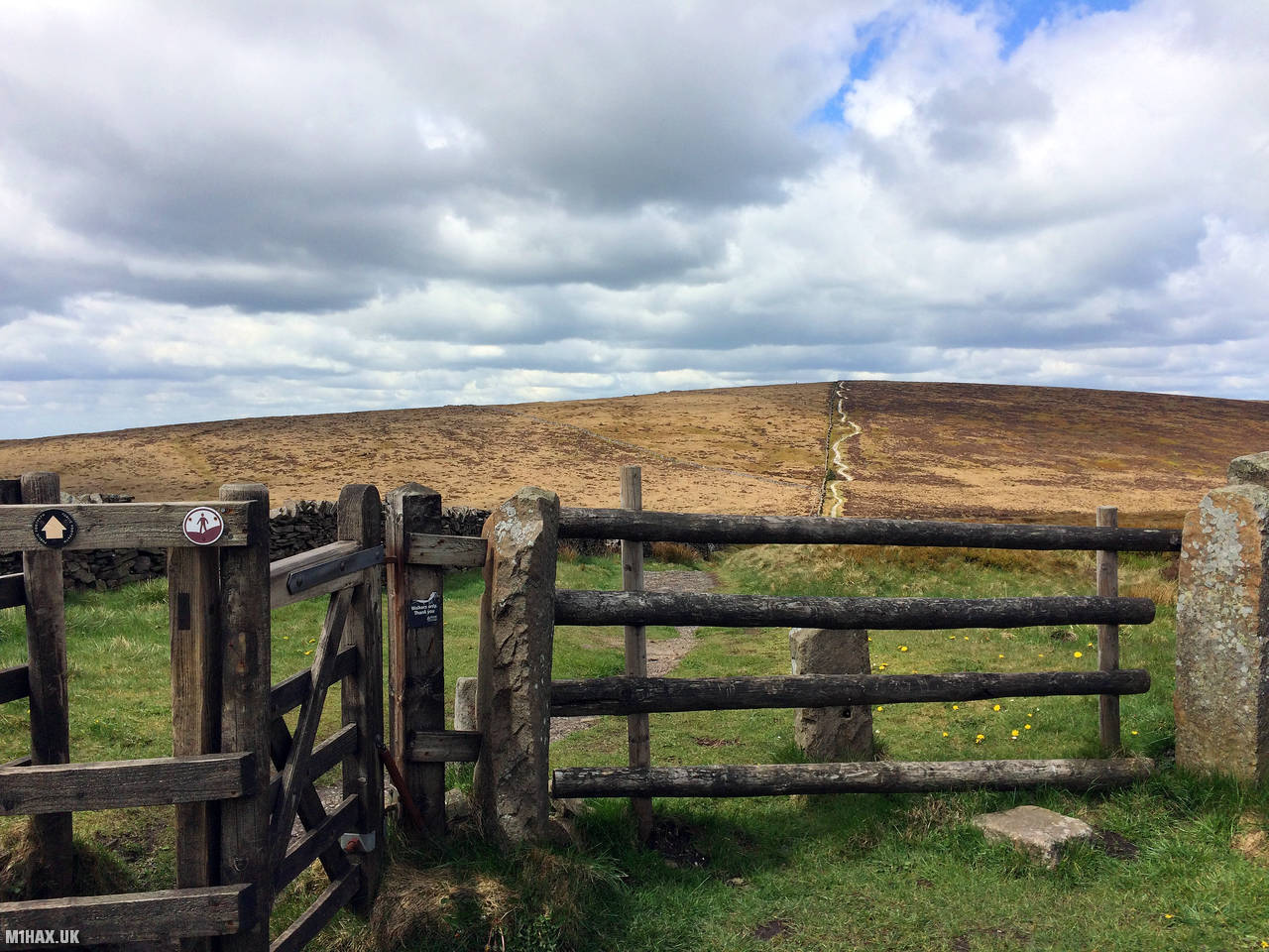
I parked on the roadside near the Cat & Fiddle Inn and approached the summit from the south.
A stony footpath runs all the way from the road to the summit where a trig point, boundary wall and seating await.
I activated the summit with my usual Yaesu FTM100D and MFJ-1714 setup. I stayed on the summit for nearly an hour, working 31 stations on 2-metres FM.
Photos
Below are some photographs taken during my activation of Shining Tor on Saturday 4th May, 2019.


Walking Route for Shining Tor
The interactive map below shows my GPS track taken to the SOTA activation zone for Shining Tor. The G/SP-004 summit area is marked on the map with a blue pin icon.
You can download the route shown above as a GPX file suitable for use with most GPS devices. This file is provided for information only, to support your own walk planning and research (it may contain navigation errors, detours and/or safety hazards). The route downloads provided here are governed by the Creative Commons BY-NC-SA 4.0 licence.
Station Log
I logged the following 31 amateur radio contacts operating as M1HAX/P from G/SP-004 Shining Tor on Saturday 4th May, 2019 (all times shown are UTC):
| Time | Callsign | Band | Mode | Notes |
|---|---|---|---|---|
| 12:31 | G4DQB/M | 2m | FM | 5/7 |
| 12:32 | 2E0MOW | 2m | FM | 5/5 |
| 12:33 | G4LGE | 2m | FM | 5/9 |
| 12:34 | M1CUE/M | 2m | FM | 5/9 |
| 12:36 | 2E0ZAP | 2m | FM | 5/5 |
| 12:37 | M6OBQ/P | 2m | FM | 5/9 |
| 12:40 | 2E0FDN | 2m | FM | 5/6 |
| 12:41 | 2E0TWT | 2m | FM | 5/9 |
| 12:43 | G4URM | 2m | FM | 5/6 |
| 12:44 | M6PMA | 2m | FM | 5/9 |
| 12:47 | 2W0JYN | 2m | FM | 5/9 |
| 12:48 | G4ZFZ/P | 2m | FM | 5/7, S2S G/CE-003 |
| 12:50 | MW0IDX | 2m | FM | 5/5 |
| 12:51 | M7RIL | 2m | FM | 5/6 |
| 12:53 | M1MLM | 2m | FM | 5/9 |
| 12:54 | GW4TJC/M | 2m | FM | 5/2 |
| 12:55 | G7OEM | 2m | FM | 5/6 |
| 12:56 | 2E0TWD/M | 2m | FM | 5/6 |
| 12:58 | G7AMD | 2m | FM | 5/9 |
| 12:59 | M0WPS | 2m | FM | 5/3 |
| 13:00 | G4XQB/M | 2m | FM | 5/9 |
| 13:02 | G6NHW | 2m | FM | 5/3 |
| 13:03 | M7TUX | 2m | FM | 5/9 |
| 13:04 | M0CSI | 2m | FM | 5/9 |
| 13:06 | M1EIB | 2m | FM | 5/9 |
| 13:07 | M3LWP/M | 2m | FM | 5/9 |
| 13:09 | 2E1ICK | 2m | FM | 5/9 |
| 13:10 | G0NJZ | 2m | FM | 5/9 |
| 13:11 | G8OGI/P | 2m | FM | 5/9, S2S G/NP-005 |
| 13:12 | G0CTR | 2m | FM | 5/9 |
| 13:15 | G1VQN/P | 2m | FM | 5/5 |
In the notes field I will usually log the other operator’s name and the signal report they provided. In accordance with the Summits on the Air rules, I do not make a log entry where a complete exchange of callsigns and signal reports was unsuccessful.
Additional Information
The following resources may be helpful to walkers, mountaineers and SOTA activators interested in Shining Tor:
- Sotl.as Summit Page for G/SP-004 Shining Tor.
- Hill Bagging UK Summit Page for Shining Tor.
- Google Maps Page for Shining Tor.
- Wikipedia entry for Shining Tor.
- 360° Panorama near summit of G/SP-004 Shining Tor.
If you found this content valuable, why not Buy Me a Coffee?