Trum y Ddysgl - GW/NW-024 SOTA (2019)

Summits on the Air Activation Report
Activation Date: Sunday 26th May, 2019.
Activator(s): Richard M1HAX, Andrew M1CJE, Peter M6XPE.
Summit: Trum y Ddysgl, North Wales, Wales.
Summit ID: SOTA reference GW/NW-024 (6 points).
Summit Height: 709m elevation, 204m prominence.
Summit Location: Lat./Long. 53.04221, -4.17197. Maidenhead Grid IO73vb.
Distance: 6.4km travelled with 552m of ascent.
Difficulty: SAC Grade T2.(?)
Elapsed Time: 4hr 30m (including operating).
Weather: Feels like 12.8°C, 26 kph SW wind, 94% humidity.
Radio Equipment: Yaesu FTM100D, MFJ-1714, Zippy 4200mAh 4S LiFePo4.
Callsign Used: MW1HAX/P.
Contacts: 4 (2m FM).
Trip Notes
Trum y Ddysgl is the second highest mountain on the celebrated Nantlle Ridge in Snowdonia, North Wales. It is also one of two Marilyns that make up the ridge, the other being Craig Cwm Silyn. The mountain has a dramatic rocky appearance with aretes and glacial cwms. It offers views of nearby Snowdonia mountains Mynydd Mawr, Yr Wyddfa, and Moel Hebog.
This was our first summit of the second day of a wild-camping weekend in North Wales attempting a number of Summits on the Air mountains.
Our route started from the glacial cwm to the immediate west of the summit, where we had camped the previous night. We navigated a bearing north-east up a steep boulder field to meet a faint track leading up the ridge to the summit.
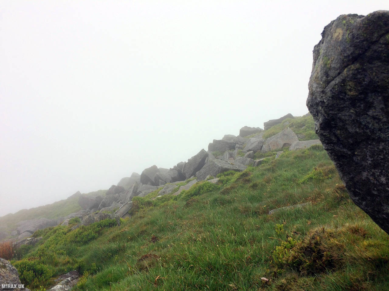
In thick mist we successfully completed our activations from the summit of Trum y Ddysgl, all using the 2-metre amateur radio band.
Our original plan for the day was to head south towards Moel Hebog, but that changed when Peter from our group injured his knee on the boulder field during the ascent. We took an escape route to the north, picking up a minor road which returned us to the Rhyd-Ddu station car park where we had left the car the day before.
Photos
Below are some photographs taken during my activation of Trum y Ddysgl on Sunday 26th May, 2019.


Walking Route for Trum y Ddysgl
The interactive map below shows my GPS track taken to the SOTA activation zone for Trum y Ddysgl. The GW/NW-024 summit area is marked on the map with a blue pin icon.
You can download the route shown above as a GPX file suitable for use with most GPS devices. This file is provided for information only, to support your own walk planning and research (it may contain navigation errors, detours and/or safety hazards). The route downloads provided here are governed by the Creative Commons BY-NC-SA 4.0 licence.
Station Log
I logged the following 4 amateur radio contacts operating as MW1HAX/P from GW/NW-024 Trum y Ddysgl on Sunday 26th May, 2019 (all times shown are UTC):
| Time | Callsign | Band | Mode | Notes |
|---|---|---|---|---|
| 09:10 | GW4TQD | 2m | FM | 5/9 |
| 09:20 | MW0VKD | 2m | FM | 4/3 |
| 09:24 | MW1CJE | 2m | FM | 5/9 |
| 09:26 | MW6XPE | 2m | FM | 5/9 |
In the notes field I will usually log the other operator’s name and the signal report they provided. In accordance with the Summits on the Air rules, I do not make a log entry where a complete exchange of callsigns and signal reports was unsuccessful.
Additional Information
The following resources may be helpful to walkers, mountaineers and SOTA activators interested in Trum y Ddysgl:
- Sotl.as Summit Page for GW/NW-024 Trum y Ddysgl.
- Hill Bagging UK Summit Page for Trum y Ddysgl.
- Google Maps Page for Trum y Ddysgl.
- Wikipedia entry for Trum y Ddysgl.
If you found this content valuable, why not Buy Me a Coffee?