Moel Hebog - GW/NW-014 SOTA (2019)

Summits on the Air Activation Report
Activation Date: Saturday 27th July, 2019.
Activator(s): Richard M1HAX.
Summit: Moel Hebog, North Wales, Wales.
Summit ID: SOTA reference GW/NW-014 (6 points).
Summit Height: 783m elevation, 585m prominence.
Summit Location: Lat./Long. 53.00051, -4.14009. Maidenhead Grid IO73wa.
Distance: 7.2km travelled with 604m of ascent.
Difficulty: SAC Grade T2.(?)
Elapsed Time: 2hr 50m (including operating).
Weather: Feels like 17.8°C, 17 kph NNW wind, 73% humidity.
Radio Equipment: Yaesu FTM100D, MFJ-1714, Zippy 4200mAh 4S LiFePo4.
Callsign Used: MW1HAX/P.
Contacts: 4 (2m FM).
Trip Notes
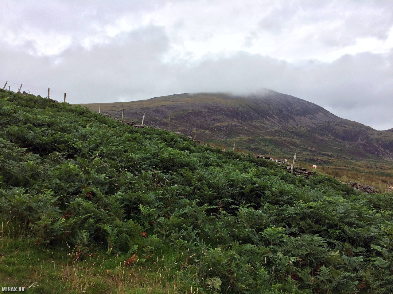
Moel Hebog is a mountain in the Snowdonia National Park in North Wales. It is located to the northwest of the town of Beddgelert and rises to a height of 828 meters. The mountain is a popular destination for walkers and hikers, and offers panoramic views of the surrounding area. There are several routes to the summit, including a more challenging route from the north that involves some scrambling. Moel Hebog is also home to a number of Iron Age hill forts, which adds to its historical interest.
This activation of Moel Hebog GW/NW-014 was undertaken as part of a bigger day activating three summits for 16 points. The weather was quite windy with rain showers all day.
I parked by the reservoir lake to the south of the mountain at Tyddyn Mawr. There is a reasonable amount of parking available at the end of a narrow track road.
The route taken tracks up the grassy hillside before eventually gaining a ridge line that reaches the summit. The paths were faint at best and some navigational skills were required. Take care to avoid cattle in the walled enclosure half way between Braich Y Cornel and Moel Hebog summit.
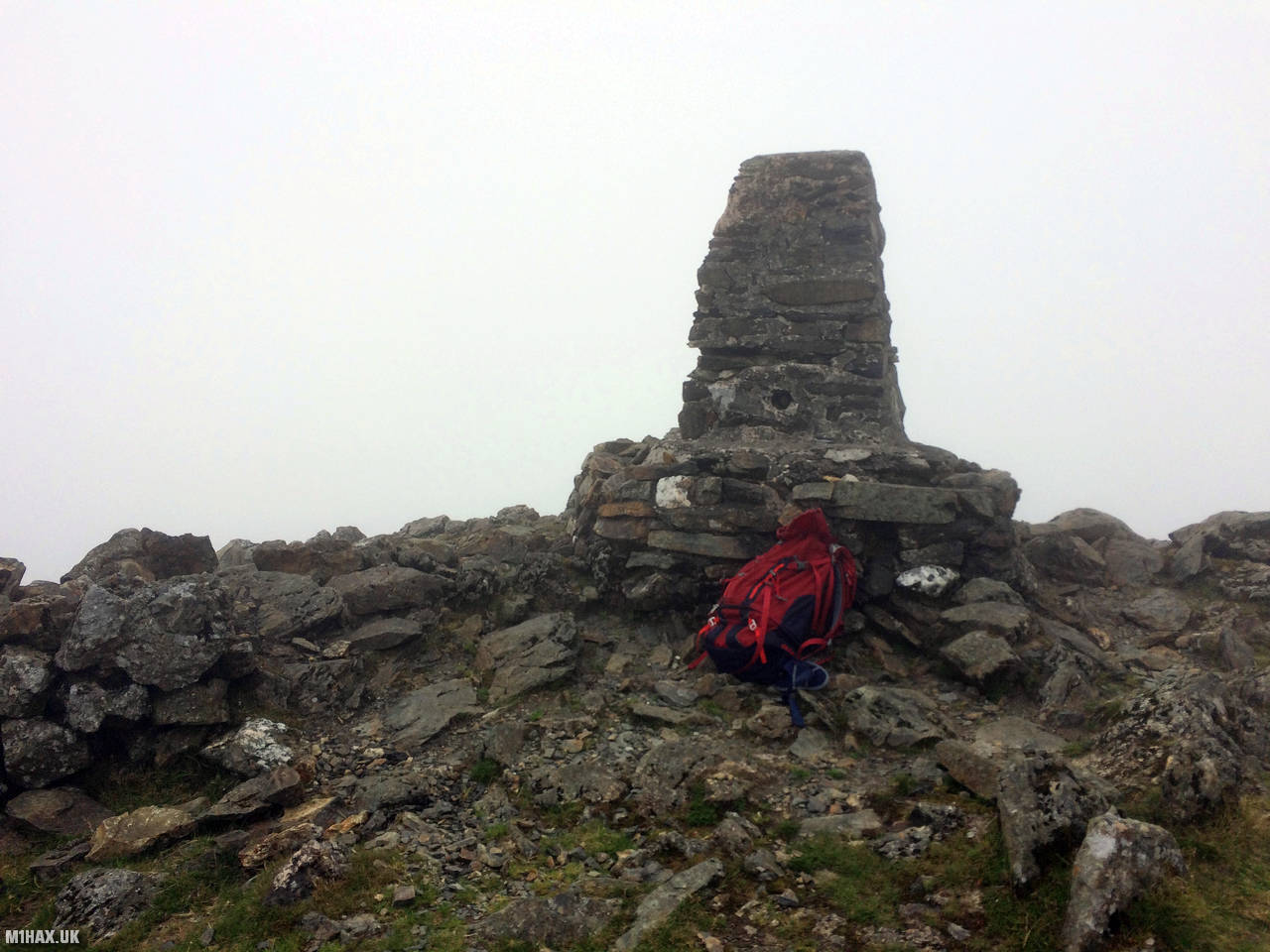
As time was short and the weather unpleasant, I opted for a quick activation at the trig point using the 2-metre amateur band. I had my four QSOs in the log in under four minutes, thanks in part to a couple of dedicated SOTA chasers, Allan GW4VPX and Frank MW0OFA.
I would not recommend this route to the summit of Moel Hebog. There is a lot of heather bashing. The route from Beddgelert with some very easy scrambling is a vastly more enjoyable experience.
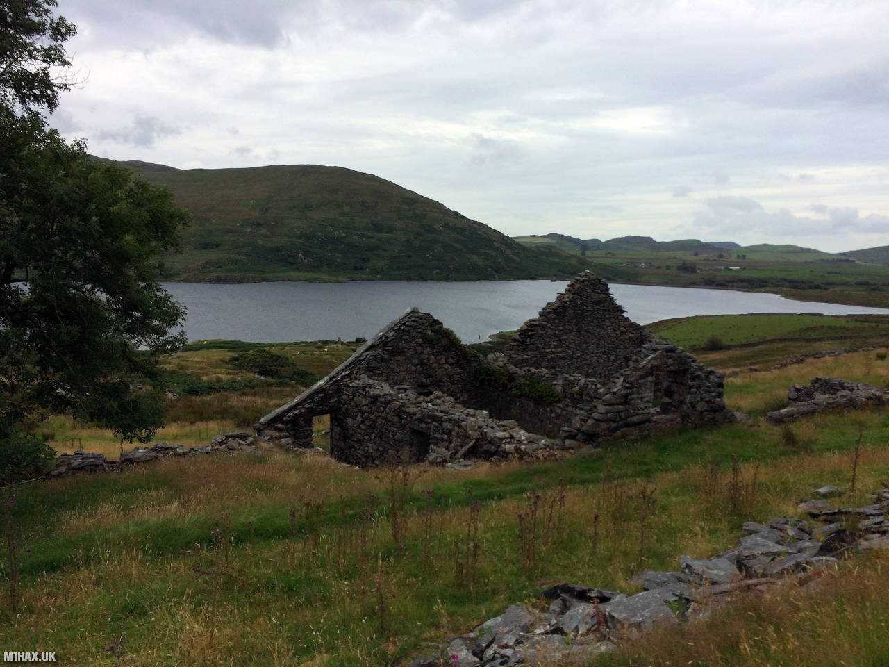
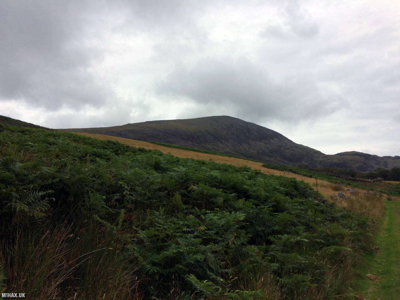
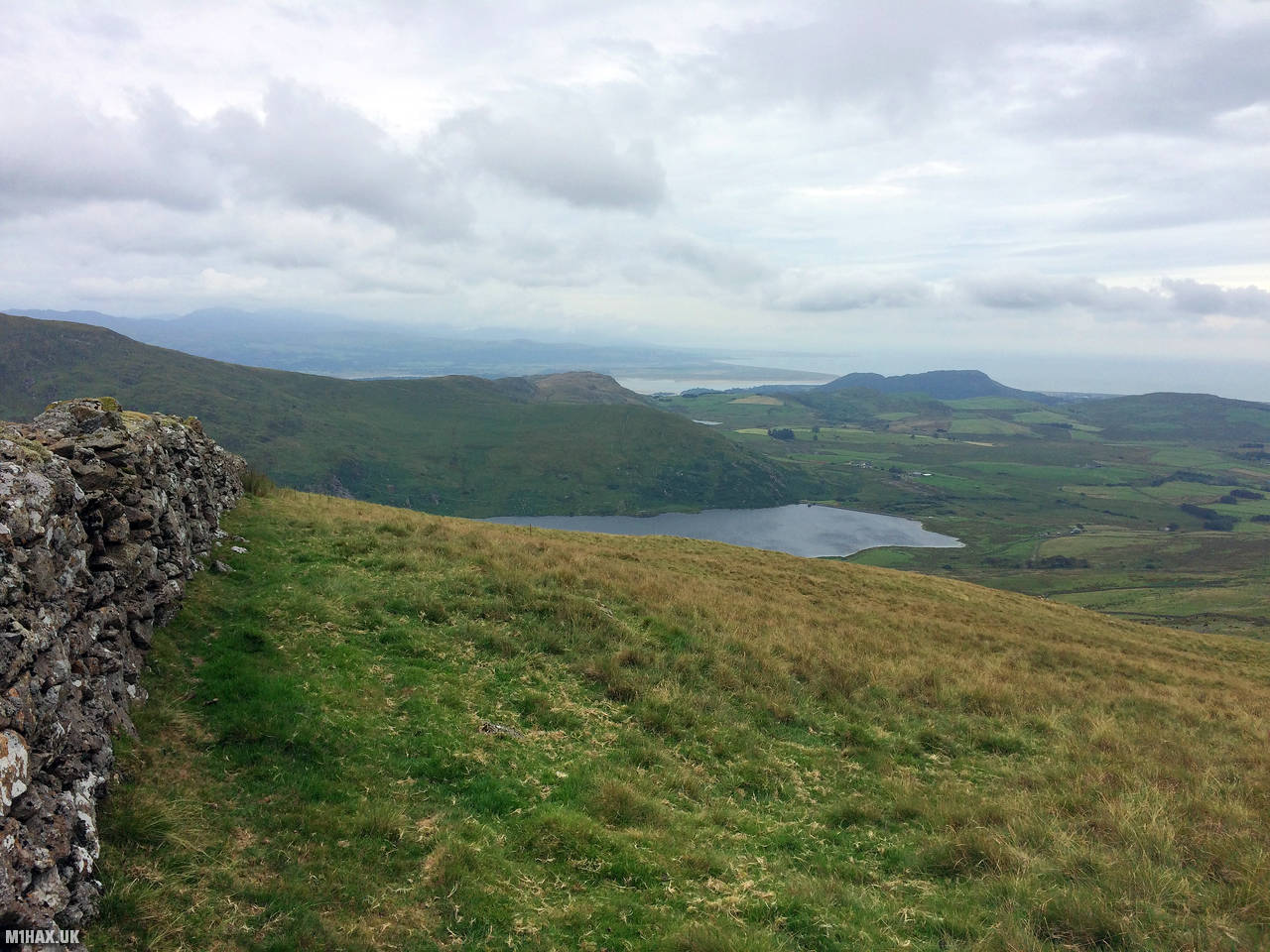
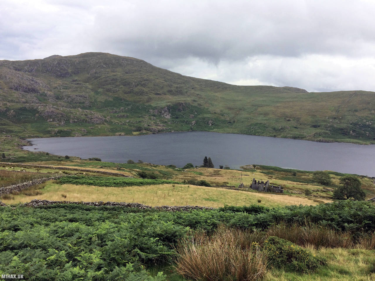
Photos
Below are some photographs taken during my activation of Moel Hebog on Saturday 27th July, 2019.


Walking Route for Moel Hebog
The interactive map below shows my GPS track taken to the SOTA activation zone for Moel Hebog. The GW/NW-014 summit area is marked on the map with a blue pin icon.
You can download the route shown above as a GPX file suitable for use with most GPS devices. This file is provided for information only, to support your own walk planning and research (it may contain navigation errors, detours and/or safety hazards). The route downloads provided here are governed by the Creative Commons BY-NC-SA 4.0 licence.
Station Log
I logged the following 4 amateur radio contacts operating as MW1HAX/P from GW/NW-014 Moel Hebog on Saturday 27th July, 2019 (all times shown are UTC):
| Time | Callsign | Band | Mode | Notes |
|---|---|---|---|---|
| 15:00 | GW4VPX | 2m | FM | Allan, 5/7 |
| 15:01 | MW0OFA | 2m | FM | Frank, 5/9 |
| 15:02 | MW0BYT | 2m | FM | Ross, 5/6 |
| 15:03 | MW0CHZ | 2m | FM | Dafydd, 5/7 |
In the notes field I will usually log the other operator’s name and the signal report they provided. In accordance with the Summits on the Air rules, I do not make a log entry where a complete exchange of callsigns and signal reports was unsuccessful.
Additional Information
The following resources may be helpful to walkers, mountaineers and SOTA activators interested in Moel Hebog:
- Sotl.as Summit Page for GW/NW-014 Moel Hebog.
- Hill Bagging UK Summit Page for Moel Hebog.
- Google Maps Page for Moel Hebog.
- Wikipedia entry for Moel Hebog.
If you found this content valuable, why not Buy Me a Coffee?