Arctic Circle Trail Diary - Day 3 (Ice Cap)
Gravel and Glaciers
On Monday, August 19th, we started our day with breakfast at the hotel restaurant within the airport complex at Kangerlussuaq. The buffet spread was decent, but as expected, everything was expensive due to the remote location. After breakfast, we visited the supermarket near the airport to get our final supplies, including gas canisters for our camp stoves. The gas was expensive, but it couldn’t be carried in our flight luggage from home, so we had little choice.
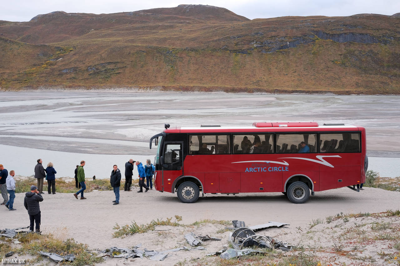
The weather was cool and dry, and it hadn’t been as cold as we had imagined the ‘arctic’ might be. We took the 1pm tourist 4x4 coach from Kangerlussuaq, operated by Albatros Arctic, to the ice cap, at a spot known as Point 660. Point 660 is a summit located near the ice-sheet, named as it is 660 meters high. It’s important to note that hiking on glaciers can be dangerous, and explorers should be well-equipped and knowledgeable about glacier travel.
The coach was late departing, but it was still a better option than walking to our start-point for the Arctic Circle Trail hike. The drive to the ice sheet took about 2 hours, and we made a number of stops along the way to take in the views. One poignant stop was to look at the undisturbed wreckage of two crashed American military planes dating from the cold war.

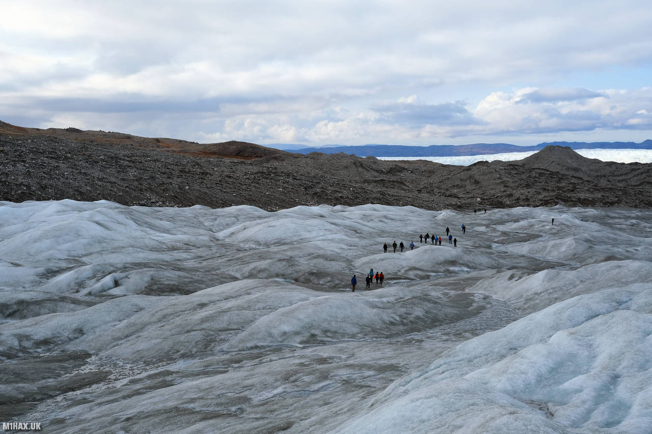
The Albatros Arctic team led the tour group on a short walk on to the ice cap, before leaving us behind on the ice, where we would begin our ACT hike. As we were travelling light for the trip, and this was the only expected bit of ice we would cover, we had not brought any crampons. Walking on the ice-sheet without crampons and 20kg backpacks was awkward at times, but we managed it.

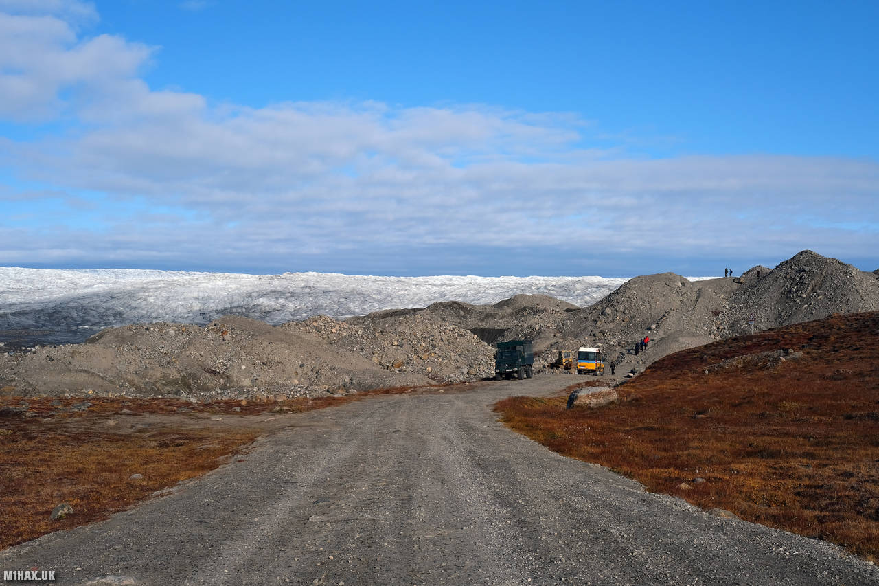
After taking some photos and flying a camera drone, we began a relatively short and flat hike of 12km to our camping spot near the Russell Glacier. The walking route would initially follow the gravel road which the bus had used to deliver us from Kangerlussuaq.

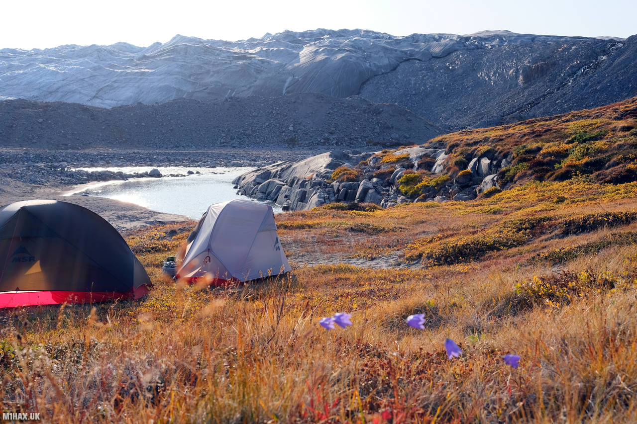
Towards the end of the day, we saw Reindeer around the Russel Glacier area where we would camp for the evening. Russell Glacier is a large glacier located in the Kangerlussuaq region of western Greenland. The glacier is around 80 km long and up to 4 km wide. It is one of the largest glaciers in Greenland and is fed by the Kangerlussuaq ice cap. The glacier flows from the ice cap to the sea and is visible from the Arctic Circle Trail.

Due to the late bus departure, we were already running a little behind schedule and would need to cover additional ground the next day to arrive back at Kangerlussuaq on time.
Click here to jump to the next entry in my Arctic Circle Trail hike diary.