Arctic Circle Trail Diary - Day 4 (Russell Glacier)
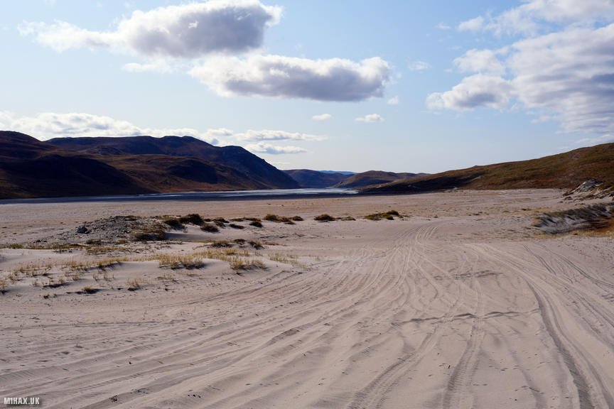
Sandy Beaches and Dusty Roads
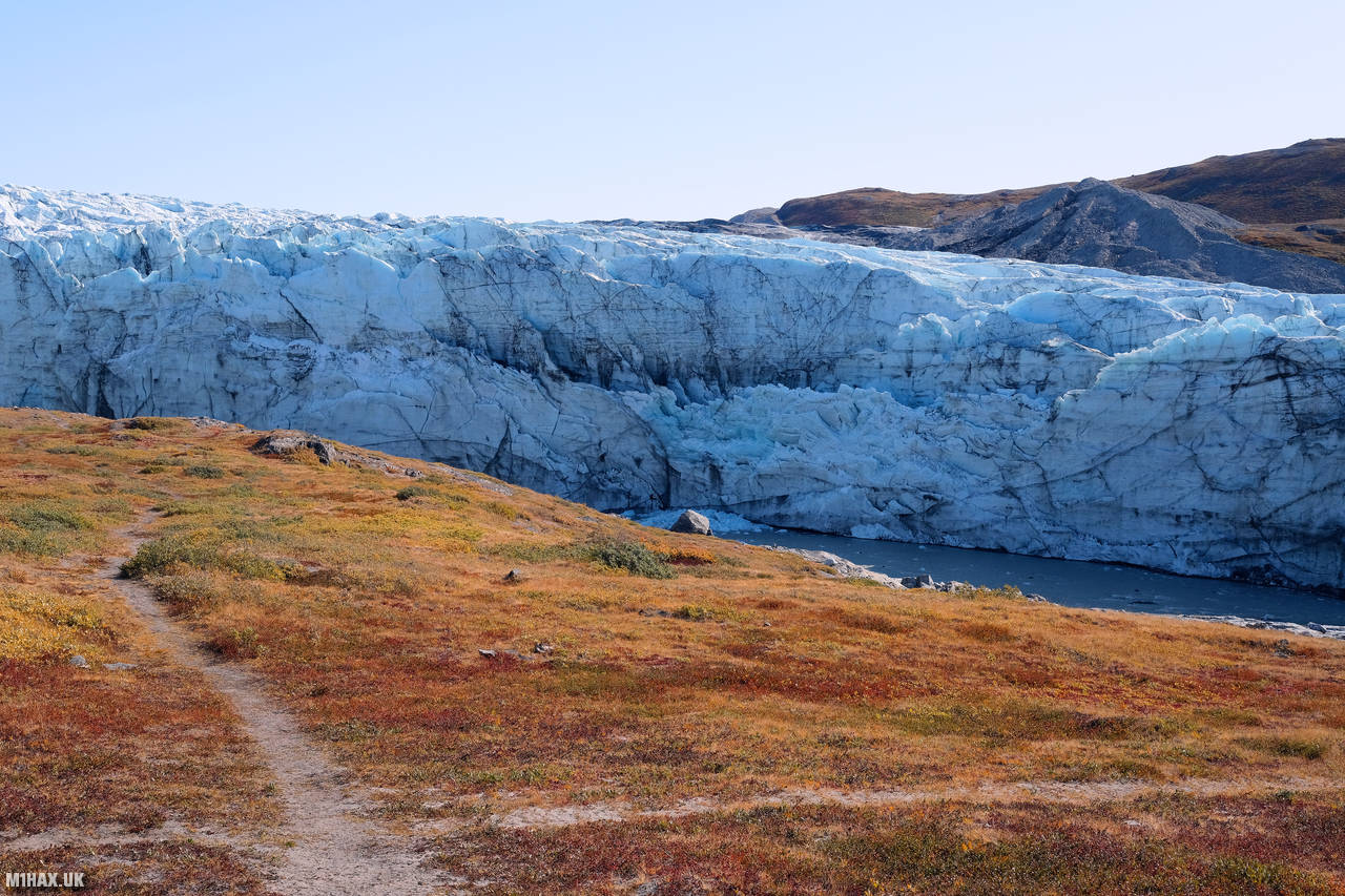
It was a peaceful night spent under the stars, the only sound being the gentle trickle of the glacier ice melting into the river by our campsite. I was using an MSR Hubba NX one-man lightweight backpacking tent on this trip and so far, it had been performing perfectly. I had brought a small selection of various extra tent pegs, and I was glad to have these on hand when pitching on the sandy ground by the glacier.

For food, we each carried a supply of various dehydrated meals. Our bags, initially weighing in at around 20kg, would get progressively lighter as the journey went on. Over breakfast, I studied the Harveys Greenland maps, which I would use for navigation. Today’s journey would be a simple task of following the gravel road we had previously driven up, all the way back to the town of Kangerlussuaq.

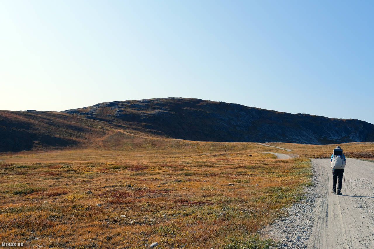
Walking in T-shirts on a hot sunny day, we proceeded to cover 32 kilometres with about 450 metres of ascent back to town. Including stoppage time for breaks and enjoying the scenery, this took us a good eight hours. Not a bad pace considering our loads, although the terrain was simple. The ground underfoot was quite sandy, almost like walking on a beach at times. Every so often, a pickup truck or tour bus would travel along the dry sandy road, kicking up a cloud of dust which would linger in our path for an unpleasant while.

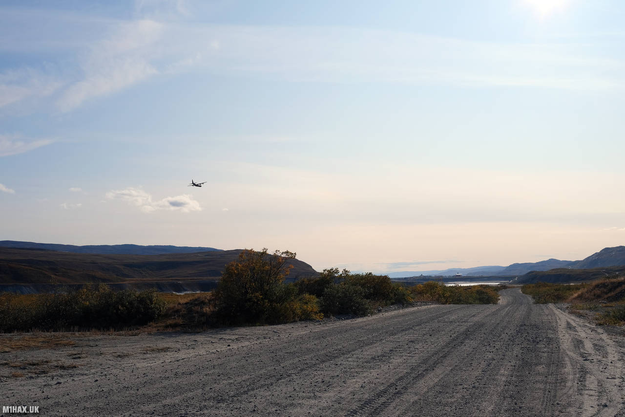
Every so often, an ‘Arktisk Kommando’ transport plane would fly low overhead, apparently practising cargo parachute drops on the adjacent dry river bed. It’s possible they were delivering supplies to fight the wildfire near Sisimuit. I’m convinced the pilot gave us a wing-tip waggle greeting at one point.
Along the journey, we passed by a small hill called Sugarloaf Mountain. This could be optionally included in this stage of the ACT hike. With the sun beating down on us and our bags weighing heavily on our backs, we agreed to continue on the road, skipping the path up and over Sugarloaf. I would come to regret not taking this rare opportunity to summit this hill I would never see again. In retrospect, I think we had the fitness and time to include it in our day.
Another point of interest when nearing town was what I believe to be the world’s “most northerly golf course”, on a sandy roadside plain. There were no players in sight. It seemed like little more than a few hole flags placed around the sand.
Eventually, we arrived back at the airport campsite in Kangerlussuaq, where we had slept the night before last. There was no sign of the Danish campsite manager this time, and the thought did occur to me that perhaps he was not actually the manager of the campsite after all.

We set up camp again for the night before heading into the airport for dinner. The burger and fries were just the ticket after all day on our feet. The cafe in the airport lounge provided several facilities which we were taking full advantage of before we left for the arctic wilderness - charging sockets for our USB powerbanks, clean water, and indoor toilets.
Our cumulative hiking statistics for the ACT journey now stood at 42.6km travelled with 628m of vertical ascent. It had been a long but rewarding day and I couldn’t wait for what tomorrow would bring on this adventure.
Click here to jump to the next entry in my Arctic Circle Trail hike diary.