Arctic Circle Trail Diary - Day 5 (Kangerlussuaq Revisited)
Urban Exploration in the Arctic
On Wednesday we were starting the 5th day of our expedition, but only the 3rd day of hiking. We had completed the optional extension from the ice-sheet, and now we were joining the official start of the Arctic Circle Trail at Kangerlussuaq.
Our journey for the day would take us out into the wilderness, finishing near the Hundesø hut. Along the ACT there are a series of bothy huts which can be used instead of camping in a tent. Around town, there had been talk of a large bush fire about two thirds of the way along the trail. I had been studying the paper maps and calculating an alternative route should we require it.
The start of the trail followed the same road we had travelled the day before, this time heading out of town away from the ice-sheet. As we left town, we bought some lunch sandwiches from the airport cafe. This would surely be our last proper food for some time. The weather was cool and overcast. In the evening it rained steadily, but we managed to remain dry for much of our hike.
At Søndestrøm Port (Umiarsualivik) - where the American tour group would no doubt be boarding their cruise liner - there were a number of large HF antenna masts. I assumed these were actually part of the military base rather than the port.
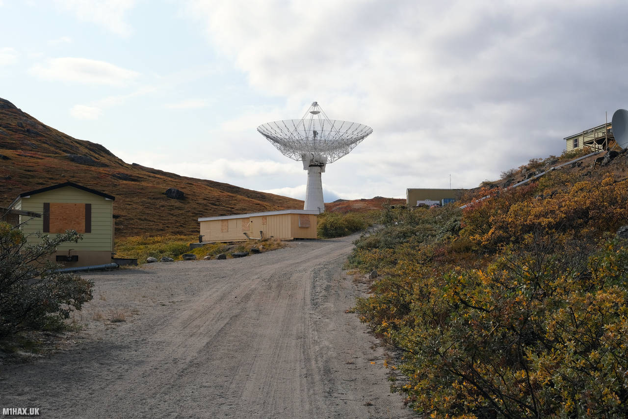
A little way further down the road from the port, we encountered the Søndestrøm Upper Atmospheric Research Facility, also known around town as ‘Kellyville’. Kellyville was an ionospheric and atmospheric research facility located 15 km west of Kangerlussuaq, Greenland. Operated by SRI International for the U.S. National Science Foundation and the Danish Meteorological Institute, it was operational from 1983 to 2018, hosting over 20 instruments providing unique information about the Arctic upper atmosphere. The centrepiece instrument was an L band incoherent scatter radar with a 32m fully steerable antenna. The facility was closed and dismantled in 2018.

Despite the presence of “no trespassing” signs and boarded up windows, I had initially entertained thoughts of exploring the abandoned facility. However, upon observing vehicles and people moving about the facility, we decided to continue on with our hike, rather than risk investigating further.
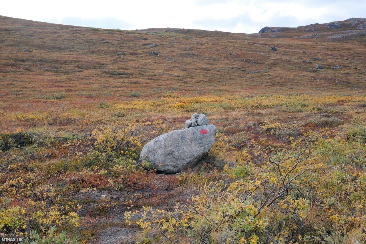
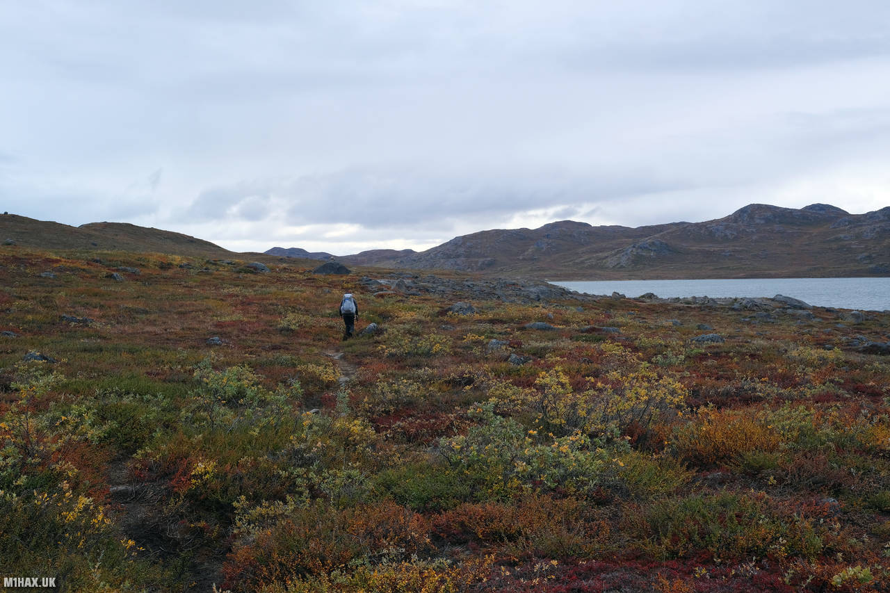
After a while, the road ends, and a faint path and the occasional painted cairn marks the way ahead. We walked onwards into the remote arctic wilderness. I became acutely aware that if anything bad were to happen, we would be a great distance from any form of assistance.

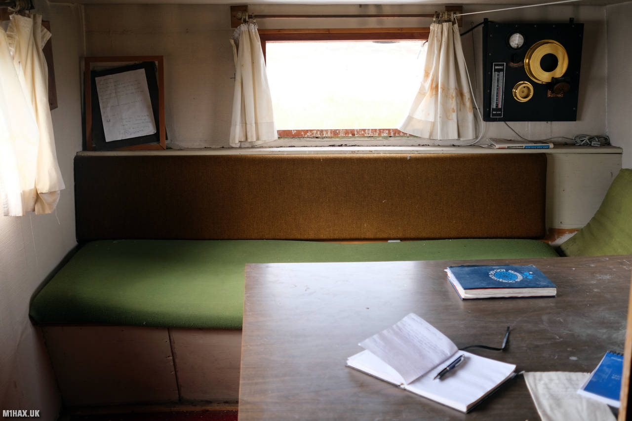
Along the trail, there are a series of hut shelters which can be used to sleep in at night. These are a little like Scottish ‘bothy’ huts, but wooden sheds, rather than stone. It is possible to complete the ACT hike without carrying a tent, however some of the huts are small with limited sleeping capacity.
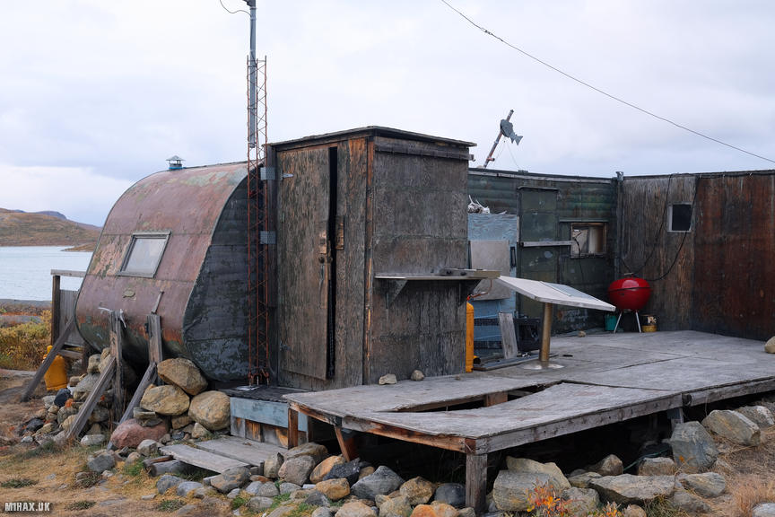
At about 3pm, we arrived at the first trail hut near Hundesø. To our amazement, there was a hiker fast asleep in one of the bunks, who we unfortunately disturbed while we inspected the hut.

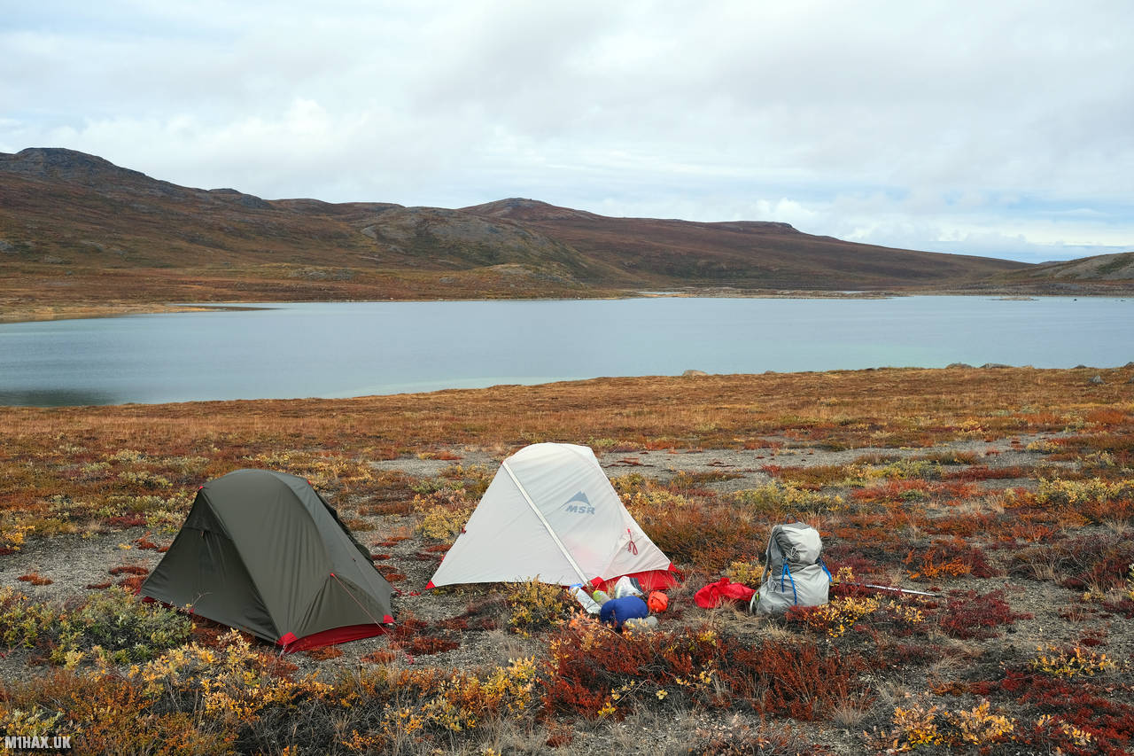
This hut is the most unusual of all the huts along the route, using an old caravan for part of the structure. We refilled our water supplies from a slightly brackish lake near the caravan before proceeding another 4km to where we would set up camp.

I had already managed to pick up a small blister on one of my feet, which I tended to once camp had been established. A dehydrated ‘beef goulash and potato’ food pouch was for dinner, which was pleasant enough. It doesn’t get fully dark until late in to the night at this time of year, and I was glad to have brought my eye-mask along for use in bed. Today we had covered about 25km with 650m of vertical ascent. Our overall ACT trip subtotal was now 66.2km with 1118m of ascent.

Click here to jump to the next entry in my Arctic Circle Trail hike diary.