Arctic Circle Trail Diary - Day 8 (Tasersuaq)
Mesmerised by Untouched Summits
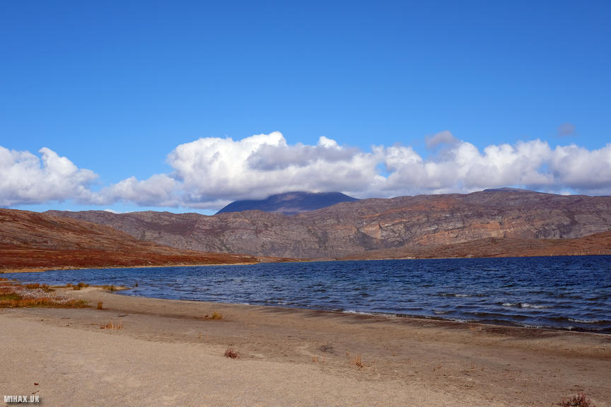
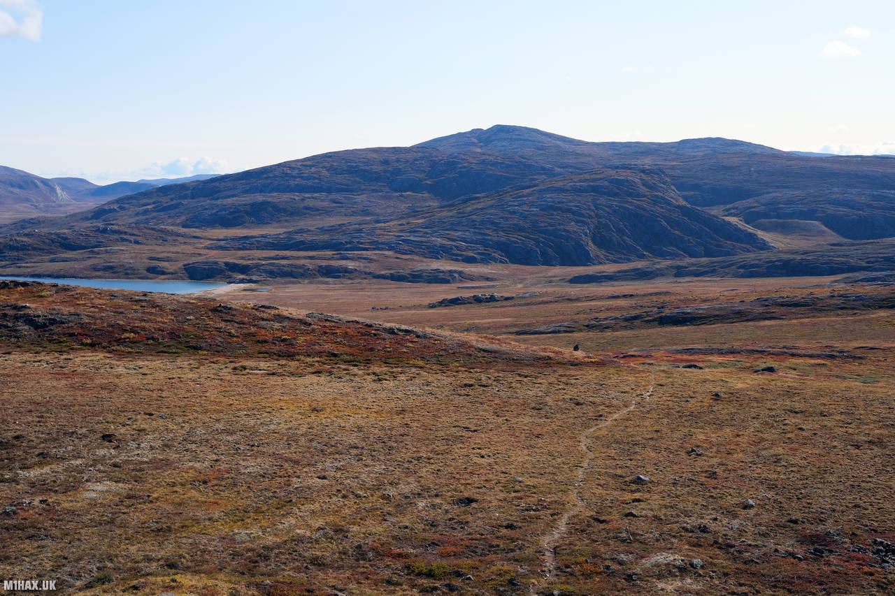
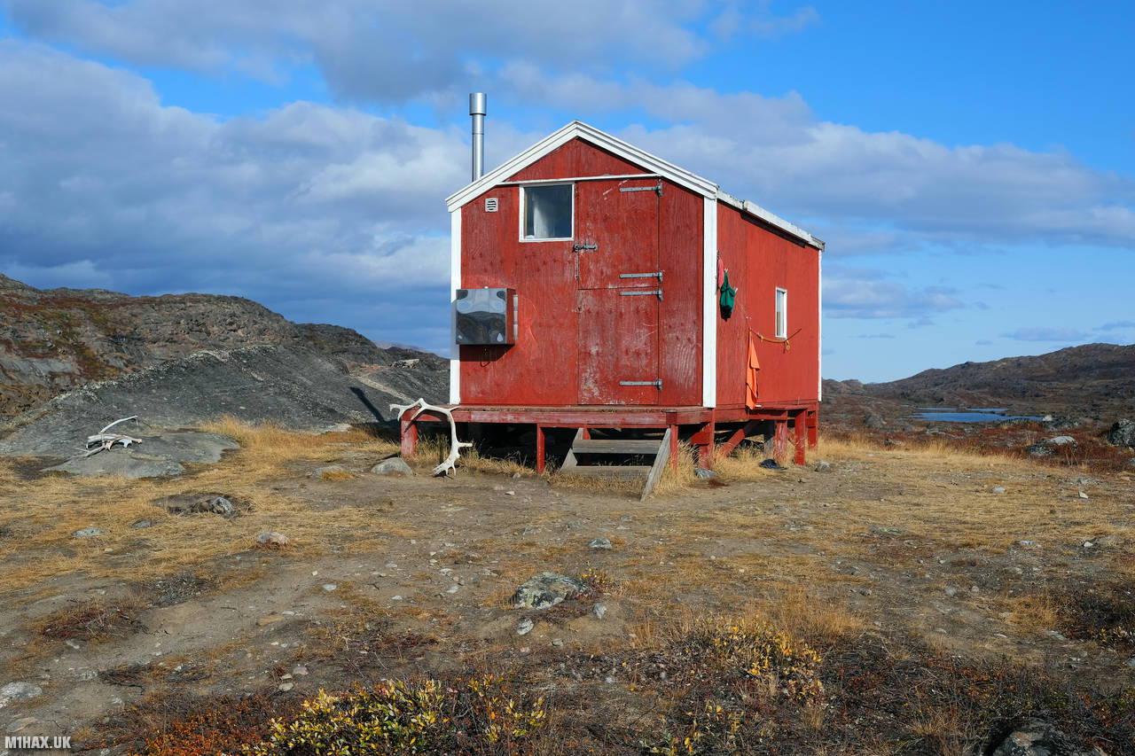
Today we set off from our Tasersuaq Lake beach campsite and walked towards the river at the end of the Kangerluatsiarsuaq lake. The morning was sunny and dry after some light rain during the night. It was a welcome change from the rain we had encountered yesterday. The day’s walk was more challenging, with a climb of nearly 800 meters through a mountainous section of the trail. We passed the Ikkattooq hut, located at a relatively high altitude, and continued into the next valley.

Shortly into the hike, we arrived at a sandy beach with a stunning view of a snow-capped mountain called Pingu (1220m). We spent much of the day discussing whether we had sufficient time in the schedule to detour off the trail to attempt a summit of Pingu. We wondered how many people had visited this remote peak - perhaps nobody?. After returning home, I later found out that the Arctic Circle Trail route used to skirt near Pingu Mountain along the northern side of the Kangerluatsiarsuaq lake.
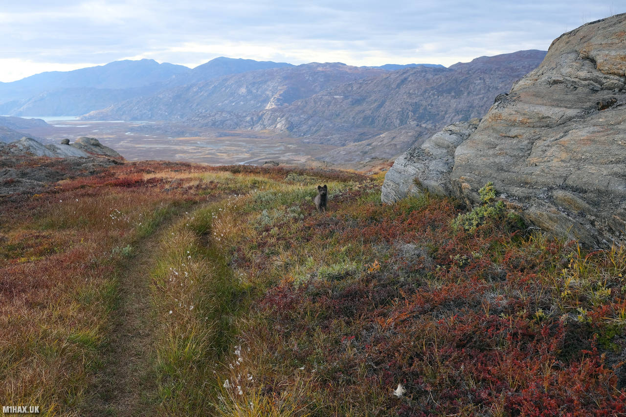
We saw three different canoes left by the side of the lake and also encountered an arctic fox during the day. It seemed excited to see us and very inquisitive, and I managed to capture some footage of the playful fox, which can be seen on my YouTube channel’s Arctic Circle Trail video. Arctic foxes are known to be quite common in Greenland, with their thick fur coats providing insulation from the cold weather.


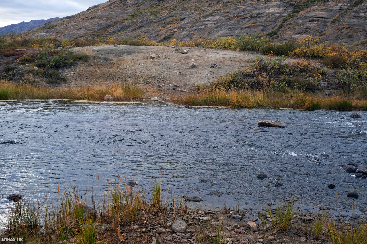
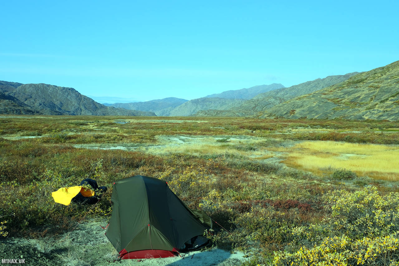
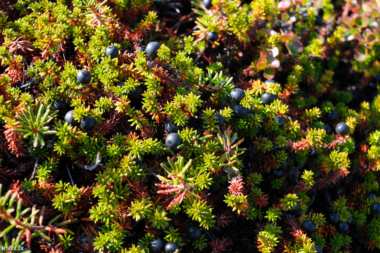
After about eight hours of trekking, we came across a river crossing on the trail. This ford across the Itinneq is the biggest river crossing on the ACT. The water was chest-deep, so we decided to find somewhere flat to set up our next campsite shortly after crossing. There is a small wooden bridge downstream but based on the comments in the Cicerone guide, decided it wasn’t worth the extra slog to reach. The river would serve as our water source until we moved on the next day. There were many bilberries available in the area, and I experimented with adding them to my meals, finding that they were particularly tasty in porridge.

During the day, my Sawyer water filtration system - which uses a foil bag to squeeze the dirty water through the filter - had split open. Fortunately, I had repair tape on hand to keep it serviceable. I had also started to run low on chlorine tablets and would soon only have the Sawyer water filter system available for purification. The water in Greenland is very clean, but I was glad to have the filter system during the early days of the trek when we were near the glacial meltwater.

Resting in camp I became aware that my feet and hips were aching a bit. I accepted that I should have spent more time acclimatizing my body to hiking with a heavy pack before coming to Greenland. Additionally, my down sleeping bag had been noticeably losing feathers, which was a slight concern for the cold nights ahead. I would spend much of the evening studying the Harveys West Greenland 1:100,000 paper map contemplating a detour to Pingu mountain the next day.

The day’s hike covered 21km, bringing our trip subtotal to 136.2km with 2696 metres of vertical ascent. The Arctic Circle Trail was testing our abilities, but the stunning landscapes and wildlife encounters were making it an unforgettable experience.
Click here to jump to the next entry in my Arctic Circle Trail hike diary.