Arctic Circle Trail Diary - Kaellingehaetten
A Scramble in the Arctic Circle
After a well-deserved day of rest in Sisimuit, my trekking partner and I were eager to tackle a new challenge on Sunday. We elected to follow the route described in Paddy Dillon’s Greenland ACT guidebook to summit Nasaasaaq, also known as Kaellingehaetten.
We emptied out much of our backpacks and left the Sisimuit Youth Hostel for the day with very light bags. The ‘out and back’ 18km trek took about six and a half hours, with 900 metres of vertical ascent in total. Progress was fast and easy, with our bodies acclimatised to trekking with heavy bags for the last two weeks.
We retraced our steps back along the Arctic Circle Trail until a fork in the path led up towards the summit of Nasaasaaq. The route was well-marked with blue painted cairns and rocks.

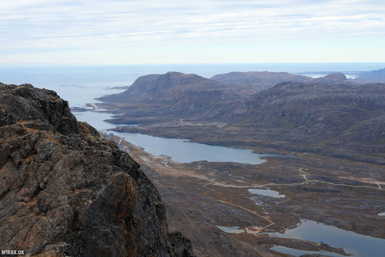
As we steadily climbed the mountain, we were met with fantastic views in every direction. The Sukkertoppen ice cap was visible on the horizon, and we could see miles of Arctic wilderness stretching out before us.

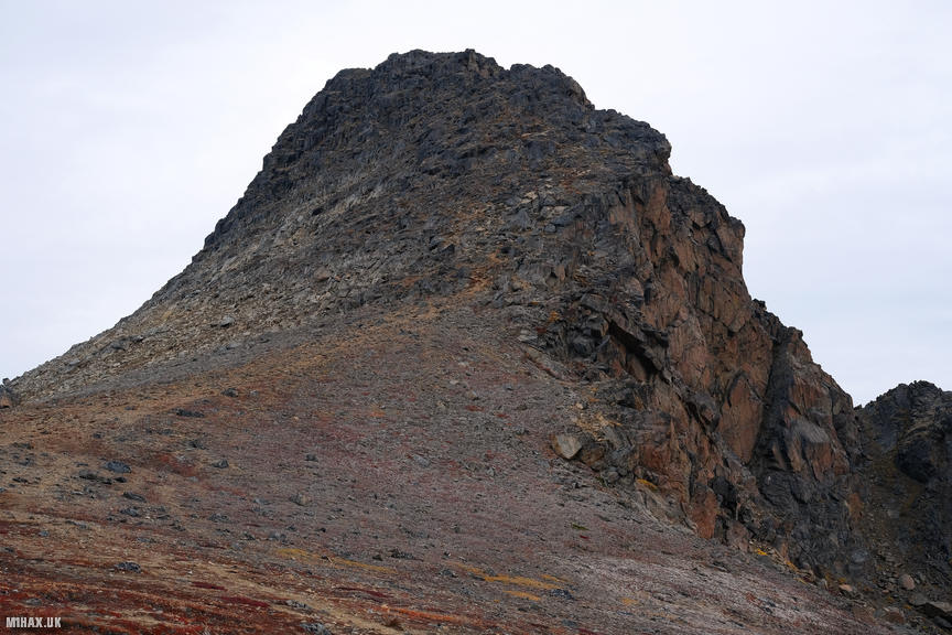
At the top of the mountain is a prominent rocky tower. Gaining the summit involved some scrambling (hands on rock), which I would consider equivalent to a UK Grade 2 scramble. The difficulty was somewhat offset by the presence of thick fixed ropes within the most challenging sections of the ascent. At times, the route was loose and exposed, with a very steep drop off the south side of the mountain as we approached the summit.
Completing the summit of Nasaasaaq was a very enjoyable undertaking, and we were both glad we had the time to add this in at the end of our trek. The feeling of accomplishment as we reached the top was amazing, and we took a few moments to savour the incredible view before beginning our descent back to Sisimuit.

Tomorrow, we will catch an overnight ferry down the west coast of Greenland to take us to the capital of Nuuk. During our time in Nuuk, we would have the pleasure of meeting Peter Thulesen, an amateur radio operator who goes by the callsign OX3XR. I had made contact with Peter and some of his colleagues before our trip, making enquiries in to the possibility of registering an OX callsign for our journey across Greenland. Peter kindly gave us a tour of the city and took me to visit the Nuuk Amateur Radio Club’s station building (OX3NUK). From Nuuk, we then flew back to London via Reykjavik, completing our epic Arctic Circle Trail adventure.
If you are considering taking on the Arctic Circle Trail, my supporters at Buy Me a Coffee get exclusive access to download all of my GPX files for this expedition!