Black Mountain - GW/SW-041 SOTA (2020)

Summits on the Air Activation Report
Activation Date: Sunday 2nd February, 2020.
Activator(s): Richard M1HAX.
Summit: Black Mountain, South Wales, Wales.
Summit ID: SOTA reference GW/SW-041 (6+3 points).
Summit Height: 704m elevation, 155m prominence.
Summit Location: Lat./Long. 52.01188, -3.08659. Maidenhead Grid IO82ka.
Distance: 6.7km travelled with 313m of ascent.
Difficulty: SAC Grade T2.(?)
Elapsed Time: 1hr 45m (including operating).
Weather: Feels like 11.1°C, 28 kph W wind, 82% humidity.
Radio Equipment: Yaesu FTM100D, MFJ-1714, Zippy 4200mAh 4S LiFePo4.
Callsign Used: MW1HAX/P.
Contacts: 12 (2m FM).
Trip Notes
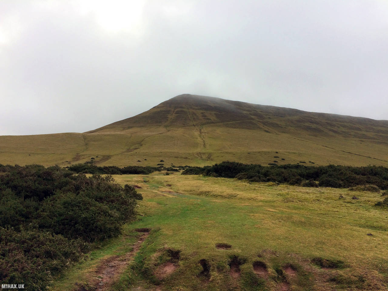
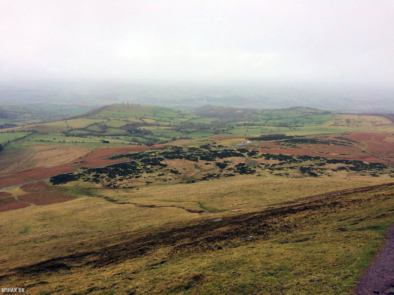
Black Mountain is a summit located near Hay Bluff in the Black Mountains range of South Wales, UK. It stands at a height of 703 meters (2,306 feet) and offers stunning views of the surrounding landscapes, including the Brecon Beacons and the Wye Valley.
My route to the summit starts at the relatively large parking area adjacent to Hay Bluff. Some narrow roads from Hay on Wye to the north lead up to this.
This is an easy six-point summit with only approximately 300 metres of climbing required. Including the three-point winter bonus this a very worthwhile hill.
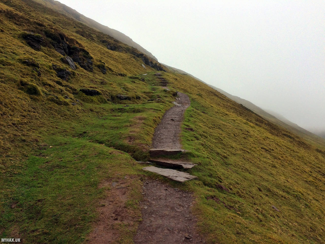
Reasonable paths lead all the way from the car park to the summit AZ.
There is a trig point on the summit of Hay Bluff however this is about a metre lower than the activation zone for GW/SW-041, so further walking is required.
The true summit is marked on some maps as Twyn Llech.
After a quick VHF SOTA activation, I retraced my steps back along the paths to the car park.
Whilst I have never tried it, I have often thought this hill lends itself well to a large loop route which would include the summit of Waun Fach.
Photos
Below are some photographs taken during my activation of Black Mountain on Sunday 2nd February, 2020.


Walking Route for Black Mountain
The interactive map below shows my GPS track taken to the SOTA activation zone for Black Mountain. The GW/SW-041 summit area is marked on the map with a blue pin icon.
You can download the route shown above as a GPX file suitable for use with most GPS devices. This file is provided for information only, to support your own walk planning and research (it may contain navigation errors, detours and/or safety hazards). The route downloads provided here are governed by the Creative Commons BY-NC-SA 4.0 licence.
Station Log
I logged the following 12 amateur radio contacts operating as MW1HAX/P from GW/SW-041 Black Mountain on Sunday 2nd February, 2020 (all times shown are UTC):
| Time | Callsign | Band | Mode | Notes |
|---|---|---|---|---|
| 10:28 | G0LGS | 2m | FM | Stewart, 5/9 |
| 10:29 | M0JLA | 2m | FM | Rod, 5/9 |
| 10:30 | 2E0RYR | 2m | FM | Roger, 5/9 |
| 10:31 | M0WYP | 2m | FM | Josh, 5/9 |
| 10:32 | G4WKY/M | 2m | FM | Nigel, 5/9 |
| 10:33 | M0NTC | 2m | FM | Jez, 5/9 |
| 10:34 | G1PHN | 2m | FM | Mick, 5/9 |
| 10:35 | G8XYJ | 2m | FM | Matt, 5/4 |
| 10:36 | M0TVU | 2m | FM | Paul, 5/9 |
| 10:37 | G7TGK | 2m | FM | Charlie, 5/8 |
| 10:38 | G8DFI | 2m | FM | Bryn, 5/8 |
| 10:39 | 2E0VNZ | 2m | FM | John, 5/6 |
In the notes field I will usually log the other operator’s name and the signal report they provided. In accordance with the Summits on the Air rules, I do not make a log entry where a complete exchange of callsigns and signal reports was unsuccessful.
Additional Information
The following resources may be helpful to walkers, mountaineers and SOTA activators interested in Black Mountain:
- Sotl.as Summit Page for GW/SW-041 Black Mountain.
- Hill Bagging UK Summit Page for Black Mountain.
- Google Maps Page for Black Mountain.
- Wikipedia entry for Black Mountain.
- 360° Panorama near summit of GW/SW-041 Black Mountain.
If you found this content valuable, why not Buy Me a Coffee?