Cleeve Hill - G/CE-001 SOTA (2020)

Summits on the Air Activation Report
Activation Date: Saturday 29th February, 2020.
Activator(s): Richard M1HAX.
Summit: Cleeve Hill, Central England, England.
Summit ID: SOTA reference G/CE-001 (1 point).
Summit Height: 330m elevation, 234m prominence.
Summit Location: Lat./Long. 51.91990, -2.00590. Maidenhead Grid IO81xw.
Distance: 0.4km travelled with 5m of ascent.
Difficulty: Drive on summit.
Elapsed Time: 25m (including operating).
Weather: Feels like 1.0°C, 22 kph SW wind, 79% humidity.
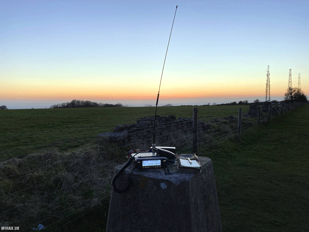
Radio Equipment: Yaesu FTM100D, Diamond SRH770S, Zippy 4200mAh 4S LiFePo4.
Callsign Used: M1HAX/P.
Contacts: 6 (2m FM).
Trip Notes
Cleeve Hill, also called Cleeve Cloud, is the tallest summit in both the Cotswolds hill range and Gloucestershire county, reaching a height of 330 meters. It is situated on Cleeve Common, which is a designated Site of Special Scientific Interest and is overseen by a small charitable organization.
Castle Rock, one of the few rock faces in the region, is situated on the hill and is stable enough for rock climbing. The routes on this rock face are challenging for their grade, short lived, and polished.
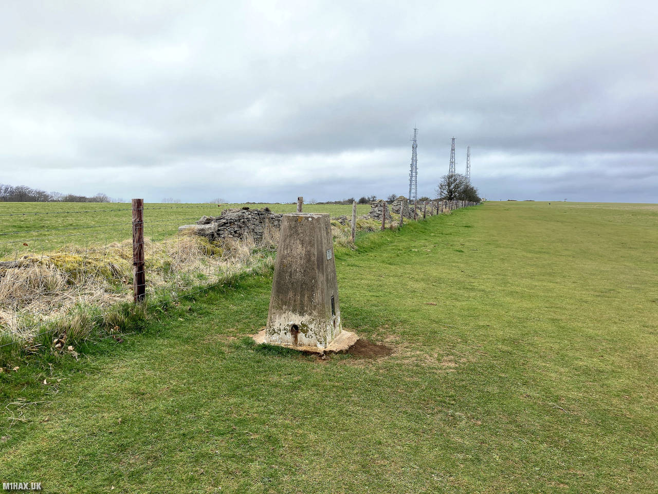
The most popular route to summit Cleeve Hill for SOTA appears to be by using the busy car park at the radio masts. This makes for a very short and flat walk and as such there is no GPX download available for this trip report.
Cleeve Common is a large area of access land and various other longer routes to the summit are possible. A more enjoyable circular walk is possible starting from Cleeve Hill Golf Club, heading towards the springs at the amusingly named Watery Bottom, then towards the summit, returning via the viewpoint near Cleeve Cloud.
I used the trig point to support my radio for the activation on the two-metre band. As my usual MFJ-1714 antenna was damaged, I was using a Diamond SRH770S instead.
After chatting to some of the locals I packed away my equipment, returning the way I had come back to the car.
Photos
Below are some photographs taken during my activation of Cleeve Hill on Saturday 29th February, 2020.


Station Log
I logged the following 6 amateur radio contacts operating as M1HAX/P from G/CE-001 Cleeve Hill on Saturday 29th February, 2020 (all times shown are UTC):
| Time | Callsign | Band | Mode | Notes |
|---|---|---|---|---|
| 16:14 | G0LGS | 2m | FM | Stewart, 5/9 |
| 16:15 | G1ERM | 2m | FM | Darren, 5/9 |
| 16:16 | 2E0MDJ | 2m | FM | Matt, 5/9 |
| 16:17 | G3LVP | 2m | FM | Ken, 5/9 |
| 16:18 | M7THK | 2m | FM | Mike, 5/9 |
| 16:33 | 2E0ECX | 2m | FM | Chris, 5/9 |
In the notes field I will usually log the other operator’s name and the signal report they provided. In accordance with the Summits on the Air rules, I do not make a log entry where a complete exchange of callsigns and signal reports was unsuccessful.
Additional Information
The following resources may be helpful to walkers, mountaineers and SOTA activators interested in Cleeve Hill:
- Sotl.as Summit Page for G/CE-001 Cleeve Hill.
- Hill Bagging UK Summit Page for Cleeve Hill.
- Google Maps Page for Cleeve Hill.
- Wikipedia entry for Cleeve Hill.
If you found this content valuable, why not Buy Me a Coffee?