Fan Nedd - GW/SW-007 SOTA (2020)

Summits on the Air Activation Report
Activation Date: Saturday 22nd February, 2020.
Activator(s): Richard M1HAX.
Summit: Fan Nedd, South Wales, Wales.
Summit ID: SOTA reference GW/SW-007 (4+3 points).
Summit Height: 663m elevation, 174m prominence.
Summit Location: Lat./Long. 51.85366, -3.57919. Maidenhead Grid IO81fu.
Also Activated: GW/SW-006.
Distance: 18.6km travelled with 890m of ascent.
Difficulty: SAC Grade T1.(?)
Elapsed Time: 4hr 40m (incl. operating and other summit(s) on the same hike).
Weather: Feels like 4.4°C, 26 kph WSW wind, 90% humidity.
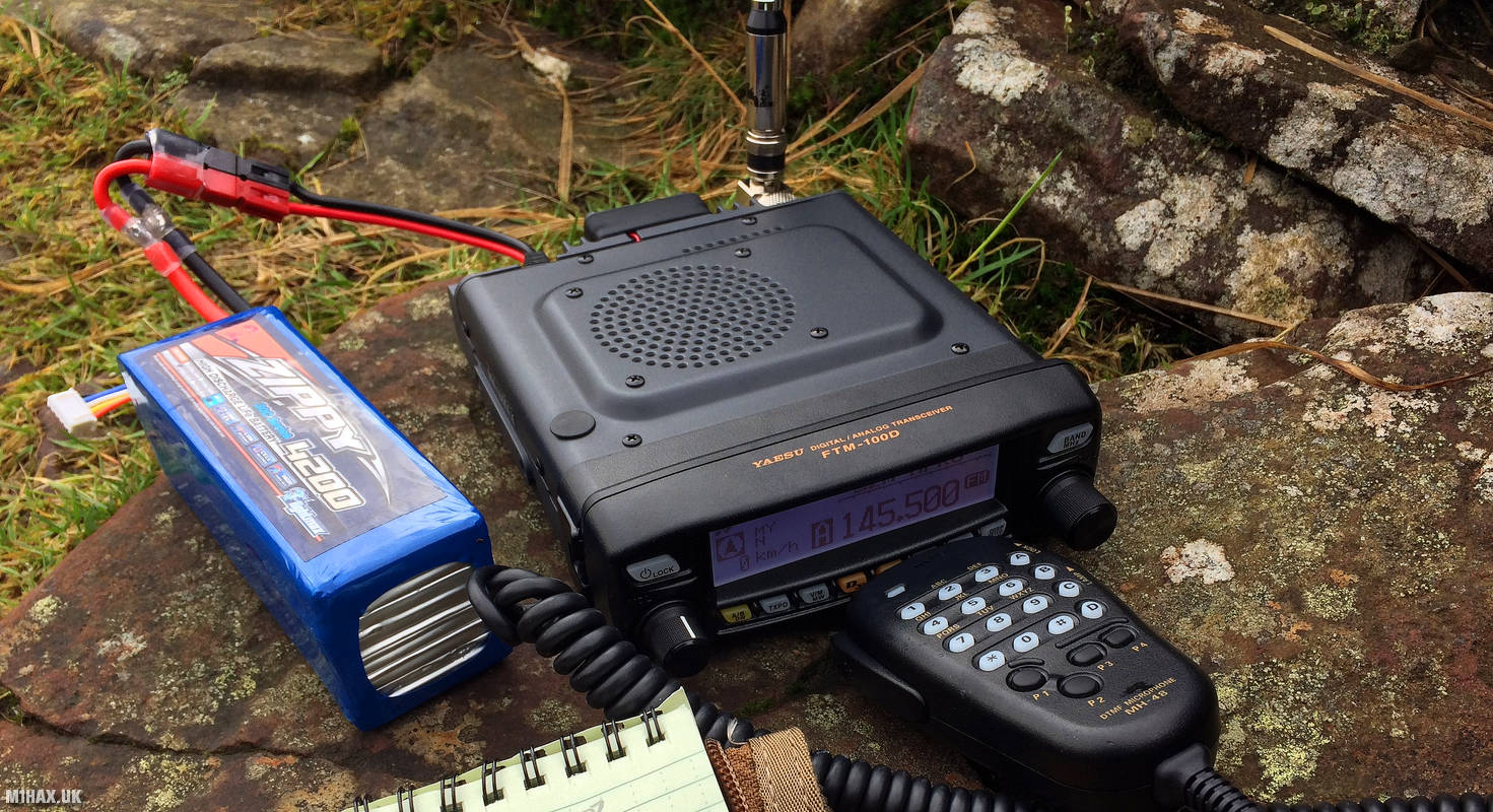
Radio Equipment: Yaesu FTM100D, MFJ-1714, Zippy 4200mAh 4S LiFePo4.
Callsign Used: MW1HAX/P.
Contacts: 5 (2m FM).
Trip Notes
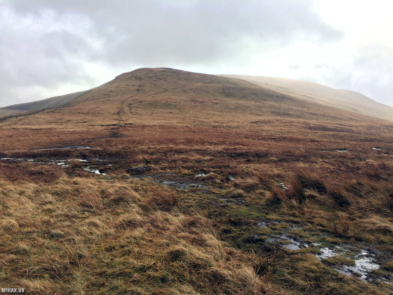
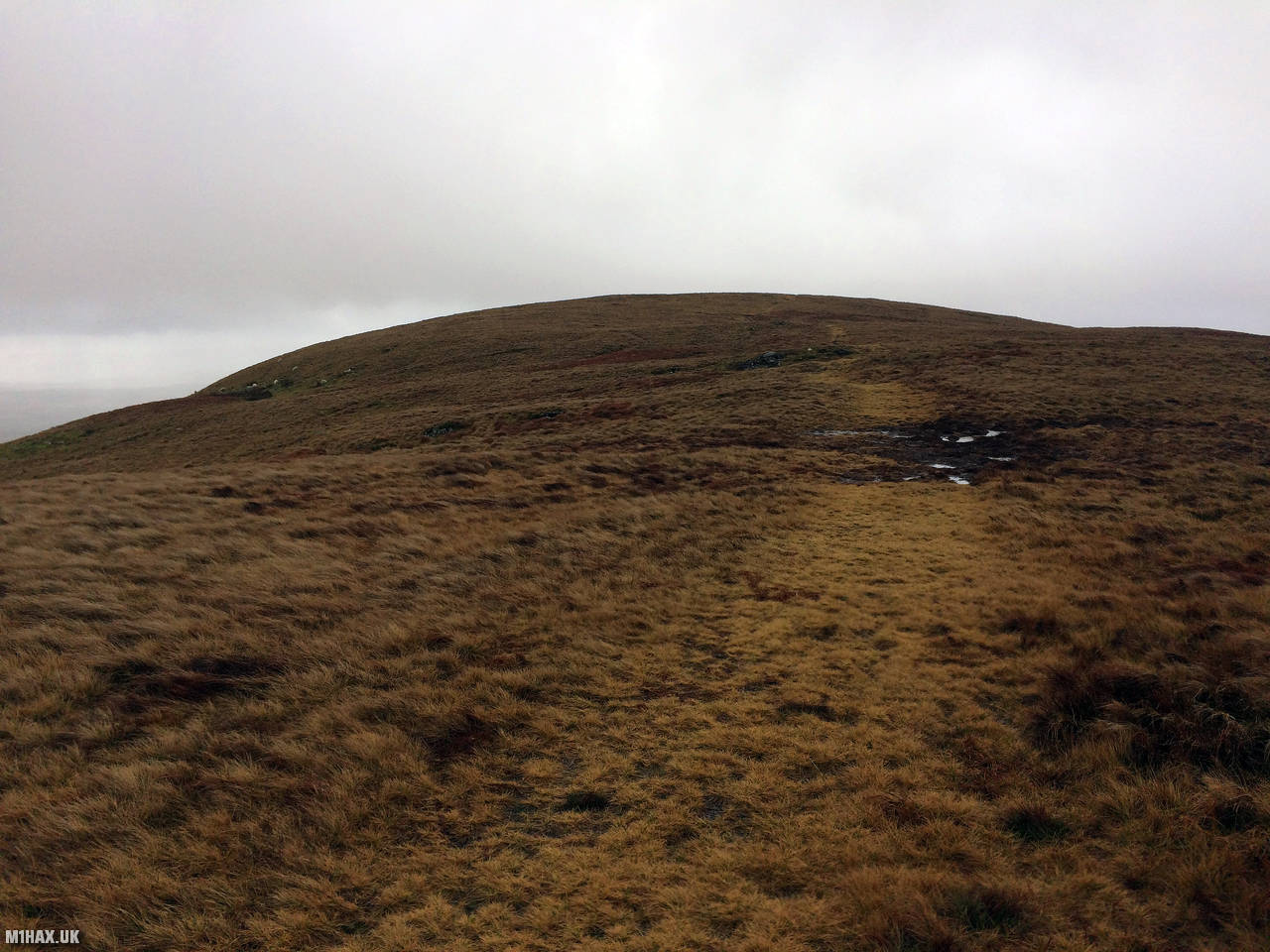
Fan Nedd is a 663-metre-high Marilyn summit in South Wales. It is a relatively plain and uninspiring grassy mound. It can be approached from almost any direction. For this activation, I gained the summit from the west.
This activation entry starts from the summit of Fan Gyhirych GW/SW-006 which I had activated earlier in the day as part of one long walk.
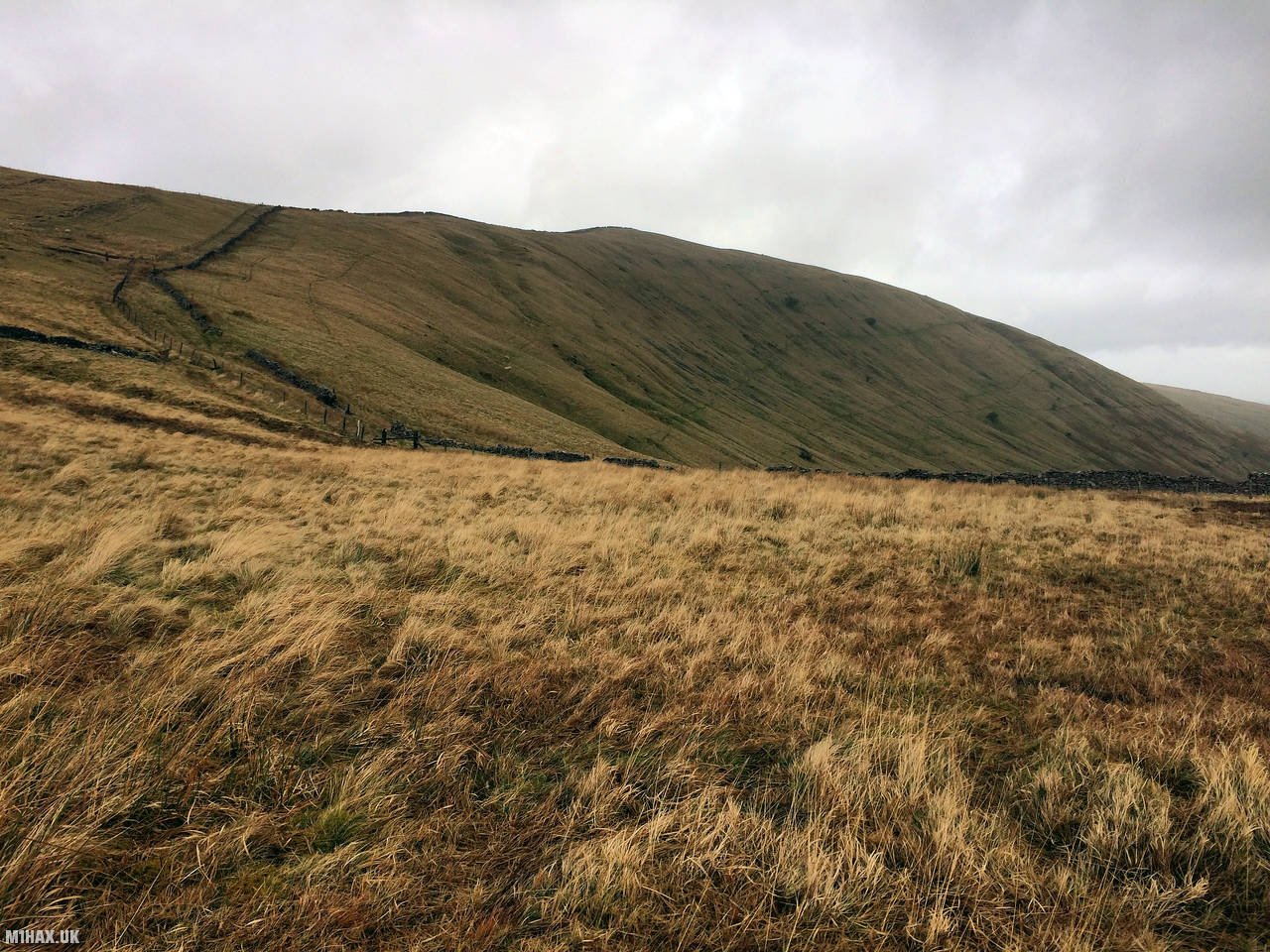
I followed the Cambrian Way eastward, heading back towards the gravel road which had been used earlier in the day from Penwyllt.
After dropping down a grassy slope, the path turns south, crossing a small stream. This area gets wet and boggy during the winter.
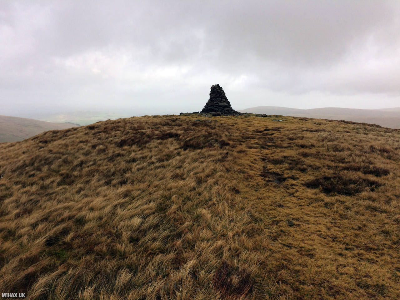
A well-defined path heads up towards a cairn on the northern end of the summit plateau. This cairn is above the 650m contour line and as such sits comfortably within the SOTA activation zone for the summit. I chose to continue the walk south and gain the summit.
I activated from the trig point at the summit, using my Yaesu FTM100D at 50 watts.
I then retraced my route, following the road and paths back about 8km back down to the car park at the South Wales Caving Club.
The route taken for these two summits makes for a very pleasant day hike in South Wales and I would recommend it to other SOTA activators. The terrain is easy and it can be completed relatively quickly given sufficient hill fitness.
Photos
Below are some photographs taken during my activation of Fan Nedd on Saturday 22nd February, 2020.


Walking Route for Fan Nedd
The interactive map below shows my GPS track taken to the SOTA activation zone for Fan Nedd. Note that this summit was activated as part of a multi-summit hike and the map below shows the full route taken on the day. The GW/SW-007 summit area is marked on the map with a blue pin icon.
You can download the route shown above as a GPX file suitable for use with most GPS devices. This file is provided for information only, to support your own walk planning and research (it may contain navigation errors, detours and/or safety hazards). The route downloads provided here are governed by the Creative Commons BY-NC-SA 4.0 licence.
Station Log
I logged the following 5 amateur radio contacts operating as MW1HAX/P from GW/SW-007 Fan Nedd on Saturday 22nd February, 2020 (all times shown are UTC):
| Time | Callsign | Band | Mode | Notes |
|---|---|---|---|---|
| 11:15 | GW7MMG | 2m | FM | Phil, 5/9 |
| 11:16 | MW6IUT | 2m | FM | Bryan, 5/5 |
| 11:17 | G4TCI | 2m | FM | Mike, 5/3 |
| 11:19 | 2W0RRG | 2m | FM | Robert, 5/9 |
| 11:21 | GW7HJN | 2m | FM | Stuart, 5/9 |
In the notes field I will usually log the other operator’s name and the signal report they provided. In accordance with the Summits on the Air rules, I do not make a log entry where a complete exchange of callsigns and signal reports was unsuccessful.
Additional Information
The following resources may be helpful to walkers, mountaineers and SOTA activators interested in Fan Nedd:
- Sotl.as Summit Page for GW/SW-007 Fan Nedd.
- Hill Bagging UK Summit Page for Fan Nedd.
- Google Maps Page for Fan Nedd.
- Wikipedia entry for Fan Nedd.
- 360° Panorama near summit of GW/SW-007 Fan Nedd.
If you found this content valuable, why not Buy Me a Coffee?