Titterstone Clee Hill - G/WB-004 SOTA (2020)

Summits on the Air Activation Report
Activation Date: Saturday 29th February, 2020.
Activator(s): Richard M1HAX.
Summit: Titterstone Clee Hill, Welsh Borders, England.
Summit ID: SOTA reference G/WB-004 (2+3 points).
Summit Height: 533m elevation, 233m prominence.
Summit Location: Lat./Long. 52.39805, -2.60196. Maidenhead Grid IO82qj.
Distance: 1.7km travelled with 107m of ascent.
Difficulty: SAC Grade T1.(?)
Elapsed Time: 35m (including operating).
Weather: Feels like 1.1°C, 31 kph SW wind, 78% humidity.
Radio Equipment: Yaesu FTM100D, MFJ-1714, Zippy 4200mAh 4S LiFePo4.
Callsign Used: M1HAX/P.
Contacts: 9 (2m FM).
Trip Notes
Titterstone Clee Hill, also known as Titterstone Clee or Clee Hill, is a prominent hill in the rural county of Shropshire, England, which reaches an altitude of 533 meters at its summit. It is situated among the Clee Hills within the Shropshire Hills Area of Outstanding Natural Beauty.
This two-point hill is part of a group known as the Famous Five or Five Peaks Challenge in the SOTA community. This cluster of hills can be completed in a single winter’s day, to net an easy 25 points. When repeated either side of New Year, 50 points can be accumulated in short order.
For my 2020 run of the ‘Famous Five’ I activated them in the following order: GW/MW-013 (Corndon Hill), G/WB-003 (Stiperstones), G/WB-005 (Long Mynd), G/WB-002 (Brown Clee Hill), G/WB-004 (Titterstone Clee Hill).
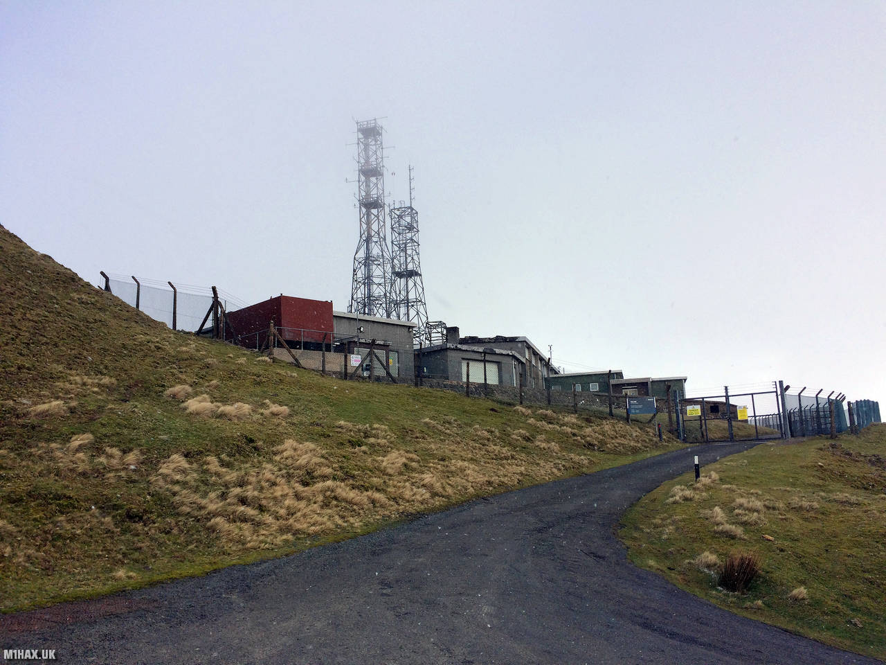
A long access road winds its way up the hillside towards the wireless station at the head of the road. I followed this all the way up, passing several busy parking areas where tourists and walkers were all parking, to pull up on the roadside very near the locked gates (see photo).
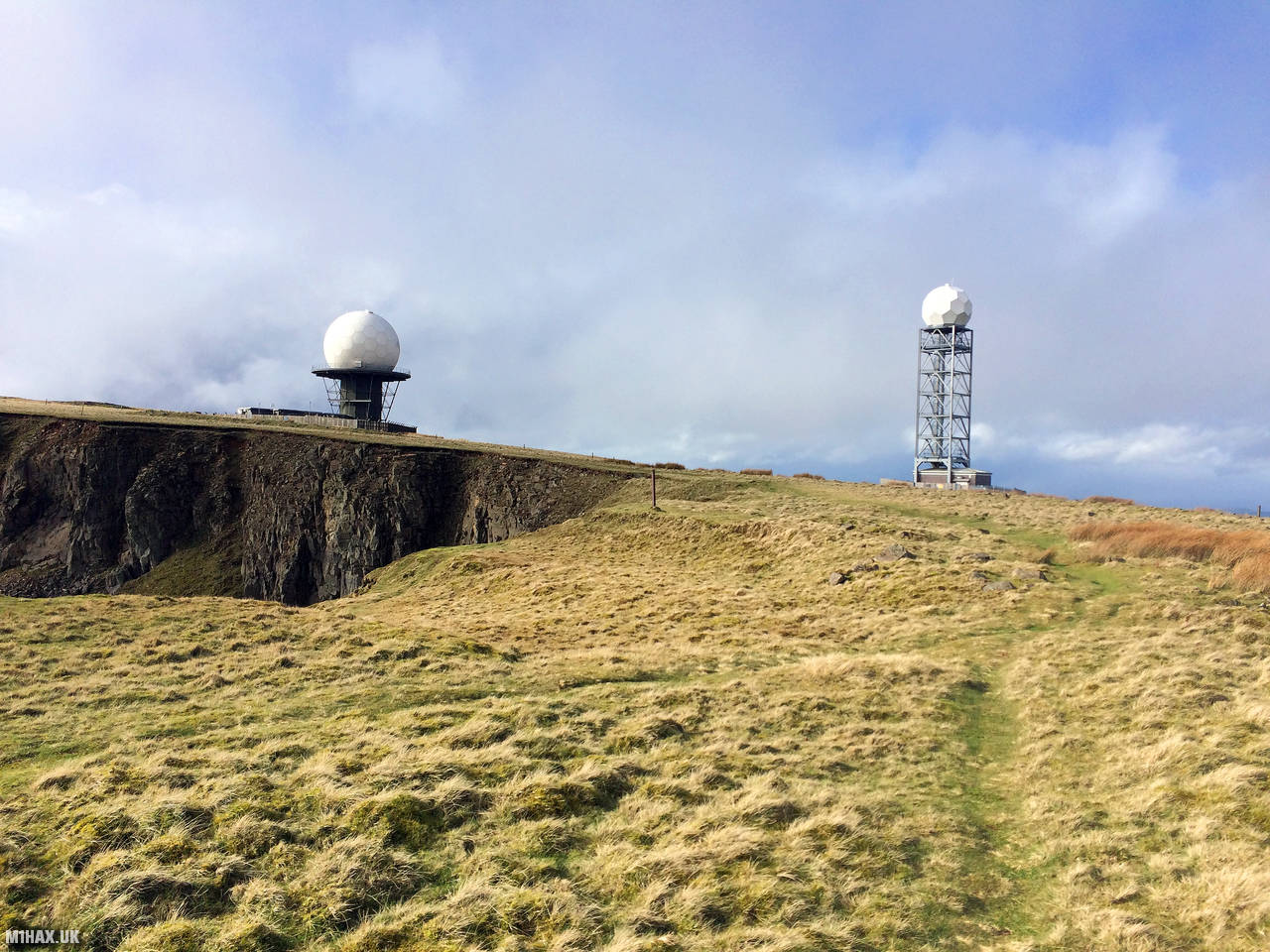
Faint grassy paths wind their way up from the parking area towards two large radomes. I continued past these to the trig point further ahead.
Several radar domes and towers are presently operational on the hill. The most extensive radar array is affiliated with the National Air Traffic Services (NATS) radar network and encompasses one of the 30 overlapping sectors of UK airspace. The radar installation on Titterstone Clee keeps an eye on all aircraft within a radius of 100 miles. The smaller of the two is a Met Office weather radar station that is part of a network of 16 stations scattered throughout the country and is utilized to detect cloud precipitation.
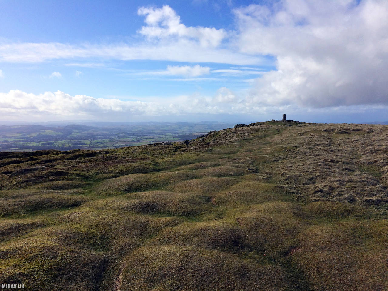
The trig point or some old building foundations nearby make for a convenient place to activate from. There is ample room for dipole antenna masts.
After another successful VHF activation, I returned to the car to start the journey home, with another 25 SOTA points in the bag.
Photos
Below are some photographs taken during my activation of Titterstone Clee Hill on Saturday 29th February, 2020.


Walking Route for Titterstone Clee Hill
The interactive map below shows my GPS track taken to the SOTA activation zone for Titterstone Clee Hill. The G/WB-004 summit area is marked on the map with a blue pin icon.
You can download the route shown above as a GPX file suitable for use with most GPS devices. This file is provided for information only, to support your own walk planning and research (it may contain navigation errors, detours and/or safety hazards). The route downloads provided here are governed by the Creative Commons BY-NC-SA 4.0 licence.
Station Log
I logged the following 9 amateur radio contacts operating as M1HAX/P from G/WB-004 Titterstone Clee Hill on Saturday 29th February, 2020 (all times shown are UTC):
| Time | Callsign | Band | Mode | Notes |
|---|---|---|---|---|
| 14:05 | M0ZVR | 2m | FM | Barry, 5/5 |
| 14:06 | M0JLA | 2m | FM | Rod, 5/9 |
| 14:07 | M0NTC/M | 2m | FM | Jez, 5/7 |
| 14:08 | 2E0MDJ | 2m | FM | Matt, 5/9 |
| 14:10 | G0LGS | 2m | FM | Stewart, 5/9 |
| 14:11 | 2E0LKC | 2m | FM | Peter, 5/9 |
| 14:12 | 2E0LMD | 2m | FM | Anne, 5/9 |
| 14:13 | M6IMN | 2m | FM | Simon, 5/9 |
| 14:15 | M0WYP | 2m | FM | Josh, 5/9 |
In the notes field I will usually log the other operator’s name and the signal report they provided. In accordance with the Summits on the Air rules, I do not make a log entry where a complete exchange of callsigns and signal reports was unsuccessful.
Additional Information
The following resources may be helpful to walkers, mountaineers and SOTA activators interested in Titterstone Clee Hill:
- Sotl.as Summit Page for G/WB-004 Titterstone Clee Hill.
- Hill Bagging UK Summit Page for Titterstone Clee Hill.
- Google Maps Page for Titterstone Clee Hill.
- Wikipedia entry for Titterstone Clee Hill.
- 360° Panorama near summit of G/WB-004 Titterstone Clee Hill.
If you found this content valuable, why not Buy Me a Coffee?