Gun - G/SP-013 SOTA (2020)

Summits on the Air Activation Report
Activation Date: Sunday 1st March, 2020.
Activator(s): Richard M1HAX.
Summit: Gun, Southern Pennines, England.
Summit ID: SOTA reference G/SP-013 (1 point).
Summit Height: 385m elevation, 168m prominence.
Summit Location: Lat./Long. 53.15078, -2.04622. Maidenhead Grid IO83xd.
Distance: 1.5km travelled with 39m of ascent.
Difficulty: SAC Grade T1.(?)
Elapsed Time: 35m (including operating).
Weather: Feels like 0.0°C, 39 kph WSW wind, 67% humidity.
Radio Equipment: Yaesu FTM100D, MFJ-1714, Zippy 4200mAh 4S LiFePo4.
Callsign Used: M1HAX/P.
Contacts: 11 (2m FM).
Trip Notes
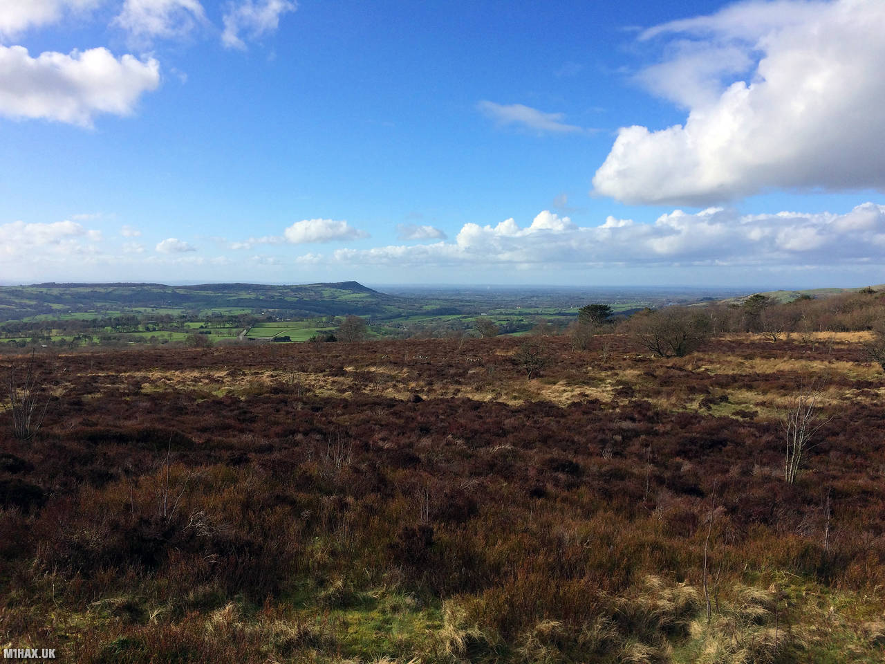
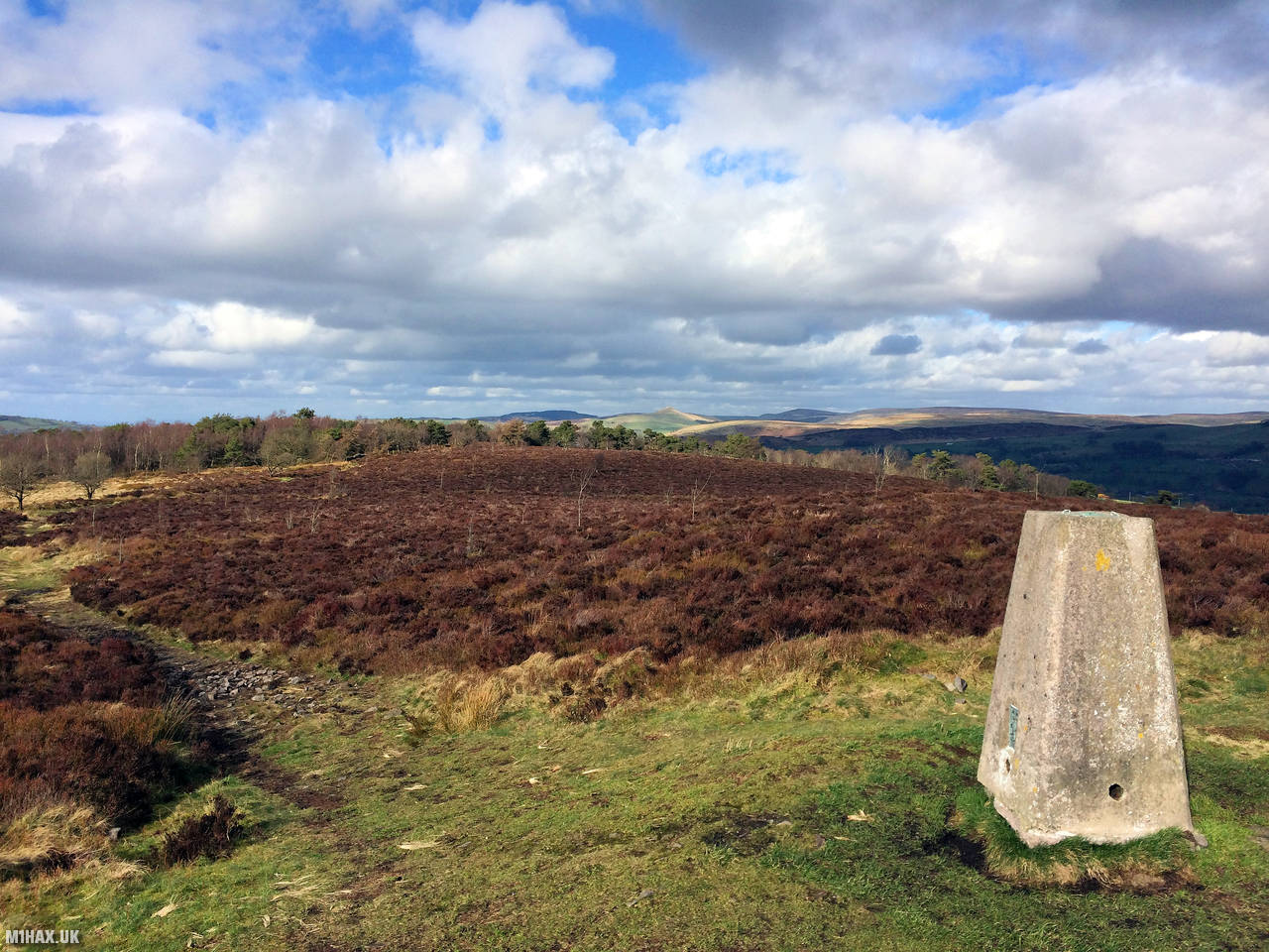
Located at the southern end of the Peak District and overlooking the town of Leek in the Staffordshire Moorlands, Gun Hill consists primarily of moorland with pockets of woodland. At its summit lies a trig point, with the hill measuring 385 metres in height. Gun Hill is designated as a Marilyn due to its prominence of 168 metres.
Gun is an unremarkable SOTA one-point summit. Reasonable countryside roads lead up to a small car park to the south of the summit.
A flat walk from the parking area leads about half a mile directly to the trig point. This hill is typically activated as part of a multi summit day including The Cloud, Shining Tor and Kinder Low.
This area is popular with dog walkers and hikers should take extra care where they step.
From the trig point on a clear day there are good views including of the radio telescopes at Jodrell Bank.
Running my radio at fifty watts, I easily made a number of contacts from the summit, including to two mobile stations.
I then headed on to The Cloud G/SP-015, to complete my 14 point day trip.
Photos
Below are some photographs taken during my activation of Gun on Sunday 1st March, 2020.


Walking Route for Gun
The interactive map below shows my GPS track taken to the SOTA activation zone for Gun. The G/SP-013 summit area is marked on the map with a blue pin icon.
You can download the route shown above as a GPX file suitable for use with most GPS devices. This file is provided for information only, to support your own walk planning and research (it may contain navigation errors, detours and/or safety hazards). The route downloads provided here are governed by the Creative Commons BY-NC-SA 4.0 licence.
Station Log
I logged the following 11 amateur radio contacts operating as M1HAX/P from G/SP-013 Gun on Sunday 1st March, 2020 (all times shown are UTC):
| Time | Callsign | Band | Mode | Notes |
|---|---|---|---|---|
| 14:00 | 2W0JYN | 2m | FM | Steven, 5/9 |
| 14:01 | 2E0LKC | 2m | FM | Peter, 5/9 |
| 14:02 | 2E0LMD | 2m | FM | Anne, 5/9 |
| 14:04 | M0NTC | 2m | FM | Jez, 5/7 |
| 14:05 | G0HRT | 2m | FM | Rob, 5/4 |
| 14:06 | 2E0OVW | 2m | FM | Gillian, 5/5 |
| 14:07 | M1IRM/M | 2m | FM | PJ, 5/9 |
| 14:09 | M0OAU | 2m | FM | Lee, 5/9 |
| 14:10 | 2E0IXM/M | 2m | FM | David, 5/9 |
| 14:11 | M7ECT | 2m | FM | Ethan, 5/9 |
| 14:13 | M6KIO | 2m | FM | Dom, 5/9 |
In the notes field I will usually log the other operator’s name and the signal report they provided. In accordance with the Summits on the Air rules, I do not make a log entry where a complete exchange of callsigns and signal reports was unsuccessful.
Additional Information
The following resources may be helpful to walkers, mountaineers and SOTA activators interested in Gun:
- Sotl.as Summit Page for G/SP-013 Gun.
- Hill Bagging UK Summit Page for Gun.
- Google Maps Page for Gun.
- Wikipedia entry for Gun.
If you found this content valuable, why not Buy Me a Coffee?