The Cloud - G/SP-015 SOTA (2020)

Summits on the Air Activation Report
Activation Date: Sunday 1st March, 2020.
Activator(s): Richard M1HAX.
Summit: The Cloud, Southern Pennines, England.
Summit ID: SOTA reference G/SP-015 (1 point).
Summit Height: 343m elevation, 177m prominence.
Summit Location: Lat./Long. 53.17037, -2.14470. Maidenhead Grid IO83we.
Distance: 1.3km travelled with 59m of ascent.
Difficulty: SAC Grade T1.(?)
Elapsed Time: 45m (including operating).
Weather: Feels like 0.0°C, 28 kph W wind, 68% humidity.
Radio Equipment: Yaesu FTM100D, MFJ-1714, Zippy 4200mAh 4S LiFePo4.
Callsign Used: M1HAX/P.
Contacts: 13 (2m FM).
Trip Notes
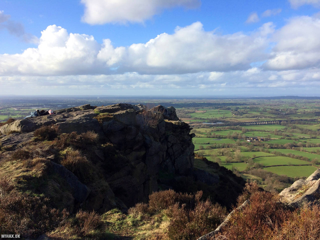
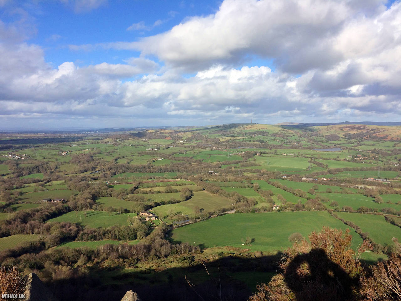
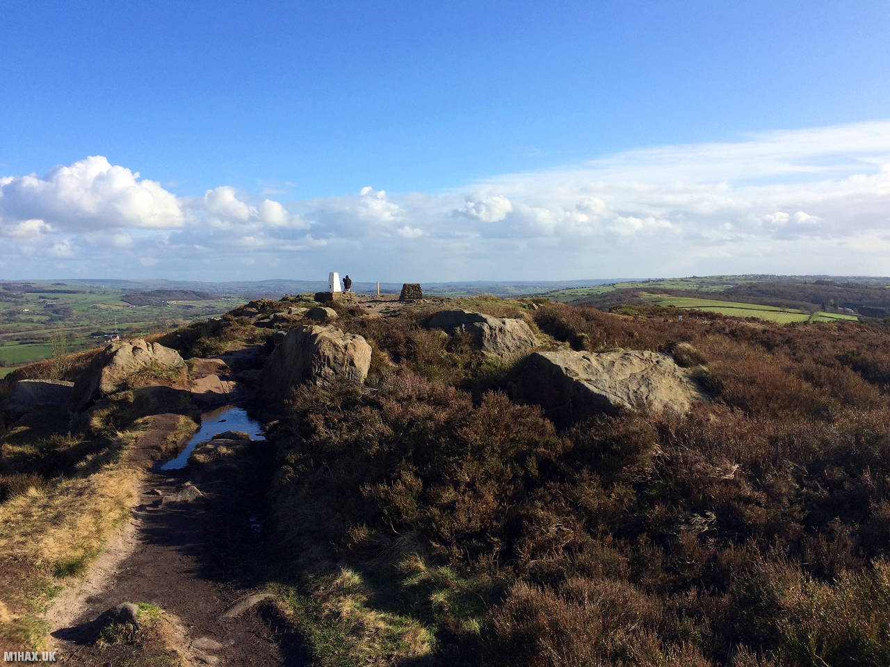
The Cloud, also known as Bosley Cloud, is a significant hill situated on the boundary of Cheshire and Staffordshire, located a few miles to the west of the Peak District National Park. Standing at an impressive height of 343 metres, it ranks among the tallest hills in the region. The heathery peak of the hill is topped by a trig point, providing expansive views across the surrounding areas, including Congleton, Macclesfield and Greater Manchester.
This was my last Summits on the Air activation of the day, having completed G/SP-001, G/SP-004 and G/SP-015 earlier. This is one of the most popular SOTA summits in the UK by activation count, thanks largely to the local activator Tom M1EYP.
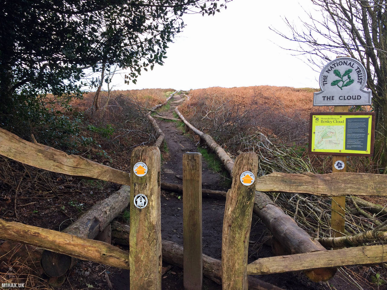
The Cloud can be approached from multiple directions, but the shortest and easiest approach is from a small car park to the south east. This hill is popular with walkers, so the small car park is often busy.
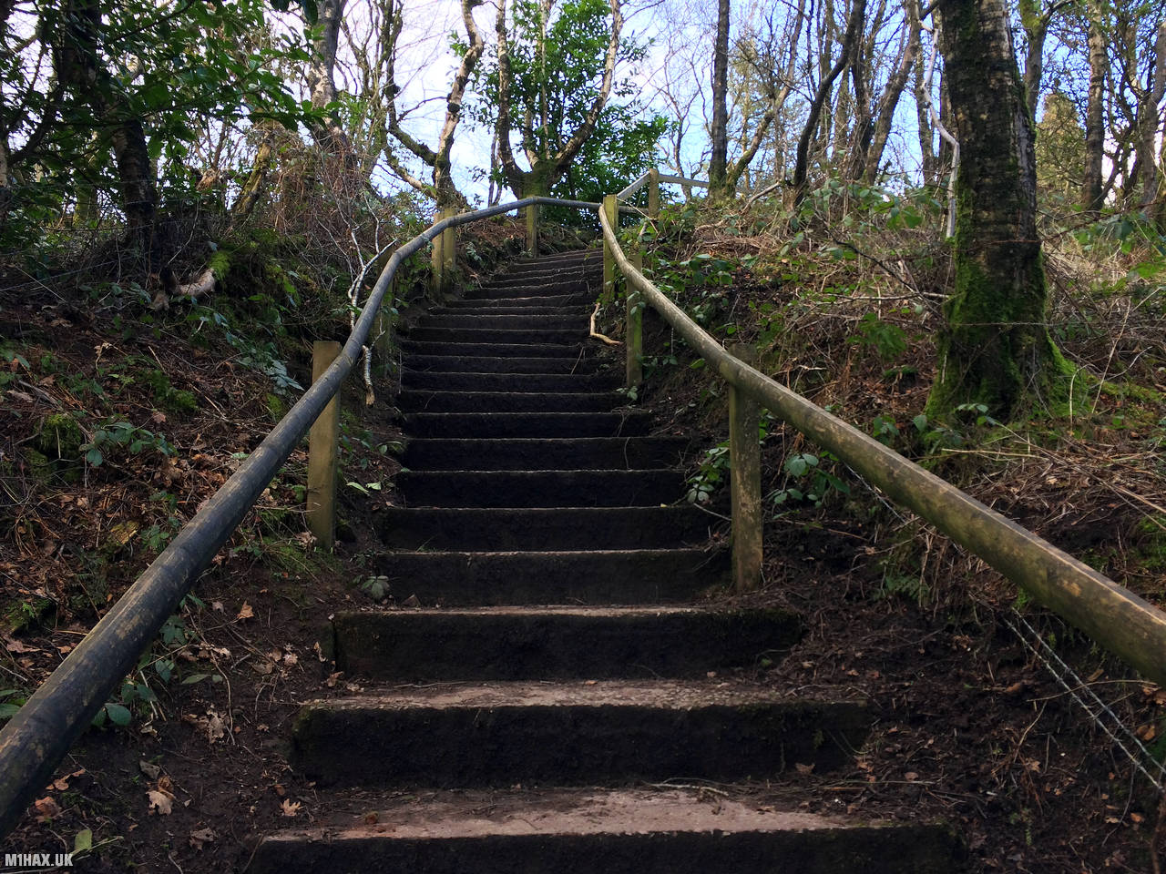
Briefly following the access road towards the hill, a set of concrete stairs lead the way up the hill. A dirt path then completes the short and easy ascent to the trig point.
There is a reasonable amount of space for larger antennas on a quiet day, however I chose to activate the summit on 2-metres with my Yaesu mobile rig.
After enjoying the view for a little while, I headed back down the path to the car.
Photos
Below are some photographs taken during my activation of The Cloud on Sunday 1st March, 2020.


Walking Route for The Cloud
The interactive map below shows my GPS track taken to the SOTA activation zone for The Cloud. The G/SP-015 summit area is marked on the map with a blue pin icon.
You can download the route shown above as a GPX file suitable for use with most GPS devices. This file is provided for information only, to support your own walk planning and research (it may contain navigation errors, detours and/or safety hazards). The route downloads provided here are governed by the Creative Commons BY-NC-SA 4.0 licence.
Station Log
I logged the following 13 amateur radio contacts operating as M1HAX/P from G/SP-015 The Cloud on Sunday 1st March, 2020 (all times shown are UTC):
| Time | Callsign | Band | Mode | Notes |
|---|---|---|---|---|
| 14:47 | 2E0LKC | 2m | FM | Peter, 5/9 |
| 14:48 | 2E0LMD | 2m | FM | Anne, 5/9 |
| 14:50 | M7MCQ | 2m | FM | Tom, 5/9 |
| 14:51 | G0TFP | 2m | FM | Jim, 4/9 |
| 14:54 | 2W0JYN | 2m | FM | Steve, 5/9 |
| 14:55 | 2E0IXM/M | 2m | FM | David, 5/9 |
| 14:56 | M7ECT | 2m | FM | Ethan, 5/9 |
| 14:57 | G0XBU/M | 2m | FM | Ian, 5/9 |
| 14:59 | 2E0XLG/P | 2m | FM | Chris, 5/9 |
| 15:00 | G8TSE | 2m | FM | Robert, 5/5 |
| 15:01 | M7MKS | 2m | FM | Mark, 5/9 |
| 15:03 | 2E0GHM | 2m | FM | Graham, 5/9 |
| 15:05 | 2E0SCX | 2m | FM | Steve, 5/9 |
In the notes field I will usually log the other operator’s name and the signal report they provided. In accordance with the Summits on the Air rules, I do not make a log entry where a complete exchange of callsigns and signal reports was unsuccessful.
Additional Information
The following resources may be helpful to walkers, mountaineers and SOTA activators interested in The Cloud:
- Sotl.as Summit Page for G/SP-015 The Cloud.
- Hill Bagging UK Summit Page for The Cloud.
- Google Maps Page for The Cloud.
- Wikipedia entry for The Cloud.
If you found this content valuable, why not Buy Me a Coffee?