Long Knoll - G/SC-007 SOTA (2020)

Summits on the Air Activation Report
Activation Date: Saturday 30th May, 2020.
Activator(s): Richard M1HAX.
Summit: Long Knoll, South Central, England.
Summit ID: SOTA reference G/SC-007 (1 point).
Summit Height: 288m elevation, 171m prominence.
Summit Location: Lat./Long. 51.13775, -2.30715. Maidenhead Grid IO81ud.
Distance: 3.4km travelled with 115m of ascent.
Difficulty: SAC Grade T1.(?)
Elapsed Time: 1hr 10m (including operating).
Weather: Feels like 23.9°C, 17 kph ESE wind, 31% humidity.
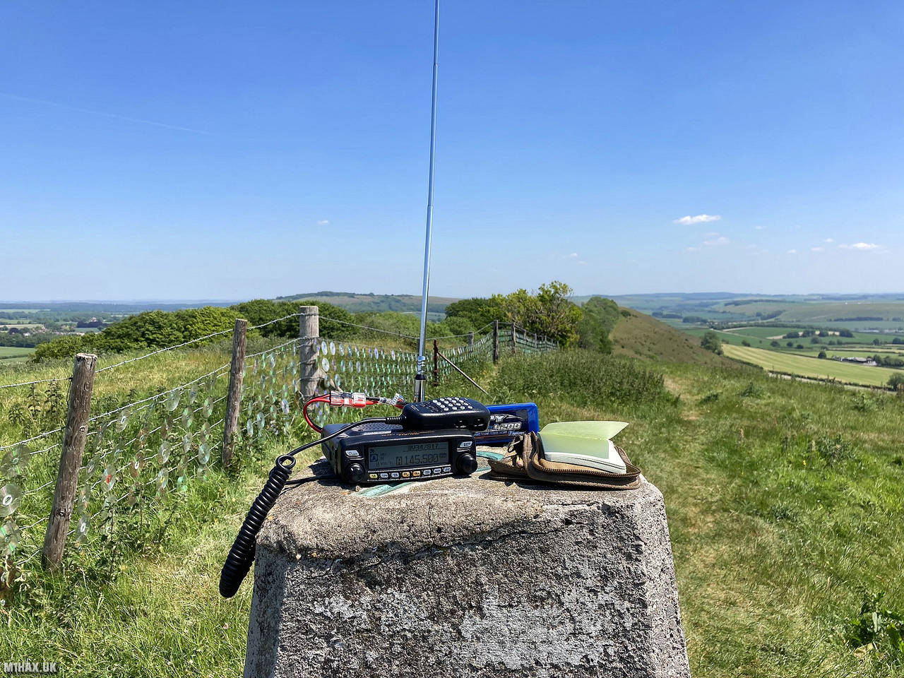
Radio Equipment: Yaesu FTM100D, MFJ-1714, Zippy 4200mAh 4S LiFePo4.
Callsign Used: M1HAX/P.
Contacts: 10 (2m FM).
Trip Notes
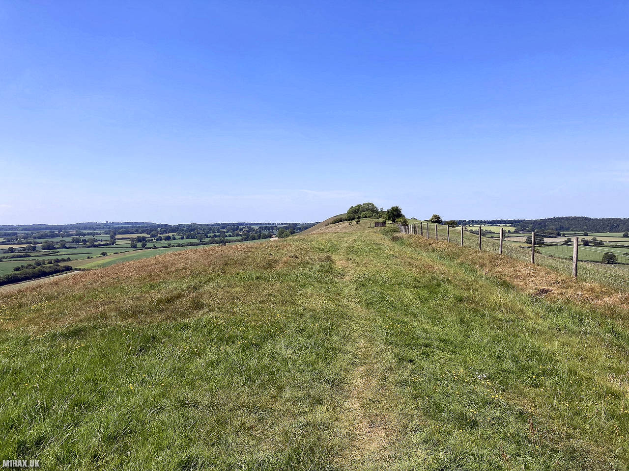
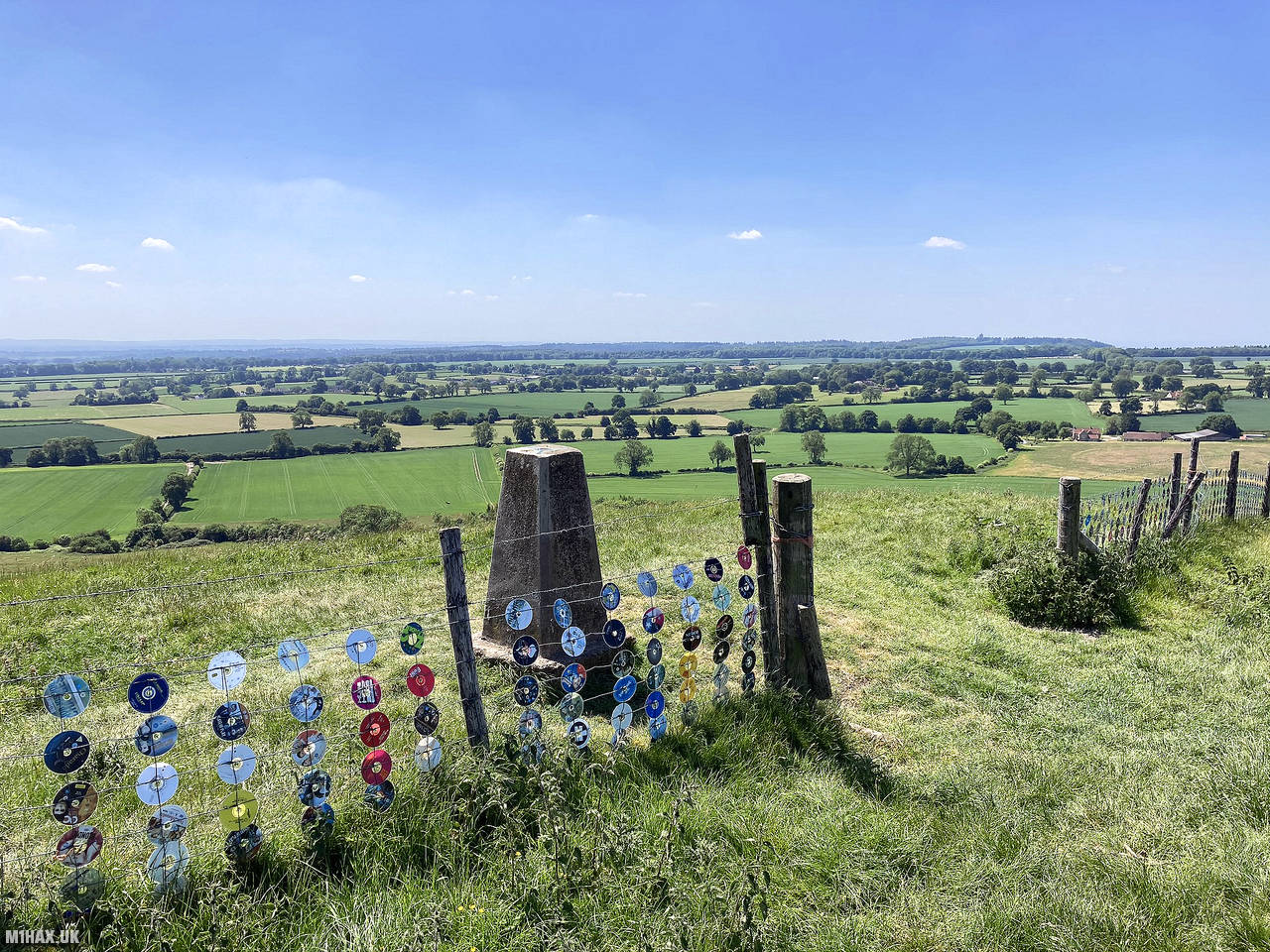
Long Knoll is a chalk grassland ridge located in the western part of Wiltshire, England. It spans 1.5 kilometres and marks the boundary between Kilmington and Maiden Bradley parishes. The highest point on the ridge stands at 288 meters above sea level and provides clear views of King Alfred’s Tower, Cranmore Tower, the Black Mountains, and Glastonbury Tor on clear days.
I parked on the roadside on the B3092 directly to the east of the hill. There is very limited parking here for one or two cars. Next time I activate this hill I will investigate approaching from the west side where there may be more opportunities to park.
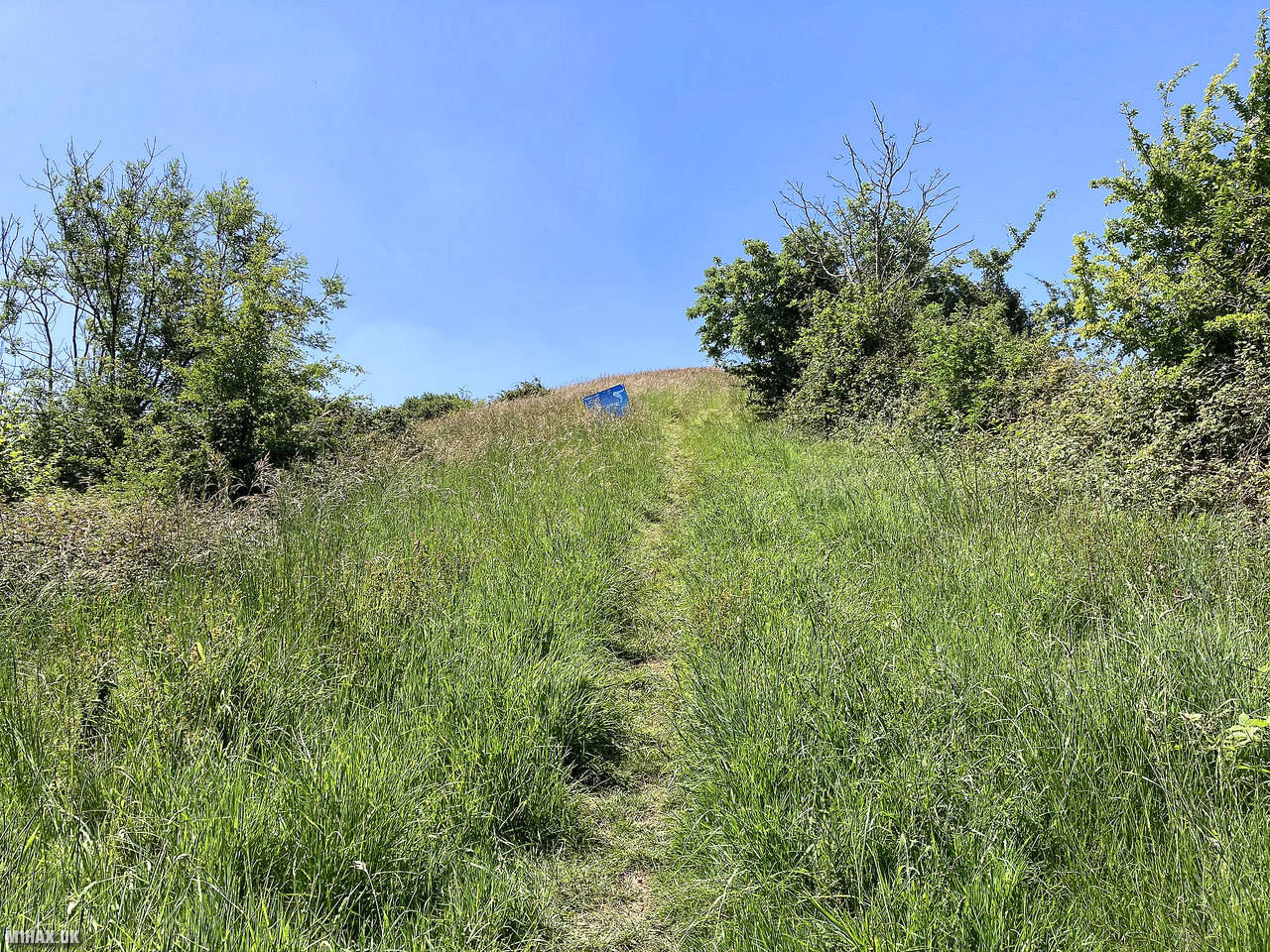
There is a rocky path that leads up through a coppice and on to the ridge. From here I followed the grassy path, which gently undulates its way up to the trig point at the western end of the ridge.
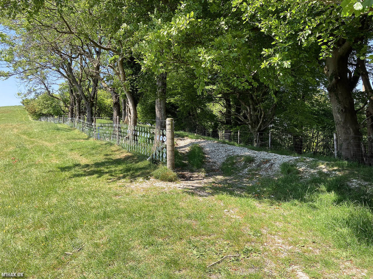
Artist Bruce Munro has attached thousands of CDs and DVDs to the fence line along the ridge, a temporary art installation in tribute to the national health service during COVID-19 pandemic. Sadly, I must say I didn’t find it particularly aesthetically pleasing.
Treated to fabulous sunny views in every direction from the summit, I easily made a number of VHF radio contacts. The strong tropospheric ducting today was making for very easy operating conditions.
This is quite an easy but enjoyable walk and would make a good target for a novice SOTA activator looking to move on from ‘drive-on summits’.
Photos
Below are some photographs taken during my activation of Long Knoll on Saturday 30th May, 2020.


Walking Route for Long Knoll
The interactive map below shows my GPS track taken to the SOTA activation zone for Long Knoll. The G/SC-007 summit area is marked on the map with a blue pin icon.
You can download the route shown above as a GPX file suitable for use with most GPS devices. This file is provided for information only, to support your own walk planning and research (it may contain navigation errors, detours and/or safety hazards). The route downloads provided here are governed by the Creative Commons BY-NC-SA 4.0 licence.
Station Log
I logged the following 10 amateur radio contacts operating as M1HAX/P from G/SC-007 Long Knoll on Saturday 30th May, 2020 (all times shown are UTC):
| Time | Callsign | Band | Mode | Notes |
|---|---|---|---|---|
| 11:56 | 2E0MDJ | 2m | FM | Matt, 5/2 |
| 11:57 | G0LGS | 2m | FM | Stewart, 5/2 |
| 11:58 | M7AJO | 2m | FM | Callum, 5/9 |
| 11:59 | 2E1EMK | 2m | FM | James, 5/9 |
| 12:00 | G0RLA | 2m | FM | Paul, 5/9 |
| 12:05 | G0FGE | 2m | FM | Baz, 5/5 |
| 12:07 | G7RRQ | 2m | FM | Vic, 5/8 |
| 12:08 | G4TCI | 2m | FM | Mike, 5/5 |
| 12:09 | G4ZWY | 2m | FM | Steve, 5/7 |
| 12:10 | G4PDS | 2m | FM | Ian, 5/6 |
In the notes field I will usually log the other operator’s name and the signal report they provided. In accordance with the Summits on the Air rules, I do not make a log entry where a complete exchange of callsigns and signal reports was unsuccessful.
Additional Information
The following resources may be helpful to walkers, mountaineers and SOTA activators interested in Long Knoll:
- Sotl.as Summit Page for G/SC-007 Long Knoll.
- Hill Bagging UK Summit Page for Long Knoll.
- Google Maps Page for Long Knoll.
- Wikipedia entry for Long Knoll.
If you found this content valuable, why not Buy Me a Coffee?