Win Green - G/SC-008 SOTA (2020)

Summits on the Air Activation Report
Activation Date: Saturday 30th May, 2020.
Activator(s): Richard M1HAX.
Summit: Win Green, South Central, England.
Summit ID: SOTA reference G/SC-008 (1 point).
Summit Height: 277m elevation, 159m prominence.
Summit Location: Lat./Long. 50.98558, -2.10800. Maidenhead Grid IO80wx.
Distance: 0.5km travelled with 14m of ascent.
Difficulty: SAC Grade T1.(?)
Elapsed Time: 30m (including operating).
Weather: Feels like 22.2°C, 13 kph E wind, 43% humidity.
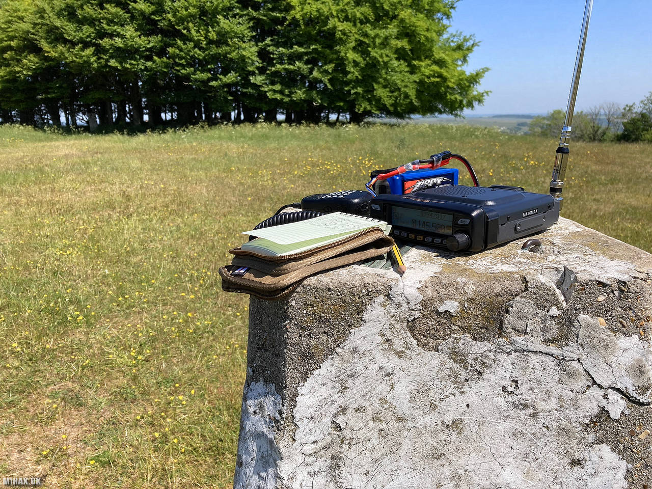
Radio Equipment: Yaesu FTM100D, MFJ-1714, Zippy 4200mAh 4S LiFePo4.
Callsign Used: M1HAX/P.
Contacts: 7 (2m FM).
Trip Notes
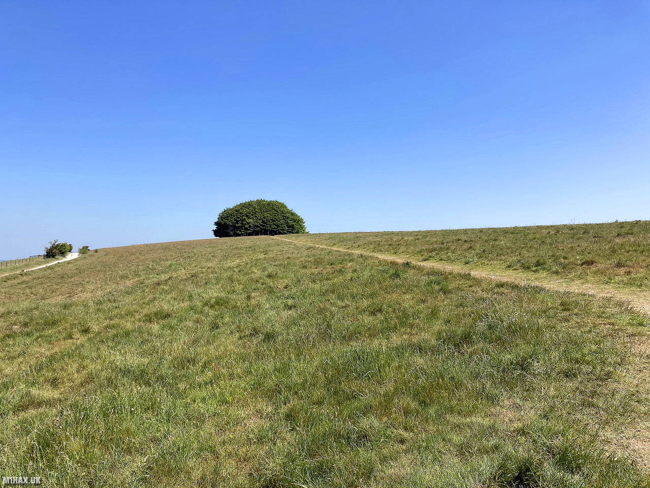
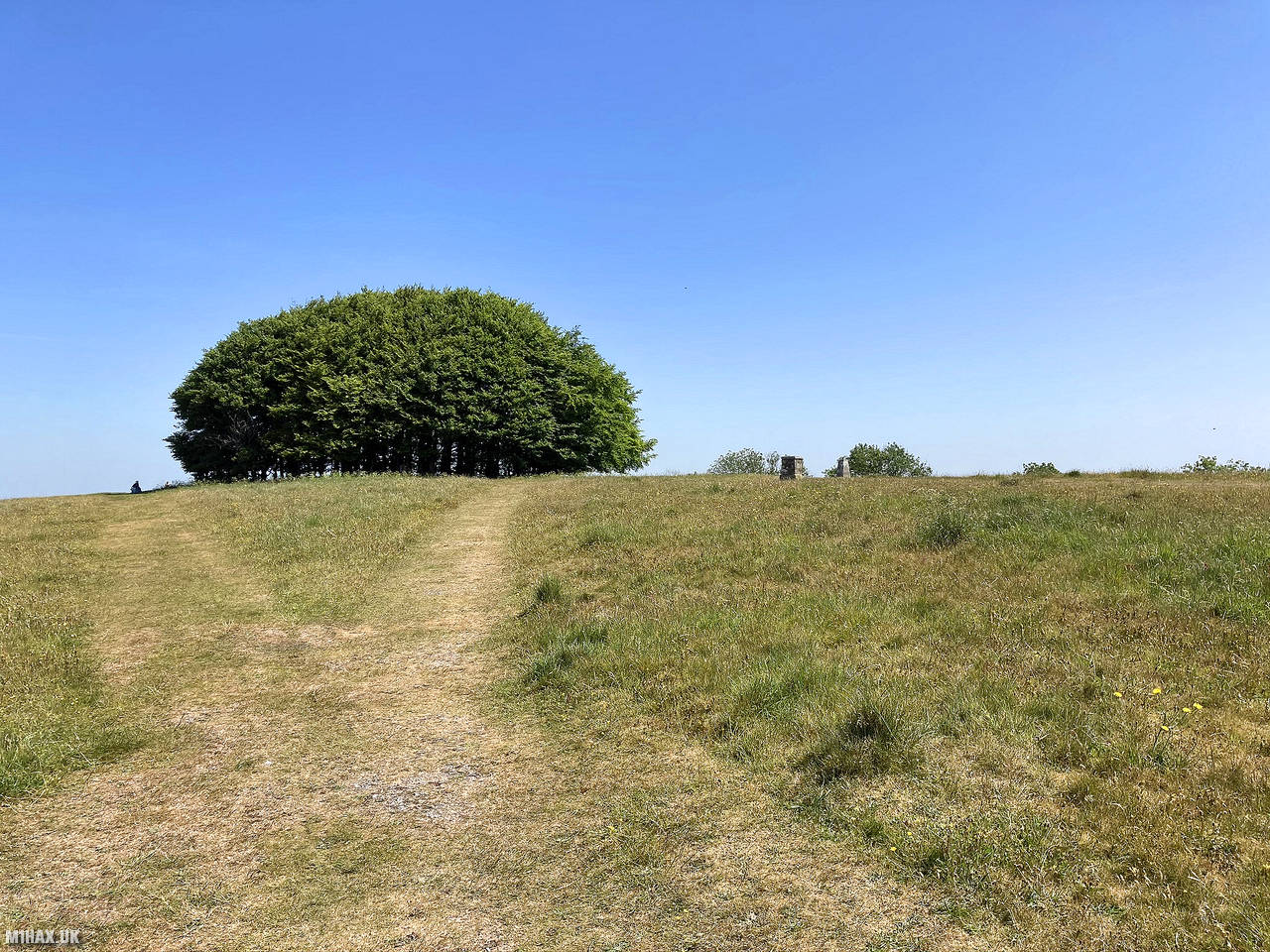
Win Green Down, located in southwestern Wiltshire, England, is a 64-acre Site of Special Scientific Interest designated in 1971. Its summit, Win Green, stands at 277 meters and is the highest point in Cranborne Chase, offering extensive views of Bournemouth, the Isle of Wight, Salisbury, Glastonbury Tor, the Mendips, and the Quantocks. With a clump of trees marking the high point, Win Green is considered a Marilyn and has Long Knoll as its parent peak.
This is a very easy one-point SOTA hill near Shaftesbury which is almost a drive-on summit. It’s best enjoyed on a sunny day. There is plenty of space for antennas.
A short chalky track leads to a busy but reasonably sized parking area. From the parking area an obvious and short grassy path leads to the trig point and trees at the summit.
As I was activating five separate summits today I undertook a quick VHF SOTA activation from the trig point before returning back to the car and moving on.
Photos
Below are some photographs taken during my activation of Win Green on Saturday 30th May, 2020.


Walking Route for Win Green
The interactive map below shows my GPS track taken to the SOTA activation zone for Win Green. The G/SC-008 summit area is marked on the map with a blue pin icon.
You can download the route shown above as a GPX file suitable for use with most GPS devices. This file is provided for information only, to support your own walk planning and research (it may contain navigation errors, detours and/or safety hazards). The route downloads provided here are governed by the Creative Commons BY-NC-SA 4.0 licence.
Station Log
I logged the following 7 amateur radio contacts operating as M1HAX/P from G/SC-008 Win Green on Saturday 30th May, 2020 (all times shown are UTC):
| Time | Callsign | Band | Mode | Notes |
|---|---|---|---|---|
| 10:31 | M6KTJ/M | 2m | FM | Kevin, 5/9 |
| 10:33 | G0SDD | 2m | FM | Chris, 5/1 |
| 10:35 | G3SJK | 2m | FM | Steve, 5/3 |
| 10:37 | GU3TUX | 2m | FM | Chris, 5/7 |
| 10:38 | GU7DAI | 2m | FM | Jason, 5/7 |
| 10:39 | G8WBO | 2m | FM | Steve, 5/9 |
| 10:45 | G6TEL | 2m | FM | Steve, 5/9 |
In the notes field I will usually log the other operator’s name and the signal report they provided. In accordance with the Summits on the Air rules, I do not make a log entry where a complete exchange of callsigns and signal reports was unsuccessful.
Additional Information
The following resources may be helpful to walkers, mountaineers and SOTA activators interested in Win Green:
- Sotl.as Summit Page for G/SC-008 Win Green.
- Hill Bagging UK Summit Page for Win Green.
- Google Maps Page for Win Green.
- Wikipedia entry for Win Green.
If you found this content valuable, why not Buy Me a Coffee?