Dunkery Beacon - G/SC-001 SOTA (2020)

Summits on the Air Activation Report
Activation Date: Saturday 13th June, 2020.
Activator(s): Richard M1HAX.
Summit: Dunkery Beacon, South Central, England.
Summit ID: SOTA reference G/SC-001 (2 points).
Summit Height: 519m elevation, 414m prominence.
Summit Location: Lat./Long. 51.16279, -3.58673. Maidenhead Grid IO81ed.
Distance: 2.9km travelled with 82m of ascent.
Difficulty: SAC Grade T1.(?)
Elapsed Time: 1hr 20m (including operating).
Weather: Feels like 15.6°C, 17 kph ESE wind, 81% humidity.
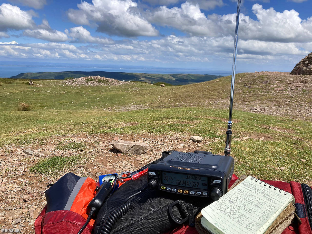
Radio Equipment: Yaesu FTM100D, MFJ-1714, Zippy 4200mAh 4S LiFePo4.
Callsign Used: M1HAX/P.
Contacts: 12 (2m FM).
Trip Notes
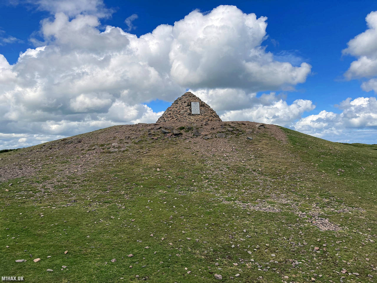
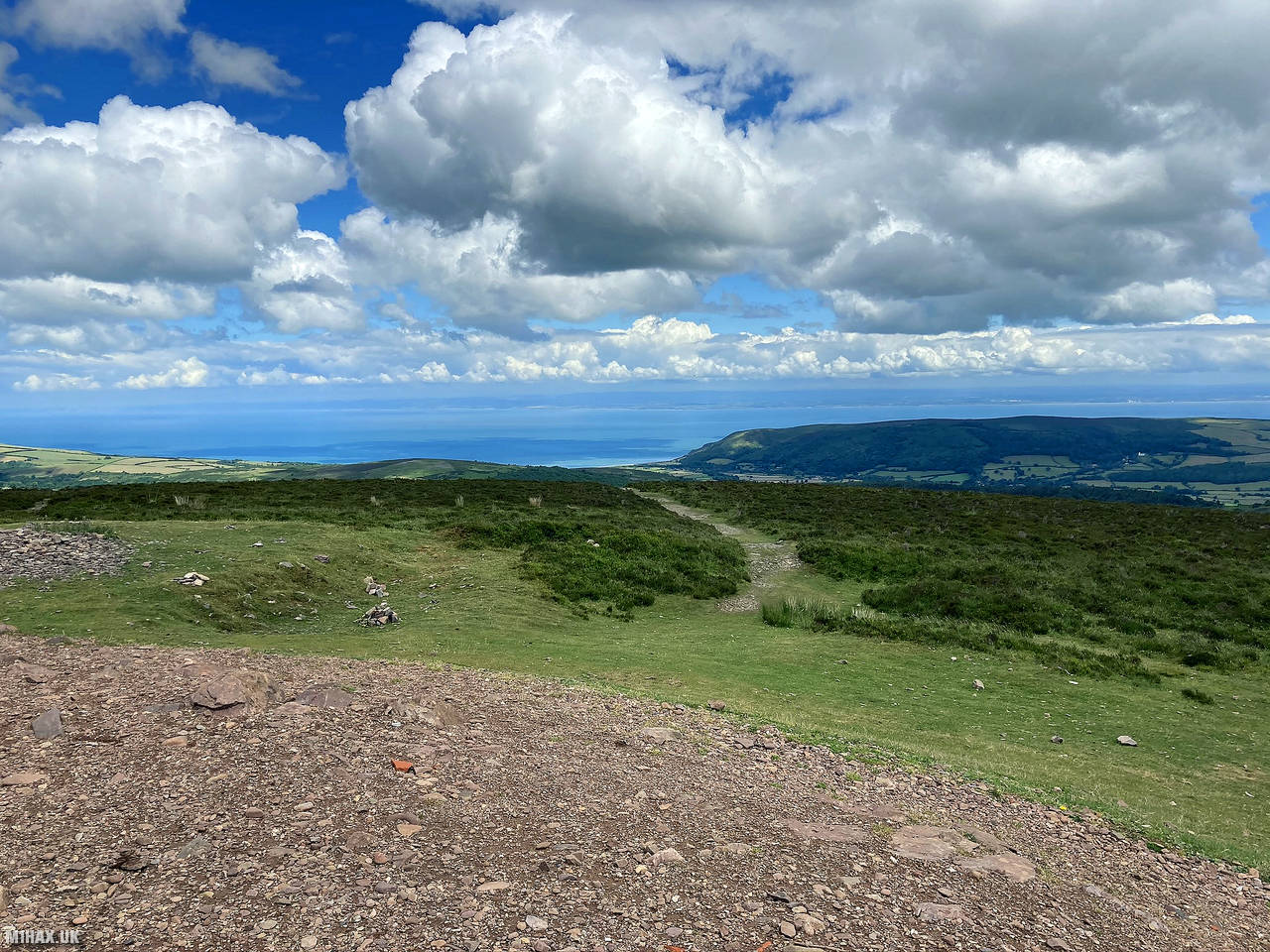
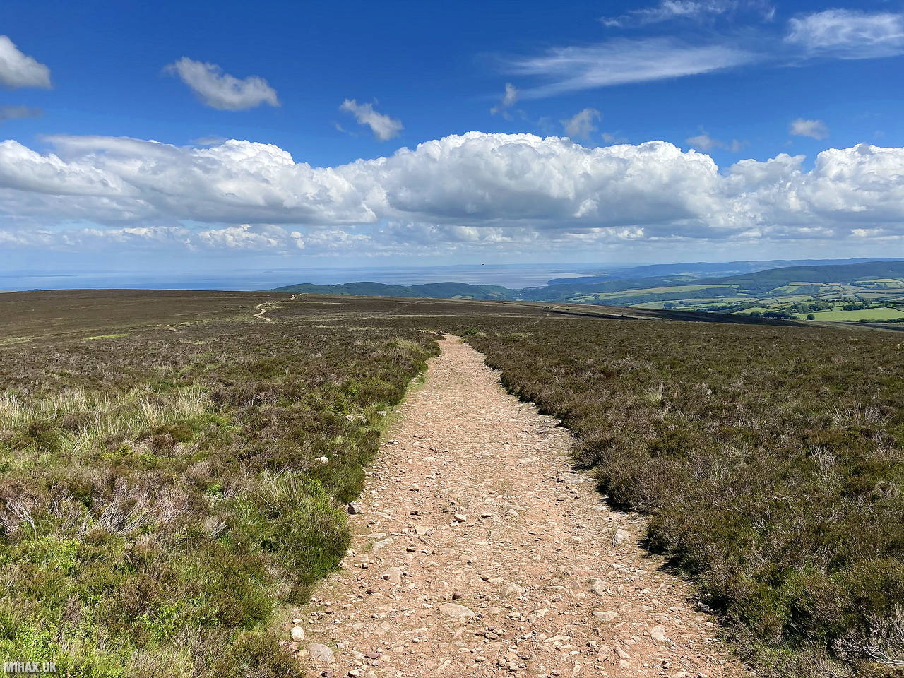
Dunkery Beacon is the highest point in Somerset, England, located at the summit of Dunkery Hill. It is also the highest point in southern England, excluding Dartmoor. Rising to 519 meters, this sandstone hill offers stunning views of the surrounding moorland, the Bristol Channel, and hills up to 138 km away. The site has a rich history, with evidence of human activity dating back to the Bronze Age, including several burial mounds in the form of cairns and bowl barrows.
This is an easy 2 pointer hill for the Summits on the Air scheme and can be activated in under 90 minutes.
I parked to the north-east of the summit where there are gravel laybys along a high-level road across the hill.
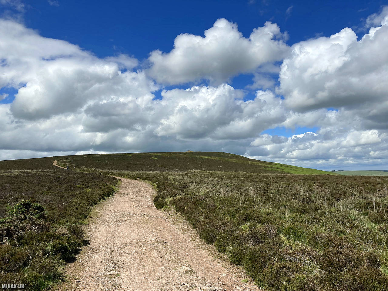
An obvious foot path leads directly up to the summit, which is about 1.4 km away from the parking spaces.
The walking route was very easy with less than a hundred metres of ascent required.
At the summit there is a large cairn. I setup next to this and made a number of contacts on the two metres band, including G2JP, operating mobile, whom I had met on High Willhays a few days previous. The weather was fine and the views were very good, being able to see Wales across the channel.
After the activation I made the easy walk back down to the car parking area. This hill would be best tackled during the SOTA winter bonus period.
Photos
Below are some photographs taken during my activation of Dunkery Beacon on Saturday 13th June, 2020.


Walking Route for Dunkery Beacon
The interactive map below shows my GPS track taken to the SOTA activation zone for Dunkery Beacon. The G/SC-001 summit area is marked on the map with a blue pin icon.
You can download the route shown above as a GPX file suitable for use with most GPS devices. This file is provided for information only, to support your own walk planning and research (it may contain navigation errors, detours and/or safety hazards). The route downloads provided here are governed by the Creative Commons BY-NC-SA 4.0 licence.
Station Log
I logged the following 12 amateur radio contacts operating as M1HAX/P from G/SC-001 Dunkery Beacon on Saturday 13th June, 2020 (all times shown are UTC):
| Time | Callsign | Band | Mode | Notes |
|---|---|---|---|---|
| 11:23 | GW4MOZ | 2m | FM | John, 5/9 |
| 11:26 | M0TGZ | 2m | FM | Tom, 5/9 |
| 11:29 | MW0TDQ | 2m | FM | George, 5/9 |
| 11:30 | MW6IUT | 2m | FM | Bryan, 5/9 |
| 11:30 | G4XWQ | 2m | FM | Dave, 5/9 |
| 11:32 | G0CDB | 2m | FM | John, 5/5 |
| 11:33 | G4CDY | 2m | FM | Terry, 5/9 |
| 11:38 | MW7ARE | 2m | FM | Jethro, 5/9 |
| 11:39 | G6SQX | 2m | FM | Steve, 5/9 |
| 11:44 | M0ZVR/P | 2m | FM | Barry, 5/4 |
| 11:54 | G2JP/M | 2m | FM | Jani, 4/2 |
| 11:58 | G0HET | 2m | FM | Peter, 5/7 |
In the notes field I will usually log the other operator’s name and the signal report they provided. In accordance with the Summits on the Air rules, I do not make a log entry where a complete exchange of callsigns and signal reports was unsuccessful.
Additional Information
The following resources may be helpful to walkers, mountaineers and SOTA activators interested in Dunkery Beacon:
- Sotl.as Summit Page for G/SC-001 Dunkery Beacon.
- Hill Bagging UK Summit Page for Dunkery Beacon.
- Google Maps Page for Dunkery Beacon.
- Wikipedia entry for Dunkery Beacon.
If you found this content valuable, why not Buy Me a Coffee?