Selworthy Beacon - G/SC-005 SOTA (2020)

Summits on the Air Activation Report
Activation Date: Saturday 13th June, 2020.
Activator(s): Richard M1HAX.
Summit: Selworthy Beacon, South Central, England.
Summit ID: SOTA reference G/SC-005 (1 point).
Summit Height: 308m elevation, 193m prominence.
Summit Location: Lat./Long. 51.22082, -3.54951. Maidenhead Grid IO81ff.
Distance: 0.9km travelled with 40m of ascent.
Difficulty: SAC Grade T1.(?)
Elapsed Time: 40m (including operating).
Weather: Feels like 15.6°C, 17 kph ESE wind, 81% humidity.
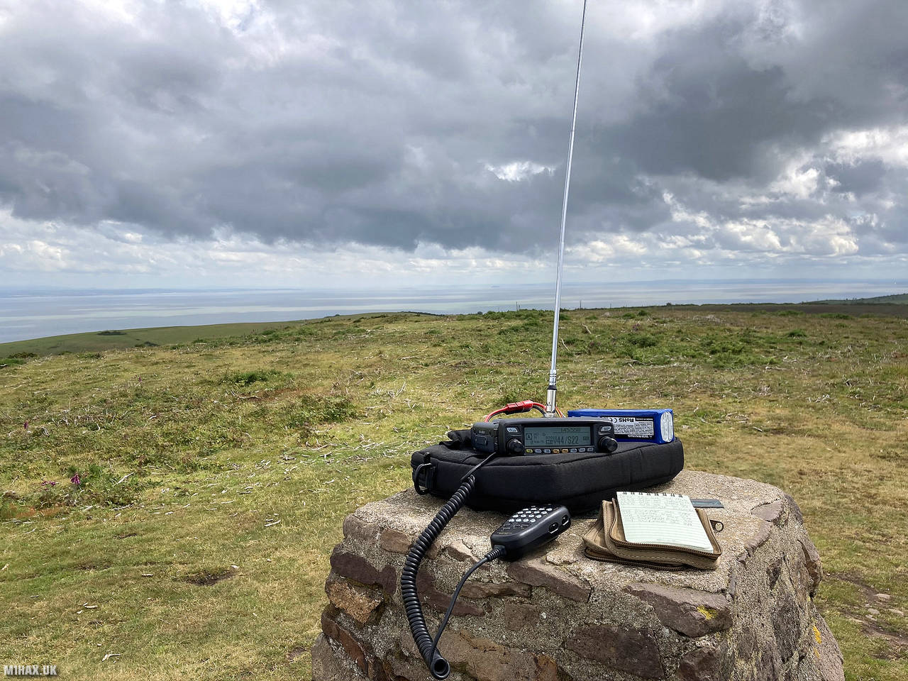
Radio Equipment: Yaesu FTM100D, MFJ-1714, Zippy 4200mAh 4S LiFePo4.
Callsign Used: M1HAX/P.
Contacts: 13 (2m FM).
Trip Notes
Located in Exmoor, Somerset, Selworthy Beacon is a hill that qualifies as a Marilyn. It is situated within the boundaries of Exmoor National Park, to the north of Selworthy village and northwest of Minehead. The South West Coast Path ascends the hill, ending just shy of the summit.
This is an easy one-point SOTA summit which is potentially a drive-on summit if you have an offroad capable vehicle.
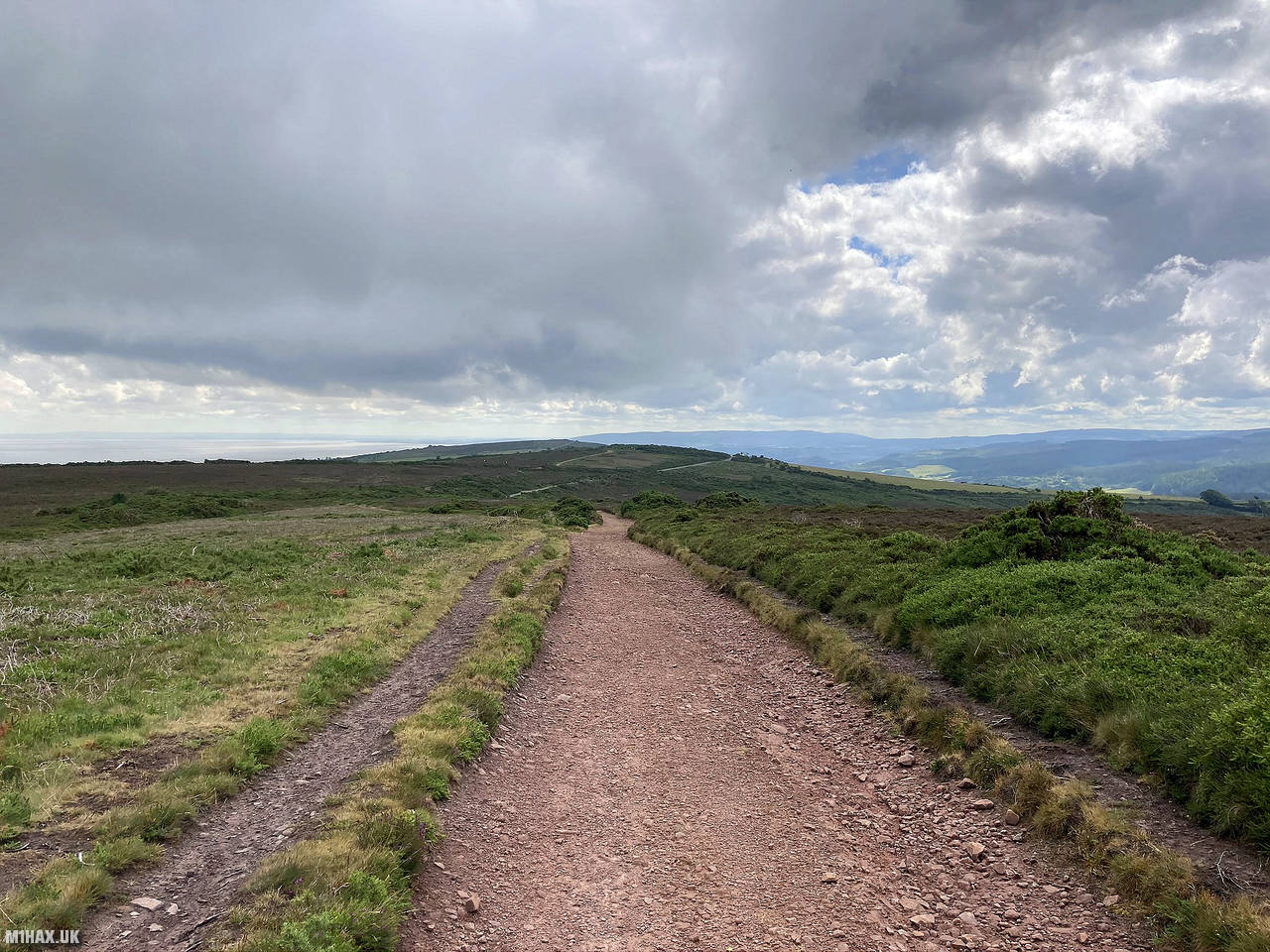
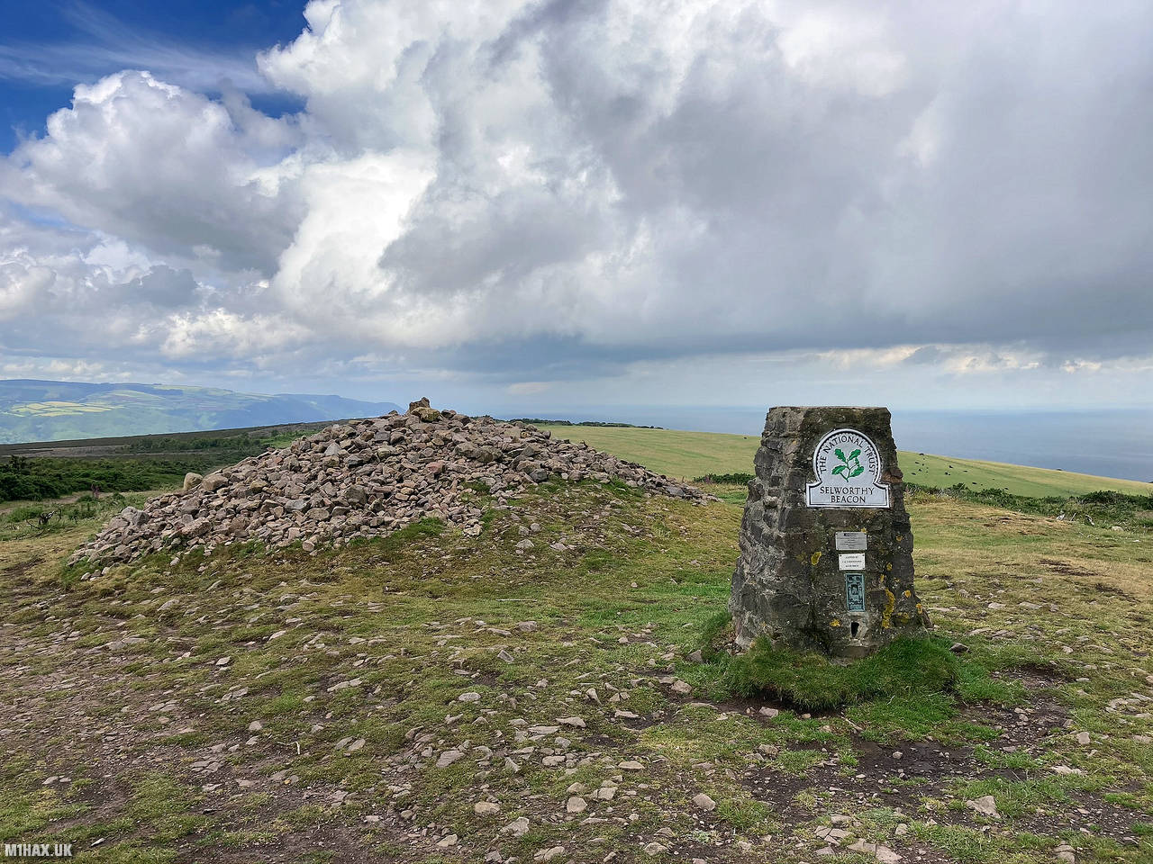
I parked on the roadside directly to the east of the summit, where a gravel track leads to the top. Following this track for a few minutes took me to the trig point at the summit where there is a National Trust plaque and fantastic views across the Bristol Channel.
At the summit I operated on VHF to activate the summit for the SOTA amateur radio scheme. Making contacts was easy and could have been done using a 5-watt handheld rather than my 50w mobile rig. I enjoyed summit to summit contacts with Rod and Vicki who were on G/WB-011 Bradnor Hill near Leominster.
This is an easy summit to activate, and worth combining with Wills Neck and Dunkery Beacon in a single trip.
Photos
Below are some photographs taken during my activation of Selworthy Beacon on Saturday 13th June, 2020.


Walking Route for Selworthy Beacon
The interactive map below shows my GPS track taken to the SOTA activation zone for Selworthy Beacon. The G/SC-005 summit area is marked on the map with a blue pin icon.
You can download the route shown above as a GPX file suitable for use with most GPS devices. This file is provided for information only, to support your own walk planning and research (it may contain navigation errors, detours and/or safety hazards). The route downloads provided here are governed by the Creative Commons BY-NC-SA 4.0 licence.
Station Log
I logged the following 13 amateur radio contacts operating as M1HAX/P from G/SC-005 Selworthy Beacon on Saturday 13th June, 2020 (all times shown are UTC):
| Time | Callsign | Band | Mode | Notes |
|---|---|---|---|---|
| 10:03 | GW4PAF | 2m | FM | John, 5/6 |
| 10:05 | GW4FOK | 2m | FM | Nigel, 5/9 |
| 10:07 | 2W0OKW | 2m | FM | Mark, 5/9 |
| 10:09 | GW4HZA | 2m | FM | Roger, 5/9 |
| 10:11 | GW4MOZ | 2m | FM | John, 5/9 |
| 10:15 | M6BWA/P | 2m | FM | Vicki, 5/1, S2S G/WB-011 |
| 10:17 | M0JLA | 2m | FM | Rod, 5/1, S2S G/WB-011 |
| 10:17 | 2E0MDJ | 2m | FM | Matt, 5/3 |
| 10:17 | G0LGS | 2m | FM | Stewart, 5/4 |
| 10:18 | MW6IUT | 2m | FM | Bryan, 4/4 |
| 10:20 | MW0AZA | 2m | FM | Wayne, 5/9 |
| 10:21 | MW7ARE | 2m | FM | Jethro, 5/9 |
| 10:22 | 2W0FLW | 2m | FM | Derek, 5/9 |
In the notes field I will usually log the other operator’s name and the signal report they provided. In accordance with the Summits on the Air rules, I do not make a log entry where a complete exchange of callsigns and signal reports was unsuccessful.
Additional Information
The following resources may be helpful to walkers, mountaineers and SOTA activators interested in Selworthy Beacon:
- Sotl.as Summit Page for G/SC-005 Selworthy Beacon.
- Hill Bagging UK Summit Page for Selworthy Beacon.
- Google Maps Page for Selworthy Beacon.
- Wikipedia entry for Selworthy Beacon.
If you found this content valuable, why not Buy Me a Coffee?