Hergest Ridge - G/WB-008 SOTA (2020)

Summits on the Air Activation Report
Activation Date: Sunday 5th July, 2020.
Activator(s): Richard M1HAX.
Summit: Hergest Ridge, Welsh Borders, England.
Summit ID: SOTA reference G/WB-008 (1 point).
Summit Height: 427m elevation, 158m prominence.
Summit Location: Lat./Long. 52.19951, -3.09240. Maidenhead Grid IO82ke.
Distance: 5.7km travelled with 171m of ascent.
Difficulty: SAC Grade T1.(?)
Elapsed Time: 1hr 25m (including operating).
Weather: Feels like 14.4°C, 20 kph W wind, 63% humidity.
Radio Equipment: Yaesu FTM100D, MFJ-1714, Zippy 4200mAh 4S LiFePo4.
Callsign Used: M1HAX/P.
Contacts: 8 (2m FM).
Trip Notes
Hergest Ridge, a substantial elongated hill, spans the England-Wales border in the United Kingdom. It stretches between Kington in Herefordshire and Gladestry in Powys. The highest point, located in England, reaches an elevation of 426 meters.
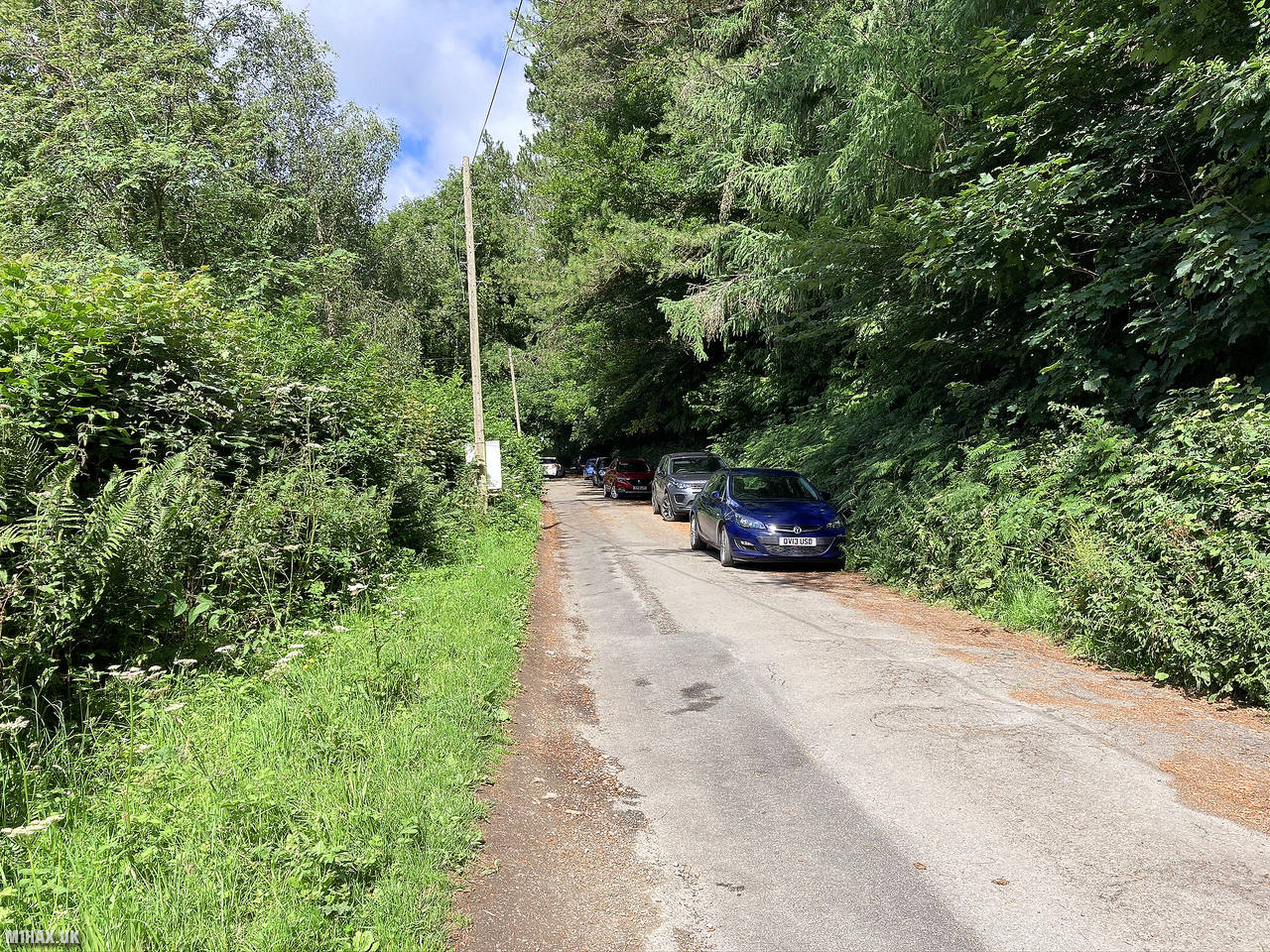
I parked towards the end of the Ridgebourne Road leading out of Kington. From here an obvious path leads towards the top of the hill. This is a popular area with numerous walkers on the hill.
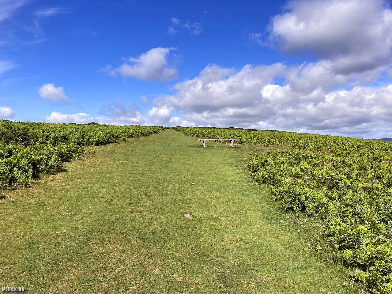
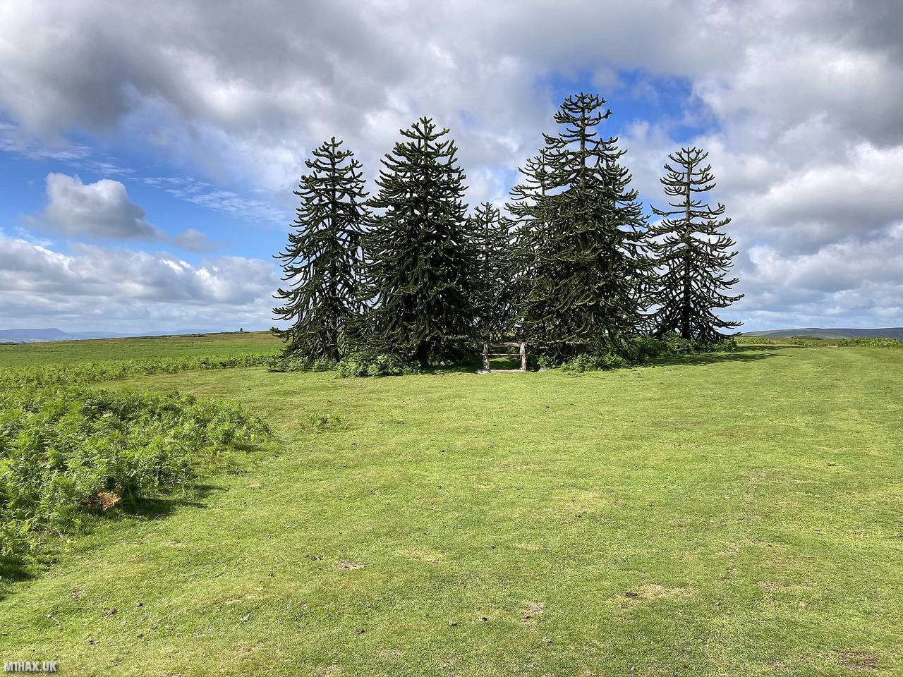
Well defined grassy paths lead up the hill. The route crosses through a disused Victorian-era horse racecourse near the summit. There is also an unexpected group of monkey puzzle trees to be seen during the ascent.
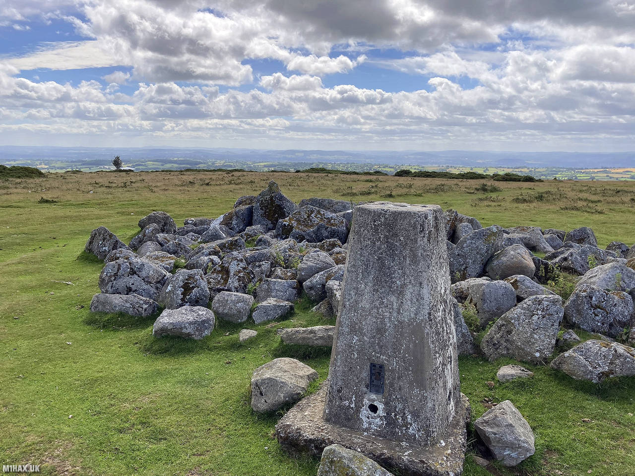
After about 45 minutes of walking, the trig point marking the highest point of the ridge comes in to view. I operated from the adjacent pile of stones. It was easy to collect a handful of Summits on the Air radio contacts on the 2-metre band.
I returned to the car back along the route I had taken to the summit. Whilst this is only a one-pointer hill for the SOTA scheme, it is very much worth a visit to see its unusual features.
Photos
Below are some photographs taken during my activation of Hergest Ridge on Sunday 5th July, 2020.


Walking Route for Hergest Ridge
The interactive map below shows my GPS track taken to the SOTA activation zone for Hergest Ridge. The G/WB-008 summit area is marked on the map with a blue pin icon.
You can download the route shown above as a GPX file suitable for use with most GPS devices. This file is provided for information only, to support your own walk planning and research (it may contain navigation errors, detours and/or safety hazards). The route downloads provided here are governed by the Creative Commons BY-NC-SA 4.0 licence.
Station Log
I logged the following 8 amateur radio contacts operating as M1HAX/P from G/WB-008 Hergest Ridge on Sunday 5th July, 2020 (all times shown are UTC):
| Time | Callsign | Band | Mode | Notes |
|---|---|---|---|---|
| 09:29 | G8XYJ | 2m | FM | Matt, 5/5 |
| 09:34 | 2E0MDJ | 2m | FM | Matt, 5/9 |
| 09:35 | G0LGS | 2m | FM | Stewart, 5/9 |
| 09:36 | M3DOO | 2m | FM | John, 5/7 |
| 09:37 | 2E0RYR | 2m | FM | Roger, 5/9 |
| 09:38 | G1ERM | 2m | FM | Darren, 5/5 |
| 09:39 | G6BPC | 2m | FM | Nick, 5/7 |
| 09:40 | G4CLR | 2m | FM | Ian, 5/9 |
In the notes field I will usually log the other operator’s name and the signal report they provided. In accordance with the Summits on the Air rules, I do not make a log entry where a complete exchange of callsigns and signal reports was unsuccessful.
Additional Information
The following resources may be helpful to walkers, mountaineers and SOTA activators interested in Hergest Ridge:
- Sotl.as Summit Page for G/WB-008 Hergest Ridge.
- Hill Bagging UK Summit Page for Hergest Ridge.
- Google Maps Page for Hergest Ridge.
- Wikipedia entry for Hergest Ridge.
If you found this content valuable, why not Buy Me a Coffee?