Sgurr Ban - GM/NS-010 SOTA (2020)

Summits on the Air Activation Report
Activation Date: Friday 14th August, 2020.
Activator(s): Richard M1HAX.
Summit: Sgurr Ban, Northern Scotland, Scotland.
Summit ID: SOTA reference GM/NS-010 (6 points).
Summit Height: 989m elevation, 165m prominence.
Summit Location: Lat./Long. 57.71854, -5.26590. Maidenhead Grid IO77ir.
Also Activated: GM/NS-006, GM/NS-016, GM/NS-022.
Distance: 15.7km travelled with 1587m of ascent.
Difficulty: SAC Grade T3.(?)
Elapsed Time: 12hr 35m (incl. operating and other summit(s) on the same hike).
Weather: Feels like 12.8°C, 4 kph ENE wind, 99% humidity.
Radio Equipment: Yaesu FT891, Linked Dipole, Zippy 8400mAh 4S LiFePo4.
Callsign Used: MM1HAX/P.
Contacts: 5 (20m SSB, 40m SSB).
Trip Notes
Nestled within the Fisherfield Forest, also known as the Great Wilderness, lie Scotland’s most secluded Munros. The region unveils a breathtaking display of dramatic peaks and ridges, offering some of the most spectacular views in all of Scotland. The Fisherfield Five route encompasses five Munros and one Corbett, with the journey commencing and concluding at Shenavall bothy or a nearby wild camp. The terrain poses challenges, featuring steep hillsides, scree, boulder fields, and broad grass slopes. Walkers should be prepared for sections of easy scrambling and serious river crossings along the way.
On this trip I would activate six Summits on the Air mountains as part of a three-night wild camping trip, bagging a total of 38 SOTA activator points. In addition to my camping equipment and food, I carried a Yaesu FT891 100-watt radio, SOTAbeams Band Hopper III linked dipole antenna and 8400mAh 4S LiFePo4 battery. I also took a Yaesu VX6 2m/70cm handheld radio (primarily to convince myself it was entirely necessary to carry the heavy Yaesu FT891 setup!).
The sequence of summits for this circular walk was GM/NS-022 (914m), GM/NS-010 (989m), GM/NS-006 (1015m), GM/NS-016 (934m), GM/NS-013 (967m), and GM/NS-021 (919m).
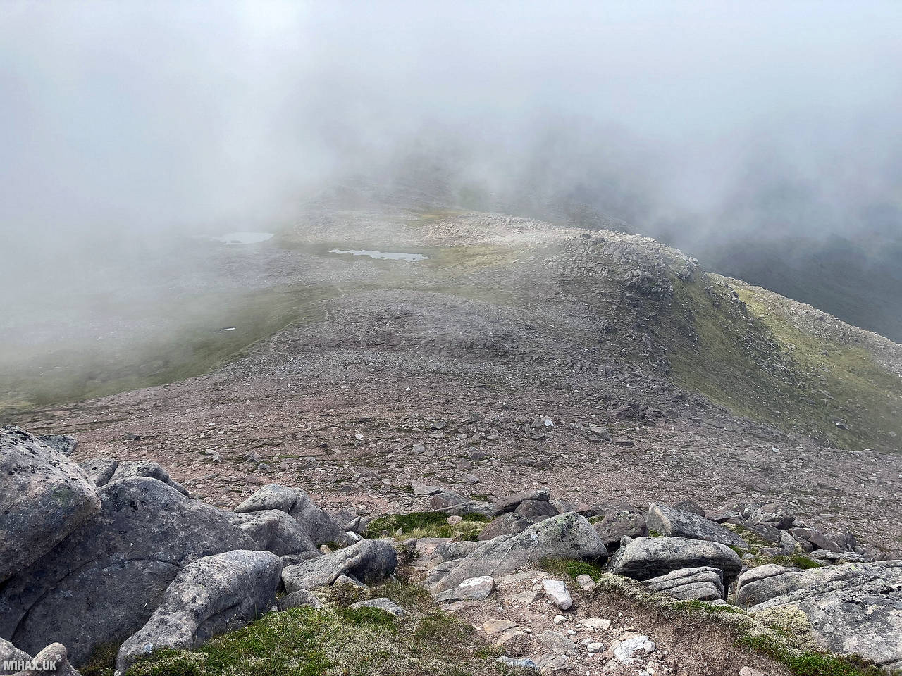
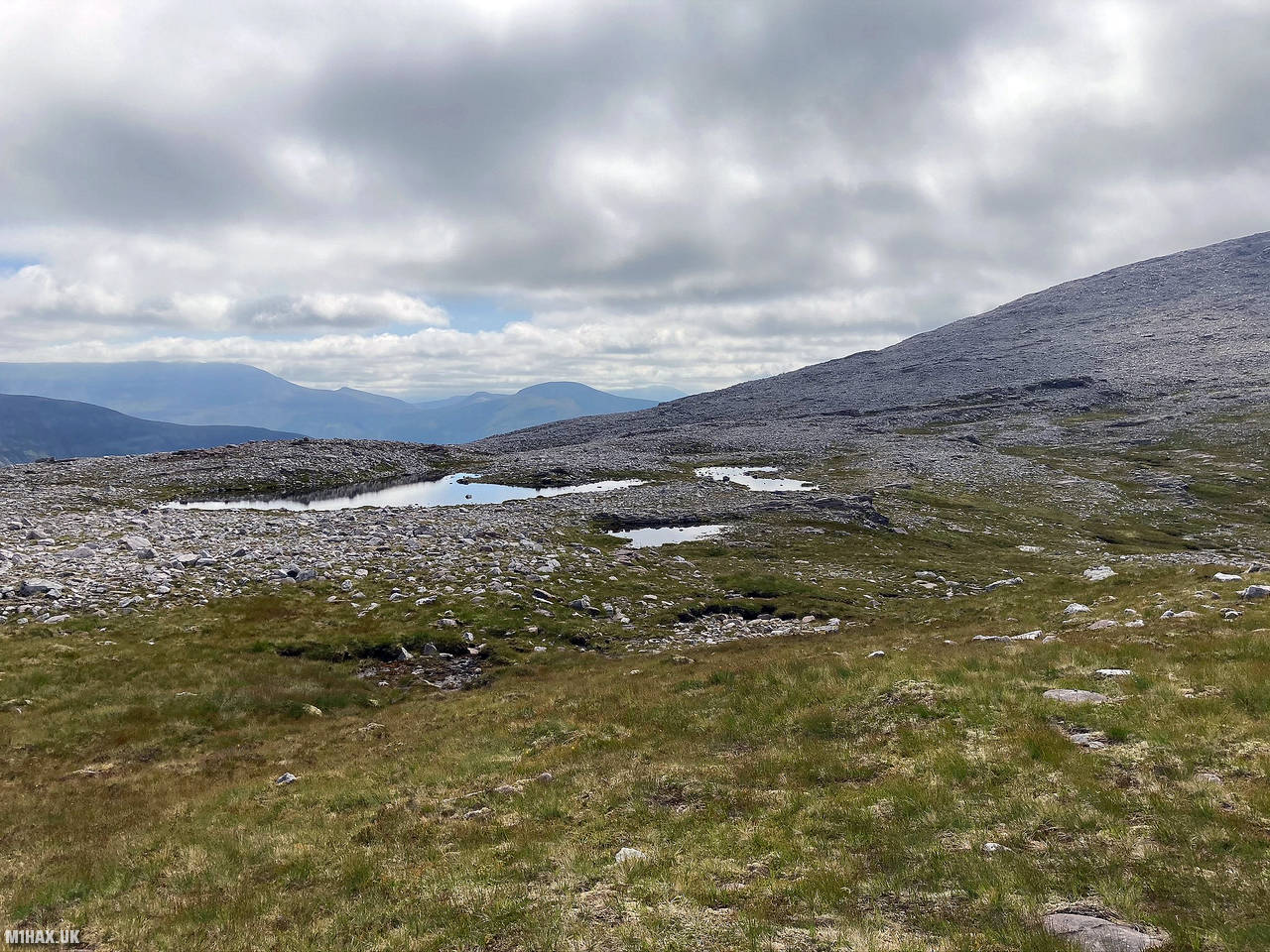
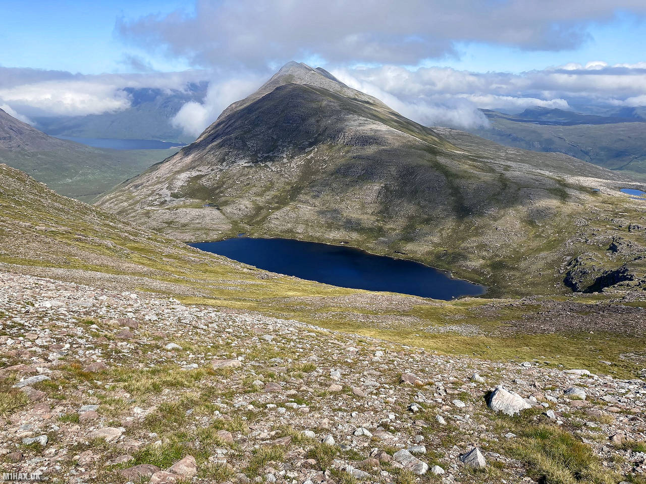
Descending in the mist from the summit of Beinn a' Chlaidheimh we followed a track down a loose gravel slope onwards to Sgurr Ban. Several ponds and a lake along the trail offered the chance to top up our water supplies as we progressed.
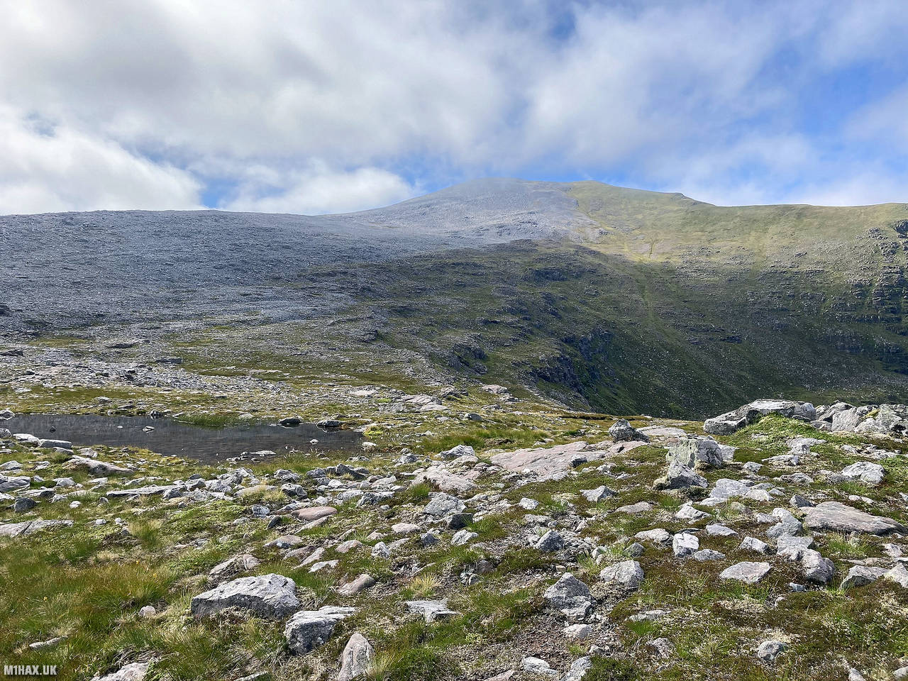
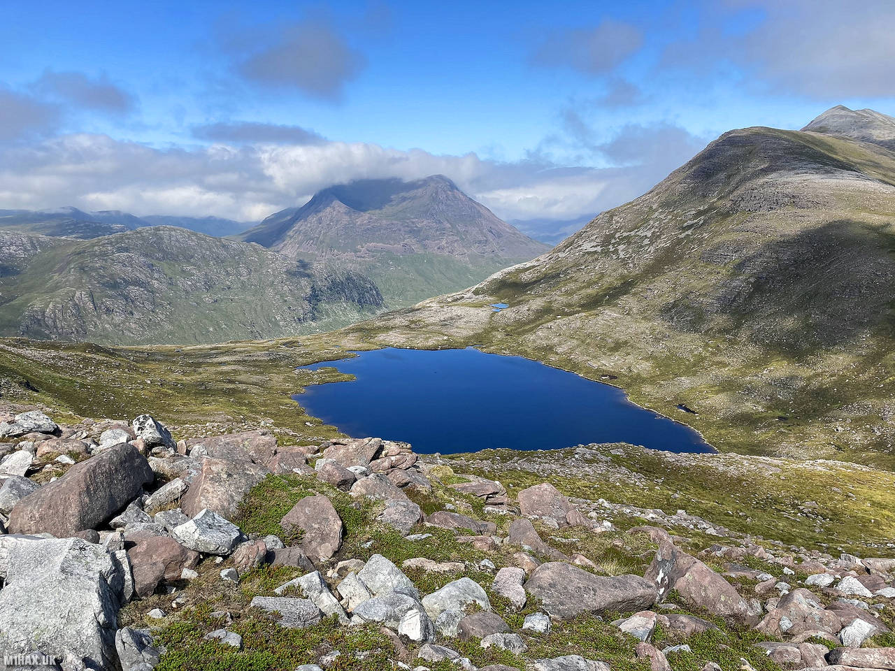
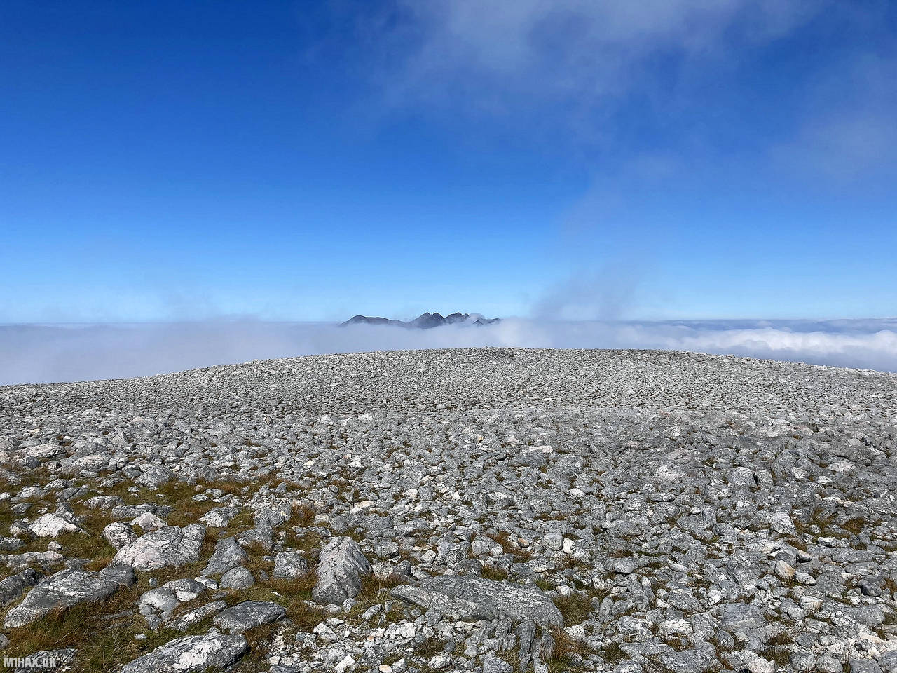
After a short while the morning fog cleared and we were treated to some magnificent views of An Teallach and the previous summit. Skirting around an expansive boulder field we progressed up the slopes of Sgurr Ban
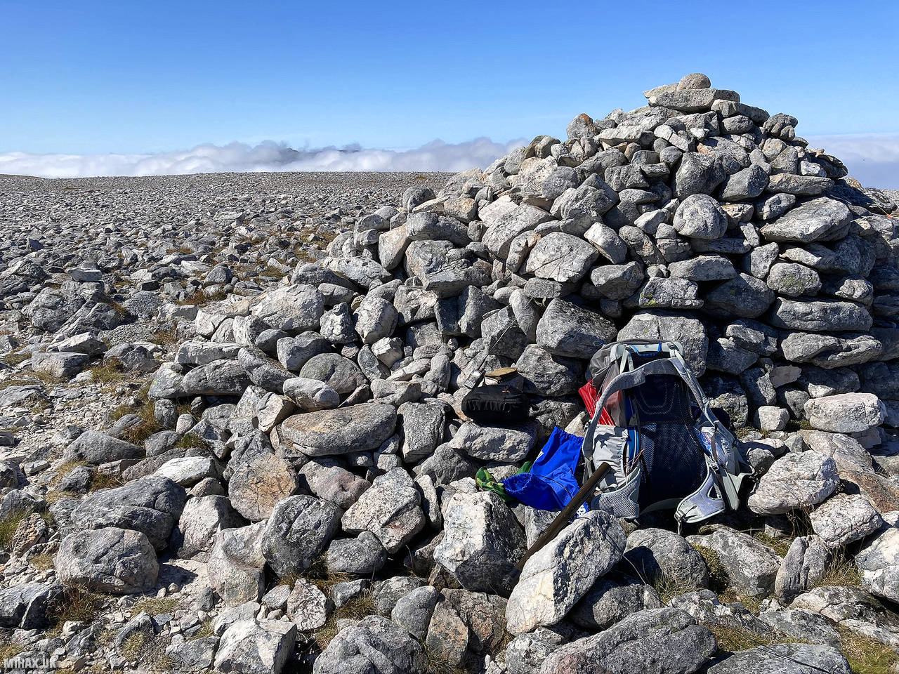
After about 4km of hiking and a 300+ metre final climb we arrived on the broad, flat hill top. The relatively uniform covering of small rocks gave the summit an almost lunar atmosphere. So far, we had not seen any other people on the hills.
Whilst my walking partner enjoyed the excellent cloud inversion views, I setup my HF radio station. The band conditions continued to disappoint, and I was only able to make five SSB contacts before I was out of time and we had to move on to keep our schedule.
After packing away the radio we continued our circuit south to the next summit, Mullach Coire Mhic Fhearchair GM/NS-006.
Photos
Below are some photographs taken during my activation of Sgurr Ban on Friday 14th August, 2020.


Walking Route for Sgurr Ban
The interactive map below shows my GPS track taken to the SOTA activation zone for Sgurr Ban. Note that this summit was activated as part of a multi-summit hike and the map below shows the full route taken on the day. The GM/NS-010 summit area is marked on the map with a blue pin icon.
You can download the route shown above as a GPX file suitable for use with most GPS devices. This file is provided for information only, to support your own walk planning and research (it may contain navigation errors, detours and/or safety hazards). The route downloads provided here are governed by the Creative Commons BY-NC-SA 4.0 licence.
Station Log
I logged the following 5 amateur radio contacts operating as MM1HAX/P from GM/NS-010 Sgurr Ban on Friday 14th August, 2020 (all times shown are UTC):
| Time | Callsign | Band | Mode | Notes |
|---|---|---|---|---|
| 12:24 | G4HPE | 40m | SSB | Steve, 5/9 |
| 12:35 | SP3AYA | 20m | SSB | Yarek, 5/9 |
| 12:36 | IQ4FJ/4 | 20m | SSB | Sezione ARI, 5/9 |
| 12:37 | G7SQW/P | 20m | SSB | Andy, 5/9 |
| 12:43 | GB5VJD | 20m | SSB | Geoff, 5/5 |
In the notes field I will usually log the other operator’s name and the signal report they provided. In accordance with the Summits on the Air rules, I do not make a log entry where a complete exchange of callsigns and signal reports was unsuccessful.
Additional Information
The following resources may be helpful to walkers, mountaineers and SOTA activators interested in Sgurr Ban:
- Sotl.as Summit Page for GM/NS-010 Sgurr Ban.
- Hill Bagging UK Summit Page for Sgurr Ban.
- Google Maps Page for Sgurr Ban.
- Wikipedia entry for Sgurr Ban.
If you found this content valuable, why not Buy Me a Coffee?