Foel Fenlli - GW/NW-051 SOTA (2020)

Summits on the Air Activation Report
Activation Date: Wednesday 23rd September, 2020.
Activator(s): Richard M1HAX.
Summit: Foel Fenlli, North Wales, Wales.
Summit ID: SOTA reference GW/NW-051 (2 points).
Summit Height: 511m elevation, 152m prominence.
Summit Location: Lat./Long. 53.13131, -3.24971. Maidenhead Grid IO83jd.
Distance: 1.5km travelled with 155m of ascent.
Difficulty: SAC Grade T1.(?)
Elapsed Time: 45m (including operating).
Weather: Feels like 13.9°C, 19 kph NW wind, 77% humidity.
Radio Equipment: Yaesu FTM100D, MFJ-1714, Zippy 4200mAh 4S LiFePo4.
Callsign Used: MW1HAX/P.
Contacts: 12 (2m FM).
Trip Notes
Foel Fenlli is a hill in Denbighshire, North Wales. It is named after the tyrannical king Benlli who is said to have lived in a hill fort here. Today, it is a popular spot for walkers who often include it in an ascent of Moel Famau.
Driving over from Moel Gyw, I parked at the Bwlch Penbarras pay and display car park which was quite busy but I still managed to find a space.
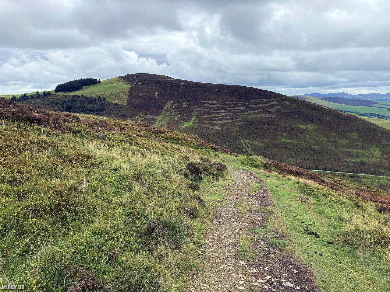
The walking route heads due south from the car park past a small duck pond and up on to the grassy slopes of Foel Fenlli. The path then cuts diagonally across the hill through some heather before picking up a stone foot path with some steps leading up to the summit.
This is a very easy 2-point SOTA hill, taking only about 800 metres from the car park to reach the summit. At the top there is a large stone cairn which can be used as a windbreak of sorts.
I worked a few familiar stations on the 2-metre radio band and after about ten minutes packed away the radio and retraced my steps back down to the car park. This hill is best paired with Moel Famau during the winter bonus period for an easy 10 points.
Photos
Below are some photographs taken during my activation of Foel Fenlli on Wednesday 23rd September, 2020.

Walking Route for Foel Fenlli
The interactive map below shows my GPS track taken to the SOTA activation zone for Foel Fenlli. The GW/NW-051 summit area is marked on the map with a blue pin icon.
You can download the route shown above as a GPX file suitable for use with most GPS devices. This file is provided for information only, to support your own walk planning and research (it may contain navigation errors, detours and/or safety hazards). The route downloads provided here are governed by the Creative Commons BY-NC-SA 4.0 licence.
Station Log
I logged the following 12 amateur radio contacts operating as MW1HAX/P from GW/NW-051 Foel Fenlli on Wednesday 23rd September, 2020 (all times shown are UTC):
| Time | Callsign | Band | Mode | Notes |
|---|---|---|---|---|
| 12:53 | 2E0XYL | 2m | FM | Karen, 5/9 |
| 12:54 | MW0UPH/M | 2m | FM | Aled, 5/9 |
| 12:55 | 2E0LKC | 2m | FM | Peter, 5/9 |
| 12:55 | 2E0LMD | 2m | FM | Anne, 5/9 |
| 12:56 | M6TPS | 2m | FM | Jamie, 5/9 |
| 12:57 | 2E0JCM | 2m | FM | John, 5/9 |
| 12:57 | M0XMX/M | 2m | FM | Mike, 5/9 |
| 12:58 | G4ZRP | 2m | FM | Brian, 5/9 |
| 12:59 | G0MHF | 2m | FM | John, 5/9 |
| 13:00 | G6LKB | 2m | FM | David, 5/9 |
| 13:01 | G4KRN | 2m | FM | Alan, 5/9 |
| 13:01 | G4TJC | 2m | FM | Simon, 5/3 |
In the notes field I will usually log the other operator’s name and the signal report they provided. In accordance with the Summits on the Air rules, I do not make a log entry where a complete exchange of callsigns and signal reports was unsuccessful.
Additional Information
The following resources may be helpful to walkers, mountaineers and SOTA activators interested in Foel Fenlli:
- Sotl.as Summit Page for GW/NW-051 Foel Fenlli.
- Hill Bagging UK Summit Page for Foel Fenlli.
- Google Maps Page for Foel Fenlli.
- Wikipedia entry for Foel Fenlli.
- 360° Panorama near summit of GW/NW-051 Foel Fenlli.
If you found this content valuable, why not Buy Me a Coffee?