Moel Famau - GW/NW-044 SOTA (2020)

Summits on the Air Activation Report
Activation Date: Wednesday 23rd September, 2020.
Activator(s): Richard M1HAX.
Summit: Moel Famau, North Wales, Wales.
Summit ID: SOTA reference GW/NW-044 (2 points).
Summit Height: 555m elevation, 278m prominence.
Summit Location: Lat./Long. 53.15456, -3.25579. Maidenhead Grid IO83id.
Distance: 5.0km travelled with 219m of ascent.
Difficulty: SAC Grade T1.(?)
Elapsed Time: 1hr 20m (including operating).
Weather: Feels like 13.9°C, 19 kph NW wind, 77% humidity.
Radio Equipment: Yaesu FTM100D, MFJ-1714, Zippy 4200mAh 4S LiFePo4.
Callsign Used: MW1HAX/P.
Contacts: 15 (2m FM).
Trip Notes
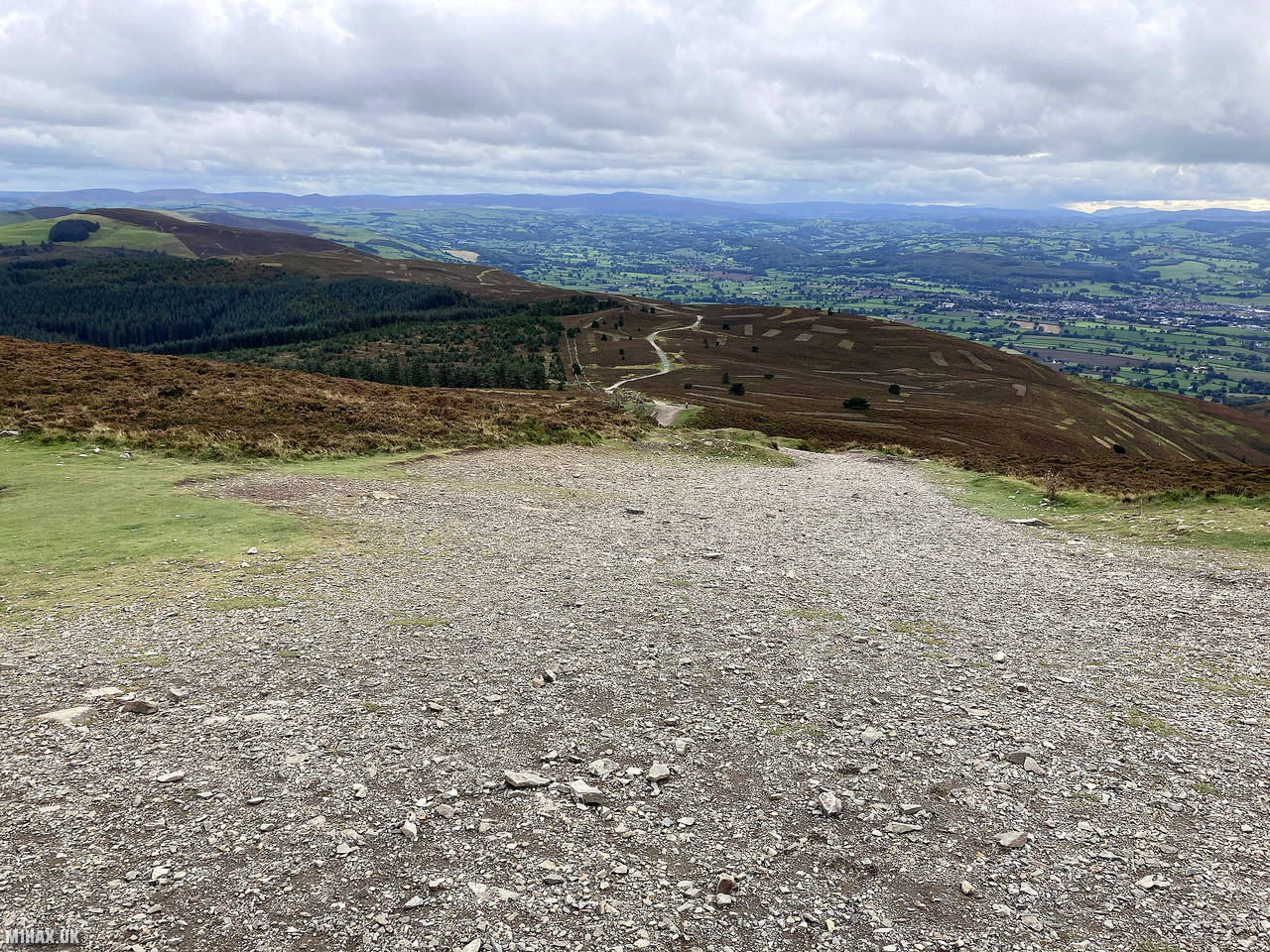
After completing Moel Gyw and Foel Fenlli earlier in the day I would tackle Moel Famau as my last hill walk of the day. This is the highest point of the county of Flintshire and the highest hill in the Clwydian Range. The hill is part of the Moel Famau country park and is also classed as an Area of Outstanding Natural Beauty.
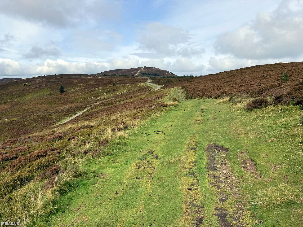
With the car still parked at the Bwlch Penbarras pay and display car park, I followed the obvious footpath to the north west. This good quality gravel track ascends continuously to the Jubilee Tower and trig point at the summit.
The walk to the top is about 2.5 kilometres with 200 metres of ascent and was readily completed in about half an hour.
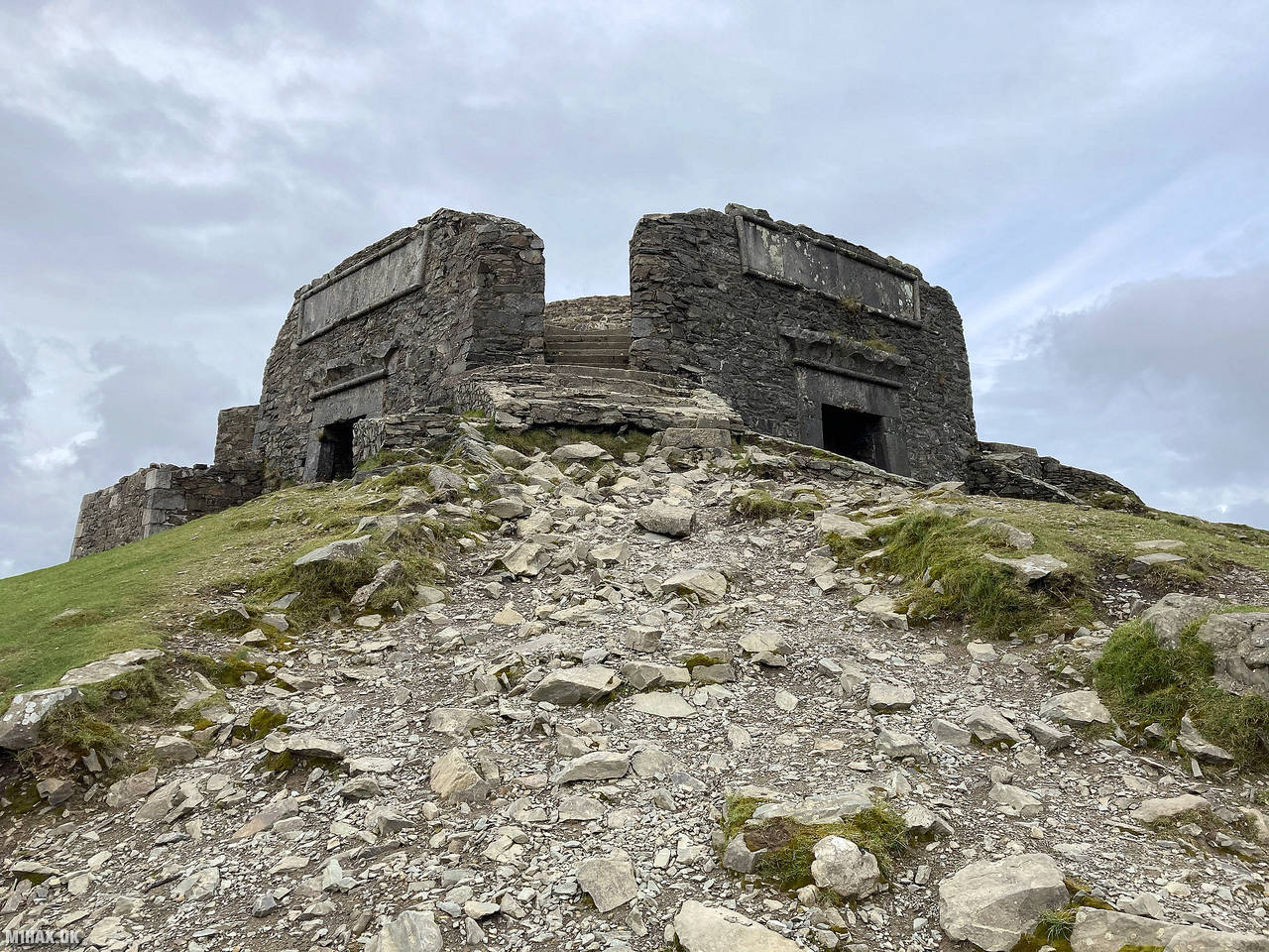
The Jubilee Tower, built in 1810 to commemorate George III’s golden jubilee, was designed by Thomas Harrison but never completed due to lack of funds. A storm in 1862 caused it to collapse, leaving only the base. The Viewfinder Panoramas website has interesting computer generated panoramic views for this summit.
I set up my VHF radio atop the tower, which makes for an excellent summit shelter! Radio take-off from here is very good and I easily made a number of radio contacts in short order.
I then returned back down the trail to the car, completing the walk in just over an hour. This is an easy and pleasant 2-point SOTA hill which is particularly notable because when paired with the neighbouring Foel Fenlli is a quick and easy 10 points during the winter season.
Photos
Below are some photographs taken during my activation of Moel Famau on Wednesday 23rd September, 2020.


Walking Route for Moel Famau
The interactive map below shows my GPS track taken to the SOTA activation zone for Moel Famau. The GW/NW-044 summit area is marked on the map with a blue pin icon.
You can download the route shown above as a GPX file suitable for use with most GPS devices. This file is provided for information only, to support your own walk planning and research (it may contain navigation errors, detours and/or safety hazards). The route downloads provided here are governed by the Creative Commons BY-NC-SA 4.0 licence.
Station Log
I logged the following 15 amateur radio contacts operating as MW1HAX/P from GW/NW-044 Moel Famau on Wednesday 23rd September, 2020 (all times shown are UTC):
| Time | Callsign | Band | Mode | Notes |
|---|---|---|---|---|
| 13:53 | G6LKB | 2m | FM | David, 5/9 |
| 13:55 | MW0UPH/M | 2m | FM | Aled, 5/9 |
| 13:56 | M0VAZ | 2m | FM | John, 5/9 |
| 13:56 | 2E0LKC | 2m | FM | Peter, 5/9 |
| 13:57 | 2E0LMD | 2m | FM | Anne, 5/9 |
| 13:58 | MW6AQT | 2m | FM | Lee, 5/9 |
| 13:59 | G0SLR | 2m | FM | Roy, 5/9 |
| 13:59 | 2E0JCM | 2m | FM | John, 5/9 |
| 14:00 | MW7KEE | 2m | FM | Simon, 5/9 |
| 14:01 | M3RNO/M | 2m | FM | Ronnie, 5/9 |
| 14:01 | G7RC | 2m | FM | Ron, 5/9 |
| 14:02 | G4KRN | 2m | FM | Alan, 5/9 |
| 14:03 | M0RHD/M | 2m | FM | Bob, 3/5 |
| 14:04 | G4ZRP | 2m | FM | Brian, 5/9 |
| 14:05 | G6DFD | 2m | FM | Mike, 5/9 |
In the notes field I will usually log the other operator’s name and the signal report they provided. In accordance with the Summits on the Air rules, I do not make a log entry where a complete exchange of callsigns and signal reports was unsuccessful.
Additional Information
The following resources may be helpful to walkers, mountaineers and SOTA activators interested in Moel Famau:
- Sotl.as Summit Page for GW/NW-044 Moel Famau.
- Hill Bagging UK Summit Page for Moel Famau.
- Google Maps Page for Moel Famau.
- Wikipedia entry for Moel Famau.
- 360° Panorama near summit of GW/NW-044 Moel Famau.
If you found this content valuable, why not Buy Me a Coffee?