Wendover Woods - G/CE-005 SOTA (2020)

Summits on the Air Activation Report
Activation Date: Sunday 6th September, 2020.
Activator(s): Richard M1HAX.
Summit: Wendover Woods, Central England, England.
Summit ID: SOTA reference G/CE-005 (1 point).
Summit Height: 267m elevation, 180m prominence.
Summit Location: Lat./Long. 51.77244, -0.71112. Maidenhead Grid IO91ps.
Distance: 0.4km travelled with 5m of ascent.
Difficulty: Drive on summit.
Elapsed Time: 20m (including operating).
Weather: Feels like 11.4C, 7 kph E wind, 78% humidity.
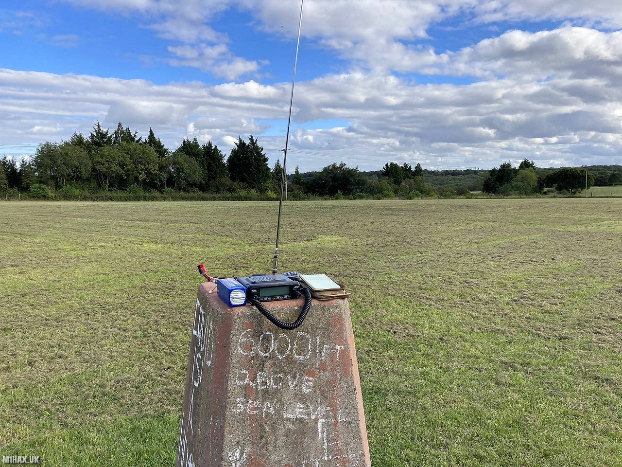
Radio Equipment: Yaesu FTM100D, MFJ-1714, Zippy 4200mAh 4S LiFePo4.
Callsign Used: M1HAX/P.
Contacts: 4 (2m FM).
Trip Notes
Wendover Woods is a woodland area in England’s Chiltern Hills, managed by Forestry England. It covers 325 hectares and offers various recreational activities. The woods provide scenic views of the Aylesbury Vale countryside to the north, and house a stone monument marking the highest point in the Chilterns at Haddington Hill.
This is a quick and easy 1 point summit with easy road access and parking available near the summit. There are good opportunities to extend the walk around the woodland if desired.
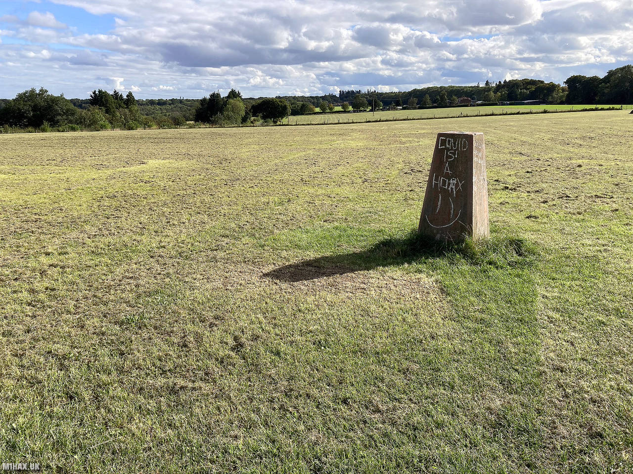
The true summit is near the visitor centre and cafe within the woodland. The activation zone for this hill is large, so I opted to operate from the trig point (260 metres) a few hundred metres to the north.
There are a few options for parking here. I parked in a layby adjacent to the field and followed a PRoW path in to the field to the trig point.
I was at the ‘summit’ in moments and began to set up my Yaesu mobile radio atop the trig point. I was saddened to see the trig point had been vandalised by graffiti.
It took me about ten minutes to log the required four contacts to earn the SOTA activation point. I then quickly returned to the car to continue my journey passing through this part of the country.
This SOTA summit (Marilyn) is something of an outlier in England and one of only a small supply of minor summits within ‘easy’ reach of the London area. I found it to be quite unremarkable as a hill and doubt I will make a return to it.
Photos
Below are some photographs taken during my activation of Wendover Woods on Sunday 6th September, 2020.


Walking Route for Wendover Woods
The interactive map below shows my GPS track taken to the SOTA activation zone for Wendover Woods. The G/CE-005 summit area is marked on the map with a blue pin icon.
You can download the route shown above as a GPX file suitable for use with most GPS devices. This file is provided for information only, to support your own walk planning and research (it may contain navigation errors, detours and/or safety hazards). The route downloads provided here are governed by the Creative Commons BY-NC-SA 4.0 licence.
Station Log
I logged the following 4 amateur radio contacts operating as M1HAX/P from G/CE-005 Wendover Woods on Sunday 6th September, 2020 (all times shown are UTC):
| Time | Callsign | Band | Mode | Notes |
|---|---|---|---|---|
| 15:01 | G7CRQ/P | 2m | FM | Adam, 5/9 |
| 15:05 | G1YDI | 2m | FM | Chris, 5/9 |
| 15:07 | M7SMI | 2m | FM | Adam, 5/9 |
| 15:10 | G4FGJ | 2m | FM | Gordon, 5/7 |
In the notes field I will usually log the other operator’s name and the signal report they provided. In accordance with the Summits on the Air rules, I do not make a log entry where a complete exchange of callsigns and signal reports was unsuccessful.
Additional Information
The following resources may be helpful to walkers, mountaineers and SOTA activators interested in Wendover Woods:
- Sotl.as Summit Page for G/CE-005 Wendover Woods.
- Hill Bagging UK Summit Page for Wendover Woods.
- Google Maps Page for Wendover Woods.
- Wikipedia entry for Wendover Woods.
If you found this content valuable, why not Buy Me a Coffee?