Burrow - G/WB-014 SOTA (2021)

Summits on the Air Activation Report
Activation Date: Saturday 12th June, 2021.
Activator(s): Richard M1HAX.
Summit: Burrow, Welsh Borders, England.
Summit ID: SOTA reference G/WB-014 (1 point).
Summit Height: 358m elevation, 189m prominence.
Summit Location: Lat./Long. 52.44222, -2.91189. Maidenhead Grid IO82nk.
Distance: 3.7km travelled with 188m of ascent.
Difficulty: SAC Grade T1.(?)
Elapsed Time: 1hr 15m (including operating).
Weather: 20°C, 8 mph WNW wind, 58% humidity.
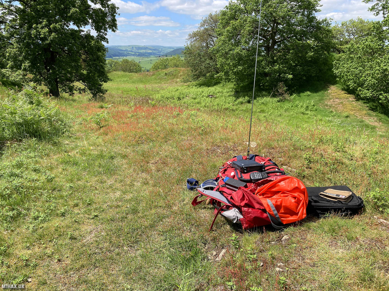
Radio Equipment: Yaesu FTM100D, MFJ-1714, Zippy 4200mAh 4S LiFePo4.
Callsign Used: M1HAX/P.
Contacts: 7 (2m FM).
Trip Notes
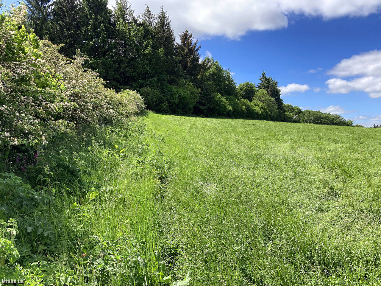
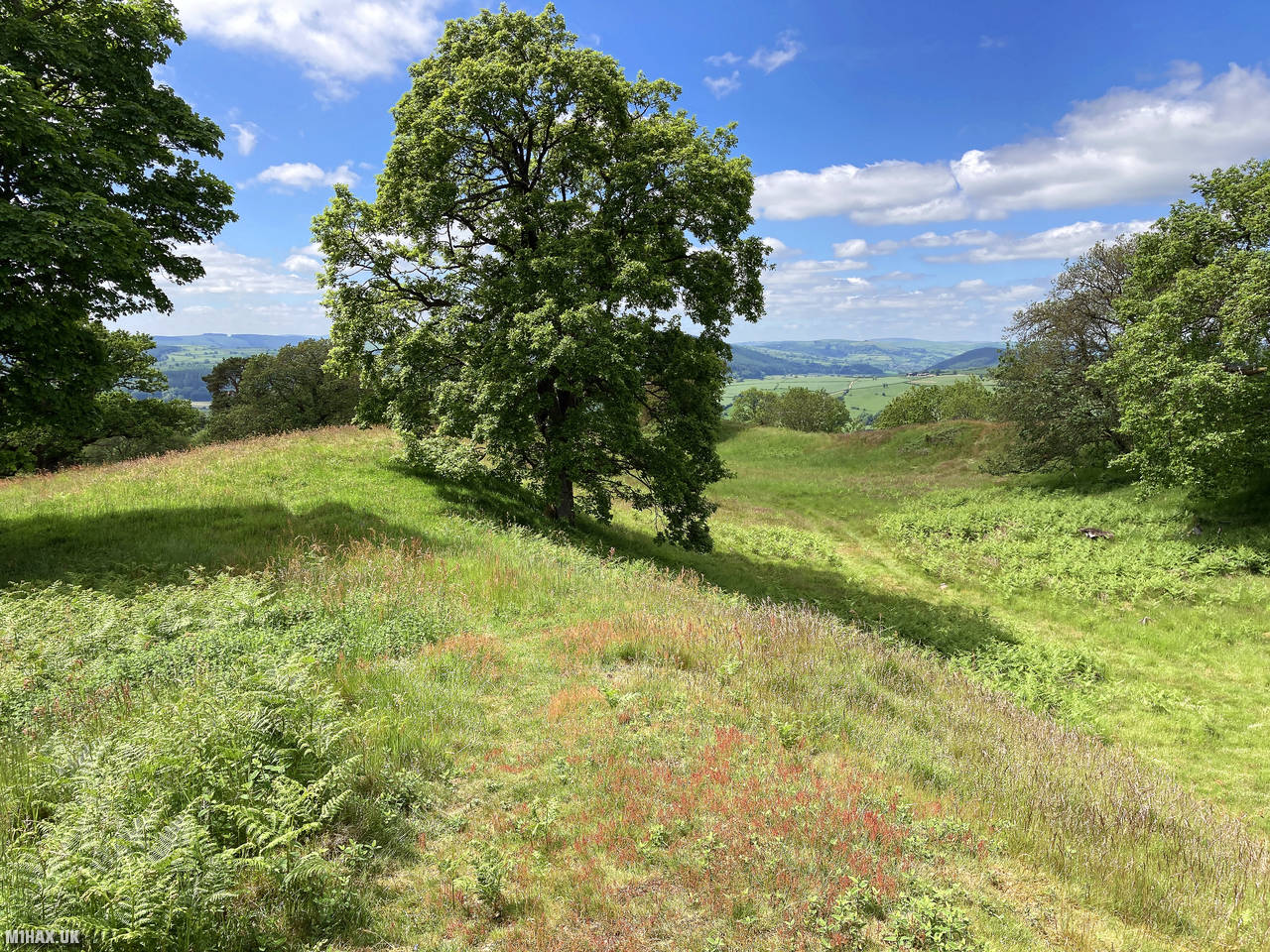
Burrow is a modest hill located in the Shropshire Hills National Landscape area, standing at 358 metres elevation. Unlike some of its more dramatic neighbors, Burrow has a gentler profile with a somewhat indistinct summit. The hill overlooks the picturesque village of Hopesay to its north.
This summit activation was part of a day trip activating five one-point hills in the Shropshire Hills area: Caer Caradoc Hill, Heath Mynd, Burrow, View Edge, and Callow Hill. Burrow was the third summit I targeted that day.
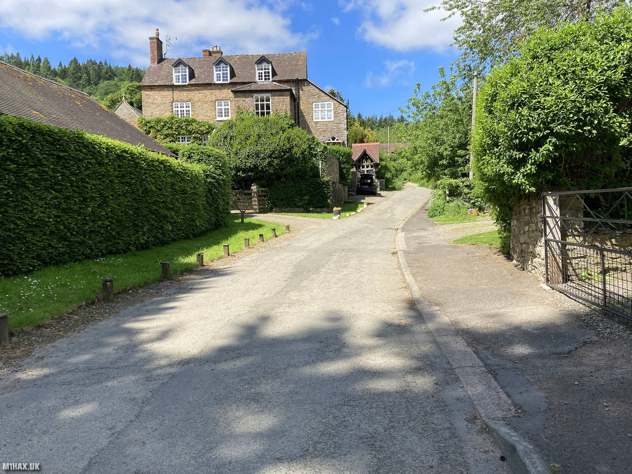
I parked in the charming village of Hopesay, where there is roadside parking for perhaps 15 cars. I had no problem finding a suitable place to leave the car near St. Mary’s Church.
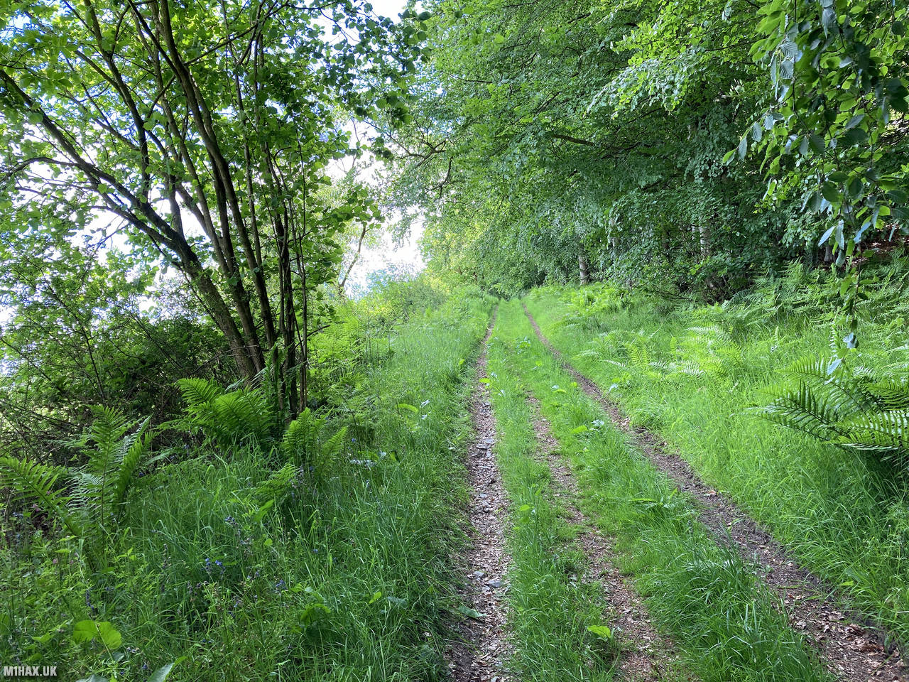
The walk started by taking faint grassy tracks heading away from the church, traversing the northern slopes of the hill. Some navigation competence was useful here as the route is not well signposted, and the paths across fields can be indistinct at times.
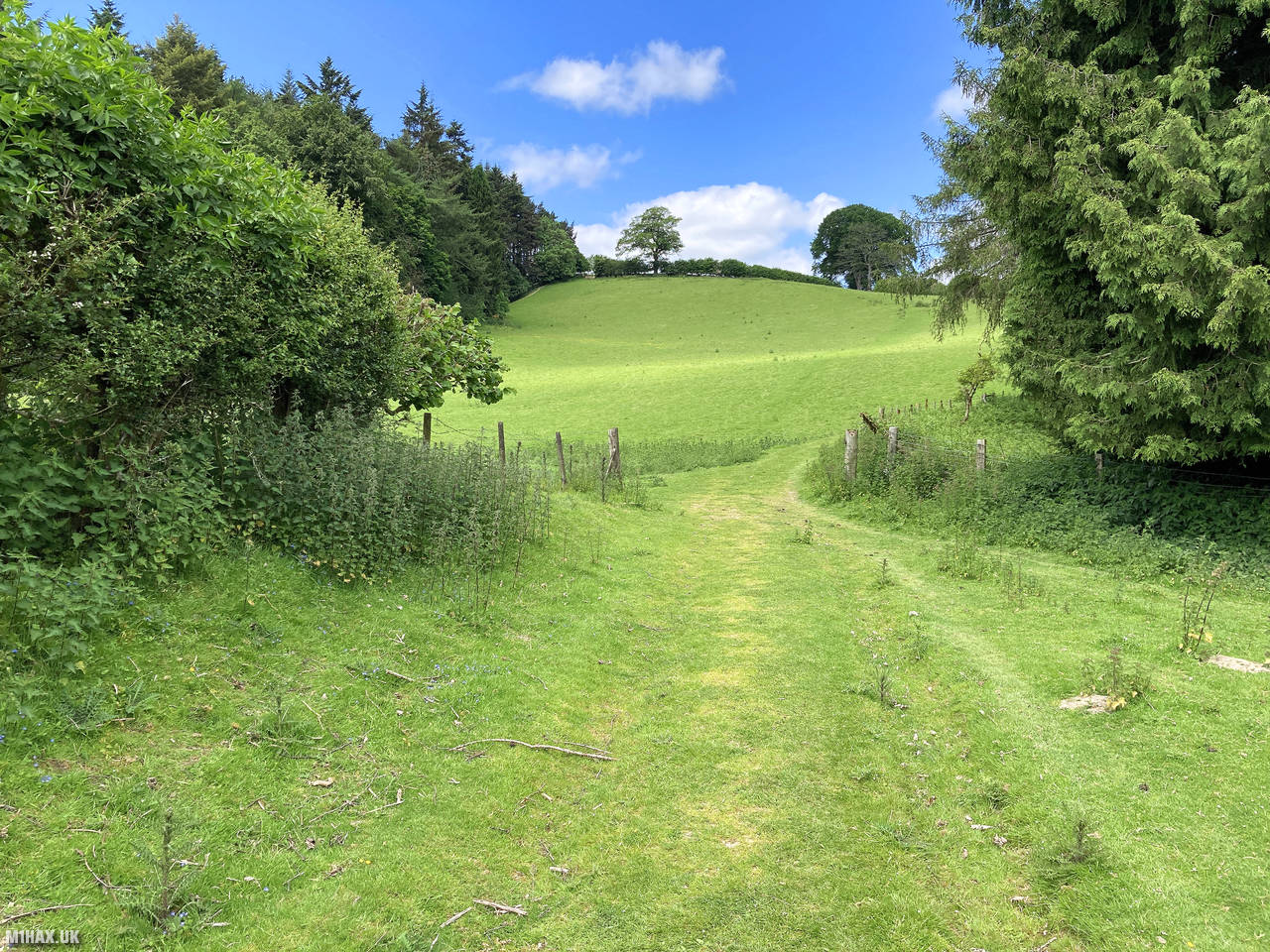
After a short distance, the route turned south through a section of woodland before continuing onwards to the summit. The ascent is gradual and pleasant, gaining about 188 metres of elevation over less than 2 kilometres of walking distance.
The summit of the hill is quite indistinct with no obvious high point or marker. I had to check my map and compass to identify the actual summit, and operated my station sitting on the ground. Unlike many SOTA summits, there is no trig point or other features at the top of Burrow.
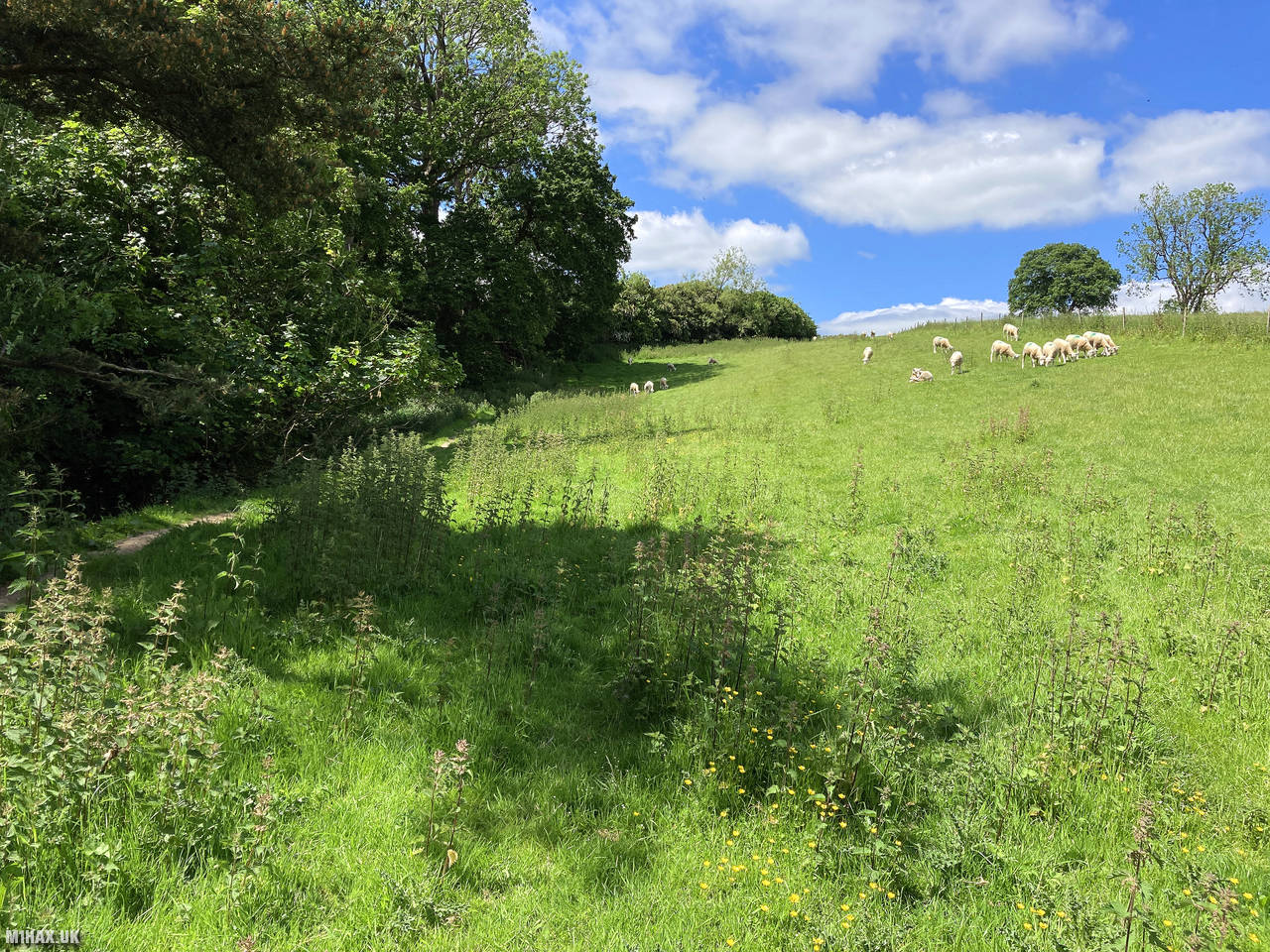
It was a sunny and warm day, making for very pleasant operating conditions at the summit. The grassy terrain would be suitable for erecting a summit shelter tent for extended operating, and there is reasonably good space on this hilltop for larger antenna deployments such as HF dipoles.
I made seven contacts on the 2-metre band, including a summit-to-summit (S2S) with Tom M1EYP/P who was still on The Cloud (G/SP-015) after I had spoken to him earlier in the day from Caer Caradoc Hill.
After completing my activation, I returned the way I came back to the car, before moving on to my next summit of the day, Heath Mynd. The round trip to the summit of Burrow, including hiking and activation, took about one hour and fifteen minutes.
Photos
Below are some photographs taken during my activation of Burrow on Saturday 12th June, 2021.


Walking Route for Burrow
The interactive map below shows my GPS track taken to the SOTA activation zone for Burrow. The G/WB-014 summit area is marked on the map with a blue pin icon.
You can download the route shown above as a GPX file suitable for use with most GPS devices. This file is provided for information only, to support your own walk planning and research (it may contain navigation errors, detours and/or safety hazards). The route downloads provided here are governed by the Creative Commons BY-NC-SA 4.0 licence.
Station Log
I logged the following 7 amateur radio contacts operating as M1HAX/P from G/WB-014 Burrow on Saturday 12th June, 2021 (all times shown are UTC):
| Time | Callsign | Band | Mode | Notes |
|---|---|---|---|---|
| 11:25 | G0LGS | 2m | FM | Stewart, 5/7 |
| 11:27 | M1EYP/P | 2m | FM | Tom, 5/9, S2S G/SP-015 |
| 11:28 | M0JLA | 2m | FM | Rod, 4/1 |
| 11:30 | G8AOJ | 2m | FM | George, 5/4 |
| 11:31 | M5RJC | 2m | FM | Rick, 5/5 |
| 11:31 | M0NTC | 2m | FM | Jez, 5/5 |
| 11:32 | M6BLV | 2m | FM | John, 5/2 |
In the notes field I will usually log the other operator’s name and the signal report they provided. In accordance with the Summits on the Air rules, I do not make a log entry where a complete exchange of callsigns and signal reports was unsuccessful.
Additional Information
The following resources may be helpful to walkers, mountaineers and SOTA activators interested in Burrow:
- Sotl.as Summit Page for G/WB-014 Burrow.
- Hill Bagging UK Summit Page for Burrow.
- Google Maps Page for Burrow.
- Wikipedia entry for Burrow.
- 360° Panorama near summit of G/WB-014 Burrow.
If you found this content valuable, why not Buy Me a Coffee?