Callow Hill - G/WB-015 SOTA (2021)

Summits on the Air Activation Report
Activation Date: Saturday 12th June, 2021.
Activator(s): Richard M1HAX.
Summit: Callow Hill, Welsh Borders, England.
Summit ID: SOTA reference G/WB-015 (1 point).
Summit Height: 336m elevation, 154m prominence.
Summit Location: Lat./Long. 52.46063, -2.79533. Maidenhead Grid IO82ol.
Distance: 1.8km travelled with 125m of ascent.
Difficulty: SAC Grade T1.(?)
Elapsed Time: 45m (including operating).
Weather: 20°C, 8 mph WNW wind, 58% humidity.
Radio Equipment: Yaesu FTM100D, MFJ-1714, Zippy 4200mAh 4S LiFePo4.
Callsign Used: M1HAX/P.
Contacts: 5 (2m FM).
Trip Notes
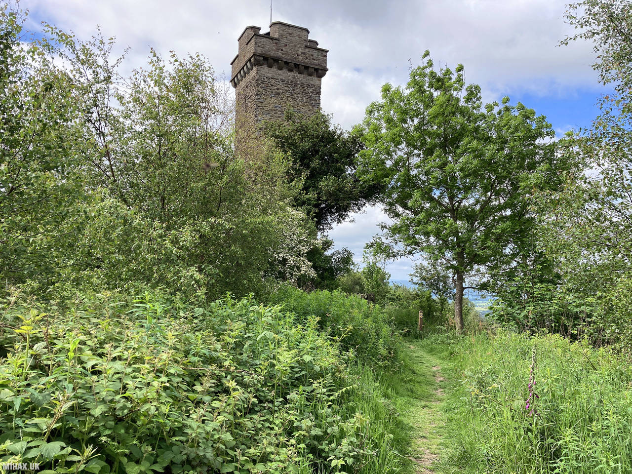
Callow Hill is a modest but attractive wooded summit in the Shropshire Hills National Landscape area, rising to an elevation of 336 metres. The hill is notable for the impressive folly structure at its summit and the pleasant woodland that covers much of its slopes.
This summit activation was part of a day trip where I activated five one-point hills in the Shropshire Hills area: Caer Caradoc Hill, Callow Hill, View Edge, Burrow, and Heath Mynd. Callow Hill was the fourth summit I visited during this productive day.
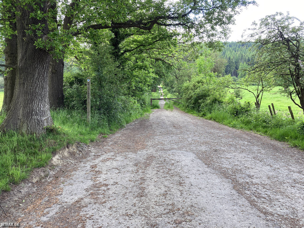
I parked on a minor single-track road to the northwest of the hill, where there is space for a few cars to park safely without obstructing the road. From here, the ascent looks inviting with woodland paths heading away from the road.
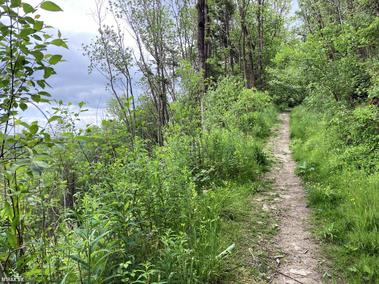
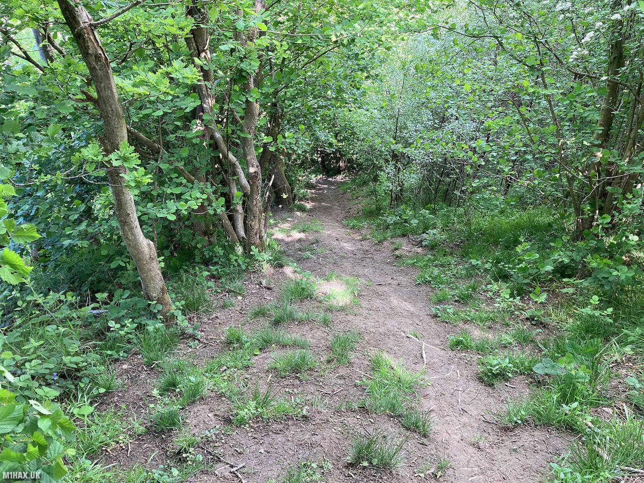
The walk began by following an obvious track that heads across the wooded hillside. The path is well-maintained and easy to follow through the pleasant deciduous woodland that covers the hill. The ascent is steady but not steep, gaining about 125 metres of elevation over less than a kilometre of walking.
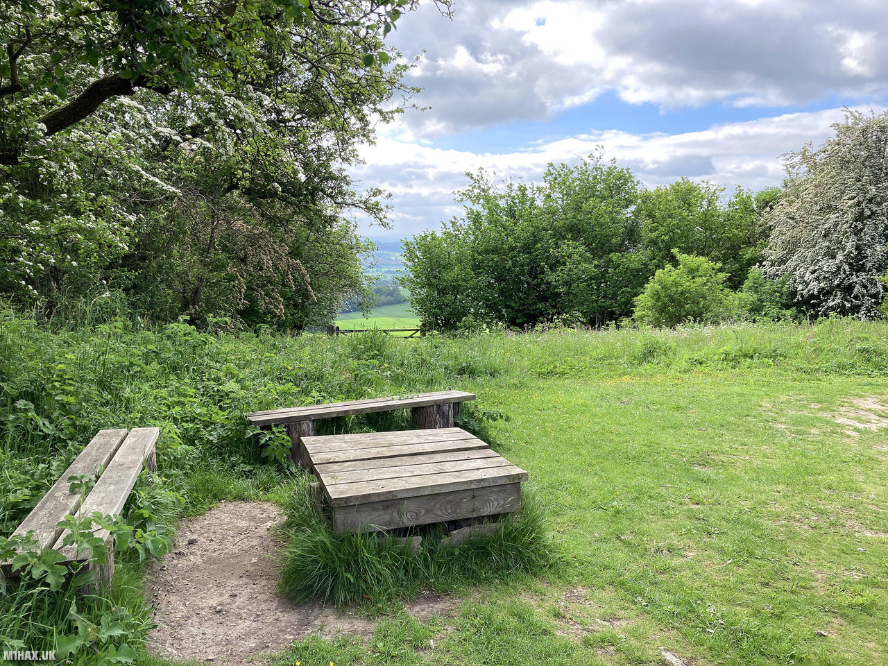
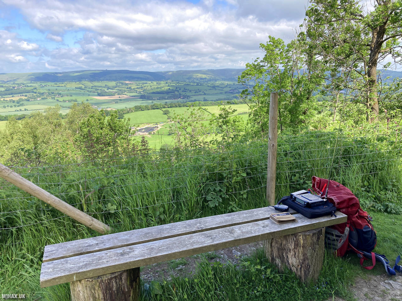
At the summit, the attractive folly structure provides a distinctive landmark, as well as several wooden benches that offer comfortable seating - a rarity on SOTA summits. This helpful provision makes the hill particularly pleasant for operating or simply enjoying the surroundings.
Setting up my Yaesu FTM100D and MFJ antenna beside one of the benches, I made five contacts in just five minutes on the 2-metre band. These included two notable summit-to-summit (S2S) QSOs: one with Tom M1EYP/P on The Cloud (G/SP-015) and another with John GW4TQE/P on Allt y Main (GW/NW-059).
After completing my activation, I descended via a more direct but steeper path back towards the road where I had parked. This alternative route made for a nice loop, offering different views through the woodland.
My excursion to Callow Hill, including hiking and activation, took only about 45 minutes. Despite its modest height, this is a very picturesque hill that I thoroughly enjoyed activating on this mild summer’s day. This was probably my favourite 1-point SOTA summit I visited on the trip. I would highly recommend this easy small hill to anyone looking for a straightforward but rewarding SOTA activation in the area.
Photos
Below are some photographs taken during my activation of Callow Hill on Saturday 12th June, 2021.


Walking Route for Callow Hill
The interactive map below shows my GPS track taken to the SOTA activation zone for Callow Hill. The G/WB-015 summit area is marked on the map with a blue pin icon.
You can download the route shown above as a GPX file suitable for use with most GPS devices. This file is provided for information only, to support your own walk planning and research (it may contain navigation errors, detours and/or safety hazards). The route downloads provided here are governed by the Creative Commons BY-NC-SA 4.0 licence.
Station Log
I logged the following 5 amateur radio contacts operating as M1HAX/P from G/WB-015 Callow Hill on Saturday 12th June, 2021 (all times shown are UTC):
| Time | Callsign | Band | Mode | Notes |
|---|---|---|---|---|
| 09:31 | 2E0BML/M | 2m | FM | Ben, 5/8 |
| 09:32 | M1EYP/P | 2m | FM | Tom, 5/9, S2S G/SP-015 |
| 09:34 | GW4TQE/P | 2m | FM | John, 5/9, S2S GW/NW-059 |
| 09:35 | G4HQB | 2m | FM | Phil, 5/9 |
| 09:36 | G4USK | 2m | FM | Barry, 5/9 |
In the notes field I will usually log the other operator’s name and the signal report they provided. In accordance with the Summits on the Air rules, I do not make a log entry where a complete exchange of callsigns and signal reports was unsuccessful.
Additional Information
The following resources may be helpful to walkers, mountaineers and SOTA activators interested in Callow Hill:
- Sotl.as Summit Page for G/WB-015 Callow Hill.
- Hill Bagging UK Summit Page for Callow Hill.
- Google Maps Page for Callow Hill.
- Wikipedia entry for Callow Hill.
- 360° Panorama near summit of G/WB-015 Callow Hill.
If you found this content valuable, why not Buy Me a Coffee?