Tryfan - GW/NW-006 SOTA (2022)

Summits on the Air Activation Report
Activation Date: Saturday 19th March, 2022.
Activator(s): Richard M1HAX.
Summit: Tryfan, North Wales, Wales.
Summit ID: SOTA reference GW/NW-006 (8 points).
Summit Height: 918m elevation, 191m prominence.
Summit Location: Lat./Long. 53.11490, -3.99749. Maidenhead Grid IO83ac.
Also Activated: GW/NW-003.
Distance: 13.7km travelled with 1265m of ascent.
Difficulty: SAC Grade T3.(?)
Elapsed Time: 6hr 55m (incl. operating and other summit(s) on the same hike).
Weather: 15°C, moderate breeze, sunny.
Radio Equipment: Yaesu VX6, Diamond SRH770S.
Callsign Used: MW1HAX/P.
Contacts: 5 (2m FM).
Trip Notes
Tryfan, standing at 918 metres, is one of the most iconic mountains in Snowdonia National Park. Its distinctive jagged profile, visible for miles around, makes it instantly recognisable among North Wales' peaks. Geologically part of the Glyders massif, this mountain is composed of Ordovician volcanic and sedimentary rocks, giving it the dramatic appearance that has attracted mountaineers since the 19th century. The summit is famously adorned with two monoliths known as ‘Adam and Eve’, where traditionally, brave hikers leap between them to gain the ‘Freedom of Tryfan’.
I was enroute to the Cairngorms for a week of mountaineering and was stopping over in Snowdonia to break up my journey. For this hike I would be approaching via a route I hadn’t previously attempted - the Little Gully grade 1 scramble on the eastern face. The weather couldn’t have been more perfect for scrambling, with cool temperatures, blue skies, and excellent visibility across Snowdonia.
My starting point was the large layby on the A5 at the eastern end of Llyn Ogwen. From here, I headed south through a footpath gate towards Tryfan Bach, a small crag that serves as a popular practice venue for climbers. Taking the opportunity, I soloed one of the easier routes on this famous rock slab before continuing to join the well-established Heather Terrace path that traverses Tryfan’s eastern face.
The start point for Little Gully is quite far along the Heather Terrace, positioned almost directly beneath the summit on the eastern face. Finding the correct gully requires some navigation skills, though the UK Climbing website provides good guidance.
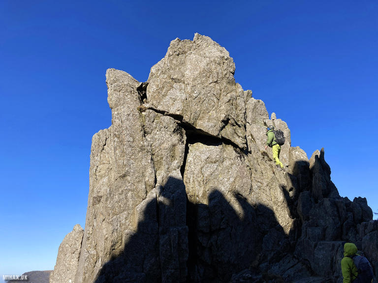
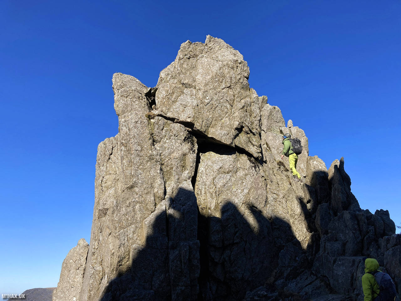
The Little Gully scramble proved tremendously enjoyable, set in a dramatic location with impressive exposure in places. Despite its intimidating appearance from below, the scrambling never felt particularly difficult for someone with reasonable experience. In a sense, the crux was locating the correct start point. The route provided a satisfying mixture of rock steps, easy moves, and short traverses.
Upon reaching the top, I was rewarded with spectacular views across the Ogwen valley. I quickly prepared my Yaesu VX6 handheld and Diamond SRH770S for a brief SOTA activation. I made five contacts on 2 metres FM, including an amusing summit-to-summit with Mal MW0NLG, who was operating from neighbouring Glyder Fawr.
After completing my radio operation, I continued over Tryfan towards Bristly Ridge and on to the summit of Glyder Fawr. Crossing through the Pinnacle Gap I had considered practising some retrievable abseil techniques here, however the ridge was surprisingly busy with other mountaineers enjoying the fine weather, so I simply continued along the route.
This circuit combining Tryfan and Glyder Fawr via Little Gully was immensely enjoyable in these perfect conditions. For competent scramblers with good navigation skills, this route offers a more varied and interesting alternative to the standard North Ridge approach, avoiding the crowds that often form on the more popular lines. I would certainly recommend it.
Photos
Below are some photographs taken during my activation of Tryfan on Saturday 19th March, 2022.


Walking Route for Tryfan
The interactive map below shows my GPS track taken to the SOTA activation zone for Tryfan. Note that this summit was activated as part of a multi-summit hike and the map below shows the full route taken on the day. The GW/NW-006 summit area is marked on the map with a blue pin icon.
You can download the route shown above as a GPX file suitable for use with most GPS devices. This file is provided for information only, to support your own walk planning and research (it may contain navigation errors, detours and/or safety hazards). The route downloads provided here are governed by the Creative Commons BY-NC-SA 4.0 licence.
Station Log
I logged the following 5 amateur radio contacts operating as MW1HAX/P from GW/NW-006 Tryfan on Saturday 19th March, 2022 (all times shown are UTC):
| Time | Callsign | Band | Mode | Notes |
|---|---|---|---|---|
| 12:30 | G6WBS/M | 2m | FM | Shane, 5/9 |
| 12:34 | GW4ZPL | 2m | FM | John, 5/7 |
| 12:36 | MW0OFA | 2m | FM | Frank, 5/1 |
| 12:38 | MW7JUE | 2m | FM | Julian, 5/9 |
| 12:41 | MW0NLG | 2m | FM | Mal, 5/9, S2S GW/NW-003 |
In the notes field I will usually log the other operator’s name and the signal report they provided. In accordance with the Summits on the Air rules, I do not make a log entry where a complete exchange of callsigns and signal reports was unsuccessful.
Additional Information
The following resources may be helpful to walkers, mountaineers and SOTA activators interested in Tryfan:
- Sotl.as Summit Page for GW/NW-006 Tryfan.
- Hill Bagging UK Summit Page for Tryfan.
- Google Maps Page for Tryfan.
- Wikipedia entry for Tryfan.
- 360° Panorama near summit of GW/NW-006 Tryfan.
If you found this content valuable, why not Buy Me a Coffee?