Holme Fell - G/LD-051 SOTA (2023)
Summits on the Air Activation Report
Activation Date: Thursday 12th January, 2023.
Activator(s): Richard M1HAX.
Summit: Holme Fell, Lake District, England.
Summit ID: SOTA reference G/LD-051 (1 point).
Summit Height: 317m elevation, 165m prominence.
Summit Location: Lat./Long. 54.39630, -3.05653. Maidenhead Grid IO84lj.
Distance: 6.2km travelled with 435m of ascent.
Difficulty: SAC Grade T1.(?)
Elapsed Time: 2h 30m (including operating).
Weather: 7°C, moderate breeze, partially sunny.
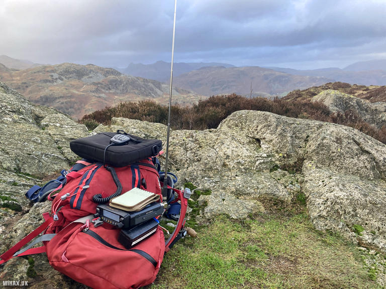
Radio Equipment: Yaesu FTM100D, MFJ-1714, Zippy 4200mAh 4S LiFePo4.
Callsign Used: M1HAX/P.
Contacts: 5 (2m FM).
Trip Notes
Holme Fell, a modest but characterful 317-metre summit near Coniston, offers a perfect introduction to the smaller Lake District fells. While its height may be unimposing compared to the region’s more famous mountains (such as the nearby Old Man of Coniston), its accessibility, varied terrain, and excellent views make it a rewarding hiking destination.
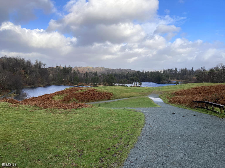
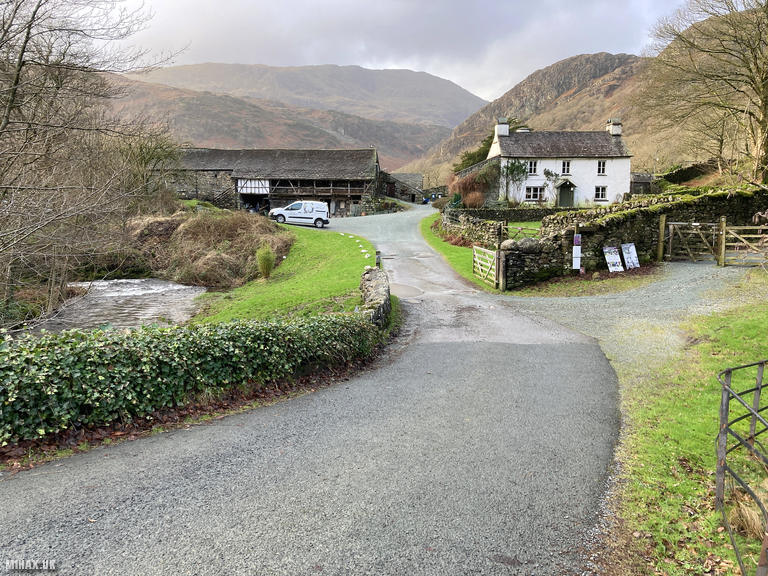
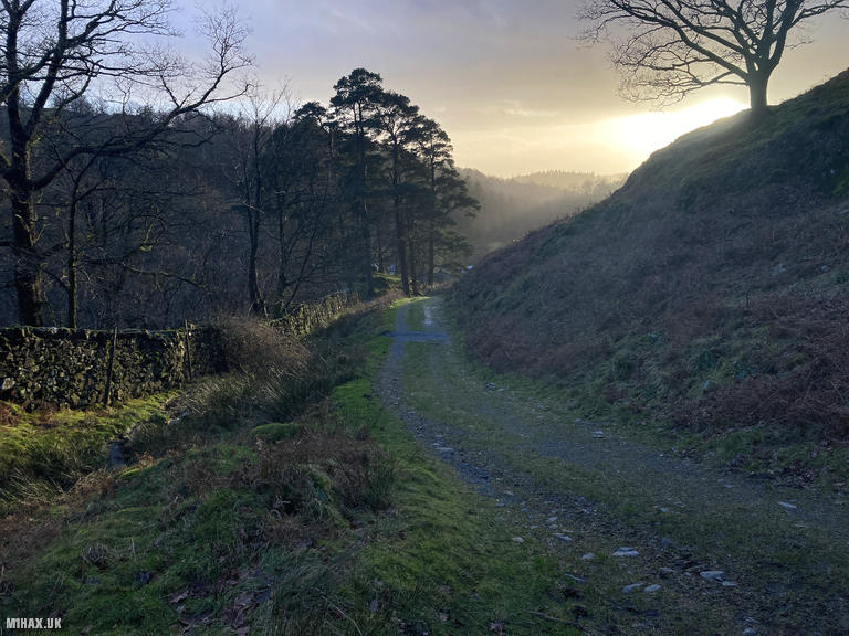
For this January activation, I chose a slightly longer approach than necessary to incorporate more of the surrounding countryside. My route began at the National Trust car park at Tarn Hows, one of the Lake District’s most picturesque and popular beauty spots. This well-maintained parking area provides an excellent starting point, though it can become busy during peak periods.
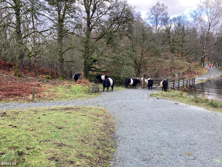
Setting off from the car park, I followed the path toward the western end of the tarn. A small herd of grazing cattle initially blocked the footbridge ahead, but they obligingly moved aside as I approached. This section offers splendid views across the tarn’s still waters, with the surrounding woodland creating a perfect frame for photographs.
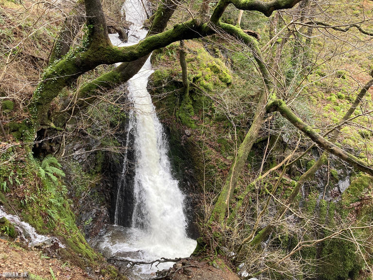
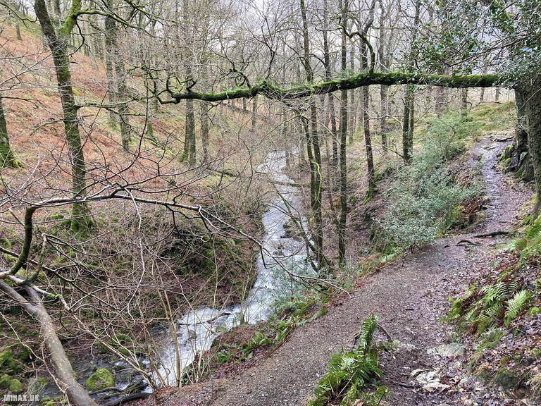
Beyond the tarn, the route continued westward through pleasant mixed woodland near Tom Heights (269m). About halfway along this forested section, the Tom Ghyll Waterfalls provided a charming interlude - one of those hidden Lake District gems that enhance the journey to the summit.
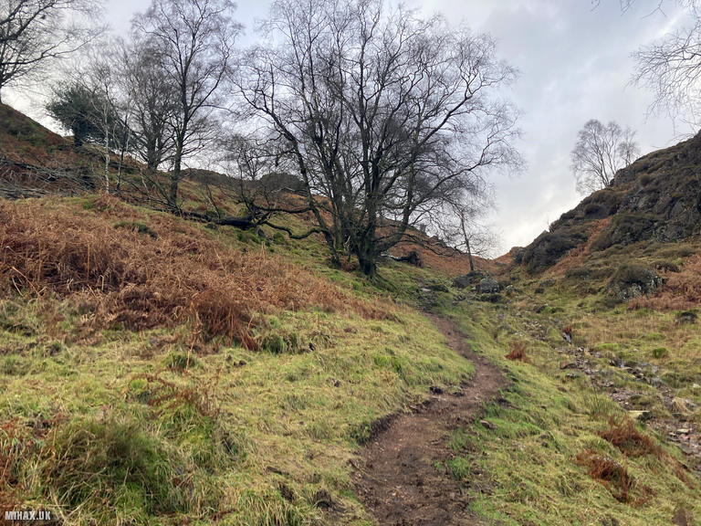
The path eventually intersected with the A593 road at Glen Mary Bridge, where a smaller car park offers an alternative starting point for those wishing to make a shorter ascent of Holme Fell. From here, I followed a public right of way heading north towards Harry Guards Wood, where the route re-enters open access land.
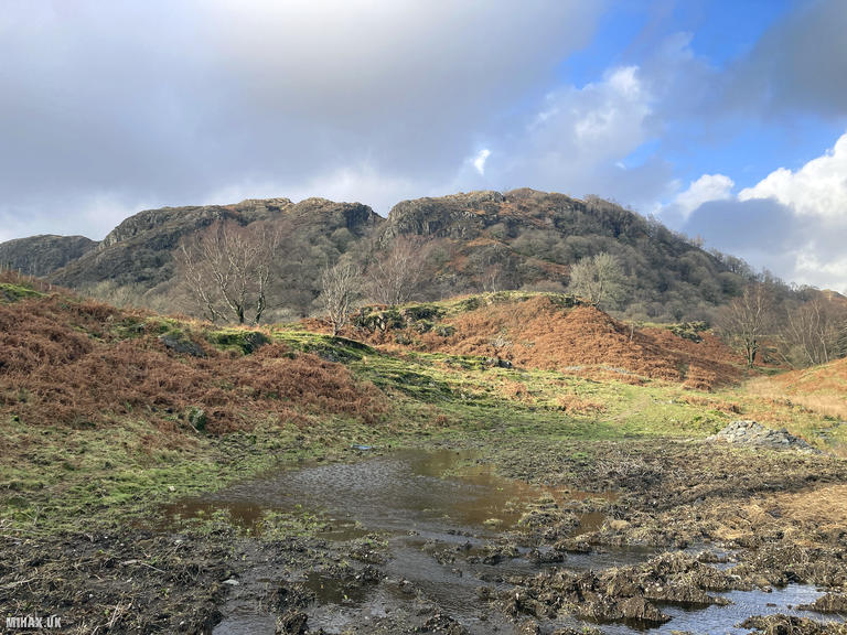
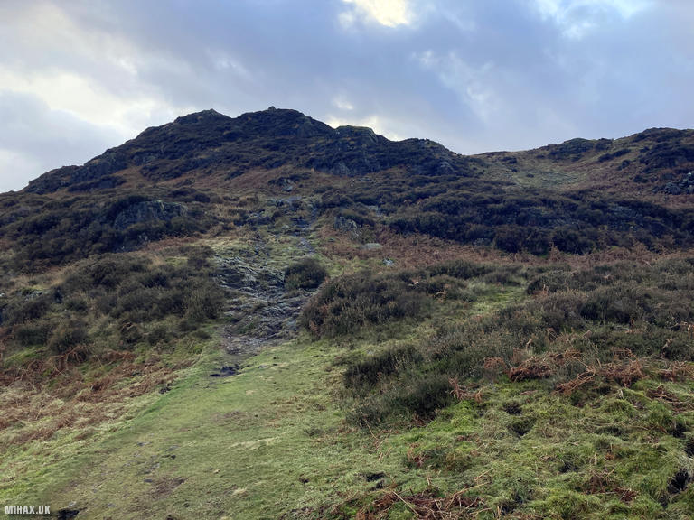
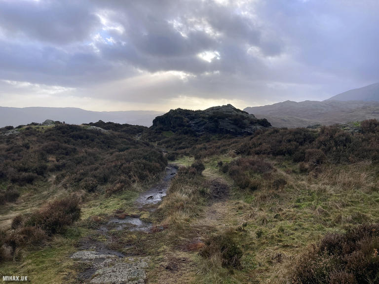
The final approach to the summit followed a reasonably well-defined grassy path that skirts around the eastern side of Ivy Crag before making the final ascent to the summit cairn. Despite its modest height, Holme Fell provides excellent panoramic views, particularly of Coniston Water and the surrounding fells, with the Langdale Pikes visible in the distance on clear days.
Setting up my Yaesu FTM100D radio at the summit, I managed to make five contacts using 2-metres FM. This relatively low count wasn’t surprising for a small one-point hill on a weekday afternoon, particularly given the summit’s limitations for VHF propagation. The surrounding higher hills create a topographical obstacle blocking signals in approximately a 180-degree arc from southwest to northeast. While historically this summit has been most frequently activated on 2 metres, an HF setup might prove more effective for consistent results.
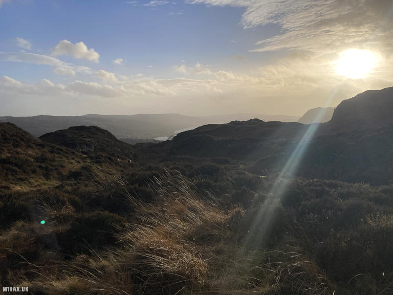
With the winter sun sinking low in the western sky, casting a golden glow across the landscape, I packed away my equipment and retraced my steps back to Tarn Hows. The entire circuit totaled 6.2 kilometres with 435 metres of cumulative ascent - a perfect half-day adventure combining a pleasant countryside walk with a Summits on the Air activity.
This route offers an excellent introduction to both the Lake District and SOTA, with the added advantage of well-maintained paths throughout and the opportunity to visit one of the region’s most celebrated beauty spots. For those seeking a shorter option, starting from Glen Mary Bridge reduces the distance considerably while still allowing an enjoyable ascent of this characterful little fell.
Photos
Below are some photographs taken during my activation of Holme Fell on Thursday 12th January, 2023.

Walking Route for Holme Fell
The interactive map below shows my GPS track taken to the SOTA activation zone for Holme Fell. The G/LD-051 summit area is marked on the map with a blue pin icon.
You can download the route shown above as a GPX file suitable for use with most GPS devices. This file is provided for information only, to support your own walk planning and research (it may contain navigation errors, detours and/or safety hazards). The route downloads provided here are governed by the Creative Commons BY-NC-SA 4.0 licence.
Station Log
I logged the following 5 amateur radio contacts operating as M1HAX/P from G/LD-051 Holme Fell on Thursday 12th January, 2023 (all times shown are UTC):
| Time | Callsign | Band | Mode | Notes |
|---|---|---|---|---|
| 14:32 | G7SXR | 2m | FM | Mark, 5/3 |
| 14:33 | M6HBU | 2m | FM | John, 5/7 |
| 14:36 | G6LKB | 2m | FM | David, 5/9 |
| 14:40 | M1DHA | 2m | FM | Alan, 5/7 |
| 14:41 | 2E0GVD | 2m | FM | Bob, 5/7 |
In the notes field I will usually log the other operator’s name and the signal report they provided. In accordance with the Summits on the Air rules, I do not make a log entry where a complete exchange of callsigns and signal reports was unsuccessful.
Additional Information
The following resources may be helpful to walkers, mountaineers and SOTA activators interested in Holme Fell:
- Sotl.as Summit Page for G/LD-051 Holme Fell.
- Hill Bagging UK Summit Page for Holme Fell.
- Google Maps Page for Holme Fell.
- Wikipedia entry for Holme Fell.
If you found this content valuable, why not Buy Me a Coffee?