Great Whernside - G/NP-008 SOTA (2023)
Summits on the Air Activation Report
Activation Date: Saturday 23rd September, 2023.
Activator(s): Richard M1HAX.
Summit: Great Whernside, Northern Pennines, England.
Summit ID: SOTA reference G/NP-008 (6 points).
Summit Height: 704m elevation, 288m prominence.
Summit Location: Lat./Long. 54.16105, -1.99836. Maidenhead Grid IO94ad.
Distance: 5.6km travelled with 245m of ascent.
Difficulty: SAC Grade T1.(?)
Elapsed Time: 2h 20m (including operating).
Weather: 10°C, light breeze, light rain.
Radio Equipment: Elecraft KX2, Long Wire, Yaesu FTM100D, MFJ-1714, Zippy 4200mAh 4S LiFePo4.
Callsign Used: M1HAX/P.
Contacts: 12 (2m FM, 40m SSB).
Trip Notes
Great Whernside, standing at 704 metres in the Yorkshire Dales, is one of the higher summits in the Northern Pennines SOTA region. With 288 metres of prominence, it qualifies as a Marilyn, Simm, Hewitt, and Nuttall. The summit is particularly notable in SOTA circles as the regular haunt of John G4YSS, who has activated from here during VHF National Field Day for over twenty consecutive years, an extraordinary demonstration of dedication to the hobby.
This was my second summit of the day, having completed Buckden Pike earlier that morning. I returned to the same roadside parking spot on Cam Gill Road, which conveniently serves both summits. This arrangement makes for an efficient two-hill day without the need to move the car between activations.
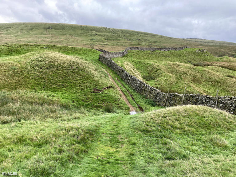
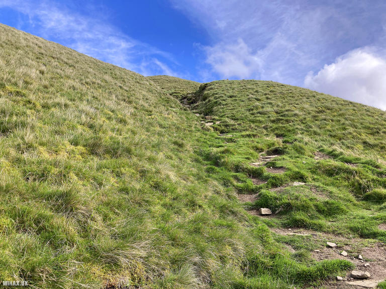
The route from Cam Gill Road to Great Whernside is straightforward. Clear paths and trails lead directly from the road towards the summit, maintaining an average gradient of approximately 10 percent throughout. The going is considerably easier than the boggy lower slopes encountered on Buckden Pike, with well-defined paths for the entire ascent.
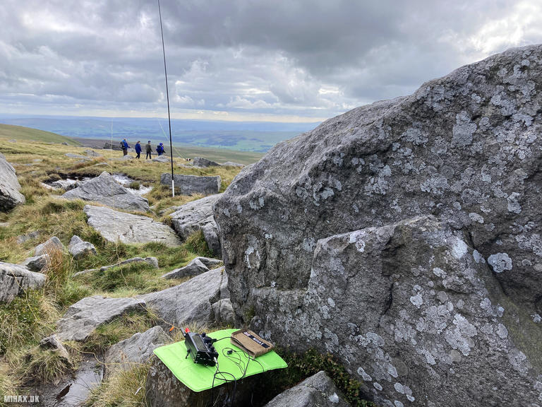
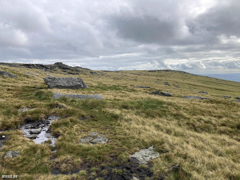
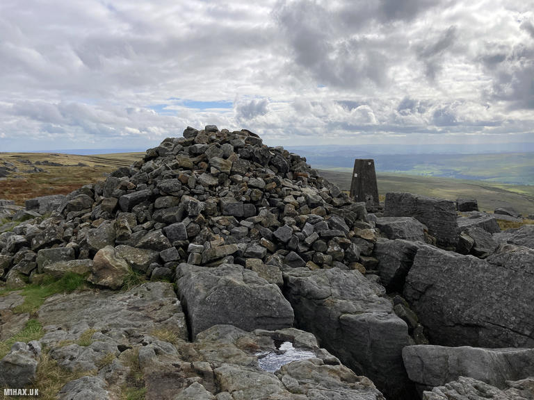
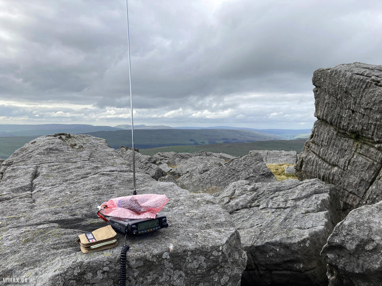
The summit area features a boulder field, trig point, and a substantial man-made pile of stones that serves as the prominent cairn. There is adequate space for antenna deployment, and the elevation provides excellent take-off in most directions. The light rain that had accompanied me throughout the day continued, though conditions remained perfectly manageable for operating.
I began my activation on 2-metre FM using the Yaesu FTM100D with MFJ-1714 antenna. The first contact proved to be a highlight: a summit-to-summit with Dave M0JKS, who was operating from Kinder Scout (G/SP-001), the highest point in the Southern Pennines approximately 87 kilometres to the south. Five further contacts on 2 metres followed in quick succession, including Mark 2E0LKC, Anne 2E0LMD, Graham 2E0GHM, Chris M0XRS, and Dave 2E0HEQ.
With VHF activity exhausted, I took the opportunity to try out my new Elecraft KX2 on the HF bands. This compact transceiver had recently joined my portable station, and Great Whernside seemed an ideal location for its inaugural SOTA outing. Switching to 40-metre SSB with a long wire antenna, I worked six stations including Garry MM0XET/P in Scotland, Phil G4OBK, John M0HEM, Don G0RQL, and John G0MHF. Chris M0XRS made a return appearance, this time on HF, demonstrating the versatility of working the same chaser on multiple bands.
The descent followed the same route back to the car. The total circuit covered 5.6 kilometres with 245 metres of ascent, completed in approximately two hours and twenty minutes including the extended operating time on both VHF and HF.
Great Whernside pairs excellently with Buckden Pike for a satisfying two-summit day from the Cam Gill Road parking area. The straightforward navigation and good paths make it accessible in most conditions, while the summit’s elevation provides reliable propagation on both VHF and HF bands. For those looking to test new equipment, the spacious summit area offers ample room for antenna experimentation.
Photos
Below are some photographs taken during my activation of Great Whernside on Saturday 23rd September, 2023.

Walking Route for Great Whernside
The interactive map below shows my GPS track taken to the SOTA activation zone for Great Whernside. The G/NP-008 summit area is marked on the map with a blue pin icon.
You can download the route shown above as a GPX file suitable for use with most GPS devices. This file is provided for information only, to support your own walk planning and research (it may contain navigation errors, detours and/or safety hazards). The route downloads provided here are governed by the Creative Commons BY-NC-SA 4.0 licence.
Station Log
I logged the following 12 amateur radio contacts operating as M1HAX/P from G/NP-008 Great Whernside on Saturday 23rd September, 2023 (all times shown are UTC):
| Time | Callsign | Band | Mode | Notes |
|---|---|---|---|---|
| 13:54 | M0JKS | 2m | FM | Dave, 5/8, S2S G/SP-001 |
| 13:55 | 2E0LKC | 2m | FM | Mark, 5/9 |
| 13:56 | 2E0LMD | 2m | FM | Anne, 5/9 |
| 13:56 | 2E0GHM | 2m | FM | Graham, 5/8 |
| 13:57 | M0XRS | 2m | FM | Chris, 5/8 |
| 13:59 | 2E0HEQ | 2m | FM | Dave, 5/7 |
| 14:17 | MM0XET/P | 40m | SSB | Garry, 5/7 |
| 14:18 | G4OBK | 40m | SSB | Phil, 5/7 |
| 14:19 | M0HEM | 40m | SSB | John, 5/9 |
| 14:20 | G0RQL | 40m | SSB | Don, 5/7 |
| 14:21 | G0MHF | 40m | SSB | John, 5/8 |
| 14:22 | M0XRS | 40m | SSB | Chris, 4/6 |
In the notes field I will usually log the other operator’s name and the signal report they provided. In accordance with the Summits on the Air rules, I do not make a log entry where a complete exchange of callsigns and signal reports was unsuccessful.
Additional Information
The following resources may be helpful to walkers, mountaineers and SOTA activators interested in Great Whernside:
- Sotl.as Summit Page for G/NP-008 Great Whernside.
- Hill Bagging UK Summit Page for Great Whernside.
- Google Maps Page for Great Whernside.
- Wikipedia entry for Great Whernside.
If you found this content valuable, why not Buy Me a Coffee?