Rombalds Moor - G/NP-028 SOTA (2023)
Summits on the Air Activation Report
Activation Date: Thursday 28th September, 2023.
Activator(s): Richard M1HAX.
Summit: Rombalds Moor, Northern Pennines, England.
Summit ID: SOTA reference G/NP-028 (1 point).
Summit Height: 402m elevation, 244m prominence.
Summit Location: Lat./Long. 53.90307, -1.82694. Maidenhead Grid IO93cv.
Distance: 1.7km travelled with 27m of ascent.
Difficulty: SAC Grade T1.(?)
Elapsed Time: 40m (including operating).
Weather: 9°C, light breeze, cloudy.
Radio Equipment: Elecraft KX2, Elecraft AX1, Yaesu FTM100D, MFJ-1714, Zippy 4200mAh 4S LiFePo4.
Callsign Used: M1HAX/P.
Contacts: 7 (20m SSB, 2m FM).
Trip Notes
Rombalds Moor, situated between the Airedale and Wharfedale valleys in West Yorkshire, is perhaps better known by its colloquial name of Ilkley Moor. The towns of Ilkley and Keighley sit at its northern and southern edges respectively. Local legend attributes the name to Rombald the Giant, whose folklore tale involves a quarrel with his wife, resulting in the creation of distinctive rock formations known as the Great and Little Skirtful of Stones. With 246 metres of prominence, it qualifies as a Marilyn.
This was a quick one-point SOTA activation squeezed in while holidaying in the Northern Pennines area. I approached from the south, following a tarmac road from Riddlesden towards Whetstone Allotment, where the road terminates at a small free car park. This road provides access to a nearby commercial antenna mast but is also popular with local walkers.
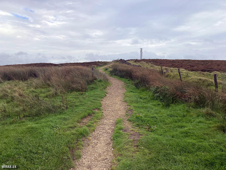
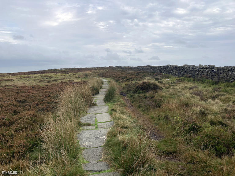
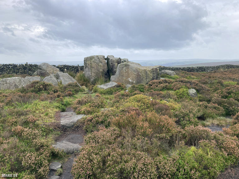
Setting off from the parking area, I walked east following an easy and obvious footpath alongside a fence line for almost a kilometre. The activation zone for Rombalds Moor is quite large, and with time pressing, I set up around some boulders near the path just inside the zone boundary.
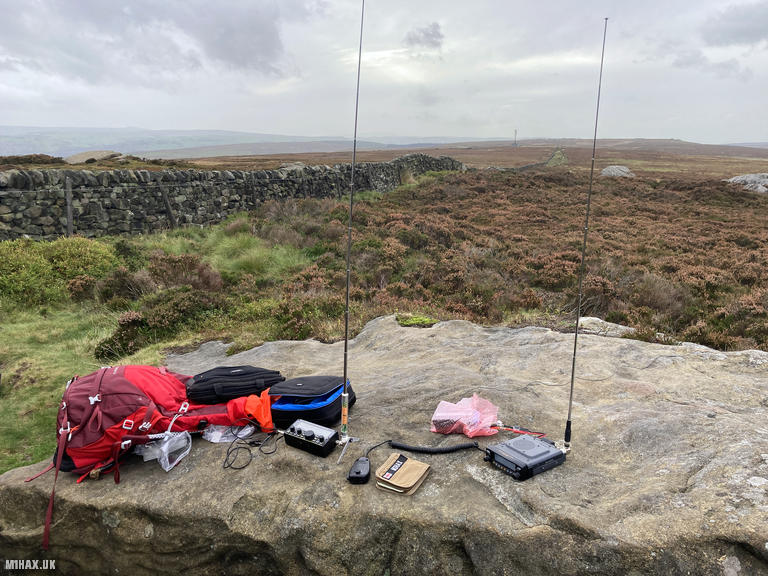
Looking back down towards the antenna mast installation and parking area, I used a large flat stone to set up my Elecraft KX2 HF radio. To save time rather than deploying my end-fed half-wave wire antenna and mast, I opted for the compact Elecraft AX1 vertical antenna on the 20-metre band. This compromise antenna relies heavily on favourable atmospheric conditions for successful contacts, and on this occasion the going proved difficult. I managed just three SSB contacts in about ten minutes: Mariusz SP6KEP in Poland, Aleksander S57S in Slovenia, and Paul M0CQE.
With only three contacts logged and the minimum four required to qualify the summit, I faced a decision. Previous comments on the SOTA database had warned of VHF difficulties from this summit, so I had hoped to qualify using HF alone. However, pragmatism won out. I quickly set up my Yaesu FTM100D with the MFJ-1714 antenna to try 2-metre FM. The results were immediate. Within two minutes I had worked Mark G7SXR, Andy M0ALA, Clifford M6LKB, and Walt G6XBF, comfortably securing my one SOTA point. One of those occasions where I misjudged the situation at the expense of time; had I started on VHF, the activation would have been considerably shorter.
The total circuit covered just 1.7 kilometres with a mere 27 metres of ascent, completed in forty minutes including operating time. Rombalds Moor is a convenient and easy one-point SOTA summit. If you have more time than I did, a network of paths across the moorland allows for a more substantial walk. The boulders I used as a table would also suit a longer activation session admirably.
Photos
Below are some photographs taken during my activation of Rombalds Moor on Thursday 28th September, 2023.

Walking Route for Rombalds Moor
The interactive map below shows my GPS track taken to the SOTA activation zone for Rombalds Moor. The G/NP-028 summit area is marked on the map with a blue pin icon.
You can download the route shown above as a GPX file suitable for use with most GPS devices. This file is provided for information only, to support your own walk planning and research (it may contain navigation errors, detours and/or safety hazards). The route downloads provided here are governed by the Creative Commons BY-NC-SA 4.0 licence.
Station Log
I logged the following 7 amateur radio contacts operating as M1HAX/P from G/NP-028 Rombalds Moor on Thursday 28th September, 2023 (all times shown are UTC):
| Time | Callsign | Band | Mode | Notes |
|---|---|---|---|---|
| 15:11 | SP6KEP | 20m | SSB | Mariusz, 5/5 |
| 15:15 | S57S | 20m | SSB | Aleksander, 5/9 |
| 15:16 | M0CQE | 20m | SSB | Paul, 5/9 |
| 15:21 | G7SXR | 2m | FM | Mark, 5/9 |
| 15:22 | M0ALA | 2m | FM | Andy, 5/8 |
| 15:22 | M6LKB | 2m | FM | Clifford, 5/1 |
| 15:23 | G6XBF | 2m | FM | Walt, 5/9 |
In the notes field I will usually log the other operator’s name and the signal report they provided. In accordance with the Summits on the Air rules, I do not make a log entry where a complete exchange of callsigns and signal reports was unsuccessful.
Additional Information
The following resources may be helpful to walkers, mountaineers and SOTA activators interested in Rombalds Moor:
- Sotl.as Summit Page for G/NP-028 Rombalds Moor.
- Hill Bagging UK Summit Page for Rombalds Moor.
- Google Maps Page for Rombalds Moor.
- Wikipedia entry for Rombalds Moor.
If you found this content valuable, why not Buy Me a Coffee?