Hardown Hill - G/SC-011 SOTA (2024)
Summits on the Air Activation Report
Activation Date: Wednesday 7th February, 2024.
Activator(s): Richard M1HAX.
Summit: Hardown Hill, South Central, England.
Summit ID: SOTA reference G/SC-011 (1 point).
Summit Height: 207m elevation, 154m prominence.
Summit Location: Lat./Long. 50.74483, -2.84395. Maidenhead Grid IO80nr.
Distance: 1.1km travelled with 53m of ascent.
Difficulty: SAC Grade T1.(?)
Elapsed Time: 1h (including operating).
Weather: 6°C, light breeze, partially sunny.
Radio Equipment: Elecraft KX2, EFHW.
Callsign Used: M1HAX/P.
Contacts: 20 (40m SSB, 20m SSB, 10m SSB).
Trip Notes
Hardown Hill rises to 207 metres between Ryall and Morcombelake in west Dorset, overlooking the patchwork fields of the Marshwood Vale to the north. Owned by the National Trust, the hill has been shaped by human activity for millennia. Bronze Age burial mounds dot the summit, and Anglo-Saxon warrior burials discovered here yielded spearheads, a shield boss, and brooches dating back 1,400 years. From medieval times until relatively recently, the hill was quarried for chert - a hard, flint-like stone that can be seen in local churches at Whitchurch Canonicorum and Charmouth. With 154 metres of prominence, Hardown qualifies as one of Dorset’s four Marilyns and is worth 1 point for SOTA.
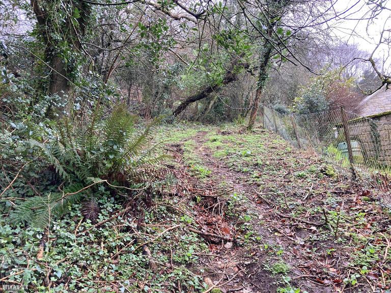
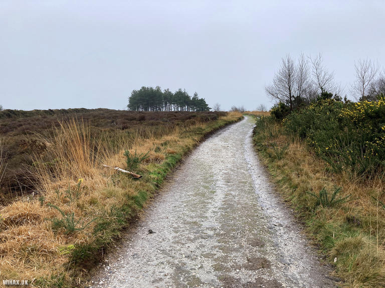
For this activation, I parked to the east on Ryall Road where a small layby accommodates at least two cars. Walking a short distance along the road, I reached a residential driveway on the left. Ascending briefly, an overgrown path led westwards through the trees.
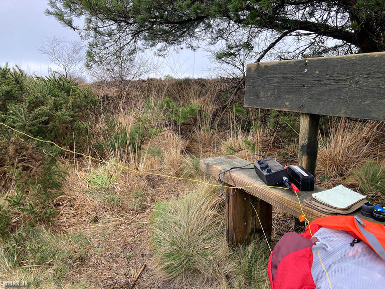
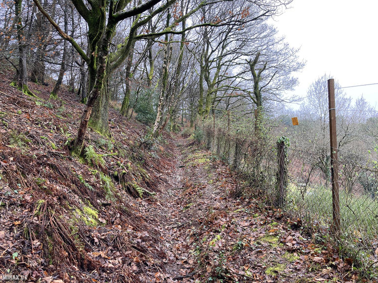
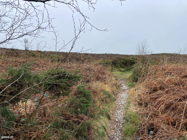
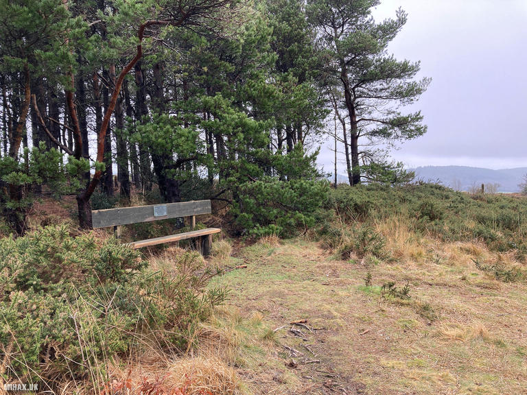
An easy track climbs through the wooded area before reaching open heathland to the north of the summit. Following a muddy trail for less than a hundred metres brought me to a gravel access track, which I followed south for approximately 200 metres to a small coppice marking the summit. Here, a conveniently placed wooden bench provides a comfortable spot for operating.
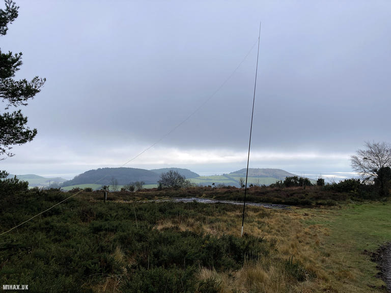
Some SOTA activators have reported 2m operation being challenging on Hardown Hill, and with a commercial radio mast nearby that may cause interference on VHF/UHF bands, I opted to use only my Elecraft KX2 with an EFHW antenna on HF. There is plenty of space for wire antennas across the heathland, and the trees offer some shelter for extended radio sessions.
Conditions proved excellent, and I completed 20 SSB contacts over approximately twenty minutes. The 40-metre band delivered a string of UK and European stations including Gerald G4OIG and Christophe ON6ZQ, before I moved to 20 metres for contacts into Spain, Germany, Slovenia and Denmark. The highlight was working into Finland on the 10-metre band - Jack OH3GZ and Harri OH6JYH both made it through despite challenging propagation.
After packing away the radio, I enjoyed the view from the bench for a while. Looking south, Golden Cap and the dramatic Jurassic Coast stretched towards Portland, while the Marshwood Vale lay spread out to the north. It is easy to see why Dorset’s tourist board lists this among the county’s finest viewpoints. Retracing my steps through the woods and back to the car completed a satisfying short activation.
Photos
Below are some photographs taken during my activation of Hardown Hill on Wednesday 7th February, 2024.

Walking Route for Hardown Hill
The interactive map below shows my GPS track taken to the SOTA activation zone for Hardown Hill. The G/SC-011 summit area is marked on the map with a blue pin icon.
You can download the route shown above as a GPX file suitable for use with most GPS devices. This file is provided for information only, to support your own walk planning and research (it may contain navigation errors, detours and/or safety hazards). The route downloads provided here are governed by the Creative Commons BY-NC-SA 4.0 licence.
Station Log
I logged the following 20 amateur radio contacts operating as M1HAX/P from G/SC-011 Hardown Hill on Wednesday 7th February, 2024 (all times shown are UTC):
| Time | Callsign | Band | Mode | Notes |
|---|---|---|---|---|
| 12:42 | G6LKB | 40m | SSB | David, 5/5 |
| 12:43 | GI4TAJ | 40m | SSB | Joe, 5/5 |
| 12:44 | M0ICR | 40m | SSB | Carl, 5/7 |
| 12:45 | ON6ZQ | 40m | SSB | Christophe, 5/5 |
| 12:45 | ON3RMB | 40m | SSB | Kris, 5/3 |
| 12:46 | G4OIG | 40m | SSB | Gerald, 5/6 |
| 12:47 | MW7LTD | 40m | SSB | Ros, 5/7 |
| 12:48 | G4IAR | 40m | SSB | Dave, 4/4 |
| 12:49 | EA2CKX | 40m | SSB | Pedro, 5/2 |
| 12:49 | M0KCB | 40m | SSB | Darius, 5/7 |
| 12:50 | G7VJA | 40m | SSB | Ken, 5/7 |
| 12:53 | OH3GZ | 20m | SSB | Jack, 5/9 |
| 12:54 | EA7GV | 20m | SSB | Jose, 5/2 |
| 12:54 | EA1DHB | 20m | SSB | Ricardo, 5/9 |
| 12:56 | DL8DXL | 20m | SSB | Fred, 5/3 |
| 12:56 | S57ILF | 20m | SSB | Franci, 4/4 |
| 12:56 | EA3HP | 20m | SSB | Daniel, 5/6 |
| 12:58 | OZ1RD | 20m | SSB | Rene, 5/5 |
| 13:01 | OH3GZ | 10m | SSB | Jack, 5/9 |
| 13:02 | OH6JYH | 10m | SSB | Harri, 4/1 |
In the notes field I will usually log the other operator’s name and the signal report they provided. In accordance with the Summits on the Air rules, I do not make a log entry where a complete exchange of callsigns and signal reports was unsuccessful.
Additional Information
The following resources may be helpful to walkers, mountaineers and SOTA activators interested in Hardown Hill:
- Sotl.as Summit Page for G/SC-011 Hardown Hill.
- Hill Bagging UK Summit Page for Hardown Hill.
- Google Maps Page for Hardown Hill.
- Wikipedia entry for Hardown Hill.
If you found this content valuable, why not Buy Me a Coffee?