Lewesdon Hill - G/SC-009 SOTA (2024)
Summits on the Air Activation Report
Activation Date: Wednesday 7th February, 2024.
Activator(s): Richard M1HAX.
Summit: Lewesdon Hill, South Central, England.
Summit ID: SOTA reference G/SC-009 (1 point).
Summit Height: 279m elevation, 185m prominence.
Summit Location: Lat./Long. 50.80732, -2.79935. Maidenhead Grid IO80ot.
Distance: 1.9km travelled with 120m of ascent.
Difficulty: SAC Grade T1.(?)
Elapsed Time: 1h 5m (including operating).
Weather: 7°C, no wind, light rain.
Radio Equipment: Yaesu FTM100D, MFJ-1714, Zippy 4200mAh 4S LiFePo4, Elecraft KX2, EFHW.
Callsign Used: M1HAX/P.
Contacts: 6 (20m SSB, 2m FM).
Trip Notes
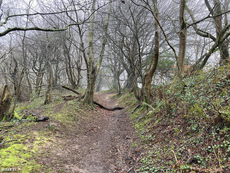
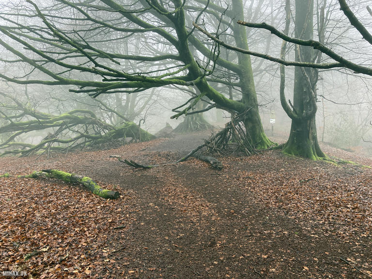
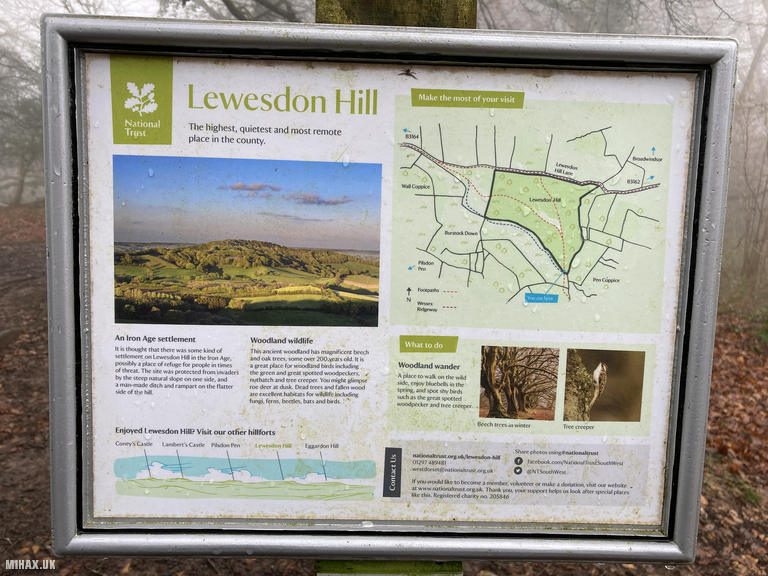
Lewesdon Hill stands at 279 metres, making it the highest point in Dorset. For many years, neighbouring Pilsdon Pen was believed to hold this distinction, but modern surveying techniques revealed that Lewesdon edges it by a few metres. With a topographic prominence of 187 metres, it qualifies as a Marilyn and is worth 1 point for SOTA activators. The elongated ridge is surrounded by ancient beech woodland, giving the summit a secluded character despite its modest altitude.
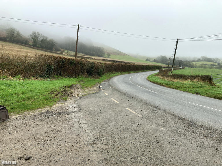
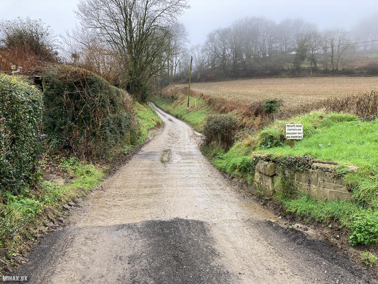
Finding suitable parking is often mentioned as one of the challenges of activating Lewesdon Hill. For this activation, I parked in the gravel layby at Buck’s Head on Coombe Lane, where there is space for perhaps three cars. It is also possible to park a single vehicle further up the lane, though turning around can be awkward if no space is available.
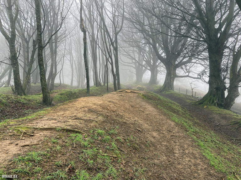
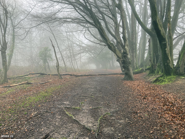
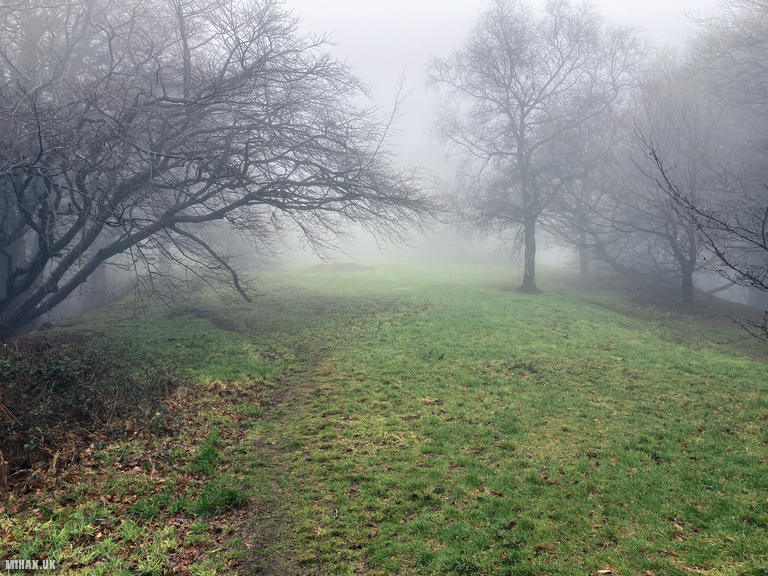
From the layby, we walked a short distance up Coombe Lane before following a muddy footpath through a gate, turning northwards onto the hillside. An obvious path ascends directly up the southern ridge to the summit, covering approximately 600 metres with around 120 metres of height gain. The February weather brought light rain and a pervasive fog that drifted through the old beech trees, lending an eerie atmosphere to the walk through the woods.
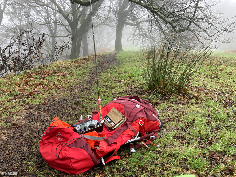
The summit opens onto a grassy plateau, where a memorial commemorates a young Belgian Spitfire pilot who crashed here in March 1942 whilst flying to an airfield in South Devon. Eight other pilots also died that tragic foggy day. The plateau provides ample space for setting up masts and antennas, though there are few good options for sitting comfortably in wet weather.
I set up my Yaesu FTM100D with the MFJ-1714 antenna and quickly worked four stations on 2-metre FM at 50 watts - Chris M7WLL, Dave M0UAC/A, Pete G7KTE, and Pete G4SSD - completing the qualification in under ten minutes. I then deployed my Elecraft KX2 with an AX1 antenna to try 20 metres, but contacts proved difficult. After exchanging reports with Ricardo EA1DHB in Spain and an impressively strong signal from Tor LA4UOA in Norway, I decided to call it a day and pack away the equipment.
The descent followed the same route, though maintaining the exact path across sections of deep wet mud proved tricky in places. Despite the poor weather, we encountered several dog walkers making the most of this accessible local hilltop. Lewesdon Hill would be a lovely summit to spend more time enjoying during the warmer summer months, when the beech woods and grassy plateau would offer a far more pleasant operating environment.
Photos
Below are some photographs taken during my activation of Lewesdon Hill on Wednesday 7th February, 2024.

Walking Route for Lewesdon Hill
The interactive map below shows my GPS track taken to the SOTA activation zone for Lewesdon Hill. The G/SC-009 summit area is marked on the map with a blue pin icon.
You can download the route shown above as a GPX file suitable for use with most GPS devices. This file is provided for information only, to support your own walk planning and research (it may contain navigation errors, detours and/or safety hazards). The route downloads provided here are governed by the Creative Commons BY-NC-SA 4.0 licence.
Station Log
I logged the following 6 amateur radio contacts operating as M1HAX/P from G/SC-009 Lewesdon Hill on Wednesday 7th February, 2024 (all times shown are UTC):
| Time | Callsign | Band | Mode | Notes |
|---|---|---|---|---|
| 11:14 | M7WLL | 2m | FM | Chris, 5/6 |
| 11:17 | M0UAC/A | 2m | FM | Dave, 5/9 |
| 11:18 | G7KTE | 2m | FM | Pete, 5/9 |
| 11:20 | G4SSD | 2m | FM | Pete, 5/9 |
| 11:31 | EA1DHB | 20m | SSB | Ricardo, 4/3 |
| 11:33 | LA4UOA | 20m | SSB | Tor, 5/3 |
In the notes field I will usually log the other operator’s name and the signal report they provided. In accordance with the Summits on the Air rules, I do not make a log entry where a complete exchange of callsigns and signal reports was unsuccessful.
Additional Information
The following resources may be helpful to walkers, mountaineers and SOTA activators interested in Lewesdon Hill:
- Sotl.as Summit Page for G/SC-009 Lewesdon Hill.
- Hill Bagging UK Summit Page for Lewesdon Hill.
- Google Maps Page for Lewesdon Hill.
- Wikipedia entry for Lewesdon Hill.
If you found this content valuable, why not Buy Me a Coffee?