Ben Nevis - GM/WS-001 SOTA (2024)
Summits on the Air Activation Report
Activation Date: Friday 29th March, 2024.
Activator(s): Richard M1HAX.
Summit: Ben Nevis, Western Scotland, Scotland.
Summit ID: SOTA reference GM/WS-001 (10 points).
Summit Height: 1345m elevation, 1345m prominence.
Summit Location: Lat./Long. 56.79689, -5.00368. Maidenhead Grid IO76lt.
Distance: 16.0km travelled with 1350m of ascent.
Difficulty: SAC Grade T3 (Winter).(?)
Elapsed Time: 6h 15m (including operating).
Weather: -2°C, light breeze, partially sunny.
Radio Equipment: Yaesu FTM100D, MFJ-1714, Zippy 4200mAh 4S LiFePo4.
Callsign Used: MM1HAX/P.
Contacts: 6 (2m FM).
Trip Notes
Ben Nevis stands at 1,345 metres, the highest mountain in the British Isles and a compelling objective for any hillwalker. Once an active volcano, the summit plateau now reveals light-coloured granite - evidence of its explosive past. The Gaelic name translates variously as “mountain with its head in the clouds” or “venomous mountain,” and with the summit shrouded in cloud for approximately 300 days per year, either interpretation seems fitting. Worth 10 points for SOTA, this is the maximum available for any summit in the programme.
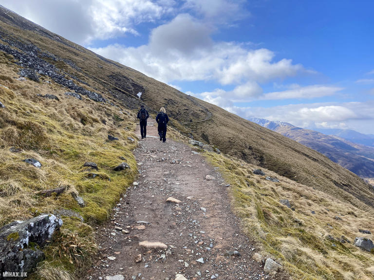
For this late March ascent, I took the Mountain Track (sometimes called the Tourist Path or Pony Track) from Glen Nevis, introducing one of my regular walking partners to using crampons and ice axe. I have previously written about a more technical winter route via the Carn Mor Dearg arete.
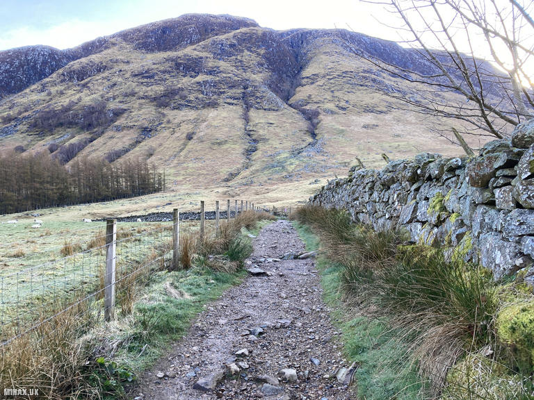
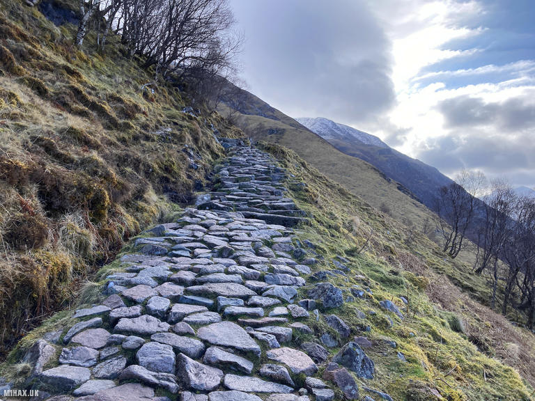
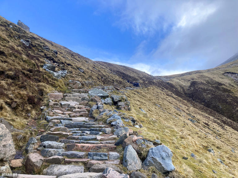
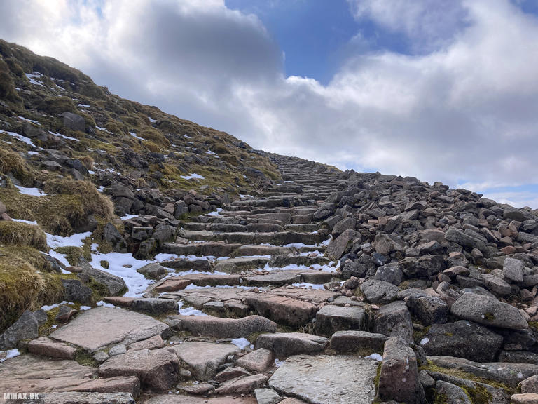
We arrived at the Glen Nevis Visitor Centre car park around quarter past eight. Despite it being a bank holiday weekend with good weather forecast, the pay-and-display car park was surprisingly quiet, though filling steadily. From here, we crossed the footbridge and traversed farmland before picking up the stone-paved path along the southern flanks of Meall an t-Suidhe - the steepest section of the route, though never particularly challenging for experienced walkers.
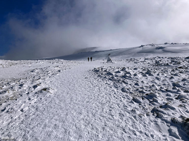
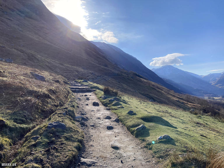
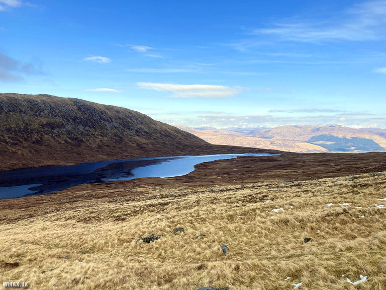
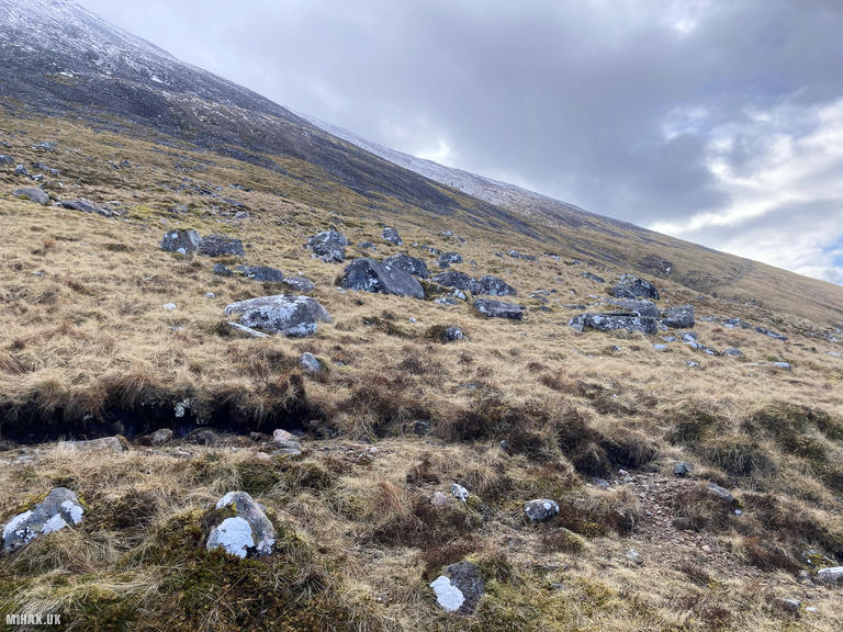
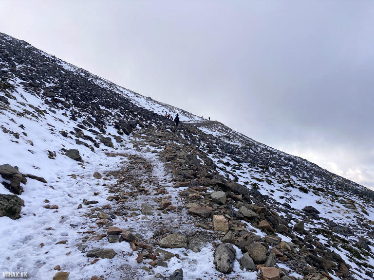
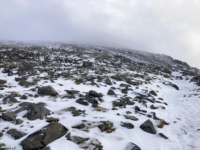
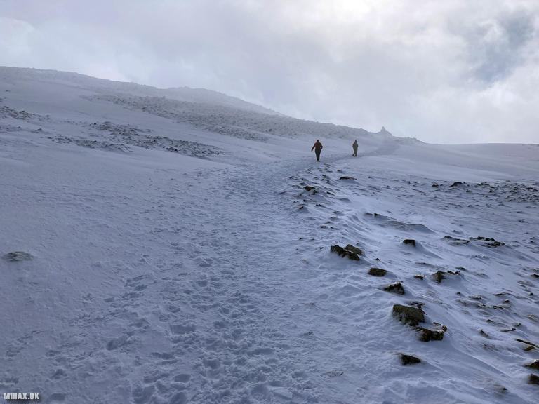
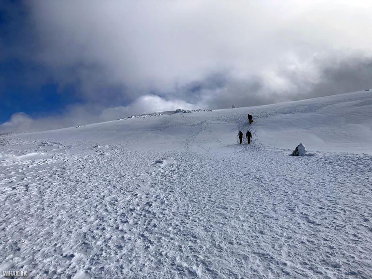
The path levels as it approaches Lochan Meall an t-Suidhe. Above 600 metres it forks, with the northern branch heading towards the climbers' hut. We turned south, passing a picturesque waterfall before reaching the famous zig-zags. At around 700 metres we encountered snow, and by 950 metres the well-compacted, icy surface demanded crampons. Most walkers we encountered were similarly equipped, though we occasionally passed people dangerously attempting the summit in trainers.
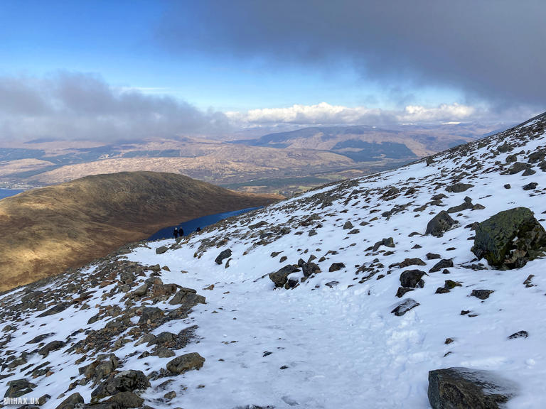
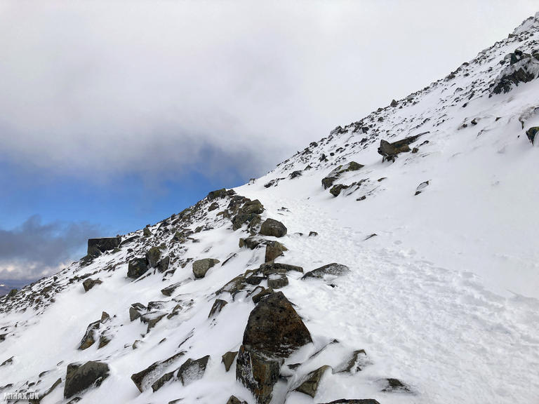
Above 1,200 metres the route heads directly towards the summit shelter. Navigation here is notoriously treacherous in poor visibility - Gardyloo Gully and Five Finger Gully have claimed lives when walkers stray from the correct bearing. The descent requires a precise “dog-leg”: 231 degrees for 150 metres from the trig point, then 282 degrees to avoid the cliffs. Snow cornices can extend several metres beyond the cliff edge, and navigation cairns are frequently buried. We stayed well clear of Coire na Ciste to the north.
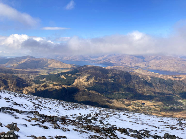
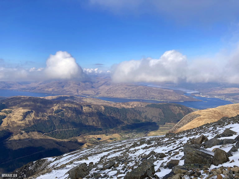
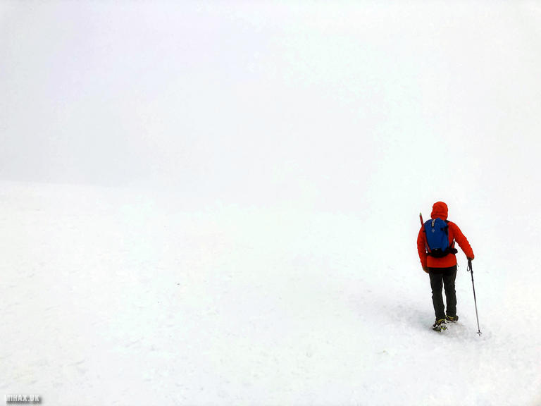
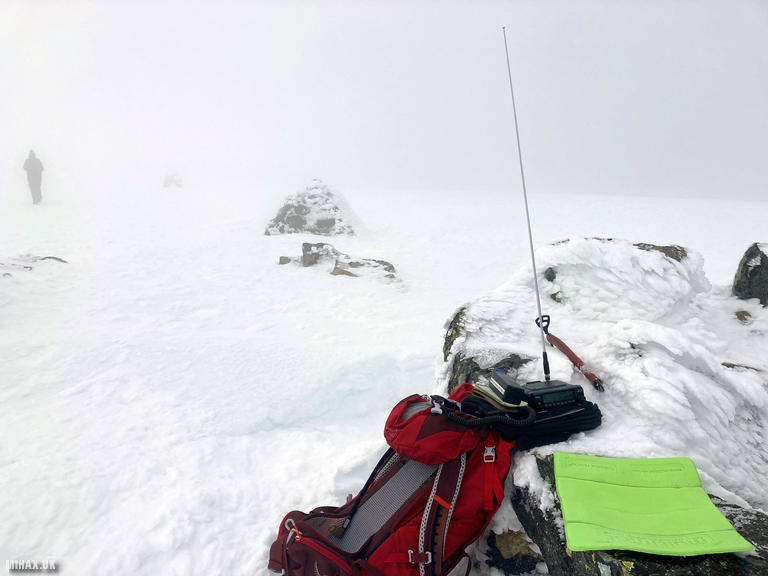
Fortune favoured us with occasional breaks in the summit cloud, revealing spectacular views across the Highlands. I quickly set up my Yaesu FTM100D and completed six contacts on 2 metres FM in about fifteen minutes - Robin GM7PKT/P, Steve MM0XPZ, Stuart MM7SWM, Steve GM7UAU, Peter GM0VEK, and Steve 2M0DKU. While I was operating, a couple of climbing parties topped out triumphantly via the Great Tower to impressed looks from walkers.
On descent, I led our party back towards the zig-zags through thick cloud, with a surprising number of others following gratefully. We passed several people struggling on the icy slopes without proper equipment. Below Number 3 Gully the visibility improved and we removed crampons where bare rock appeared.
As the highest mountain in the United Kingdom, Ben Nevis welcomes around 125,000 walkers annually. It is a fine objective for securing ten SOTA activator points, and a mountain every hiking enthusiast should experience - though winter conditions demand respect, proper equipment, and sound navigation skills.
Photos
Below are some photographs taken during my activation of Ben Nevis on Friday 29th March, 2024.

Walking Route for Ben Nevis
The interactive map below shows my GPS track taken to the SOTA activation zone for Ben Nevis. The GM/WS-001 summit area is marked on the map with a blue pin icon.
You can download the route shown above as a GPX file suitable for use with most GPS devices. This file is provided for information only, to support your own walk planning and research (it may contain navigation errors, detours and/or safety hazards). The route downloads provided here are governed by the Creative Commons BY-NC-SA 4.0 licence.
Station Log
I logged the following 6 amateur radio contacts operating as MM1HAX/P from GM/WS-001 Ben Nevis on Friday 29th March, 2024 (all times shown are UTC):
| Time | Callsign | Band | Mode | Notes |
|---|---|---|---|---|
| 11:43 | GM7PKT/P | 2m | FM | Robin, 5/9 |
| 11:45 | MM0XPZ | 2m | FM | Steve, 5/9 |
| 11:47 | MM7SWM | 2m | FM | Stuart, 5/4 |
| 11:50 | GM7UAU | 2m | FM | Steve, 5/9 |
| 11:56 | GM0VEK | 2m | FM | Peter, 5/3 |
| 11:58 | 2M0DKU | 2m | FM | Steve, 5/9 |
In the notes field I will usually log the other operator’s name and the signal report they provided. In accordance with the Summits on the Air rules, I do not make a log entry where a complete exchange of callsigns and signal reports was unsuccessful.
Additional Information
The following resources may be helpful to walkers, mountaineers and SOTA activators interested in Ben Nevis:
- Sotl.as Summit Page for GM/WS-001 Ben Nevis.
- Hill Bagging UK Summit Page for Ben Nevis.
- Google Maps Page for Ben Nevis.
- Wikipedia entry for Ben Nevis.
If you found this content valuable, why not Buy Me a Coffee?