Semaforo - IS0/IS-266 SOTA (2024)
Summits on the Air Activation Report
Activation Date: Sunday 5th May, 2024.
Activator(s): Richard M1HAX.
Summit: Semaforo, Sardinia, Italy.
Summit ID: SOTA reference IS0/IS-266 (1 point).
Summit Height: 342m elevation, 338m prominence.
Summit Location: Lat./Long. 40.99780, 9.65310. Maidenhead Grid JN40tx.
Distance: 12.2km travelled with 378m of ascent.
Difficulty: SAC Grade T1.(?)
Elapsed Time: 3h 25m (including operating).
Weather: 23°C, clear, 15 kph ENE wind, 50% humidity.
Radio Equipment: Elecraft KX2, EFHW.
Callsign Used: IS0/M1HAX/P.
Contacts: 5 (20m SSB, 17m SSB).
Trip Notes
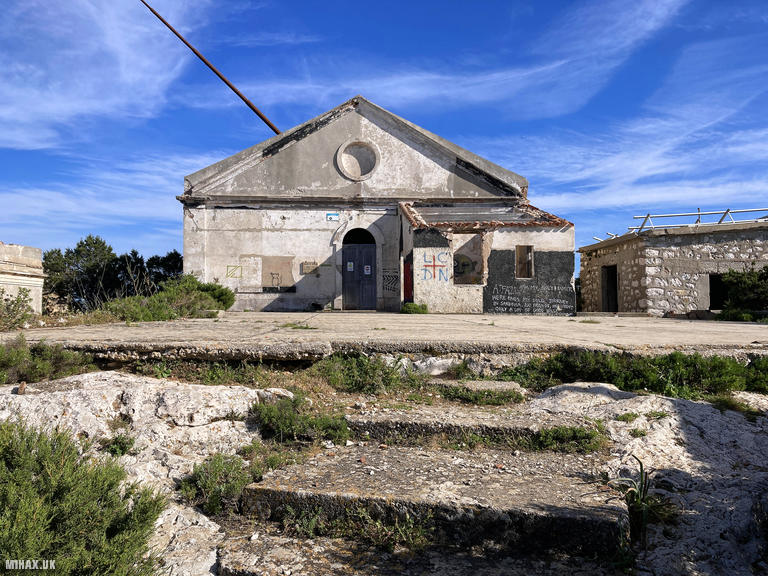
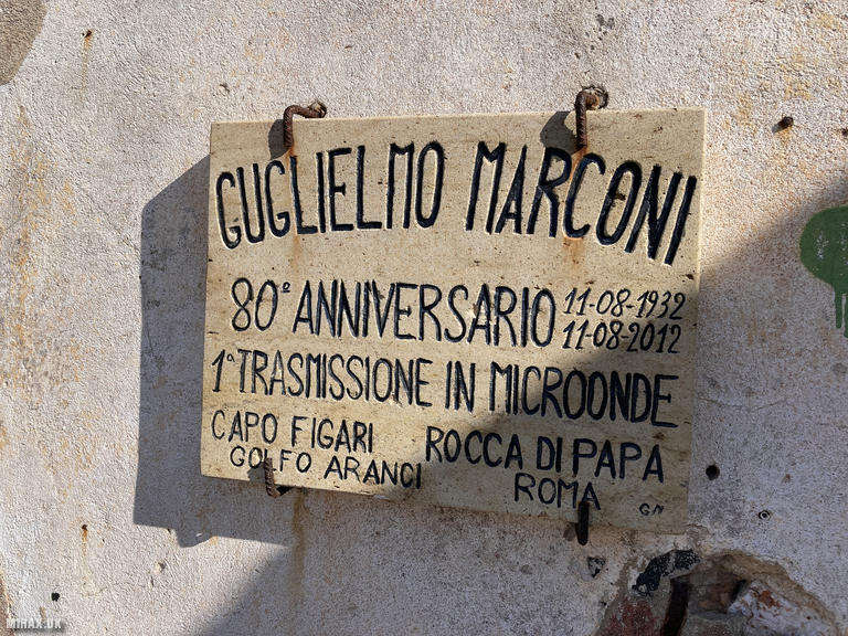
Punta Semaforo sits atop the Capo Figari promontory overlooking Golfo Aranci in northeastern Sardinia. At 342 metres with an impressive 338 metres of prominence, this summit holds immense significance in the history of wireless communication. The semaphore building was inaugurated in 1890 by the Italian Royal Navy to communicate with passing ships using flags and visual signals. In 1932, Nobel laureate Guglielmo Marconi selected this site as the ideal reception point for his groundbreaking short-wave radio experiments.
On 11 August 1932, Marconi and his team successfully established a microwave radio link between Capo Figari and a transmitter at Rocca di Papa near Rome, a distance of 269 kilometres across the Tyrrhenian Sea. His laboratory yacht Elettra served as a relay point during the experiments. This achievement proved the potential for long-distance wireless communication and paved the way for technologies we rely upon today. The complex was abandoned in the late 1950s and now stands as atmospheric ruins.
I visited this summit during a holiday trip to Sardinia. Operating under CEPT guidelines, I was using the callsign IS0/M1HAX/P. Every April, local amateur radio groups celebrate International Marconi Day by reactivating the station, making contact with other historical Marconi sites worldwide. Unfortunately, I had missed this exciting event by a couple of weeks.
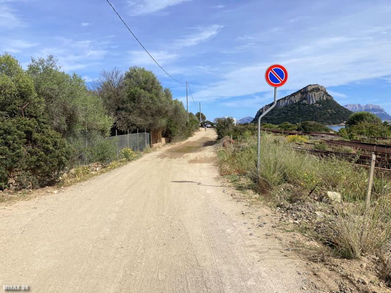
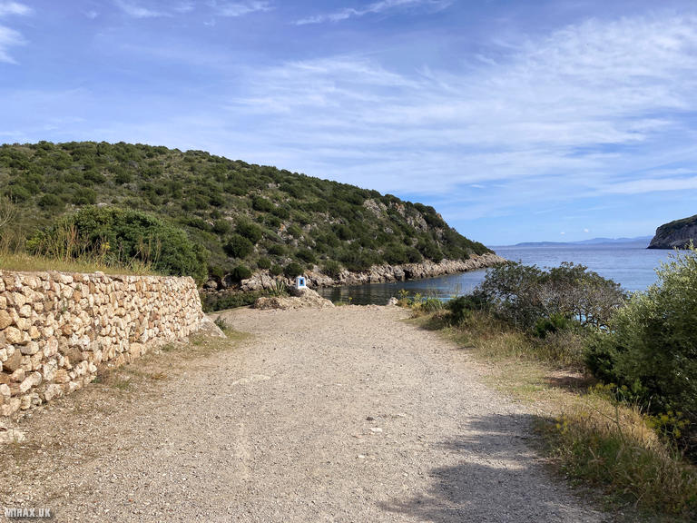
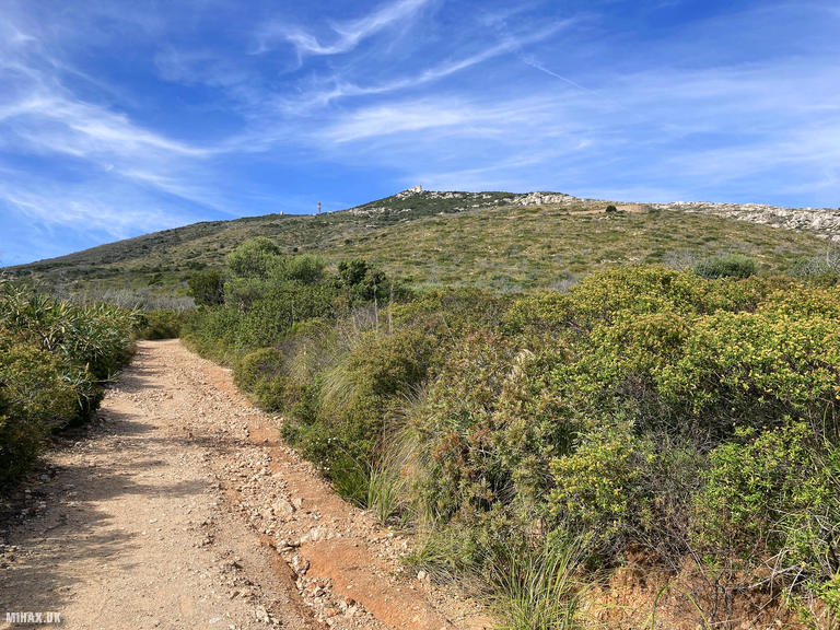
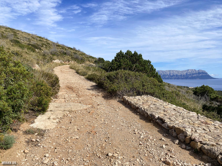
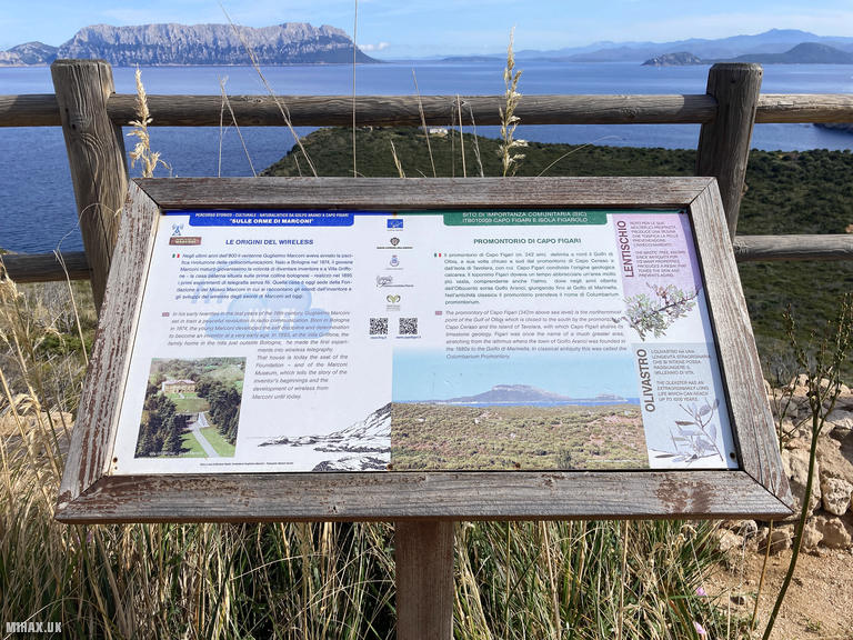
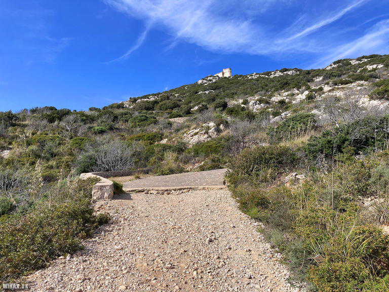
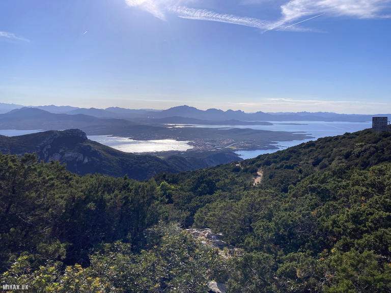
Starting from the town of Golfo Aranci, I walked along a sandy road to reach the trailhead near Cala Moresca beach. A well-established gravel path leads 3.5 kilometres to the summit, climbing steadily through Mediterranean scrub vegetation. Information boards along the route detail the flora, fauna, and Marconi’s historic experiments.
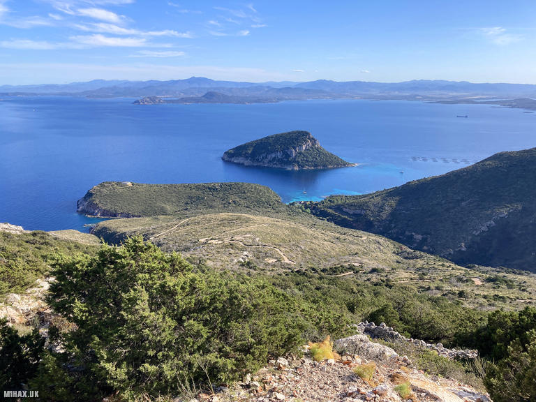
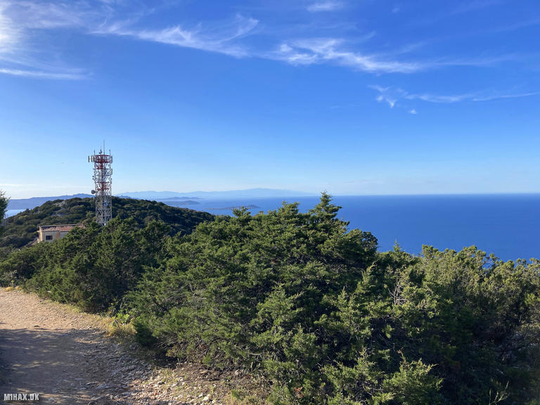
Reaching the summit, the zigzag path below back to the trailhead was clearly visible. The large derelict ruins of Marconi’s station can be freely explored at the top, offering a fascinating glimpse into early twentieth-century radio history.
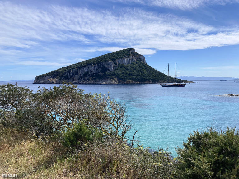
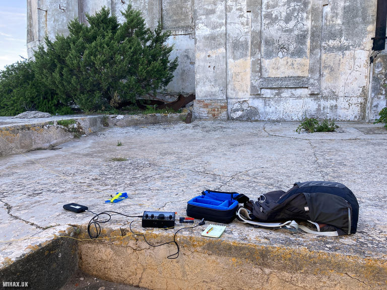
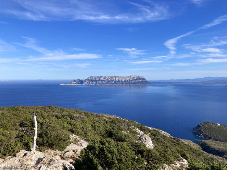
Seeking shade from the hot sun, I set up my Elecraft KX2 with an end-fed half-wave antenna on a patio area at the rear of the complex. Band conditions were unfortunately poor, and I made just five contacts on 20 and 17 metres SSB. Chasers from Spain, Poland, Belgium, and Greece made it into the log. After enjoying the panoramic views across to the island of Tavolara and the distant coast of Corsica, I returned down the path to Golfo Aranci.
Photos
Below are some photographs taken during my activation of Semaforo on Sunday 5th May, 2024.

Walking Route for Semaforo
The interactive map below shows my GPS track taken to the SOTA activation zone for Semaforo. The IS0/IS-266 summit area is marked on the map with a blue pin icon.
You can download the route shown above as a GPX file suitable for use with most GPS devices. This file is provided for information only, to support your own walk planning and research (it may contain navigation errors, detours and/or safety hazards). The route downloads provided here are governed by the Creative Commons BY-NC-SA 4.0 licence.
Station Log
I logged the following 5 amateur radio contacts operating as IS0/M1HAX/P from IS0/IS-266 Semaforo on Sunday 5th May, 2024 (all times shown are UTC):
| Time | Callsign | Band | Mode | Notes |
|---|---|---|---|---|
| 15:48 | EA2DT | 20m | SSB | Manuel, 5/2 |
| 15:50 | SP6KEP | 20m | SSB | Lesnica Radio Club, 5/4 |
| 15:51 | OS8D | 20m | SSB | Etienne, 5/5 |
| 15:57 | SV1RVJ | 20m | SSB | Kyriakos, 5/5 |
| 16:01 | SO9P | 17m | SSB | Mario, 4/4 |
In the notes field I will usually log the other operator’s name and the signal report they provided. In accordance with the Summits on the Air rules, I do not make a log entry where a complete exchange of callsigns and signal reports was unsuccessful.
Additional Information
The following resources may be helpful to walkers, mountaineers and SOTA activators interested in Semaforo:
- Sotl.as Summit Page for IS0/IS-266 Semaforo.
- Peak Bagger Page for Semaforo.
- Google Maps Page for Semaforo.
- Wikipedia entry for Semaforo.
If you found this content valuable, why not Buy Me a Coffee?