Branderschrofen - DL/AM-031 SOTA (2024)
Summits on the Air Activation Report
Activation Date: Saturday 20th July, 2024.
Activator(s): Richard M1HAX.
Summit: Branderschrofen, Ammergau Alps, Germany.
Summit ID: SOTA reference DL/AM-031 (8 points).
Summit Height: 1881m elevation, 260m prominence.
Summit Location: Lat./Long. 47.55939, 10.78701. Maidenhead Grid JN57jn.
Distance: 8.7km travelled with 1015m of ascent.
Difficulty: SAC Grade T4 / VF-C.(?)
Elapsed Time: 5h 20m (including operating).
Weather: 19°C, clear, 4kph SW wind, 70% humidity.
Radio Equipment: Elecraft KX2, Elecraft AX1.
Callsign Used: DL/M1HAX/P.
Contacts: 5 (20m SSB).
Trip Notes
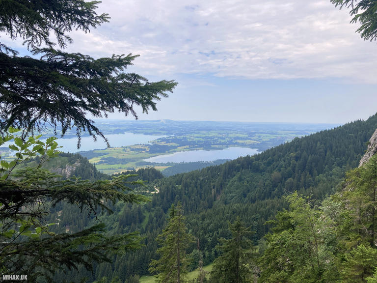
Branderschrofen (1881m) is a prominent summit in the Ammergau Alps of Bavaria, positioned above the famous Tegelberg ridge near the fairy-tale castle of Neuschwanstein. The peak offers commanding views across to the Zugspitze and the surrounding Alpine landscape, making it a popular destination for hillwalkers and via ferrata enthusiasts alike. The mountain is accessible via several routes, with the Tegelbergsteig Klettersteig providing the most engaging approach for those with appropriate experience and equipment.
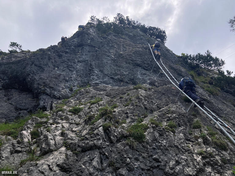
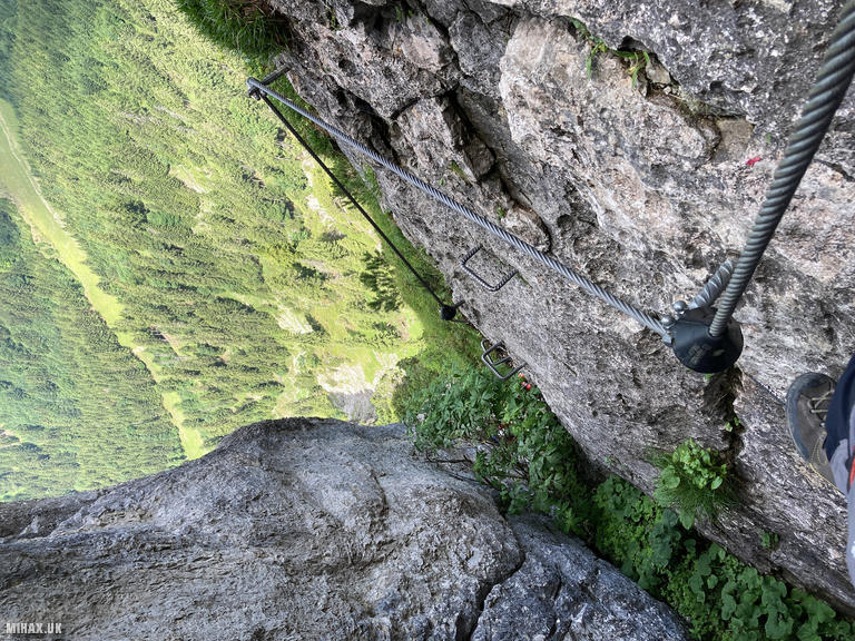
A via ferrata (Italian for ‘iron path’) is a protected climbing route equipped with steel cables, rungs, and ladders fixed to the rock. Climbers attach themselves to these fixtures using specialist equipment consisting of a harness, energy-absorbing lanyard, and two carabiners, allowing safe progression through terrain that would otherwise require technical rock-climbing skills. The Tegelbergsteig is graded C on the international scale, indicating moderate difficulty requiring good upper body strength and a head for heights.
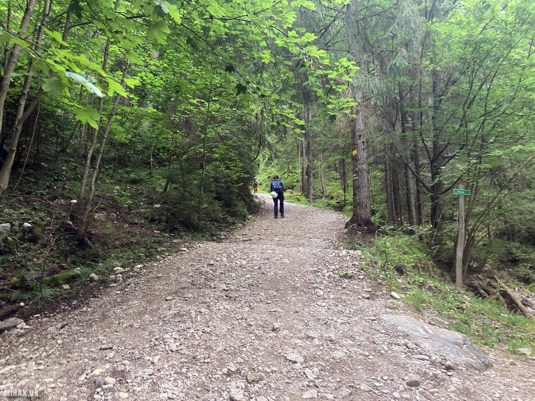
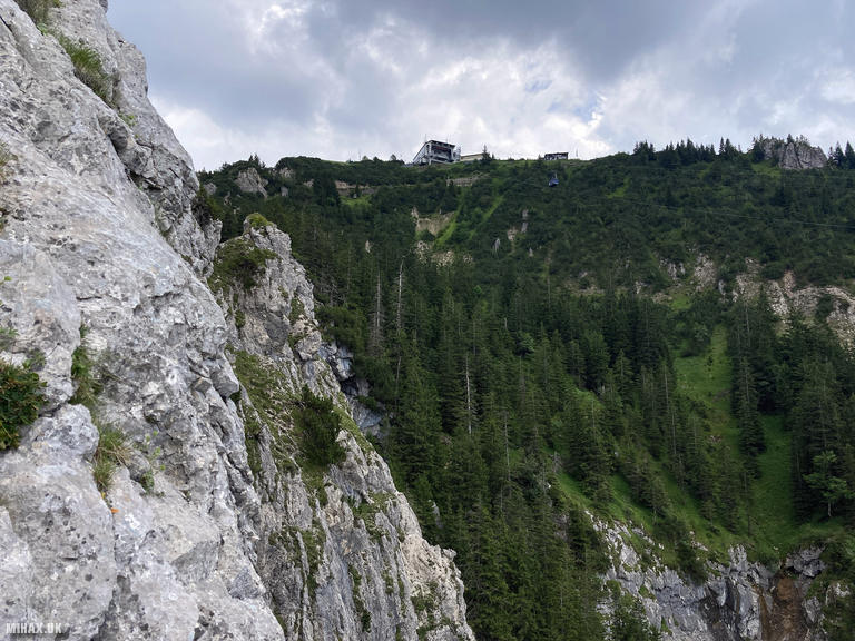
I parked at the large pay and display car park at the Tegelberg cable car station near Schwangau, where the valley was already bustling with tourists, hang gliders preparing for flight, and fellow climbers heading for the various routes on the mountain. The approach begins by following a trail southeast along the Rautbach stream, a pleasant 1.5 kilometre walk through mixed woodland.
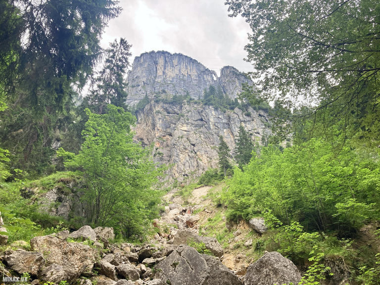
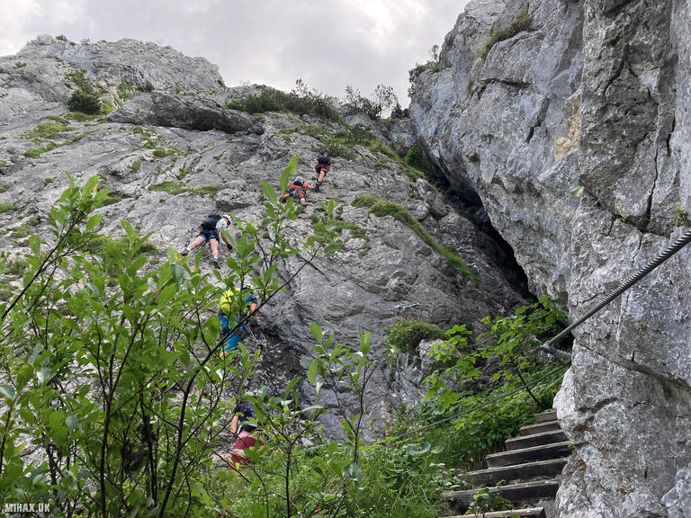
After leaving the main track, a smaller, steeper path climbs southward to reach the start of the Klettersteig proper. The route begins dramatically with a large iron ladder, which serves as an effective ability checkpoint before full commitment. There was a queue here, with a delay while a novice group slowly climbed the ladder before retreating off the route. Rock fall is a genuine hazard at this point; indeed, a falling stone struck the helmet of someone queuing ahead of me, reinforcing the importance of proper protective equipment.
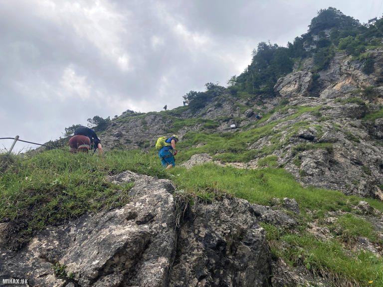
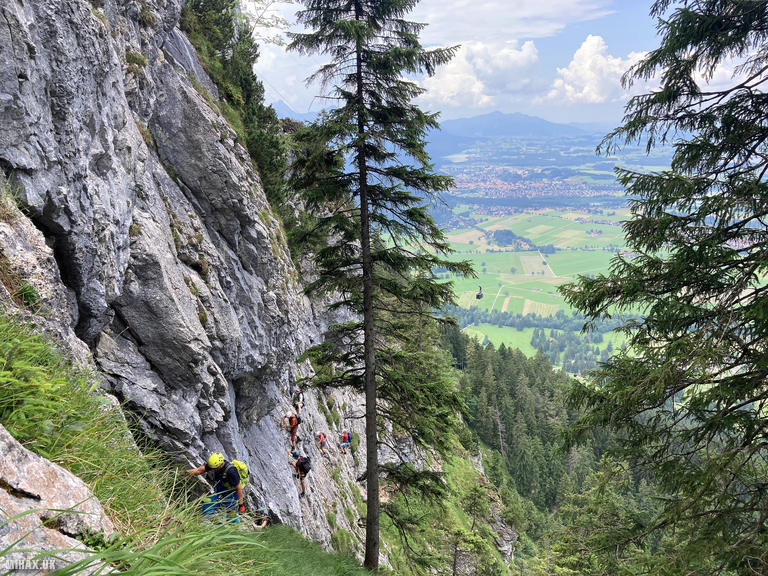
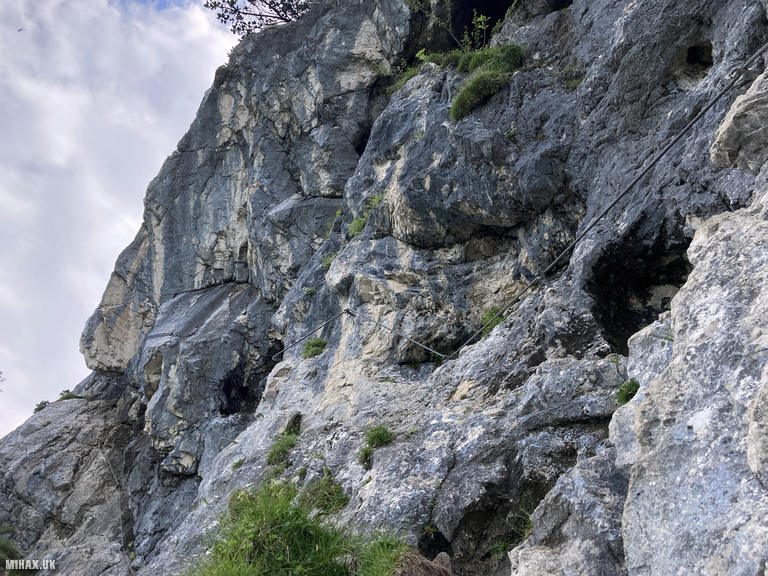
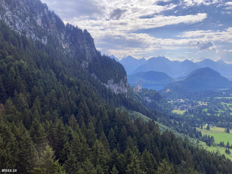
Once established on the route, the Tegelbergsteig traverses across and up the mountain face through a series of engaging passages. The main technical difficulties occur on steep slabs graded up to C, requiring confident movement on rock and trust in the fixed protection. A wire bridge midway through adds variety to the climbing. The exposure is significant in places, with dramatic views opening up across the valley to the Forggensee lake and the distant spires of Neuschwanstein Castle.
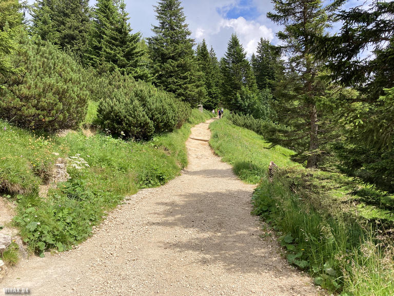
The climbing is sustained but never desperate, with good rest positions between the harder sections. The quality of the fixtures is excellent, with well-maintained cables and secure anchor points throughout. As the route progresses, the angle gradually eases and the path transitions into a more conventional hiking trail through the forest toward the Tegelberghaus mountain restaurant.
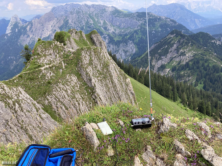
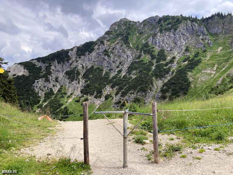
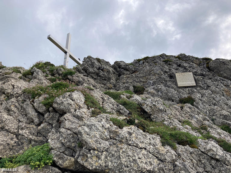
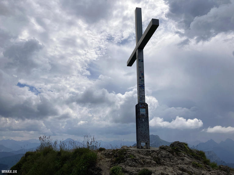
From the Panorama Restaurant at the cable car station, I followed a good path for the final ascent to the rocky summit of Branderschrofen. The summit offers exceptional 360-degree panoramic views encompassing much of the Bavarian Alps, with the massive bulk of the Zugspitze dominating the southern horizon and the distinctive profile of the Sauling prominent to the southwest.
At the summit I quickly established my Elecraft KX2 station with the AX1 whip antenna. Conditions on 20m SSB were fair, and I completed five contacts including stations in Greece, Poland, and Croatia within approximately fifteen minutes. The compact antenna setup proved ideal for the exposed and somewhat busy summit area.
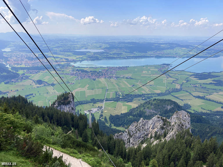
I descended via the cable car back to the valley station, an expensive but efficient conclusion to the day. The gondola provided an opportunity to appreciate the scale of the terrain covered during the ascent. This was a truly memorable and glorious day on a significant Alpine mountain. The combination of engaging climbing, stunning scenery, and a successful SOTA activation will remain one of my finest mountain experiences to date. I highly recommend this route to anyone competent at via ferrata climbing, though it is best avoided in wet conditions when the rock becomes slippery.
Photos
Below are some photographs taken during my activation of Branderschrofen on Saturday 20th July, 2024.

Walking Route for Branderschrofen
The interactive map below shows my GPS track taken to the SOTA activation zone for Branderschrofen. The DL/AM-031 summit area is marked on the map with a blue pin icon.
You can download the route shown above as a GPX file suitable for use with most GPS devices. This file is provided for information only, to support your own walk planning and research (it may contain navigation errors, detours and/or safety hazards). The route downloads provided here are governed by the Creative Commons BY-NC-SA 4.0 licence.
Station Log
I logged the following 5 amateur radio contacts operating as DL/M1HAX/P from DL/AM-031 Branderschrofen on Saturday 20th July, 2024 (all times shown are UTC):
| Time | Callsign | Band | Mode | Notes |
|---|---|---|---|---|
| 15:24 | SV3IEG | 20m | SSB | Dinos, 4/4 |
| 15:26 | SQ9MDF | 20m | SSB | Leszek, 5/7 |
| 15:26 | SQ9NOT | 20m | SSB | Violeta, 5/5 |
| 15:26 | 9A6CW | 20m | SSB | Ivicta, 5/9 |
| 15:27 | EA3EVL | 20m | SSB | Pablo, 5/5 |
In the notes field I will usually log the other operator’s name and the signal report they provided. In accordance with the Summits on the Air rules, I do not make a log entry where a complete exchange of callsigns and signal reports was unsuccessful.
Additional Information
The following resources may be helpful to walkers, mountaineers and SOTA activators interested in Branderschrofen:
- Sotl.as Summit Page for DL/AM-031 Branderschrofen.
- Peak Bagger Page for Branderschrofen.
- Google Maps Page for Branderschrofen.
- Wikipedia entry for Branderschrofen.
If you found this content valuable, why not Buy Me a Coffee?