Wengenkopf - DL/AL-076 SOTA (2024)
Summits on the Air Activation Report
Activation Date: Sunday 21st July, 2024.
Activator(s): Richard M1HAX.
Summit: Wengenkopf, Allgau Alps, Germany.
Summit ID: SOTA reference DL/AL-076 (10 points).
Summit Height: 2235m elevation, 149m prominence.
Summit Location: Lat./Long. 47.42286, 10.35034. Maidenhead Grid JN57ek.
Distance: 3.8km travelled with 190m of ascent.
Difficulty: SAC Grade T4 / VF-C.(?)
Elapsed Time: 3h 30m (including operating).
Weather: 18°C, clear, 1kph N wind, 63% humidity.
Radio Equipment: Elecraft KX2, Elecraft AX1.
Callsign Used: DL/M1HAX/P.
Contacts: 5 (20m SSB).
Trip Notes
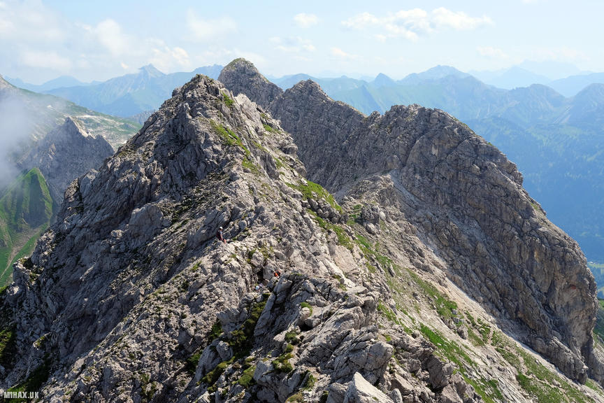
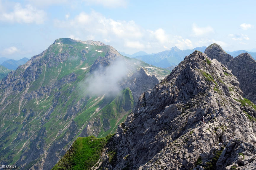
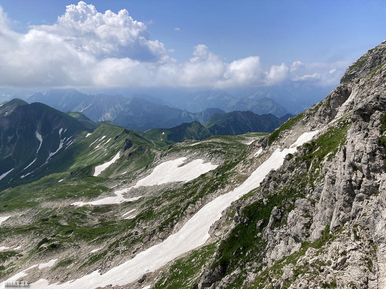
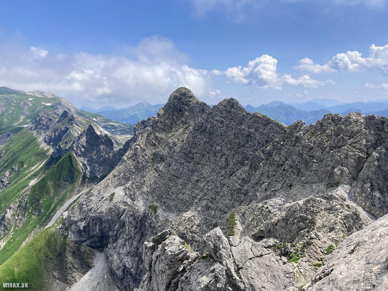
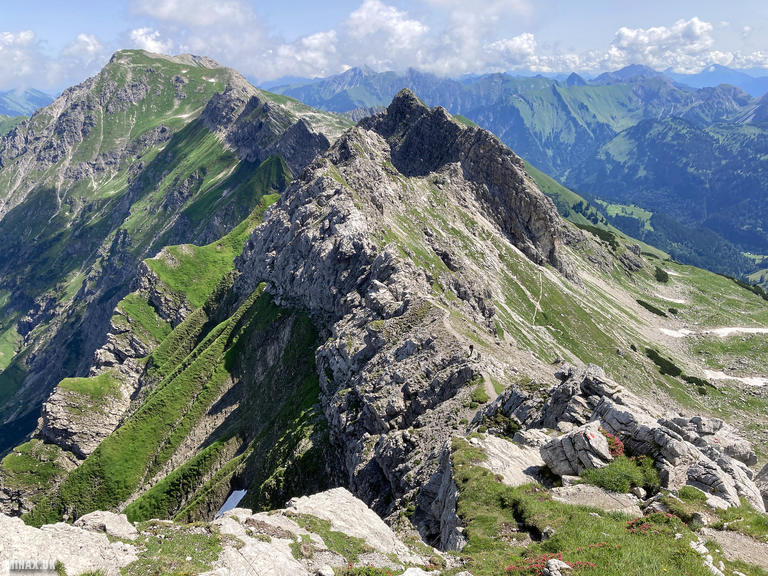
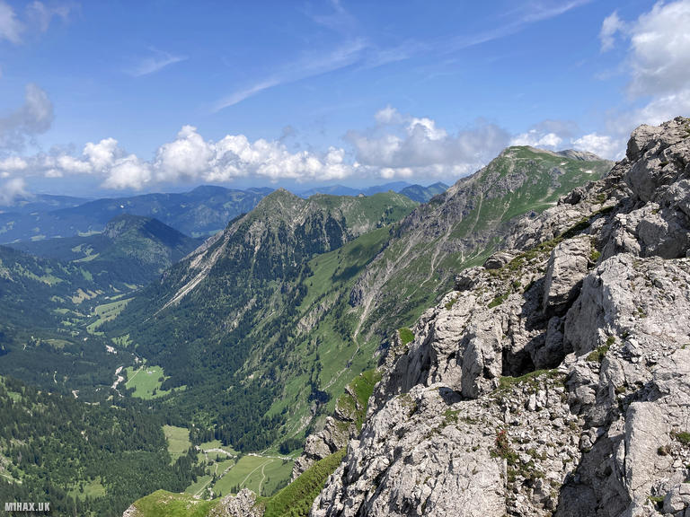
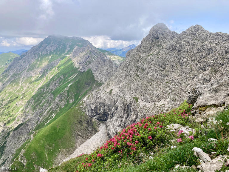
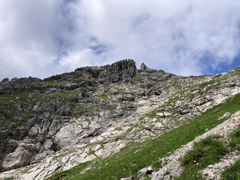
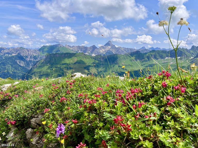
The Westlicher Wengenkopf (2235m) is one of the prominent summits along the famous Hindelanger Klettersteig, a spectacular ridge traverse in the Allgau Alps above Oberstdorf. This via ferrata, constructed between 1973 and 1978, is considered one of the finest in Germany, running for approximately four kilometres along an exposed ridge connecting the Nebelhorn to the Grosser Daumen. The route offers almost continuous panoramic views extending from the Zugspitze to the Swiss Alps on clear days.
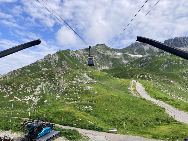
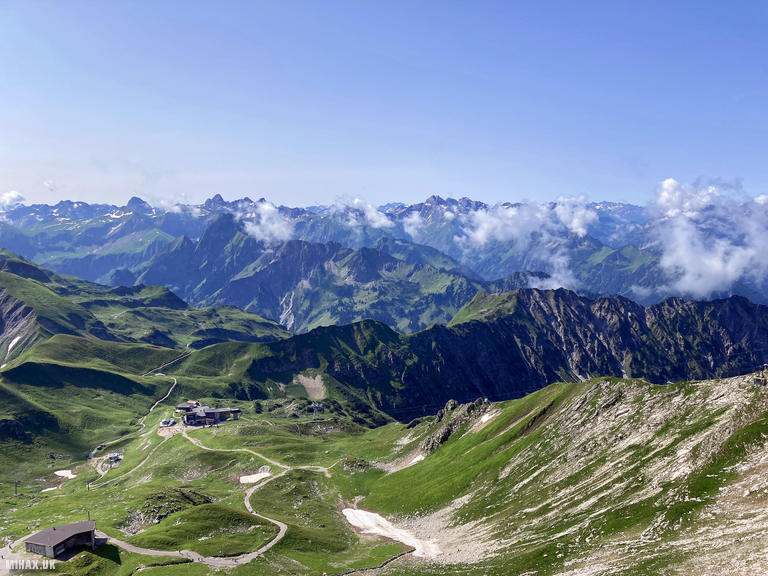
I began the day at the Nebelhornbahn valley station in Oberstdorf, joining the queue for the first cable cars of the day. The journey involves two sections, rising from the town at 815 metres to the summit station at 2224 metres in approximately 25 minutes. A short ladder descent from the summit facility provides access to the trail head.
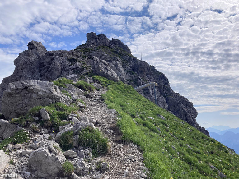
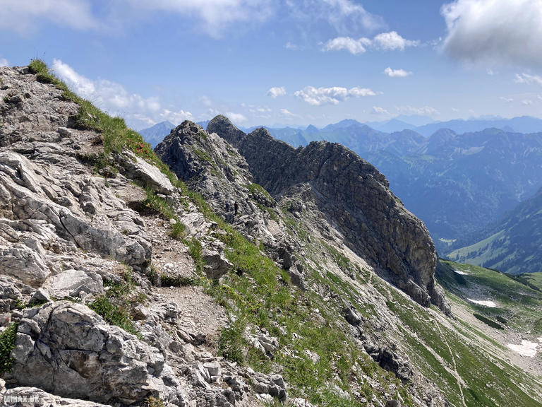
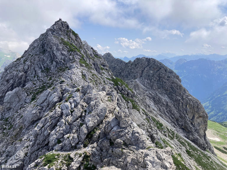
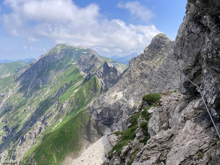
The Hindelanger Klettersteig is graded B/C, making it accessible to reasonably experienced via ferrata climbers. The route begins with a short approach walk before the first technical sections, where a prominent iron ladder marks the transition onto the ridge proper. The climbing initially follows secured passages along the ridge toward the Westlicher Wengenkopf, with cables and occasional ladders protecting the more exposed sections.
What strikes first-time visitors is the balance between protected and unprotected terrain. Significant portions of the route involve easy but exposed scrambling at grade I-II without fixed protection, requiring constant attention and confident movement. The character reminded me of technical terrain encountered in Snowdonia or Scotland, and at times the use of via ferrata equipment felt almost contrived on the easier sections.
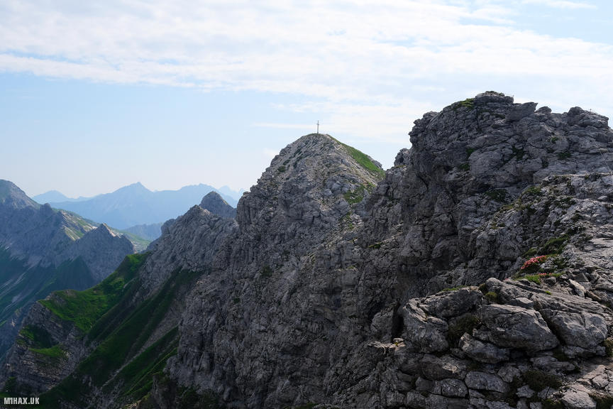
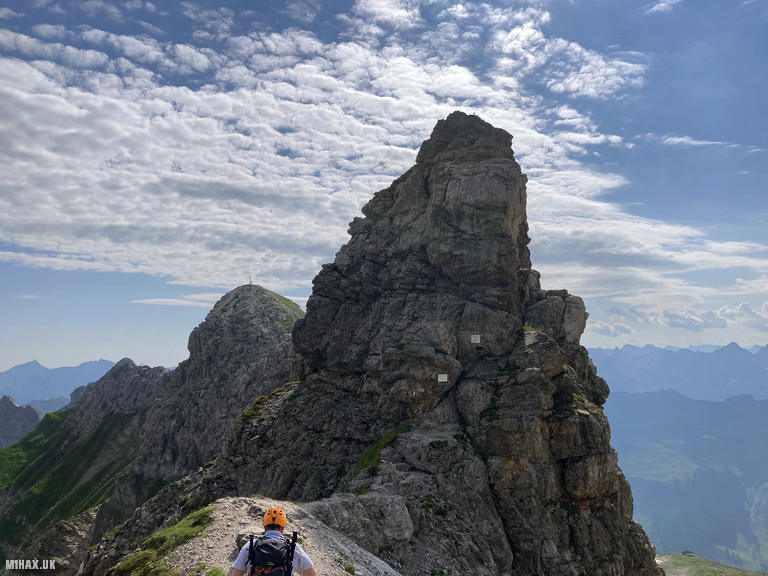
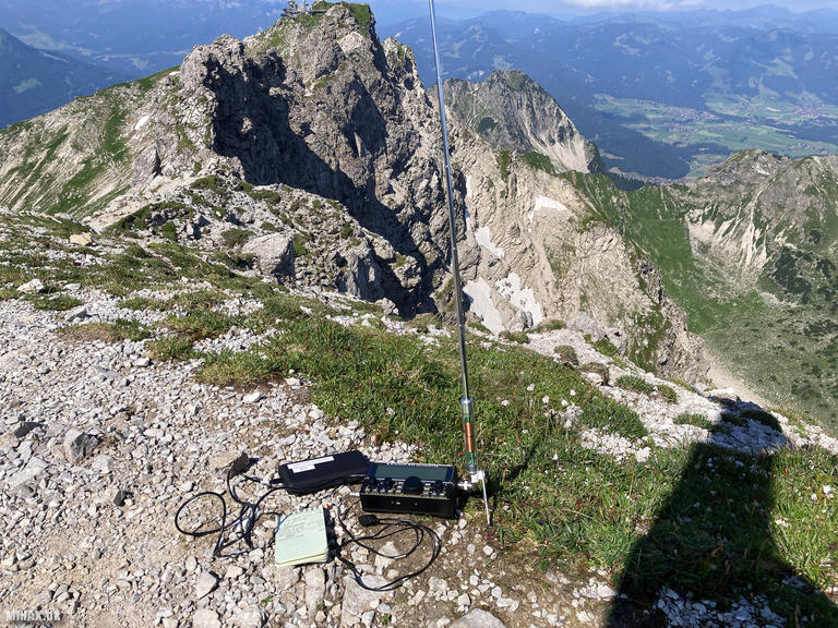
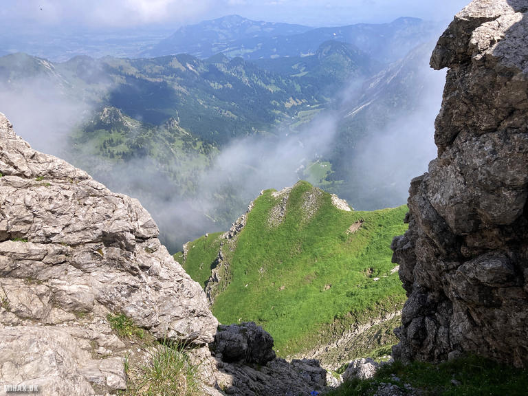
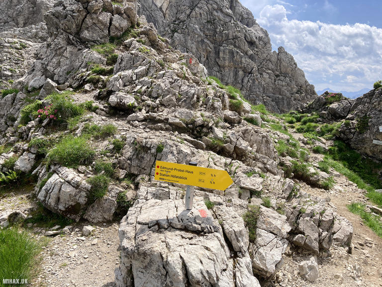
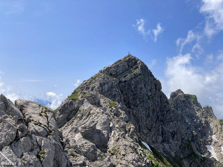
The route undulates along the ridge with several short but steep descents and ascents between the rock towers. The Westlicher Wengenkopf summit, marked with a cross, lies approximately 20 minutes' walking beyond where the main protected sections conclude. From this lofty vantage point, the views are exceptional, with the distinctive profile of the Hochvogel prominent among the surrounding peaks.
I made a quick activation using my Elecraft KX2 and AX1 antenna while seated at the summit. On 20m SSB I completed five contacts, including a summit to summit with John GW4TQE/P operating from GW/MW-026 in Wales. The rapid nature of the operation reflected both the excellent band conditions and the need to continue along the ridge.
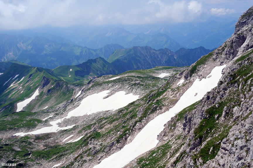
Having traversed this route several times previously, I believe an experienced fast-moving team could complete the full traverse to Grosser Daumen (DL/AL-077) and return to the cable car in time for the last departure. However, on this occasion I took one of the earlier descent options, following marked paths down to the Koblat plateau and then to the intermediate cable car station below the Nebelhorn summit.
The Hindelanger Klettersteig is a thoroughly enjoyable Alpine outing combining technical interest with outstanding scenery. Just remember to check cable car departure times carefully, as missing the last service would necessitate a descent of over 1400 metres on foot.
Photos
Below are some photographs taken during my activation of Wengenkopf on Sunday 21st July, 2024.


Walking Route for Wengenkopf
The interactive map below shows my GPS track taken to the SOTA activation zone for Wengenkopf. The DL/AL-076 summit area is marked on the map with a blue pin icon.
You can download the route shown above as a GPX file suitable for use with most GPS devices. This file is provided for information only, to support your own walk planning and research (it may contain navigation errors, detours and/or safety hazards). The route downloads provided here are governed by the Creative Commons BY-NC-SA 4.0 licence.
Station Log
I logged the following 5 amateur radio contacts operating as DL/M1HAX/P from DL/AL-076 Wengenkopf on Sunday 21st July, 2024 (all times shown are UTC):
| Time | Callsign | Band | Mode | Notes |
|---|---|---|---|---|
| 08:36 | GW4TQE/P | 20m | SSB | John, 5/6, S2S GW/MW-026 |
| 08:39 | SM5LNE | 20m | SSB | John, 5/7 |
| 08:39 | EA5FPL | 20m | SSB | Francisco, 5/1 |
| 08:40 | EA2DT | 20m | SSB | Manuel, 5/2 |
| 08:42 | EA1DHB | 20m | SSB | Ricardo, 5/5 |
In the notes field I will usually log the other operator’s name and the signal report they provided. In accordance with the Summits on the Air rules, I do not make a log entry where a complete exchange of callsigns and signal reports was unsuccessful.
Additional Information
The following resources may be helpful to walkers, mountaineers and SOTA activators interested in Wengenkopf:
- Sotl.as Summit Page for DL/AL-076 Wengenkopf.
- Peak Bagger Page for Wengenkopf.
- Google Maps Page for Wengenkopf.
- Wikipedia entry for Wengenkopf.
If you found this content valuable, why not Buy Me a Coffee?