Zugspitze - DL/WS-001 SOTA (2024)
Summits on the Air Activation Report
Activation Date: Saturday 27th July, 2024.
Activator(s): Richard M1HAX.
Summit: Zugspitze, Wetterstein, Germany.
Summit ID: SOTA reference DL/WS-001 (10 points).
Summit Height: 2962m elevation, 1745m prominence.
Summit Location: Lat./Long. 47.42119, 10.98635. Maidenhead Grid JN57lk.
Distance: 0.7km travelled with 30m of ascent.
Difficulty: SAC Grade T3.(?)
Elapsed Time: 1h 10m (including operating).
Weather: 15°C, clear, 11kph S wind, 73% humidity.
Radio Equipment: Elecraft KX2, Elecraft AX1.
Callsign Used: DL/M1HAX/P.
Contacts: 6 (20m SSB, 17m SSB).
Trip Notes
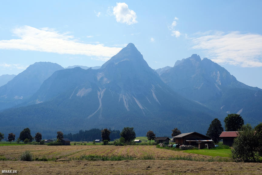
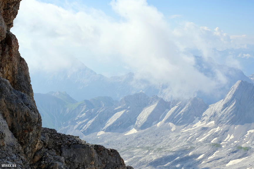
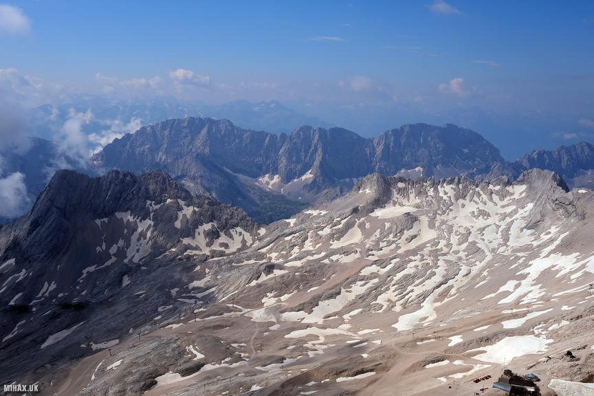
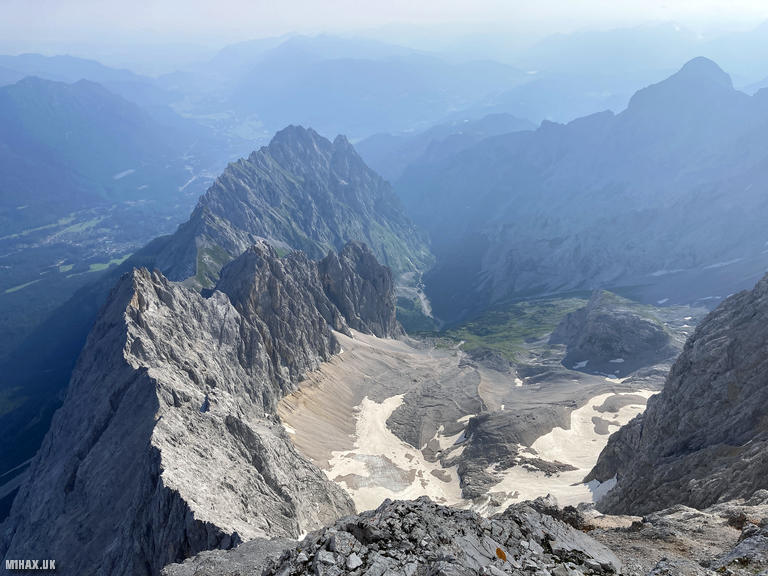
The Zugspitze (2962m) stands as Germany’s highest mountain, a prominent peak in the Wetterstein range that straddles the border between Bavaria and Tyrol. The summit has attracted visitors since the first recorded ascent in 1820, and today receives hundreds of thousands of tourists annually via cable cars from both the German and Austrian sides. The mountain holds significant historical importance in Alpine history and features two of Germany’s remaining glaciers, the Northern Schneeferner and Hollentalferner.
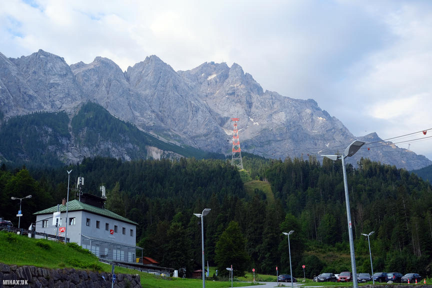
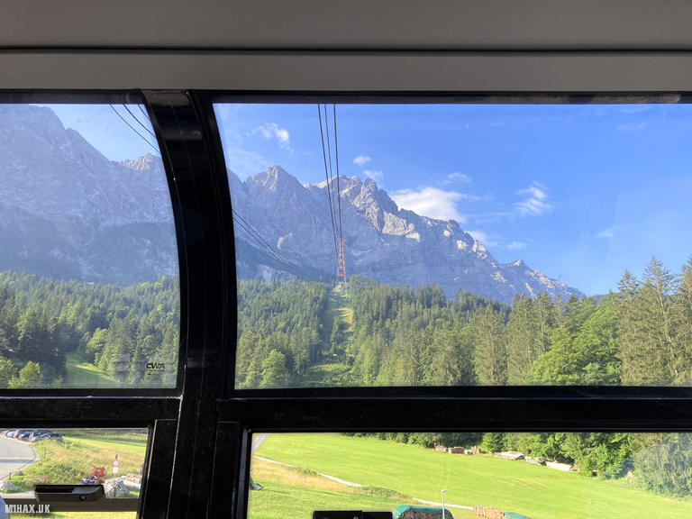
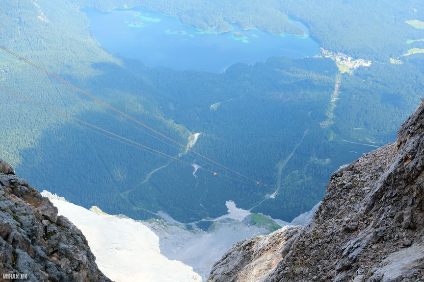
For this activation, I chose the straightforward option of ascending via the Seilbahn Zugspitze, the impressive cable car that opened in December 2017. This remarkable engineering achievement holds three world records: the longest free span in a cable car at 3213 metres, the greatest total elevation gain of 1945 metres in a single section, and the tallest lattice steel support tower at 127 metres. The floor-to-ceiling glass cabins provide spectacular views during the ten-minute ascent from Lake Eibsee to the summit station.
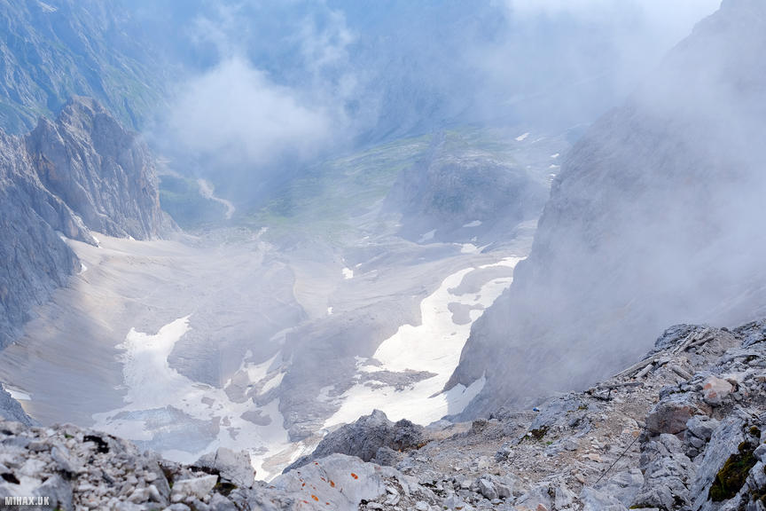
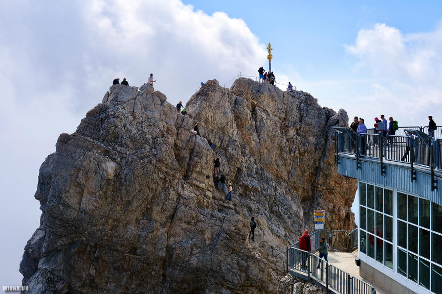
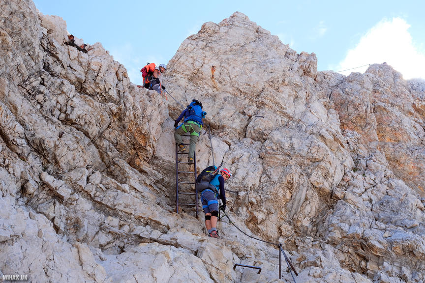
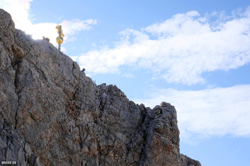
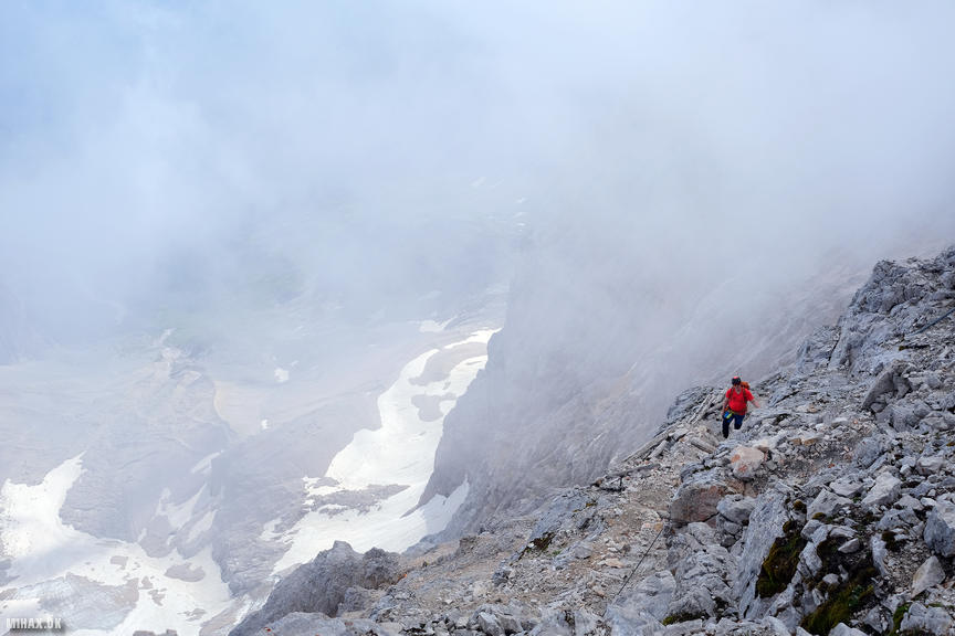
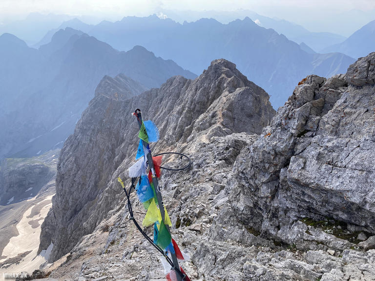
The summit complex is a substantial facility spanning both German and Austrian territory, with restaurants, viewing platforms, and a small museum. After exploring the building and taking in the initial views, I located a staircase leading down to an access gate onto the mountain itself. From here, a short section of fixed ropes and metal rungs provides access to the true summit, requiring careful footwork but presenting no serious difficulty.
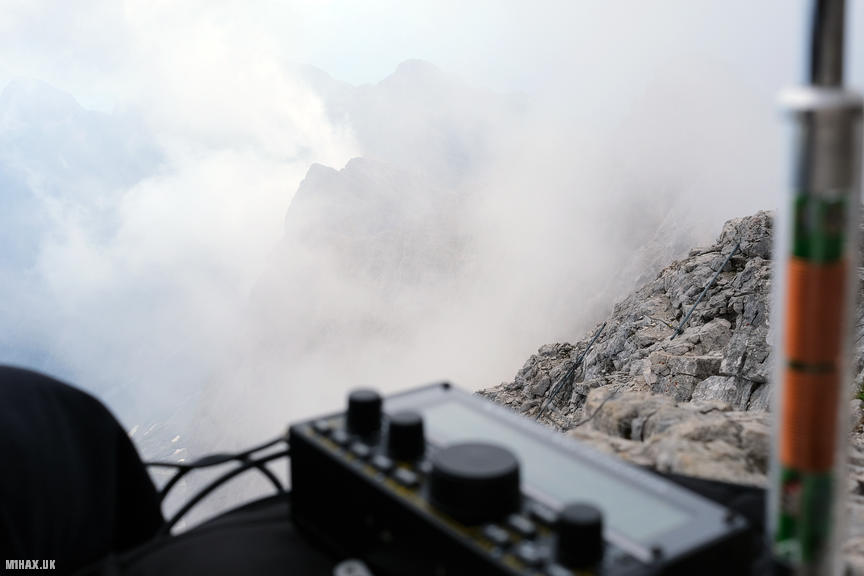
I descended a short distance below the main walking route to find a relatively quiet spot on some rocks for my activation. Setting up the Elecraft KX2 with the AX1 antenna, I worked both 20m and 17m SSB, completing six contacts including a summit to summit with Alex DH2ID/P on DM/BW-284. The highlight was working Makoto JI0LQJ/0 in Japan on 17m SSB, a QRP DX personal best of approximately 9300km - demonstrating the excellent propagation available from this lofty position!
Whether due to the breathtaking views or the genuine altitude, the air felt noticeably thinner than at ground level. Below me, I could see climbers completing the Klettersteig ascent routes from the Hollental and Reintal valleys, their efforts making my cable car approach feel almost indulgent by comparison. This was one of the easiest ten-point SOTA activations I have completed, and at 2962 metres, my highest altitude activation to date.
The cable car tickets are expensive, but the experience of standing atop Germany’s highest peak with views extending across more than 400 Alpine summits makes for an unforgettable visit. For those seeking a more challenging approach, the various Klettersteig routes offer genuine mountaineering adventures, though they require significantly more time, fitness, and technical competence.
Photos
Below are some photographs taken during my activation of Zugspitze on Saturday 27th July, 2024.

Walking Route for Zugspitze
The interactive map below shows my GPS track taken to the SOTA activation zone for Zugspitze. The DL/WS-001 summit area is marked on the map with a blue pin icon.
You can download the route shown above as a GPX file suitable for use with most GPS devices. This file is provided for information only, to support your own walk planning and research (it may contain navigation errors, detours and/or safety hazards). The route downloads provided here are governed by the Creative Commons BY-NC-SA 4.0 licence.
Station Log
I logged the following 6 amateur radio contacts operating as DL/M1HAX/P from DL/WS-001 Zugspitze on Saturday 27th July, 2024 (all times shown are UTC):
| Time | Callsign | Band | Mode | Notes |
|---|---|---|---|---|
| 07:19 | SM4CJM | 20m | SSB | Hans, 5/5 |
| 07:19 | SV1RVJ | 20m | SSB | Kyriakos, 5/3 |
| 07:22 | DJ2MX | 20m | SSB | Mario, 5/2 |
| 07:31 | DH2ID/P | 17m | SSB | Alex, 5/1, S2S DM/BW-284 |
| 07:33 | DJ2MX | 17m | SSB | Mario, 5/5 |
| 07:37 | JI0LQJ/0 | 17m | SSB | Makoto, 5/5 |
In the notes field I will usually log the other operator’s name and the signal report they provided. In accordance with the Summits on the Air rules, I do not make a log entry where a complete exchange of callsigns and signal reports was unsuccessful.
Additional Information
The following resources may be helpful to walkers, mountaineers and SOTA activators interested in Zugspitze:
- Sotl.as Summit Page for DL/WS-001 Zugspitze.
- Peak Bagger Page for Zugspitze.
- Google Maps Page for Zugspitze.
- Wikipedia entry for Zugspitze.
If you found this content valuable, why not Buy Me a Coffee?