Disgwylfa Fawr - GW/MW-038 SOTA (2025)
Summits on the Air Activation Report
Activation Date: Sunday 9th March, 2025.
Activator(s): Richard M1HAX.
Summit: Disgwylfa Fawr, Mid Wales, Wales.
Summit ID: SOTA reference GW/MW-038 (2+3 points).
Summit Height: 507m elevation, 154m prominence.
Summit Location: Lat./Long. 52.44599, -3.85931. Maidenhead Grid IO82bk.
Distance: 3.1km travelled with 215m of ascent.
Difficulty: SAC Grade T2.(?)
Elapsed Time: 1h 5m (including operating).
Weather: 17°C, clear, 11kph ESE wind, 44% humidity.
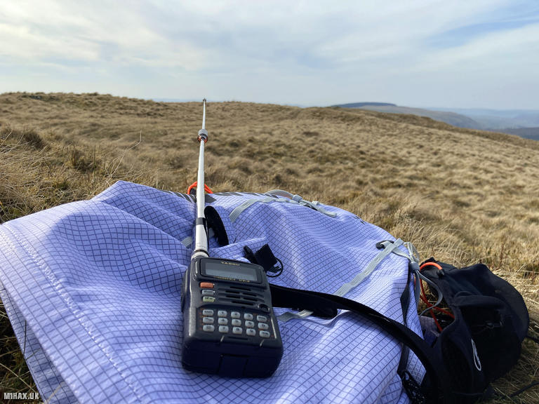
Radio Equipment: Yaesu VX6, Diamond RH-770.
Callsign Used: MW1HAX/P.
Contacts: 6 (2m FM, 70cm FM).
Trip Notes
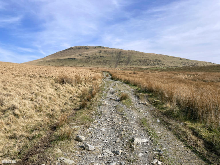
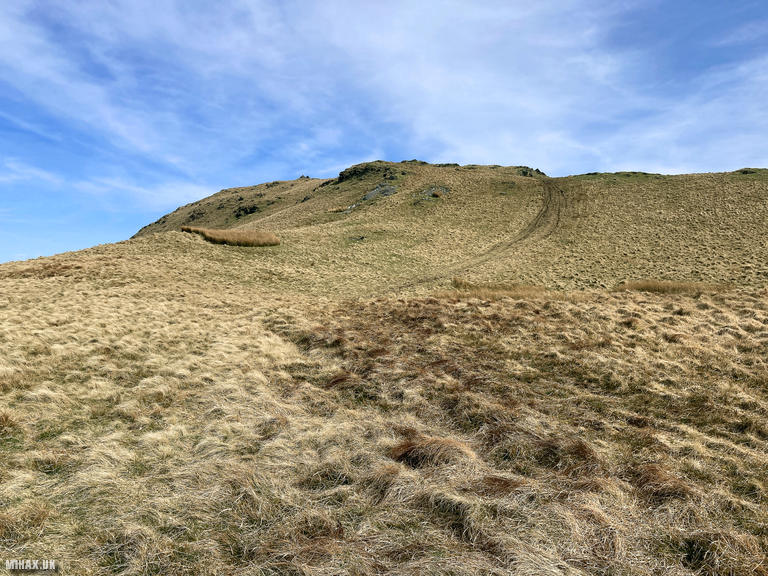
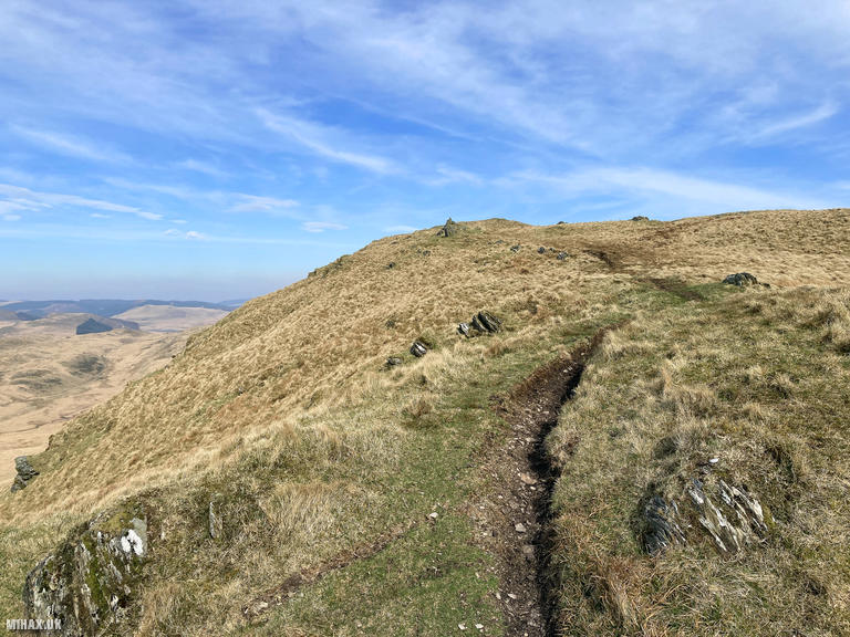
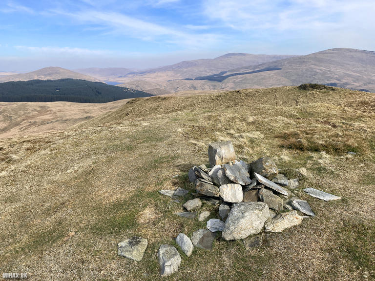
Disgwylfa Fawr (507m) is a characterful hill in the remote Pumlumon area of the Cambrian Mountains in Mid Wales. The name translates roughly as ‘great lookout’, an apt description given the views toward the higher peaks of Pumlumon Fawr (752m) and Y Garn that dominate the northeastern skyline. With 154 metres of prominence, the summit qualifies as a Marilyn and offers a genuine sense of wilderness rarely found in southern Britain. A small stone cairn marks the highest point on an otherwise featureless grassy ridge.
I paired this walk with a separate hike up Pumlumon Fawr (GW/MW-001) earlier in the day, achieving fourteen points including the winter bonus that applies during the colder months. This was also an initial test for my new Mammut Trion 15 lightweight alpine backpack, which performed excellently.
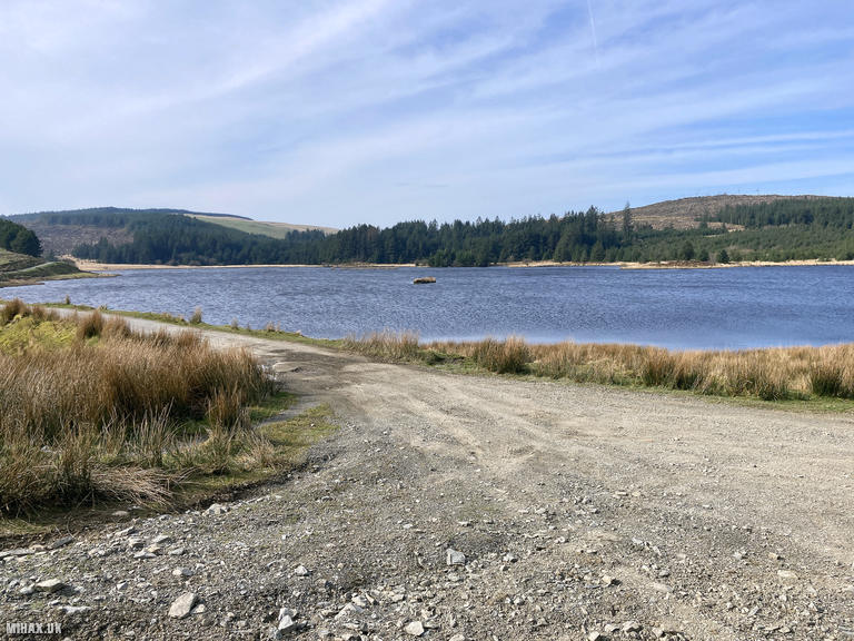
The approach by car from the west follows a narrow mountain road past Llyn Pendam toward Llyn Syfydrin. A warning sign near the final section advises against vehicular access, but I continued on to use the start point reported by other SOTA activators. The road condition beyond this point was very poor and I would not repeat this decision. Future visitors should consider parking at the sign and walking the extra distance.
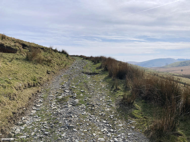
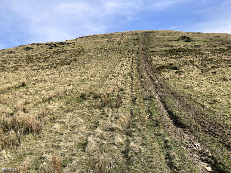
From the quarry workings near Llyn Syfydrin, a farm track heads southeast before the route progresses directly up the visible hillside. This climb is steep and pathless in places. On the return leg, I opted to descend the gentler southwestern slope rather than retrace my steps, which proved more comfortable.
To my satisfaction I was able to complete this activation using only my Yaesu VX6 handheld radio with a Diamond RH-770 antenna. The two-metre band was reasonably active, and I made six contacts including three summit-to-summit with Viki MW6BWA/P and M0JLA/P both on GW/SW-004, with Viki also providing a 70cm contact. Additionally, I worked two mobile stations in the area.
This is a fairly remote feeling and picturesque hill that I would recommend for those seeking solitude in the Welsh uplands. Just be cautious about driving conditions on the final approach road.
Photos
Below are some photographs taken during my activation of Disgwylfa Fawr on Sunday 9th March, 2025.

Walking Route for Disgwylfa Fawr
The interactive map below shows my GPS track taken to the SOTA activation zone for Disgwylfa Fawr. The GW/MW-038 summit area is marked on the map with a blue pin icon.
You can download the route shown above as a GPX file suitable for use with most GPS devices. This file is provided for information only, to support your own walk planning and research (it may contain navigation errors, detours and/or safety hazards). The route downloads provided here are governed by the Creative Commons BY-NC-SA 4.0 licence.
Station Log
I logged the following 6 amateur radio contacts operating as MW1HAX/P from GW/MW-038 Disgwylfa Fawr on Sunday 9th March, 2025 (all times shown are UTC):
| Time | Callsign | Band | Mode | Notes |
|---|---|---|---|---|
| 13:05 | MW0XDK | 2m | FM | s59 r59 |
| 13:07 | MW6BWA/P | 2m | FM | s58 r55, S2S GW/SW-004 |
| 13:08 | MW0JLA/P | 2m | FM | s58 r56, S2S GW/SW-004 |
| 13:10 | MW3ZCB/M | 2m | FM | s57 r57 |
| 13:10 | MW1MAJ/M | 2m | FM | s57 r57 |
| 13:12 | MW6BWA/P | 70cm | FM | s56 r51, S2S GW/SW-004 |
In the notes field I will usually log the other operator’s name and the signal report they provided. In accordance with the Summits on the Air rules, I do not make a log entry where a complete exchange of callsigns and signal reports was unsuccessful.
Additional Information
The following resources may be helpful to walkers, mountaineers and SOTA activators interested in Disgwylfa Fawr:
- Sotl.as Summit Page for GW/MW-038 Disgwylfa Fawr.
- Hill Bagging UK Summit Page for Disgwylfa Fawr.
- Google Maps Page for Disgwylfa Fawr.
- Wikipedia entry for Disgwylfa Fawr.
If you found this content valuable, why not Buy Me a Coffee?