Crowborough - G/SE-007 SOTA (2025)
Summits on the Air Activation Report
Activation Date: Sunday 13th April, 2025.
Activator(s): Richard M1HAX.
Summit: Crowborough, Southern England, England.
Summit ID: SOTA reference G/SE-007 (1 point).
Summit Height: 242m elevation, 159m prominence.
Summit Location: Lat./Long. 51.05510, 0.15387. Maidenhead Grid JO01bb.
Distance: 0.2km travelled with 0m of ascent.
Difficulty: SAC Grade T1.(?)
Elapsed Time: 20m (including operating).
Weather: 14°C, cloudy, 19kph SW wind, 65% humidity.
Radio Equipment: Elecraft KX2, Elecraft AX1.
Callsign Used: M1HAX/P.
Contacts: 5 (20m SSB).
Trip Notes
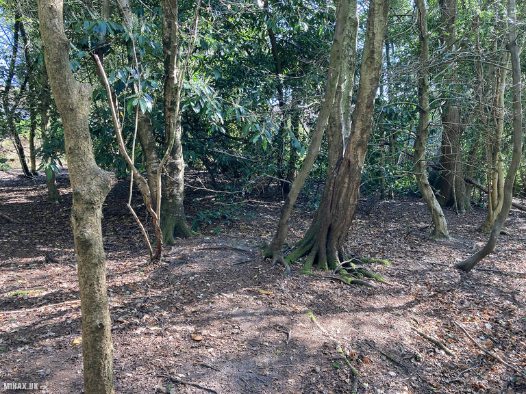
Crowborough presents an unusual challenge for SOTA activators: the highest point lies within the town itself, making this more of an urban activation than a hill walk. The large activation zone means there are several options for operating positions, but none offer the sense of wilderness typically associated with SOTA. This was my first summit on Sunday morning as I continued working through the G/SE region.
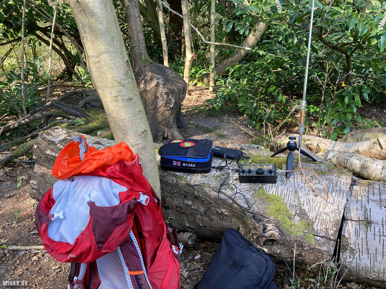
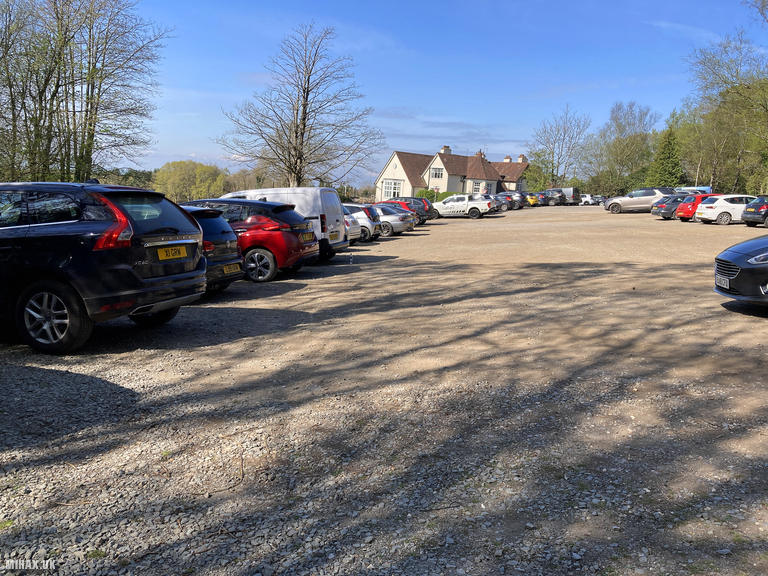
I parked at the Crowborough Beacon Golf Club car park and walked a short distance into the adjacent woodland, finding a felled tree that provided a suitable operating position. The Elecraft KX2 and AX1 antenna were quickly deployed.
Five contacts were made on 20m SSB, including a S2S with EA6/DK1ZX/P on EA6/MA-065 in Mallorca. The activation was completed in approximately twenty minutes before I returned through the woodland to the car.
Much like Detling Hill which I would visit later that day, this summit was uninspiring from a hillwalking perspective. I was glad to tick it off and move on to more interesting destinations. For those seeking to complete all G/SE summits, Crowborough is simply one that must be done rather than one to savour.
Photos
Below are some photographs taken during my activation of Crowborough on Sunday 13th April, 2025.

Walking Route for Crowborough
The interactive map below shows my GPS track taken to the SOTA activation zone for Crowborough. The G/SE-007 summit area is marked on the map with a blue pin icon.
You can download the route shown above as a GPX file suitable for use with most GPS devices. This file is provided for information only, to support your own walk planning and research (it may contain navigation errors, detours and/or safety hazards). The route downloads provided here are governed by the Creative Commons BY-NC-SA 4.0 licence.
Station Log
I logged the following 5 amateur radio contacts operating as M1HAX/P from G/SE-007 Crowborough on Sunday 13th April, 2025 (all times shown are UTC):
| Time | Callsign | Band | Mode | Notes |
|---|---|---|---|---|
| 09:32 | OE3GGS | 20m | SSB | s55 r55 |
| 09:32 | EA7GV | 20m | SSB | s56 r53 |
| 09:34 | OE3GKQ | 20m | SSB | s55 r47 |
| 09:38 | EA6/DK1ZX/P | 20m | SSB | s53 r54, S2S EA6/MA-065 |
| 09:40 | SV3IEG | 20m | SSB | s57 r56 |
In the notes field I will usually log the other operator’s name and the signal report they provided. In accordance with the Summits on the Air rules, I do not make a log entry where a complete exchange of callsigns and signal reports was unsuccessful.
Additional Information
The following resources may be helpful to walkers, mountaineers and SOTA activators interested in Crowborough:
- Sotl.as Summit Page for G/SE-007 Crowborough.
- Hill Bagging UK Summit Page for Crowborough.
- Google Maps Page for Crowborough.
- Wikipedia entry for Crowborough.
If you found this content valuable, why not Buy Me a Coffee?