Ditchling Beacon - G/SE-006 SOTA (2025)
Summits on the Air Activation Report
Activation Date: Saturday 12th April, 2025.
Activator(s): Richard M1HAX.
Summit: Ditchling Beacon, Southern England, England.
Summit ID: SOTA reference G/SE-006 (1 point).
Summit Height: 248m elevation, 214m prominence.
Summit Location: Lat./Long. 50.90174, -0.10763. Maidenhead Grid IO90wv.
Distance: 0.5km travelled with 15m of ascent.
Difficulty: SAC Grade T1.(?)
Elapsed Time: 20m (including operating).
Weather: 18°C, cloudy, 9kph S wind, 47% humidity.
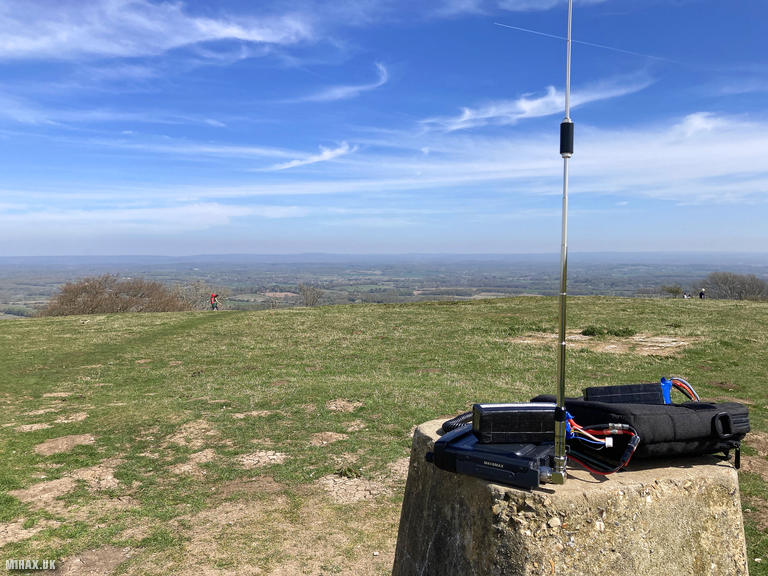
Radio Equipment: Yaesu FTM100D, Diamond RH-770, Zippy 4200mAh 4S LiFePo4.
Callsign Used: M1HAX/P.
Contacts: 4 (2m FM).
Trip Notes
Ditchling Beacon (248m) is the highest point in East Sussex and has served as a warning beacon site since at least the Elizabethan era. The summit was once an Iron Age hillfort, with defensive ramparts still visible on the north and east sides enclosing approximately 5.5 hectares. The steep northern escarpment provided a natural defensive position commanding the Low Weald below. Today the site is managed by the National Trust and Sussex Wildlife Trust, recognised as a Site of Special Scientific Interest for its chalk grassland flora.
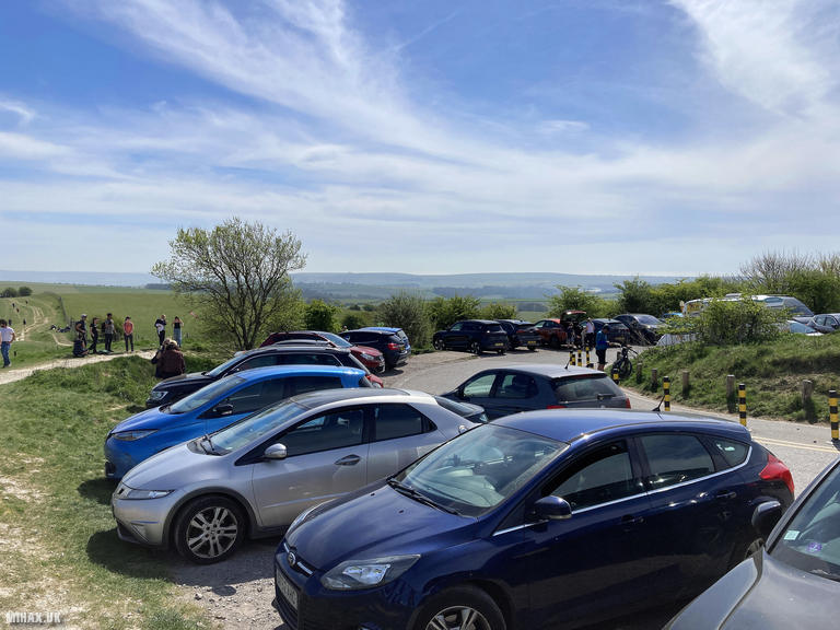
I had crossed Ditchling Beacon several times in the past when cycling the London to Brighton charity bike ride, but this was my first time visiting on foot for a SOTA activation. Access could not be simpler: a steep, narrow road climbs directly from Ditchling village to a pay and display car park at the summit.
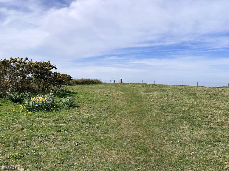
The walk to the trig point from the car park took perhaps five minutes on gently sloping ground. I set up my Yaesu FTM100D using the trig point as an operating stand and made four quick contacts on 2m FM. The entire visit took around twenty minutes.
I would not recommend visiting this summit on a weekend. The small car park was exceptionally busy, with vehicles still circling looking for spaces when I departed. There is no alternative parking nearby. Approaching by bicycle would be well suited to this location, avoiding the parking difficulties entirely.
Photos
Below are some photographs taken during my activation of Ditchling Beacon on Saturday 12th April, 2025.

Walking Route for Ditchling Beacon
The interactive map below shows my GPS track taken to the SOTA activation zone for Ditchling Beacon. The G/SE-006 summit area is marked on the map with a blue pin icon.
You can download the route shown above as a GPX file suitable for use with most GPS devices. This file is provided for information only, to support your own walk planning and research (it may contain navigation errors, detours and/or safety hazards). The route downloads provided here are governed by the Creative Commons BY-NC-SA 4.0 licence.
Station Log
I logged the following 4 amateur radio contacts operating as M1HAX/P from G/SE-006 Ditchling Beacon on Saturday 12th April, 2025 (all times shown are UTC):
| Time | Callsign | Band | Mode | Notes |
|---|---|---|---|---|
| 11:31 | M1ELK/M | 2m | FM | s59 r57 |
| 11:34 | G8DUK | 2m | FM | s59 r41 |
| 11:35 | M0RDV | 2m | FM | s58 r59 |
| 11:37 | M0WWJ | 2m | FM | s59 r49 |
In the notes field I will usually log the other operator’s name and the signal report they provided. In accordance with the Summits on the Air rules, I do not make a log entry where a complete exchange of callsigns and signal reports was unsuccessful.
Additional Information
The following resources may be helpful to walkers, mountaineers and SOTA activators interested in Ditchling Beacon:
- Sotl.as Summit Page for G/SE-006 Ditchling Beacon.
- Hill Bagging UK Summit Page for Ditchling Beacon.
- Google Maps Page for Ditchling Beacon.
- Wikipedia entry for Ditchling Beacon.
If you found this content valuable, why not Buy Me a Coffee?