Brown Willy - G/DC-002 SOTA (2025)
Summits on the Air Activation Report
Activation Date: Saturday 7th June, 2025.
Activator(s): Richard M1HAX.
Summit: Brown Willy, Devon & Cornwall, England.
Summit ID: SOTA reference G/DC-002 (1 point).
Summit Height: 420m elevation, 314m prominence.
Summit Location: Lat./Long. 50.59059, -4.60274. Maidenhead Grid IO70qo.
Distance: 6.5km travelled with 343m of ascent.
Difficulty: SAC Grade T1.(?)
Elapsed Time: 2h 10m (including operating).
Weather: 12°C, light rain, 19kph WSW wind, 98% humidity.
Radio Equipment: Elecraft KX2, Elecraft AX1.
Callsign Used: M1HAX/P.
Contacts: 5 (20m SSB).
Trip Notes
Brown Willy, at 420 metres, is the highest point in Cornwall and the summit of Bodmin Moor. The name derives from the Cornish Bronn Wennili, meaning “hill of swallows”, though historian Henry Jenner suggested it might come from bronn ewhella meaning “highest hill”. The summit bears two Bronze Age cairns that have never been excavated - local folklore suggests an ancient Cornish king lies entombed beneath one of them. With 322 metres of prominence, Brown Willy qualifies as a Marilyn and holds the title of County High for Cornwall. The hill is also responsible for a meteorological phenomenon known as the “Brown Willy Effect”, where heavy showers develop over the moor and travel downwind to produce severe localised flooding, most notably at Boscastle in 2004.
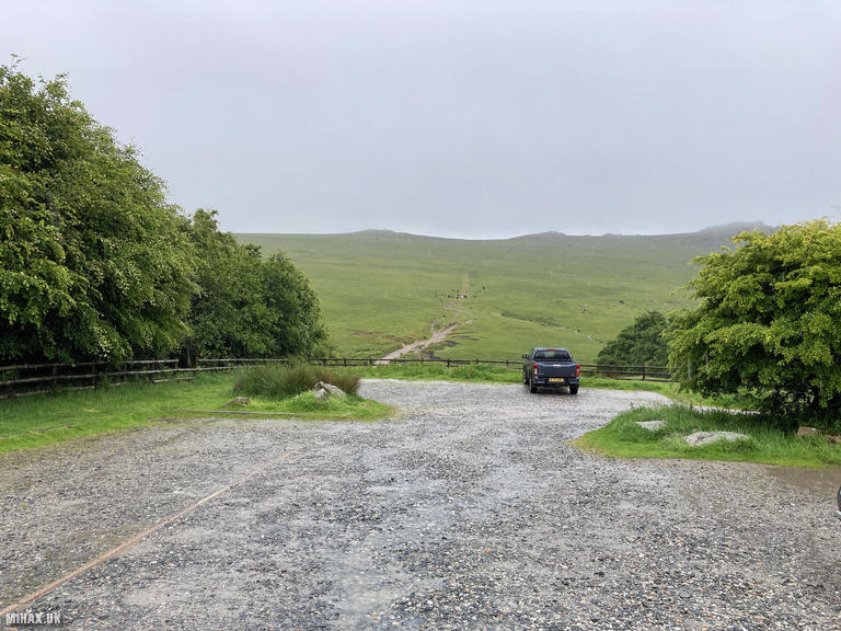
I chose to approach Brown Willy via Rough Tor to the northwest. An alternative route approaches from the southeast at Codda, convenient for those travelling on the A30 near Jamaica Inn. A generous gravel parking area marks the start point, and despite steady rain there were several other visitors present.
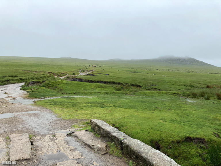
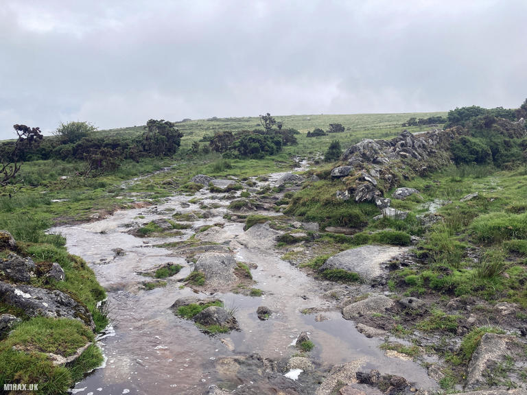
Setting off from the car park, I headed southeast with Rough Tor visible in the distance. A large number of cattle blocked the footpath, so I detoured around them keeping a safe distance. My route aimed for the saddle between Showery Tor - aptly named given the conditions - and Rough Tor. Beyond this point the path descends towards a bridge over the De Lank River, one of several watercourses rising on these moors.
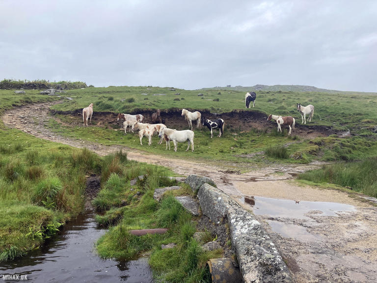
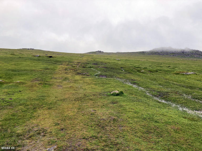
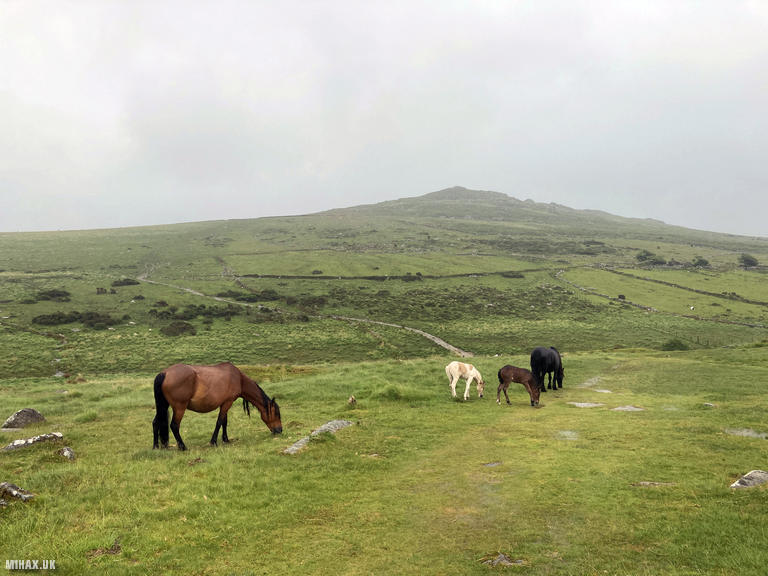
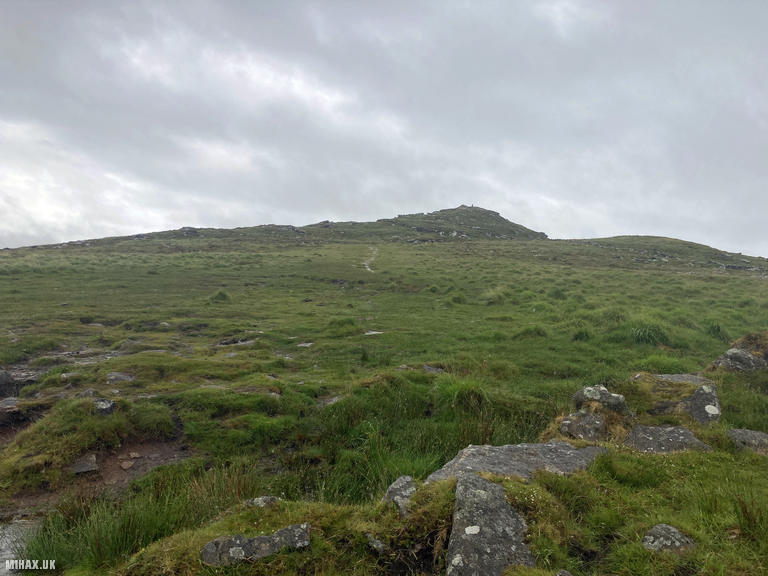
At the bridge I encountered a group of wild ponies sheltering from the weather, and they seemed distinctly unhappy to see me. Fortunately, a stile immediately after the bridge allowed me to put a fence between us before continuing. The conditions were thoroughly wet, with some paths degrading into muddy streams. The trig point on Brown Willy became visible in the distance as the route followed a grassy path up to the summit.
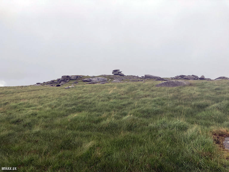
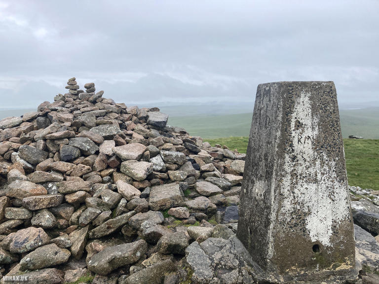
Arriving at the top, I found the trig point standing alongside a substantial stone cairn. Views today were limited given the weather, though on clearer days the panorama extends to both coasts of Cornwall.
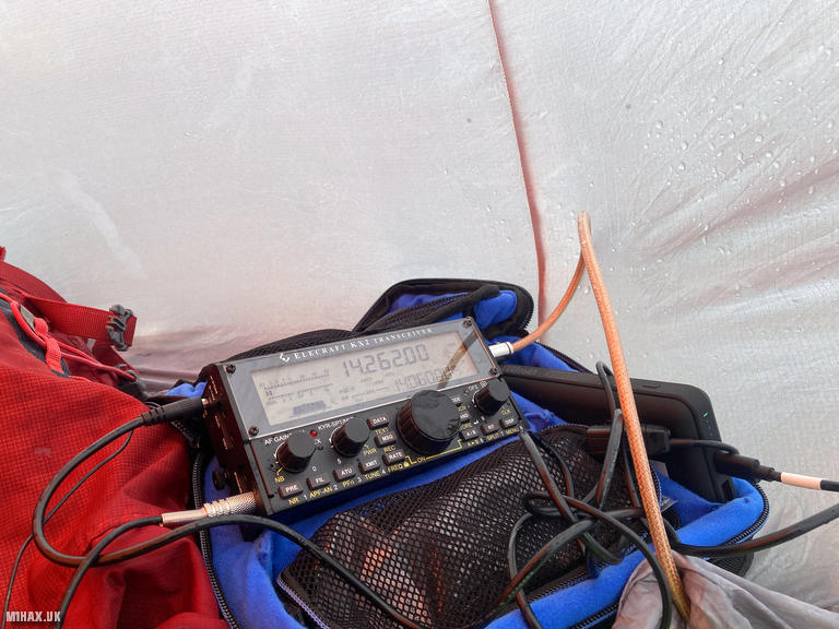
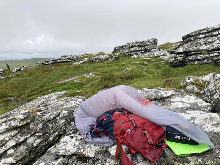
For radio operations, I set up on one of the many rocky outcrops near the summit. With persistent rain, I resorted to operating my Elecraft KX2 inside my lightweight storm shelter - essential given the radio’s lack of weather-proofing. Using the compact AX1 antenna, I managed five contacts on the 20-metre band before happily packing away the kit.
The damp return journey followed the same route as my approach. From here I drove towards Watch Croft for a second activation later that day.
Photos
Below are some photographs taken during my activation of Brown Willy on Saturday 7th June, 2025.

Walking Route for Brown Willy
The interactive map below shows my GPS track taken to the SOTA activation zone for Brown Willy. The G/DC-002 summit area is marked on the map with a blue pin icon.
You can download the route shown above as a GPX file suitable for use with most GPS devices. This file is provided for information only, to support your own walk planning and research (it may contain navigation errors, detours and/or safety hazards). The route downloads provided here are governed by the Creative Commons BY-NC-SA 4.0 licence.
Station Log
I logged the following 5 amateur radio contacts operating as M1HAX/P from G/DC-002 Brown Willy on Saturday 7th June, 2025 (all times shown are UTC):
| Time | Callsign | Band | Mode | Notes |
|---|---|---|---|---|
| 13:34 | DG0JMB | 20m | SSB | |
| 13:35 | SQ9MDF | 20m | SSB | |
| 13:35 | OE5PZM | 20m | SSB | |
| 13:42 | IN3KDD | 20m | SSB | |
| 13:44 | EA2DDG | 20m | SSB |
In the notes field I will usually log the other operator’s name and the signal report they provided. In accordance with the Summits on the Air rules, I do not make a log entry where a complete exchange of callsigns and signal reports was unsuccessful.
Additional Information
The following resources may be helpful to walkers, mountaineers and SOTA activators interested in Brown Willy:
- Sotl.as Summit Page for G/DC-002 Brown Willy.
- Hill Bagging UK Summit Page for Brown Willy.
- Google Maps Page for Brown Willy.
- Wikipedia entry for Brown Willy.
If you found this content valuable, why not Buy Me a Coffee?