Penycloddiau - GW/NW-054 SOTA (2025)
Summits on the Air Activation Report
Activation Date: Sunday 17th August, 2025.
Activator(s): Richard M1HAX.
Summit: Penycloddiau, North Wales, Wales.
Summit ID: SOTA reference GW/NW-054 (1 point).
Summit Height: 440m elevation, 157m prominence.
Summit Location: Lat./Long. 53.20090, -3.30815. Maidenhead Grid IO83ie.
Distance: 3.4km travelled with 153m of ascent.
Difficulty: SAC Grade T1.(?)
Elapsed Time: 2h (including operating).
Weather: 18°C, sunny, 9kph SSE wind, 66% humidity.
Radio Equipment: Yaesu FTM100D, Slim-J, Zippy 4200mAh 4S LiFePo4, Elecraft KX2, AX1.
Callsign Used: MW1HAX/P.
Contacts: 27 (2m FM, 20m SSB).
Trip Notes
Penycloddiau, meaning “Hill of the Ditches” in Welsh, is crowned by one of the largest Iron Age hillforts in Wales. Enclosing approximately 21 hectares within its multiple concentric ramparts, the fort dates back to around 500 BCE, though archaeological excavations by Liverpool University between 2012 and 2018 uncovered Bronze Age artefacts suggesting human activity here 4,000 years ago. Rising to 440 metres in the Clwydian Range, this Marilyn offers one SOTA point and is crossed by the Offa’s Dyke Path.
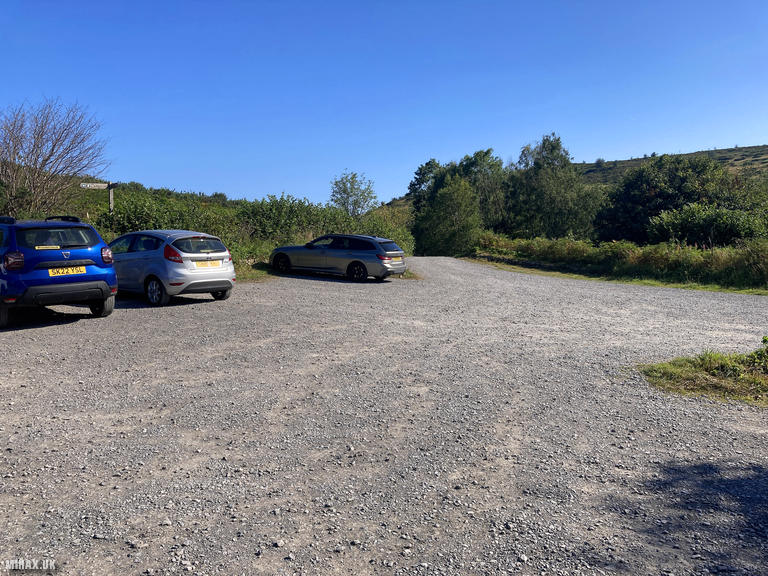
After a lengthy drive along single-track roads, I arrived at the spacious free gravel car park. The area proved popular with families and dog walkers, unsurprising given the excellent walking terrain. An information board in the car park displays various walking routes through the area.
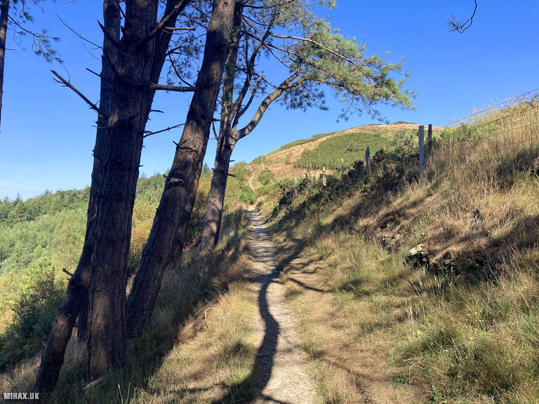
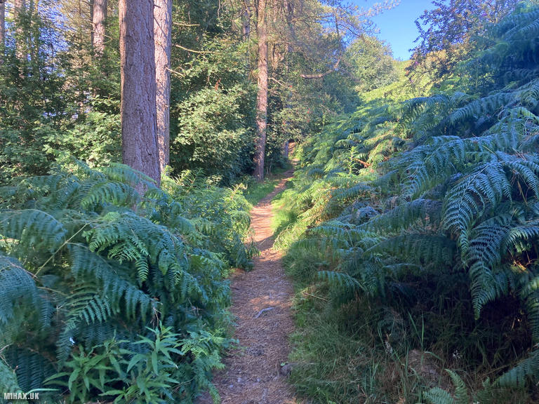
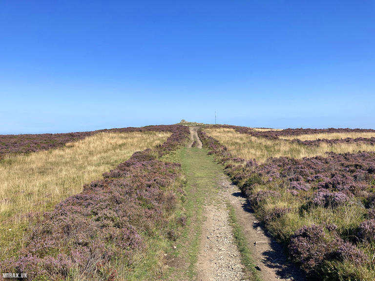
The weather was warm and sunny with dry conditions underfoot - perfect for hillwalking. My route began along a well-established footpath through a plantation of Scandinavian conifers interspersed with ferns, creating a rather pretty atmosphere. After less than a kilometre, the path turned north-northwest towards the summit, leaving the forest behind and crossing open heather moorland.
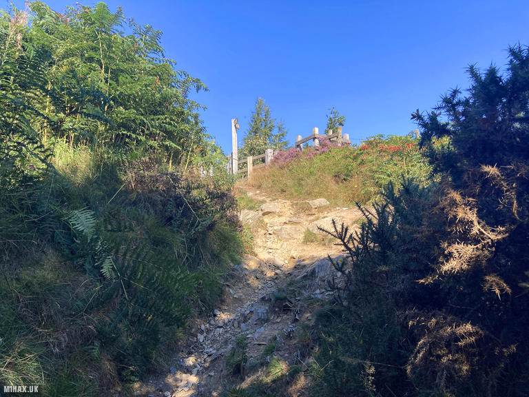
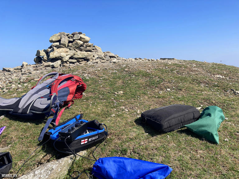
An obvious stone path led up to the summit cairn and the reconstructed Bronze Age burial mound. The wind was notably stronger at the top. While there was a convenient sheltered hollow nearby, it was occupied by other walkers, so I set up my station perched on the ancient stones instead.
Enjoying the weather and expansive views across the Clwydian Range, I operated for about 45 minutes. The 2-metre band proved exceptionally productive with my Yaesu FTM100D and Slim-J antenna - I worked 23 stations on FM. Switching to my Elecraft KX2 with the AX1 antenna, I added four more contacts on 20-metre SSB, reaching Finland, Spain, Slovenia, and Sweden. With 27 contacts logged, this was an unusually busy activation for a Welsh one-point SOTA summit.
I returned to the car via the same route, thoroughly satisfied with this delightful walk. Penycloddiau is an absolutely lovely picturesque hill which I would happily revisit.
Photos
Below are some photographs taken during my activation of Penycloddiau on Sunday 17th August, 2025.

Walking Route for Penycloddiau
The interactive map below shows my GPS track taken to the SOTA activation zone for Penycloddiau. The GW/NW-054 summit area is marked on the map with a blue pin icon.
You can download the route shown above as a GPX file suitable for use with most GPS devices. This file is provided for information only, to support your own walk planning and research (it may contain navigation errors, detours and/or safety hazards). The route downloads provided here are governed by the Creative Commons BY-NC-SA 4.0 licence.
Station Log
I logged the following 27 amateur radio contacts operating as MW1HAX/P from GW/NW-054 Penycloddiau on Sunday 17th August, 2025 (all times shown are UTC):
| Time | Callsign | Band | Mode | Notes |
|---|---|---|---|---|
| 09:50 | 2E0JWA | 2m | FM | RX: 59, TX: 59 |
| 09:55 | G6AEK | 2m | FM | RX: 54, TX: 59 |
| 09:56 | 2E0RIP | 2m | FM | RX: 54, TX: 54 |
| 09:56 | MW7MWZ | 2m | FM | RX: 59, TX: 59 |
| 09:57 | M7SZY | 2m | FM | RX: 59, TX: 57 |
| 09:58 | 2E0SEY | 2m | FM | RX: 59, TX: 59 |
| 09:59 | 2E0JCM | 2m | FM | RX: 55, TX: 57 |
| 10:00 | G8NNL | 2m | FM | RX: 59, TX: 59 |
| 10:00 | M0LOR | 2m | FM | RX: 59, TX: 59 |
| 10:01 | GW4VPX | 2m | FM | RX: 51, TX: 59 |
| 10:05 | G7ICY | 2m | FM | RX: 59, TX: 59 |
| 10:07 | G4UKV | 2m | FM | RX: 57, TX: 59 |
| 10:07 | M1AOB | 2m | FM | RX: 56, TX: 59 |
| 10:08 | 2E0VBE | 2m | FM | RX: 59, TX: 59 |
| 10:08 | M6KWB | 2m | FM | RX: 57, TX: 57 |
| 10:10 | M7OSX | 2m | FM | RX: 59, TX: 59 |
| 10:10 | G7SXR | 2m | FM | RX: 42, TX: 53 |
| 10:11 | 2E0HPS | 2m | FM | RX: 57, TX: 58 |
| 10:12 | G0TFD | 2m | FM | RX: 57, TX: 58 |
| 10:12 | G4JNN | 2m | FM | RX: 58, TX: 59 |
| 10:13 | M6BLV | 2m | FM | RX: 59, TX: 59 |
| 10:16 | G6JJI | 2m | FM | RX: 59, TX: 56 |
| 10:17 | G4BLH | 2m | FM | RX: 59, TX: 59 |
| 10:31 | OH3GZ | 20m | SSB | RX: 55, TX: 44 |
| 10:32 | EA1HFQ/P | 20m | SSB | RX: 51, TX: 52 |
| 10:33 | S57S | 20m | SSB | RX: 57, TX: 58 |
| 10:34 | SA4BLM | 20m | SSB | RX: 55, TX: 58 |
In the notes field I will usually log the other operator’s name and the signal report they provided. In accordance with the Summits on the Air rules, I do not make a log entry where a complete exchange of callsigns and signal reports was unsuccessful.
Additional Information
The following resources may be helpful to walkers, mountaineers and SOTA activators interested in Penycloddiau:
- Sotl.as Summit Page for GW/NW-054 Penycloddiau.
- Hill Bagging UK Summit Page for Penycloddiau.
- Google Maps Page for Penycloddiau.
- Wikipedia entry for Penycloddiau.
If you found this content valuable, why not Buy Me a Coffee?