Allt y Main - GW/NW-059 SOTA (2025)
Summits on the Air Activation Report
Activation Date: Tuesday 16th September, 2025.
Activator(s): Richard M1HAX.
Summit: Allt y Main, North Wales, Wales.
Summit ID: SOTA reference GW/NW-059 (1 point).
Summit Height: 356m elevation, 171m prominence.
Summit Location: Lat./Long. 52.72745, -3.24215. Maidenhead Grid IO82jr.
Distance: 6.1km travelled with 275m of ascent.
Difficulty: SAC Grade T1.(?)
Elapsed Time: 1h 40m (including operating).
Weather: 11°C, cloudy, 30kph W wind, 87% humidity.
Radio Equipment: Yaesu FTM100D, Slim-J, Zippy 4200mAh 4S LiFePo4.
Callsign Used: MW1HAX/P.
Contacts: 5 (2m FM).
Trip Notes
Allt y Main rises to 356 metres in the hills west of Welshpool, its name translating from Welsh as “the wooded slope of the narrow place” - an apt description of the ridge’s slender form. With 171 metres of prominence, this Marilyn qualifies for one SOTA point. The summit lies in relatively quiet countryside between Meifod and Llanfair Caereinion, seeing fewer activations than many Welsh hills and appearing on historical “Most Wanted” lists for the GW/NW region.
This was the first of five separate hill walks planned for a weekday raid on small Marilyn summits in Wales. I parked in a secluded layby on the A495 road to the east of the summit, beginning my walk shortly after 8am. The weather was cool at 11 degrees Celsius with a brisk westerly wind of 30 kilometres per hour and high humidity. Cloud cover was complete, though conditions remained dry throughout.
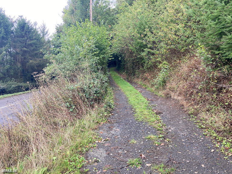
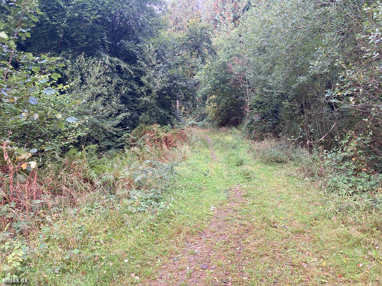
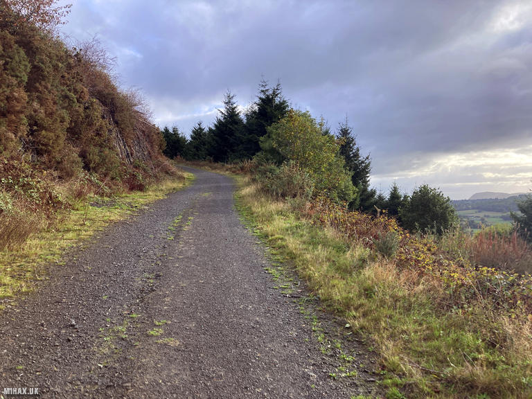
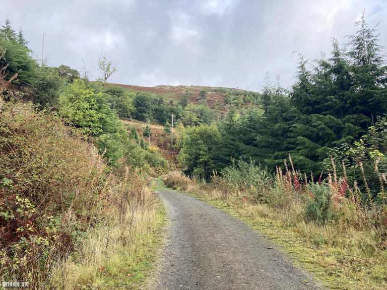
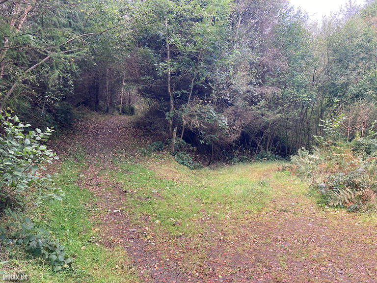
The route follows an obvious and established track weaving its way towards the summit from the road. It initially heads along the base of the hill before turning back to climb northward. Other activators have noted that the signed public footpath can lead into impassable vegetation, so following the forest tracks rather than waymarked paths is advisable.
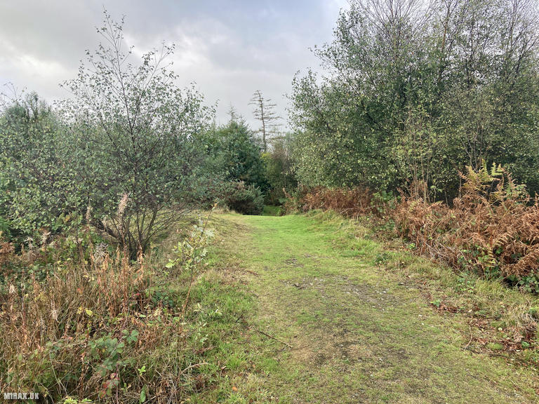
Nearing the summit, the gravel track fades away to a grassy path. It was wet underfoot from overnight dew but still easy walking. At 6.1 kilometres, this is quite a long walk for a one-point summit, with 275 metres of cumulative ascent making it one of the more demanding activations of my day.
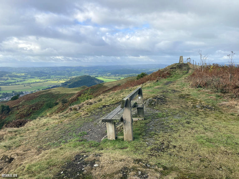
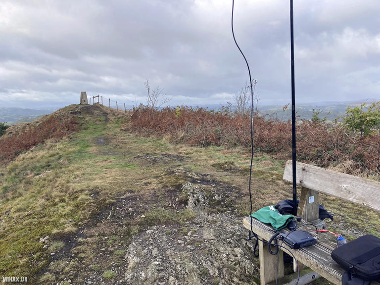
The summit offers great views in every direction across the Welsh border hills. There is an Ordnance Survey trig point and a wooden bench providing an excellent operating position - a welcome feature for SOTA activators.
Setting up my Yaesu FTM100D with the Slim-J antenna, I made a quick early morning activation on 2 metres. The bands were quiet at this hour, but I managed five contacts on FM. Fortunately, several of these stations - including M7SDO, GW4RFT, and G0MHF - would chase me throughout the day’s activities across all five summits.
This is a very pleasant hill which is worth a visit and suitable for all hiking abilities despite its length. The peaceful atmosphere and panoramic views make the extra distance worthwhile.
Photos
Below are some photographs taken during my activation of Allt y Main on Tuesday 16th September, 2025.

Walking Route for Allt y Main
The interactive map below shows my GPS track taken to the SOTA activation zone for Allt y Main. The GW/NW-059 summit area is marked on the map with a blue pin icon.
You can download the route shown above as a GPX file suitable for use with most GPS devices. This file is provided for information only, to support your own walk planning and research (it may contain navigation errors, detours and/or safety hazards). The route downloads provided here are governed by the Creative Commons BY-NC-SA 4.0 licence.
Station Log
I logged the following 5 amateur radio contacts operating as MW1HAX/P from GW/NW-059 Allt y Main on Tuesday 16th September, 2025 (all times shown are UTC):
| Time | Callsign | Band | Mode | Notes |
|---|---|---|---|---|
| 08:31 | M7SDO | 2m | FM | RX: 56, TX: 56 |
| 08:32 | GW4RFT | 2m | FM | RX: 52, TX: 52 |
| 08:33 | G0KSB | 2m | FM | RX: 59, TX: 59 |
| 08:34 | M0PLZ | 2m | FM | RX: 57, TX: 57 |
| 08:34 | G0MHF | 2m | FM | RX: 51, TX: 51 |
In the notes field I will usually log the other operator’s name and the signal report they provided. In accordance with the Summits on the Air rules, I do not make a log entry where a complete exchange of callsigns and signal reports was unsuccessful.
Additional Information
The following resources may be helpful to walkers, mountaineers and SOTA activators interested in Allt y Main:
- Sotl.as Summit Page for GW/NW-059 Allt y Main.
- Hill Bagging UK Summit Page for Allt y Main.
- Google Maps Page for Allt y Main.
- Wikipedia entry for Allt y Main.
If you found this content valuable, why not Buy Me a Coffee?