Brighstone Down - G/SE-012 SOTA (2025)
Summits on the Air Activation Report
Activation Date: Saturday 27th September, 2025.
Activator(s): Richard M1HAX.
Summit: Brighstone Down, Southern England, England.
Summit ID: SOTA reference G/SE-012 (1 point).
Summit Height: 214m elevation, 150m prominence.
Summit Location: Lat./Long. 50.66060, -1.38955. Maidenhead Grid IO90hp.
Distance: 3.6km travelled with 91m of ascent.
Difficulty: SAC Grade T1.(?)
Elapsed Time: 1h 10m (including operating).
Weather: 15°C, clear, 9kph S wind, 77% humidity.
Radio Equipment: Elecraft KX2, Elecraft AX1.
Callsign Used: M1HAX/P.
Contacts: 10 (17m SSB, 20m SSB).
Trip Notes
Brighstone Down rises to 214 metres on the Isle of Wight’s central chalk spine, making it the island’s second-highest summit. The name derives from Anglo-Saxon: Beorhtwigs tun, meaning the farmstead of a man called Beorhtw?g. Historical records show fascinating evolution through Brihtwiston in 1212, Brixton from the sixteenth century onwards, and finally the modern Brighstone. Parish records alternated between the two spellings well into the nineteenth century.
Bronze Age tumuli scattered across the down add archaeological interest. The burial mounds, approximately two metres high, include what may be a disc barrow - potentially the only one on the island. The Tennyson Trail, a popular long-distance path named after the Victorian poet laureate who lived nearby, passes directly beside these ancient burial sites.
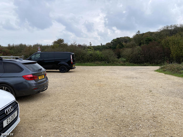
This was my second and final summit to complete the SOTA hills on the Isle of Wight. I drove to a large free gravel parking area beside the road where several mountain bikers were using the car park as their base. Unlike St Boniface Down earlier that morning, this hill required a modest walk of approximately 1.8 kilometres to reach the trig point.
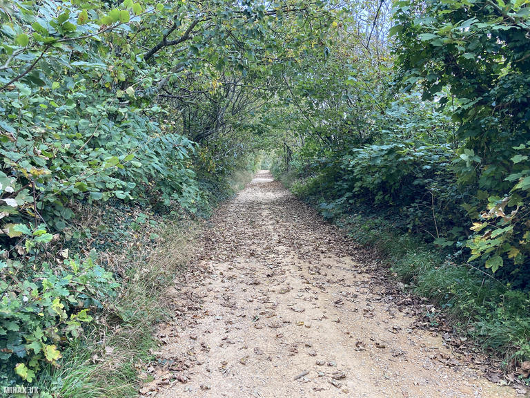
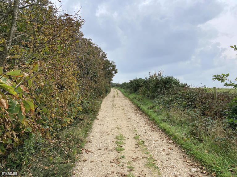
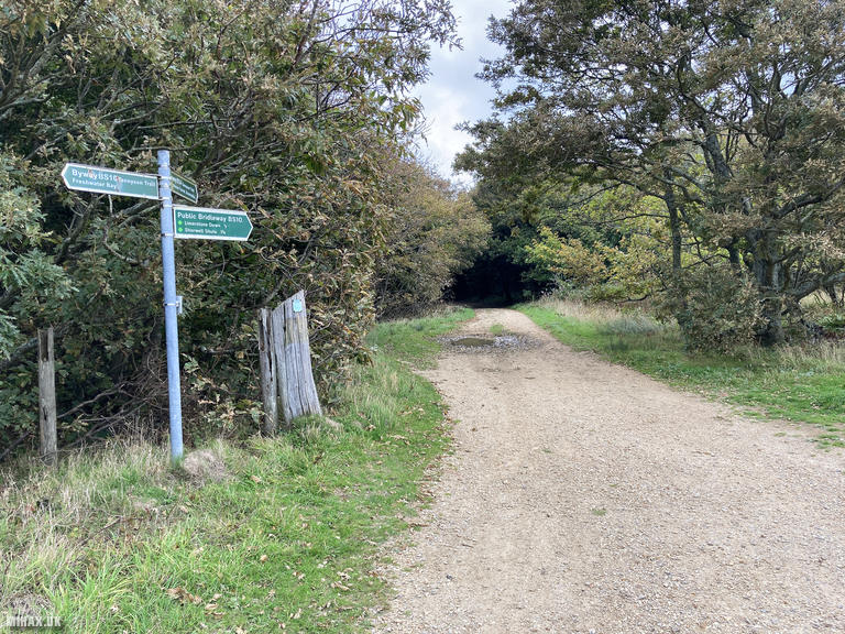
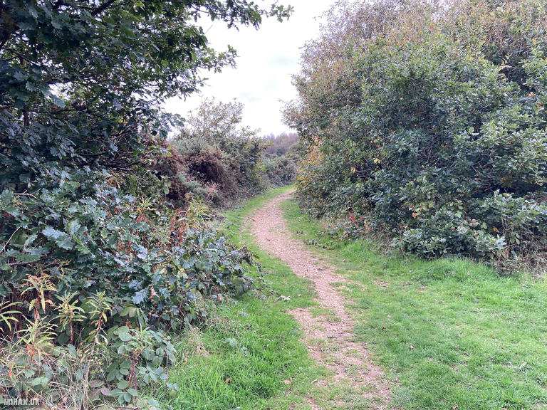
From the car park, I crossed the road to reach a gravel track heading east. At the path junction I bore left, heading north-east. Here lies a maze of paths and trails where careful navigation proves important. Compared to mountain routes I am typically more casual with navigation on these small hills, and as so often happens I took a wrong turn before relocating to find the correct path towards the true summit.
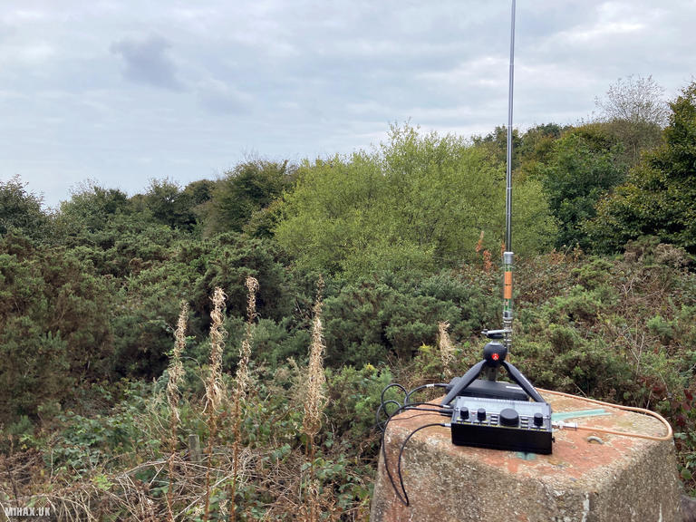
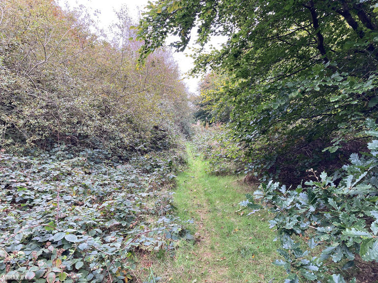
The final approach to the trig point is not immediately obvious, following a narrow trail into woodland off the main path. Previous activators on the SOTA Reflector have noted the summit clearing is surprisingly small: room-sized and surrounded by gorse. This creates genuine antenna challenges, with one activator recommending HF operators be inventive or prepared to battle the vegetation.
I opted for my compact AX1 antenna given the restricted space, operating on 20 metres and 17 metres SSB. My first contact proved a highlight: a summit-to-summit with SOTA legend Marko S57MS/P on Osojnica (821m) in Slovenia. I completed ten contacts in about twenty minutes before packing away and retracing my route to the car park.
While this summit offers more extensive walking routes - Phil G4OBK has posted a 10-kilometre circular on SOTA Mapping Project - my brief visit proved a pleasant conclusion to a successful Isle of Wight SOTA expedition.
Photos
Below are some photographs taken during my activation of Brighstone Down on Saturday 27th September, 2025.

Walking Route for Brighstone Down
The interactive map below shows my GPS track taken to the SOTA activation zone for Brighstone Down. The G/SE-012 summit area is marked on the map with a blue pin icon.
You can download the route shown above as a GPX file suitable for use with most GPS devices. This file is provided for information only, to support your own walk planning and research (it may contain navigation errors, detours and/or safety hazards). The route downloads provided here are governed by the Creative Commons BY-NC-SA 4.0 licence.
Station Log
I logged the following 10 amateur radio contacts operating as M1HAX/P from G/SE-012 Brighstone Down on Saturday 27th September, 2025 (all times shown are UTC):
| Time | Callsign | Band | Mode | Notes |
|---|---|---|---|---|
| 12:42 | S57MS/P | 20m | SSB | RSTr: 52, RSTs: 53, S2S S5/BR-018 |
| 12:43 | DL2EMU | 20m | SSB | RSTr: 54, RSTs: 56 |
| 12:44 | EA3EVL | 20m | SSB | RSTr: 53, RSTs: 51 |
| 12:45 | S57ILF | 20m | SSB | RSTr: 55, RSTs: 55 |
| 12:46 | HB9CGA | 20m | SSB | RSTr: 55, RSTs: 54 |
| 12:47 | SV3IEG | 20m | SSB | RSTr: 55, RSTs: 56 |
| 12:48 | EA6/M0DLL | 20m | SSB | RSTr: 54, RSTs: 58 |
| 12:48 | F4JAI | 20m | SSB | RSTr: 55, RSTs: 57 |
| 12:53 | EA3EVL | 17m | SSB | RSTr: 51, RSTs: 44 |
| 12:55 | SP6OJG | 17m | SSB | RSTr: 55, RSTs: 33 |
In the notes field I will usually log the other operator’s name and the signal report they provided. In accordance with the Summits on the Air rules, I do not make a log entry where a complete exchange of callsigns and signal reports was unsuccessful.
Additional Information
The following resources may be helpful to walkers, mountaineers and SOTA activators interested in Brighstone Down:
- Sotl.as Summit Page for G/SE-012 Brighstone Down.
- Hill Bagging UK Summit Page for Brighstone Down.
- Google Maps Page for Brighstone Down.
- Wikipedia entry for Brighstone Down.
If you found this content valuable, why not Buy Me a Coffee?