Long Mountain - GW/MW-026 SOTA (2025)
Summits on the Air Activation Report
Activation Date: Tuesday 16th September, 2025.
Activator(s): Richard M1HAX.
Summit: Long Mountain, Mid Wales, Wales.
Summit ID: SOTA reference GW/MW-026 (1 point).
Summit Height: 408m elevation, 305m prominence.
Summit Location: Lat./Long. 52.64515, -3.08813. Maidenhead Grid IO82kp.
Distance: 1.6km travelled with 36m of ascent.
Difficulty: SAC Grade T1.(?)
Elapsed Time: 1h (including operating).
Weather: 13°C, cloudy, 20kph WSW wind, 76% humidity.
Radio Equipment: Yaesu FTM100D, Slim-J, Zippy 4200mAh 4S LiFePo4, Elecraft KX2, AX1.
Callsign Used: MW1HAX/P.
Contacts: 10 (2m FM, 20m SSB).
Trip Notes
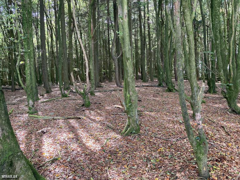
Long Mountain, known in Welsh as Cefn Digoll meaning “unbroken ridge,” rises to 408 metres just outside Welshpool. Its 305-metre prominence - the highest of the five summits I visited today - marks it as a genuinely significant hill. The summit hosts Beacon Ring, a scheduled Iron Age hillfort with impressive ramparts, and carries considerable historical weight. In 630 AD, King Cadwallon of Gwynedd defeated Edwin of Northumbria here, while on 13th August 1485, Henry Tudor assembled his army on these slopes before marching to Bosworth Field to become King Henry VII. Trees planted in 1953 spell out “EIIR” for Elizabeth II’s coronation, visible on aerial imagery. This Marilyn offers amateur radio enthusiasts one SOTA point.
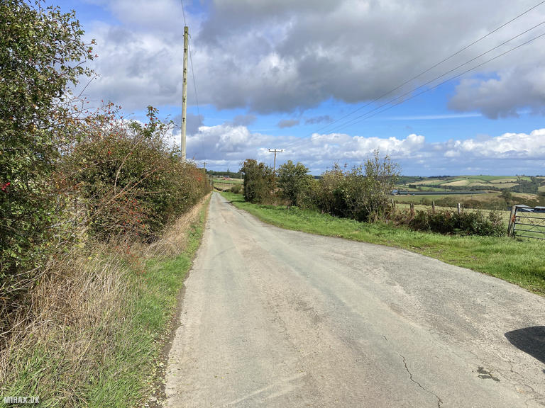
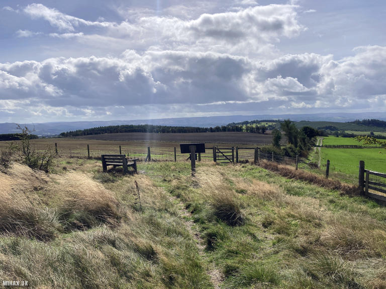
This was my fourth summit of the day, and by far the easiest to access. There is a large layby on the lane near the summit, making this one of Wales’s most accessible SOTA summits I have encountered so far.
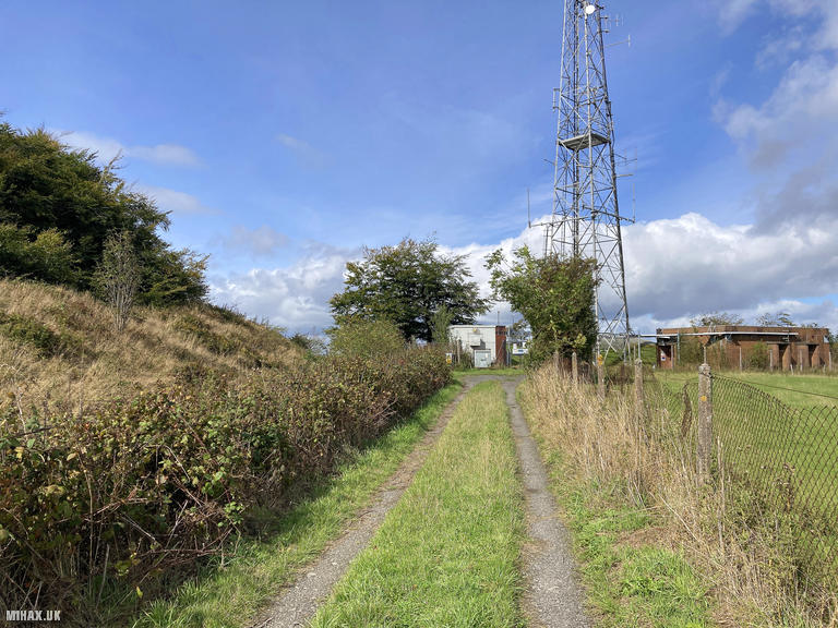
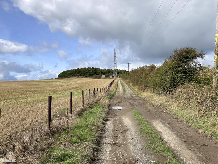
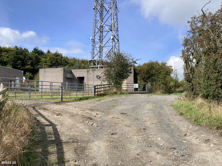
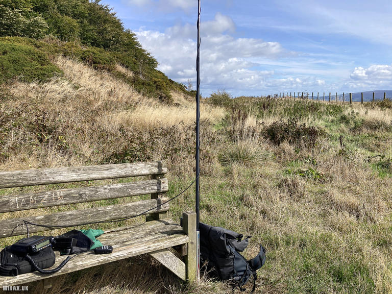
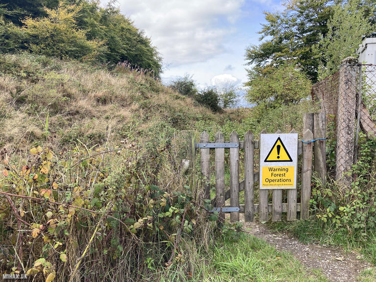
I followed a private track used to access the communication mast on the hill, moving northwest from the road. The 52-metre transmitter serves Mid Wales television and radio but does not impede activation. At the mast compound, a gate leads onto the summit area. An indistinct trail enters the woodland planted for the coronation, crossing to the far side where a wooden bench provides an excellent operating position. Alternatively, the footpath around the outside of the woods can be used. The activation zone is large, offering flexibility in choosing a sheltered spot.
Setting up both my Yaesu FTM100D and Elecraft KX2 with AX1 antenna, I worked ten stations across 2-metre FM and 20-metre SSB. The highlight was a summit-to-summit contact with Beppe I1WKN, a veteran six-times Mountain Goat award recipient, who was operating from Monte Scopello (I/TO-083) in Italy - a fine example of the international connections SOTA enables.
The round trip of just 1.6 kilometres with 36 metres of ascent took an hour including operating. Easy to drive to, easy to walk around, with pretty woodland and genuine historical interest - Long Mountain is well worth a visit. It may also provide a good location within the woodland for a more extended SOTA activation involving tents etc.
Photos
Below are some photographs taken during my activation of Long Mountain on Tuesday 16th September, 2025.

Walking Route for Long Mountain
The interactive map below shows my GPS track taken to the SOTA activation zone for Long Mountain. The GW/MW-026 summit area is marked on the map with a blue pin icon.
You can download the route shown above as a GPX file suitable for use with most GPS devices. This file is provided for information only, to support your own walk planning and research (it may contain navigation errors, detours and/or safety hazards). The route downloads provided here are governed by the Creative Commons BY-NC-SA 4.0 licence.
Station Log
I logged the following 10 amateur radio contacts operating as MW1HAX/P from GW/MW-026 Long Mountain on Tuesday 16th September, 2025 (all times shown are UTC):
| Time | Callsign | Band | Mode | Notes |
|---|---|---|---|---|
| 12:32 | M7SDO | 2m | FM | RX: 57, TX: 59 |
| 12:33 | GW4RFT | 2m | FM | RX: 51, TX: 51 |
| 12:34 | M6NSV | 2m | FM | RX: 56, TX: 58 |
| 12:35 | M7JCZ | 2m | FM | RX: 55, TX: 55 |
| 12:43 | M0TVU | 2m | FM | RX: 55, TX: 58 |
| 12:47 | SQ9JYK | 20m | SSB | RX: 55, TX: 55 |
| 12:49 | MW0TSU | 20m | SSB | RX: 56, TX: 58 |
| 12:58 | DL3JPN | 20m | SSB | RX: 44, TX: 58 |
| 13:00 | I1WKN/P | 20m | SSB | RX: 33, TX: 44, S2S I/TO-083 |
| 13:02 | HB9DHA | 20m | SSB | RX: 57, TX: 57 |
In the notes field I will usually log the other operator’s name and the signal report they provided. In accordance with the Summits on the Air rules, I do not make a log entry where a complete exchange of callsigns and signal reports was unsuccessful.
Additional Information
The following resources may be helpful to walkers, mountaineers and SOTA activators interested in Long Mountain:
- Sotl.as Summit Page for GW/MW-026 Long Mountain.
- Hill Bagging UK Summit Page for Long Mountain.
- Google Maps Page for Long Mountain.
- Wikipedia entry for Long Mountain.
If you found this content valuable, why not Buy Me a Coffee?